|
|
Yosemite
High Sierra Camp Loop Hike - Day 2
An
edited version of my
adventure on the High Sierra Camps Loop appeared in the second issue
of Sidewalk
- A hiking and
backpacking
magazine
|
 Day 1
Day 1

Day 3 |
|
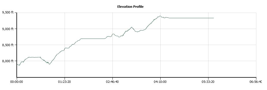
Trip Date: 08/22/2014
Distance: 8.4 Miles
Vertical Gain:
1500'
Group Size:
6
Hike Rating:
Easy
Moderate
Hard
Strenuous |
 GPX for
this trip
GPX for
this trip
|
|
|
Start Coordinates: |
N 37 52.699, W 119 20.315
(parking for first day's hike) |
|
End Coordinates: |
Same as Start Coordinates
|
| Car Shuttle
Req'd: |
No |
|
Parking
Directions: |
Take
Highway 395 south from Monitor Pass toward Mono Lake. At Lee
Vining, turn on Highway 120 (Tioga Pass) and enter Yosemite Park on the
east side. About 10 miles into the park turn at the
Wilderness Permit area (Tuolumne Meadows Lodge Road) and continue to
the parking coordinates for backpacker vehicles. |
| Hazards of
Note: |
Wildlife, especially bears.
Some of the trails are difficult and footing can be tenuous
at times. Much of the uphill and downhill sections are made
up of granite steps which are rough on the feet after time. |
|
Crowd Factor: |
Mixed. Yosemite is a
very popular destination during the summer months, and this hike and
option to stay in the HSC locations with served meals is available only
by lottery system. The further into the park the trails will
be less crowded, but there are many places for day hikers to pick up
the trail system. |
General Notes:
Day two starts from the Glen Aulin HSC site, and then heads back about
2/10 of a mile to the junction toward May Lake. Along the
first part of the trail you are passing through a pleasant wooded area,
and soon McGee Lake makes an appearance on the left side.
There are a couple of nice camping spots here right on the
shoreline. Past the lake you will slowly start to gain
elevation, and hints of Tuolumne Peak will appear on the right side as
you make your way up the trail. About 4 miles into the hike
you will finally leave the forest for the last time, and begin a
significant climb up granite switchbacks and trail as you head up to a
flat area with Raisin Lake off to your left. Some more
climbing ensues, until you finally drop down into the May Lake basin,
catching your first glimpse of the lake through the trees.
Mt. Hoffman rises high above the lake on the Northwest shore,
and is the geographic center of Yosemite National Park. Worth
a dayhike climb to the top, but only if you have lots of energy after
the nearly 8 1/2 mile hike to the May Lake HSC. An easier
alternative is to climb "The Ridge" behind the dining tent, where you
are afforded fantasic views of the area including Vogelsang Peak,
Clouds Rest and Half Dome off in the distance. A bonus is
that cell phone service from this spot is perfect. |
|
|
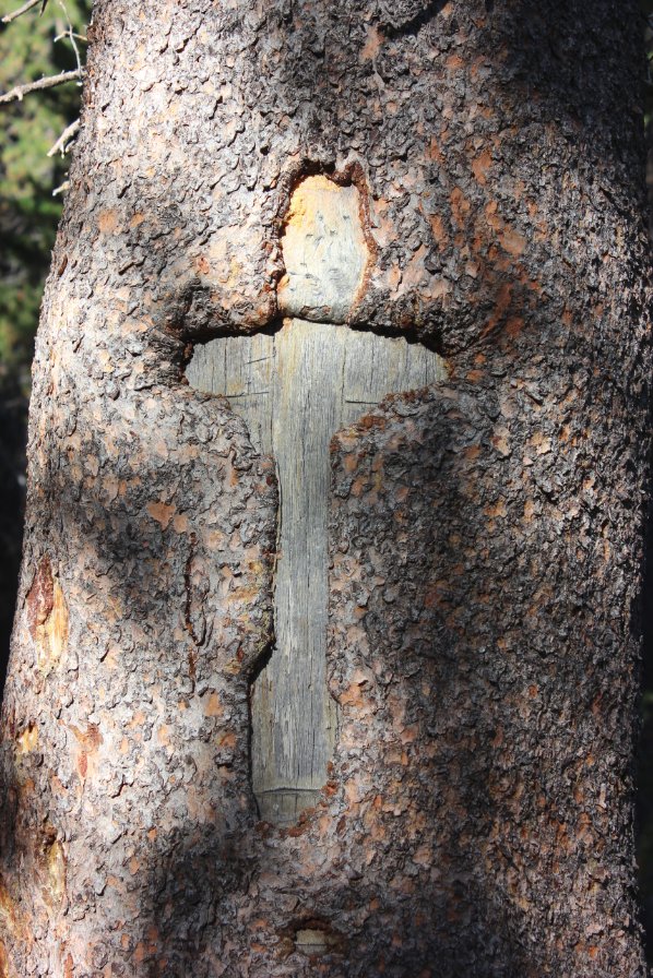
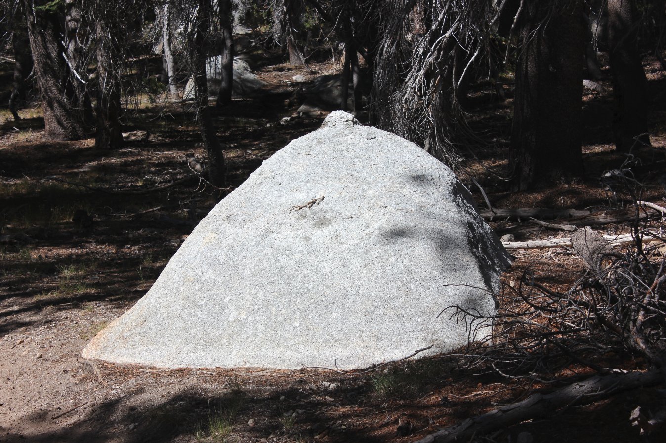
Early on the trail to May
Lake, I came across one of the most unique trail blazes I have ever
seen. |
 |
|
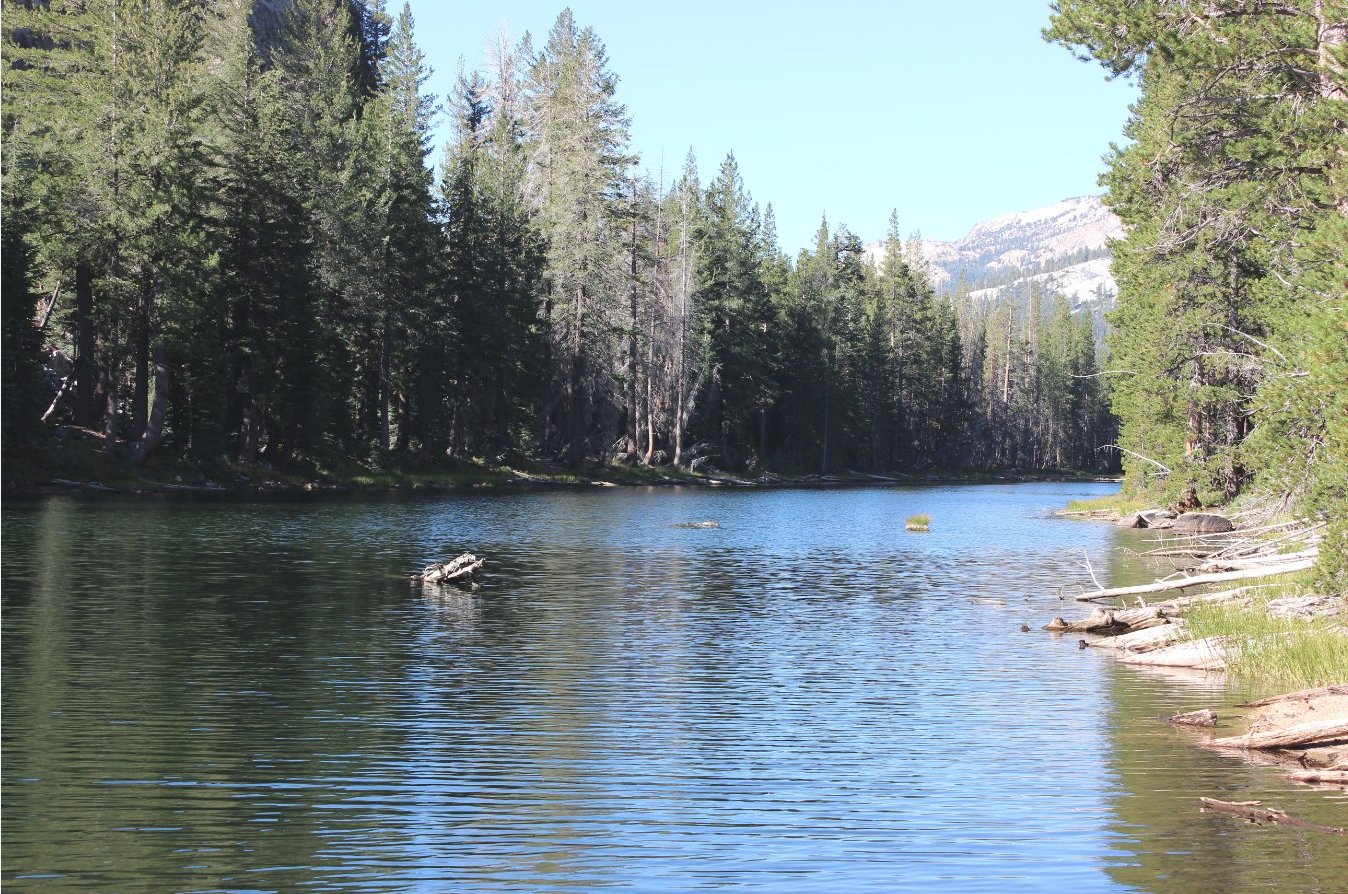
McGee Lake appeared on our
left early along the trail, and I was very glad to be past the mosquito
season while checking this location out.
|
 |
|
Just past McGee Lake there was
a rise off to the right, and climbing up it gave a great view toward
the Falls Ridge range with Cathedral Creek running through the middle
of it. |
 |
|
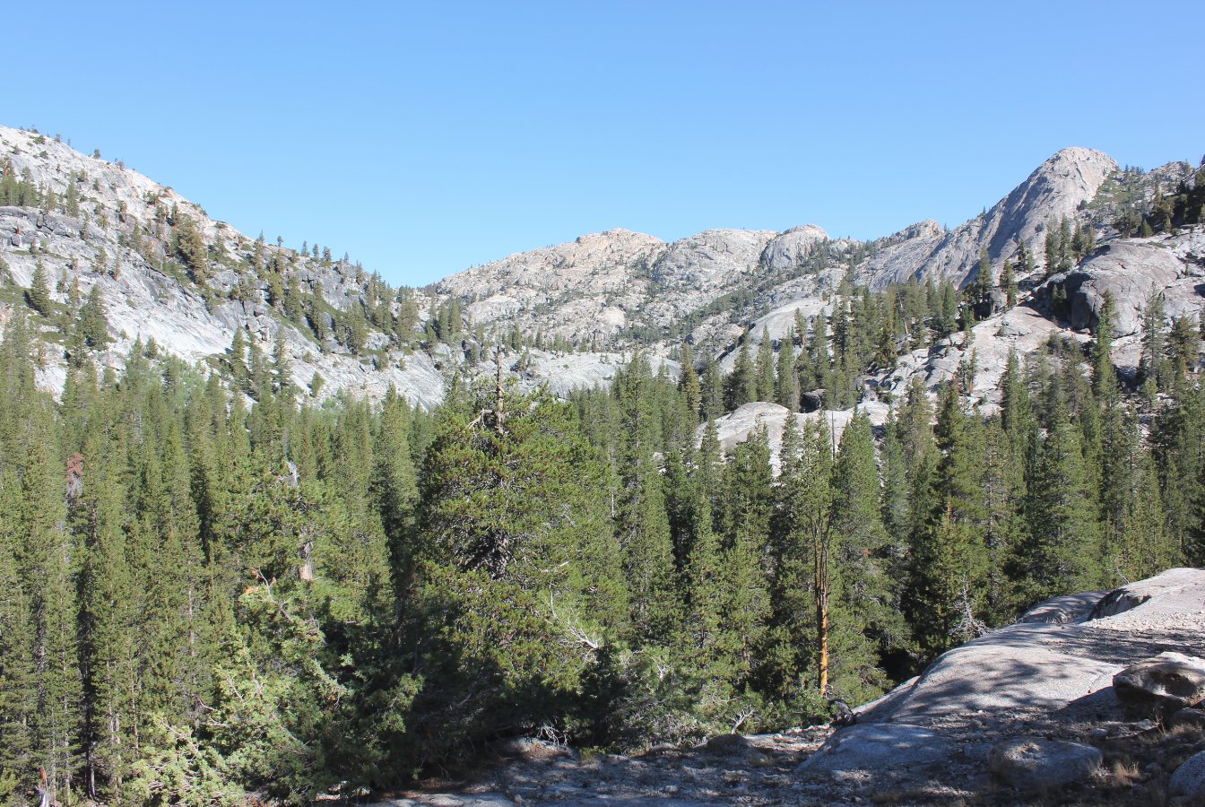
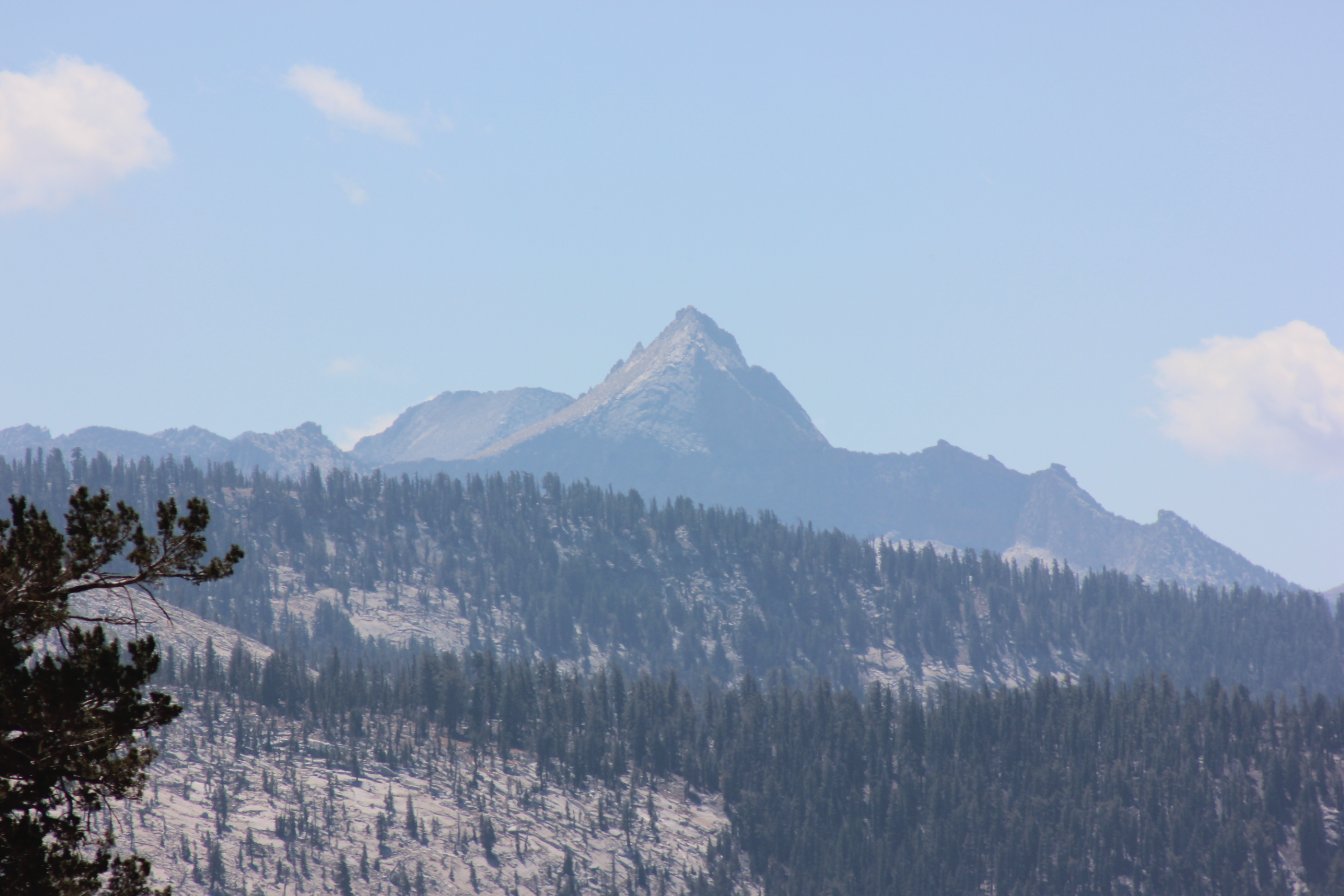
Every time we came to a high
spot in the trail, there was a view of distant mountains in almost
every direction. It was odd to be in a place where I didn't
know all the names of at least the most prominent ones. |
 |
|
Yep, that's a pretty unique
rock formation, I must admit.
|
 |
|
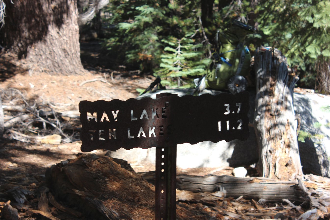
The first junction in the
trail after the one early on was a spot where we waited until the group
all caught up, and some mule riders who were on the same track for the
first three days were waiting there when we arrived. |
 |
|
This would certainly be one
way to experience the high country, but it seemed too dusty and not
challenging enough for my tastes. |
 |
|
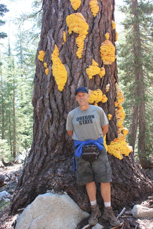
Phil and I checking out some
really
crazy, neon colored lichen or similar on a tree at the junction.
|
  |
|
Views ahead of Vogelsang Peak
in the distance, where we would be two days from now. |
 |
|
Yes, that's where we are
headed eventually. Just a little intimidating from here... |
 |
|
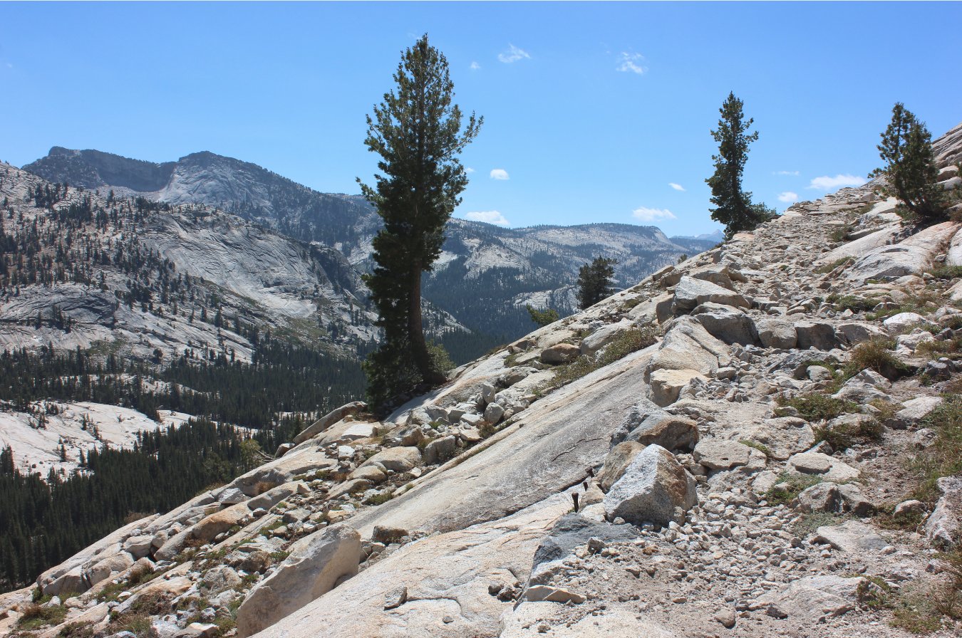
A good example of all of the
work that has been done by people to make these trails accessible to
hikers such as ourselves. |
 |
|
The views are just incredible
along the trail in every direction you turn. |
 |
|
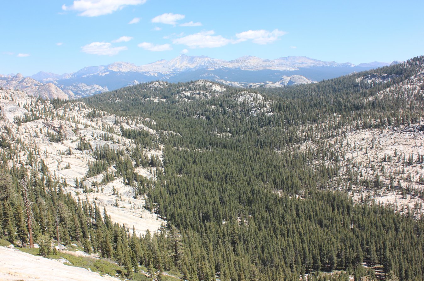
Finally, after what seems like
a pretty long climb May Lake and Mt. Hoffman make their appearance to a
tired hiker. |
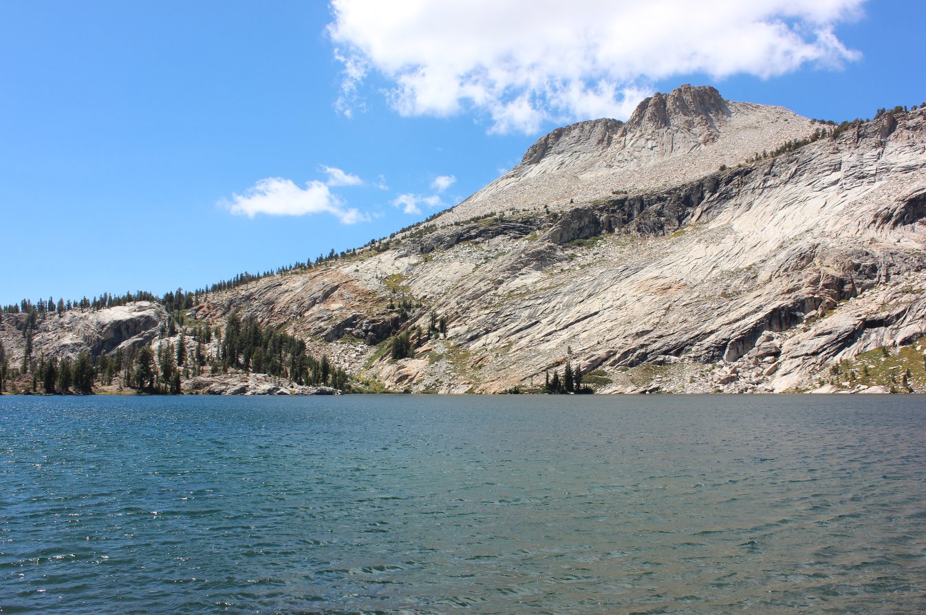 |
|
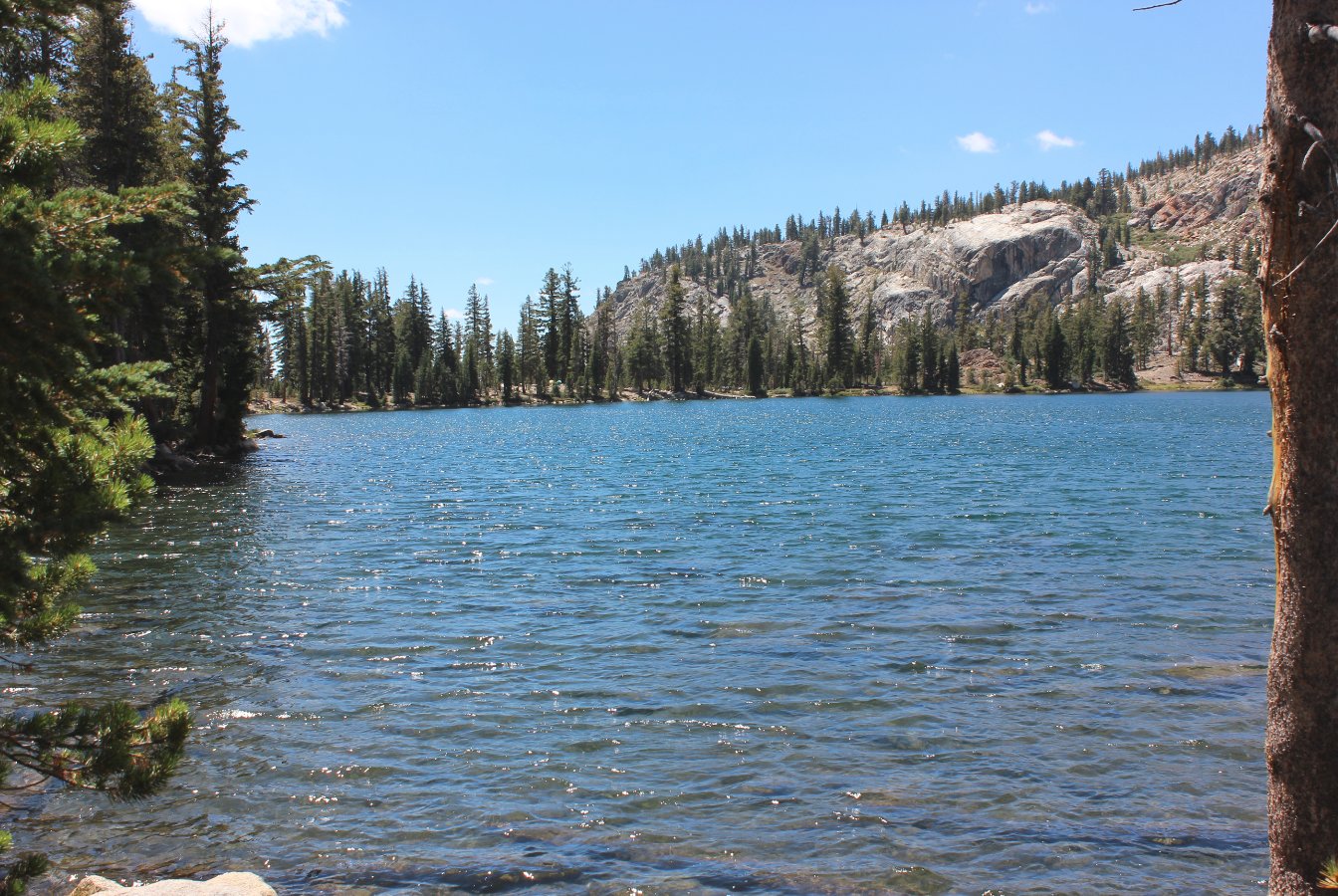
The view across May
Lake toward the backpackers campground on the far side of the picture. |
 |
|
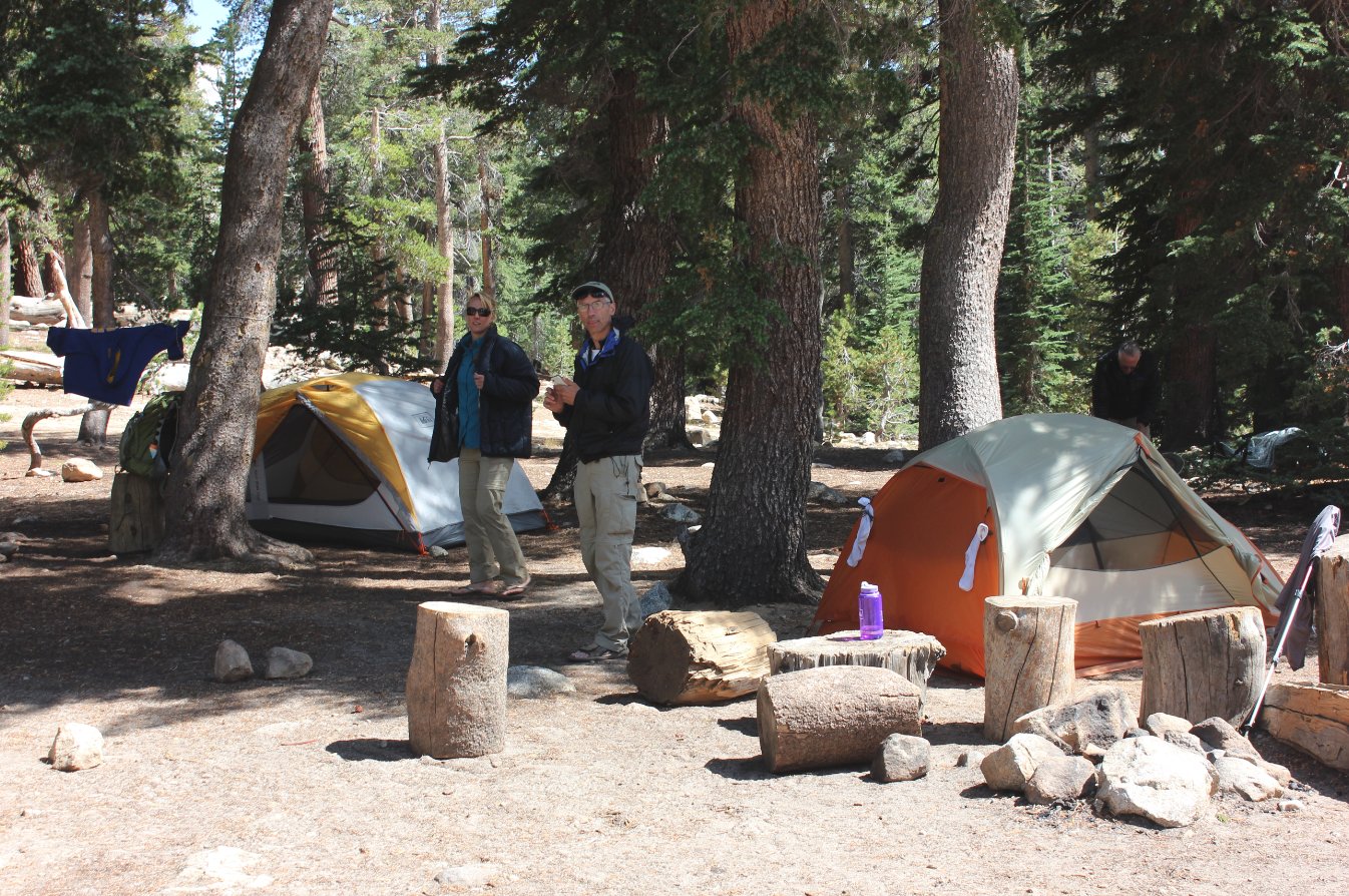
Our campsite not too far from
the lake. |
 |
|
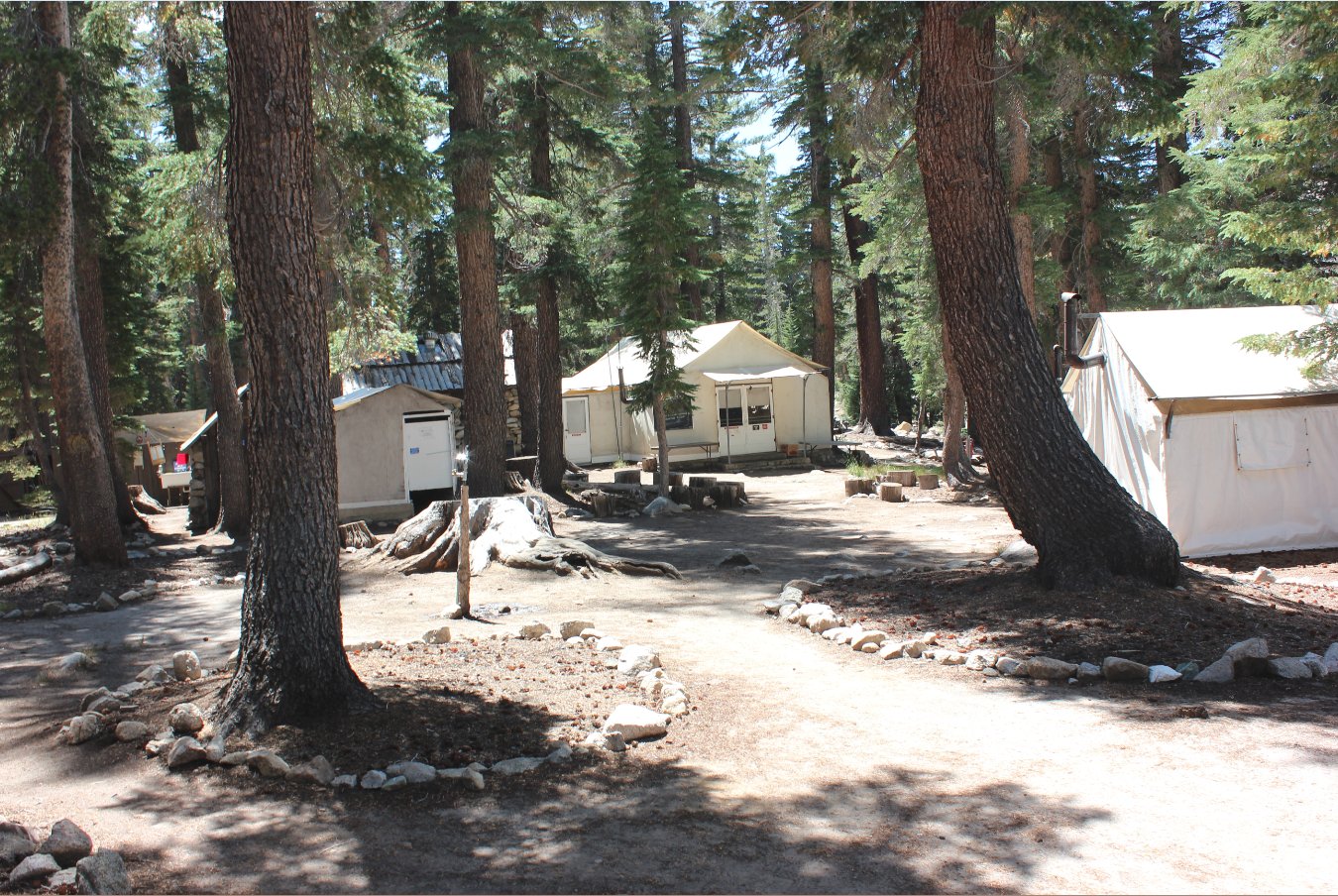
The main office and mess hall
cabin for the May Lake HSC. |
 |
|
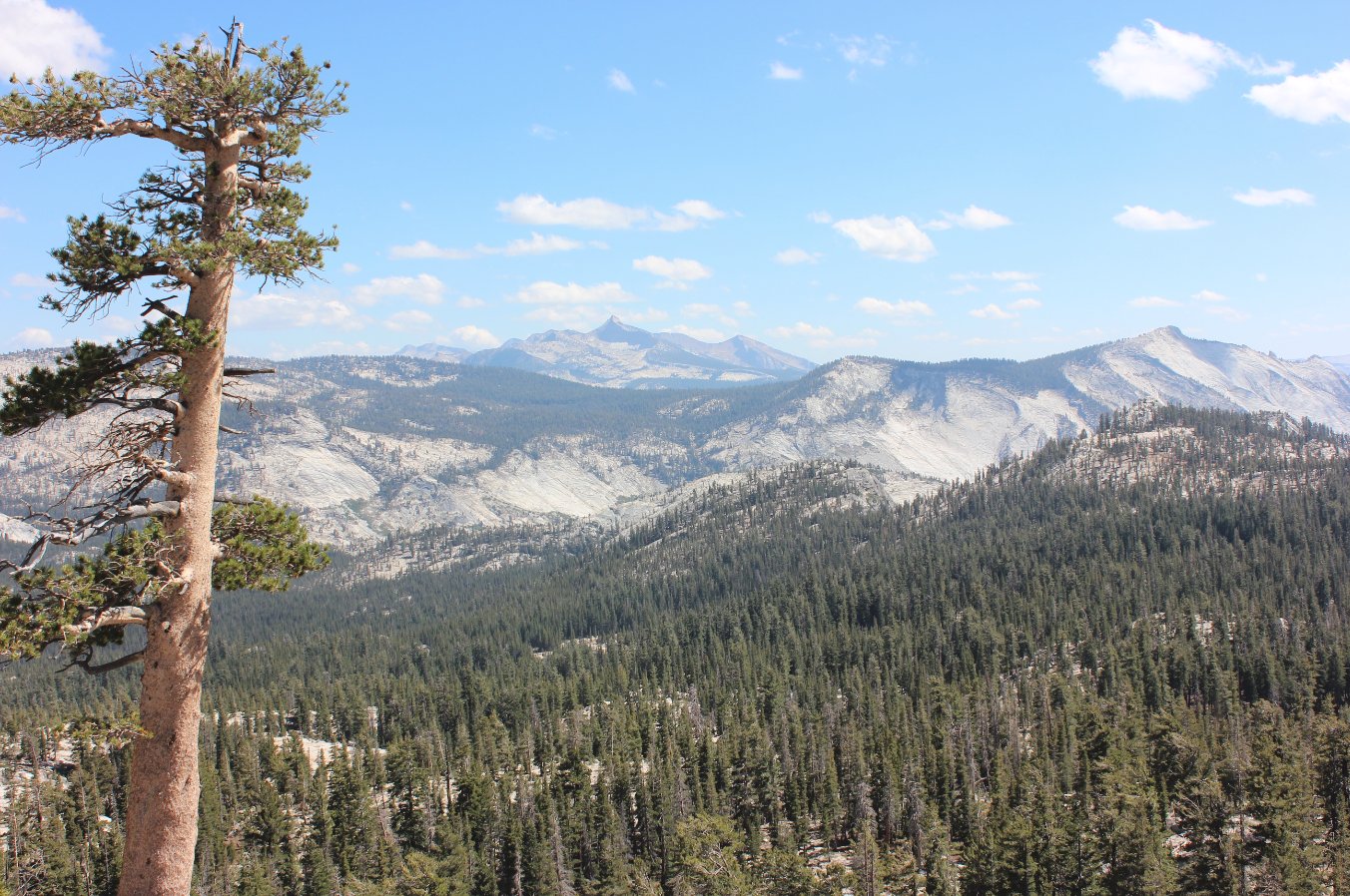
Just
behind the HSC area there was a small area to climb up called "The
Ridge," and the views from there were absolutely spectacular. |
 |
|
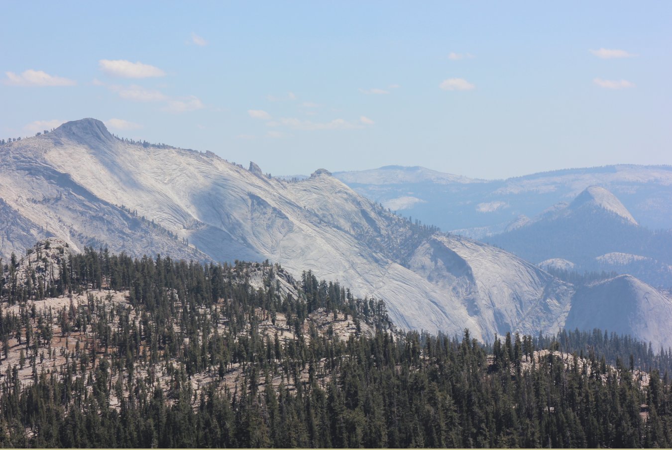
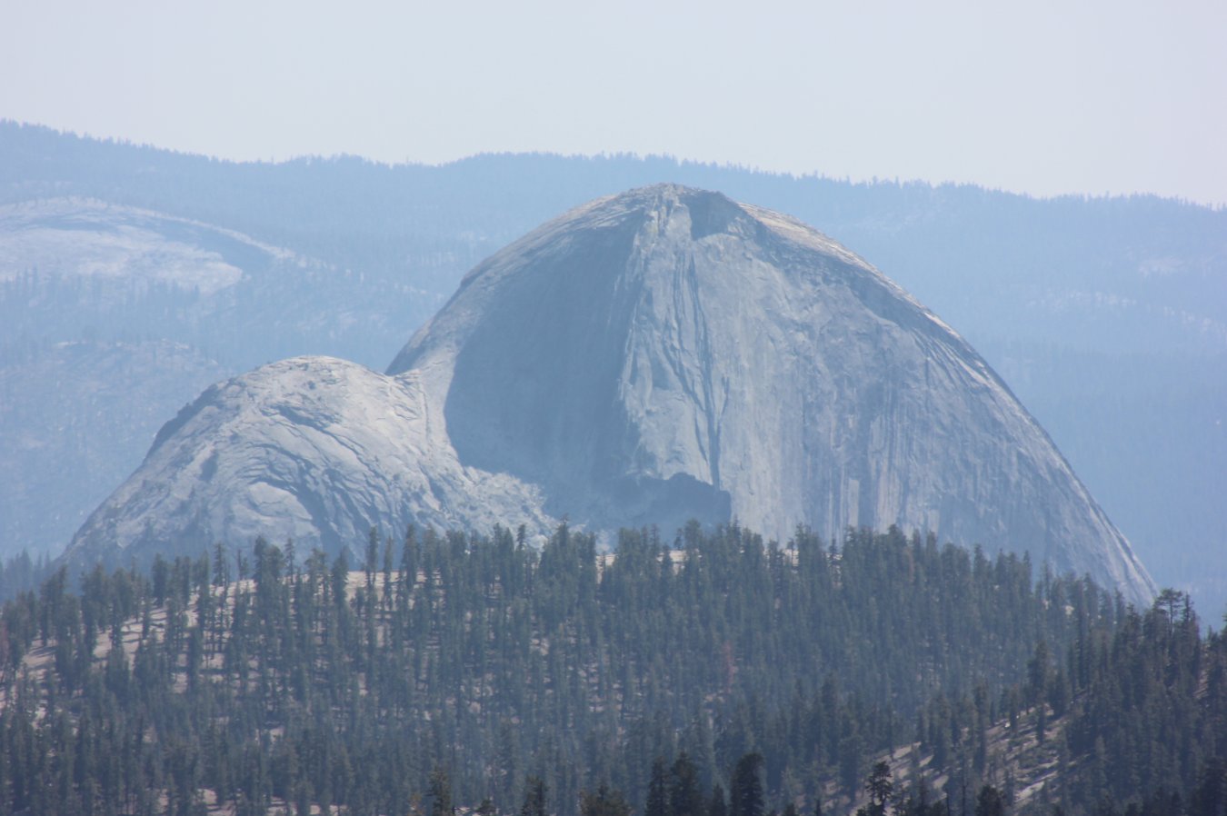
You could see all the way to
Cloud's Rest and Half Dome from here, and had great cell reception as
well! |
 |
|
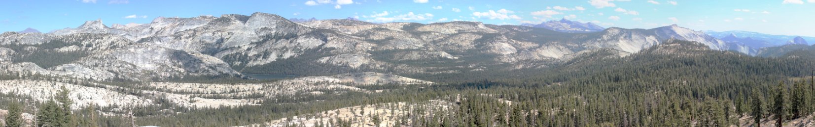
Panorama from The Ridge, of
all the way from Cathedral Peak on the left to Half Dome on the right. |
 |
|
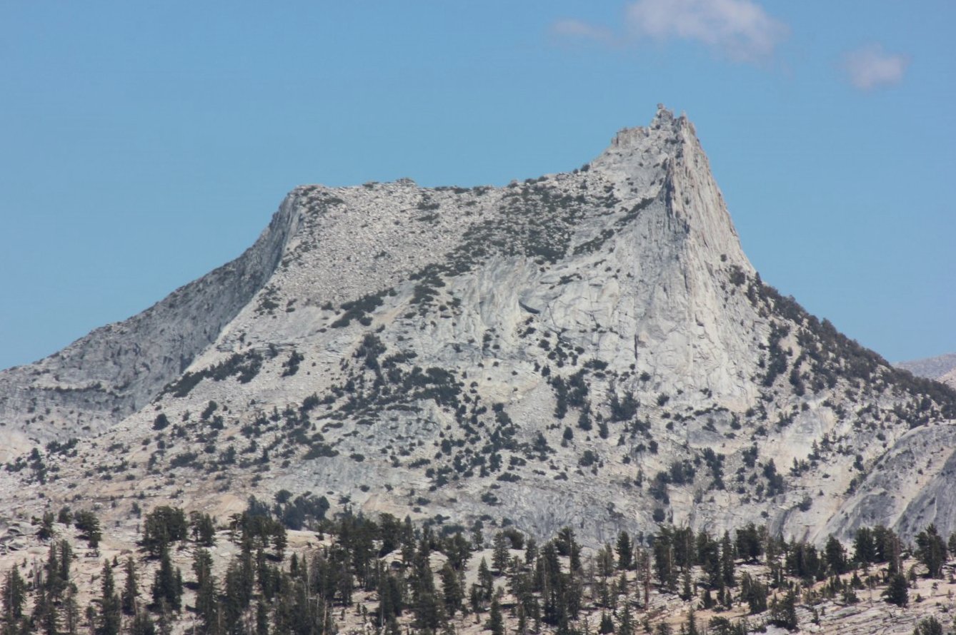
Close up shot of Cathedral
Peak from this side. |
 |
|
Front row seats to the amazing
views from this spot. |
 |
|
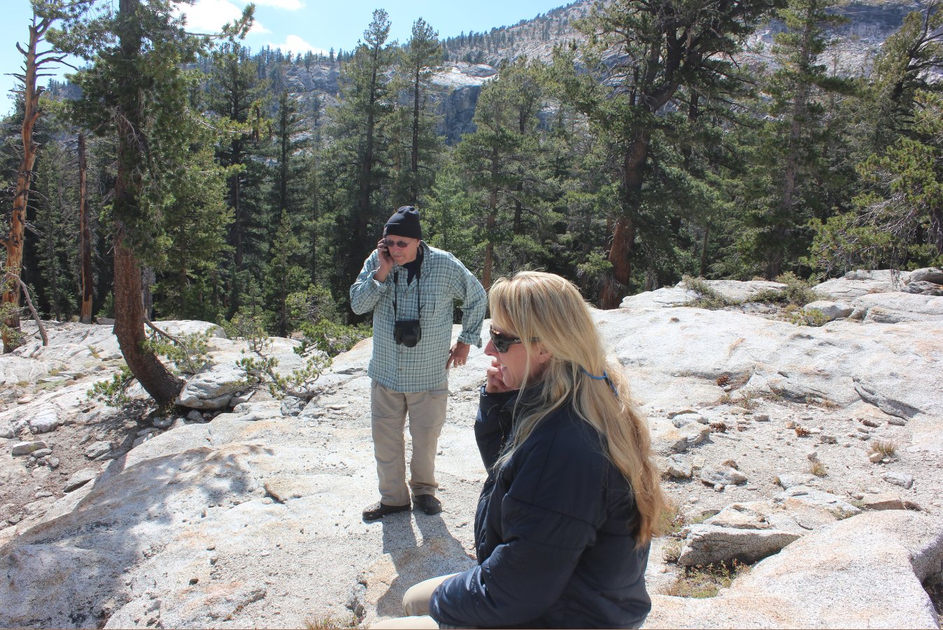
This was one of only two
places we had cell reception on the trip, so everyone took advantage of
a chance to call home. |
 |
|
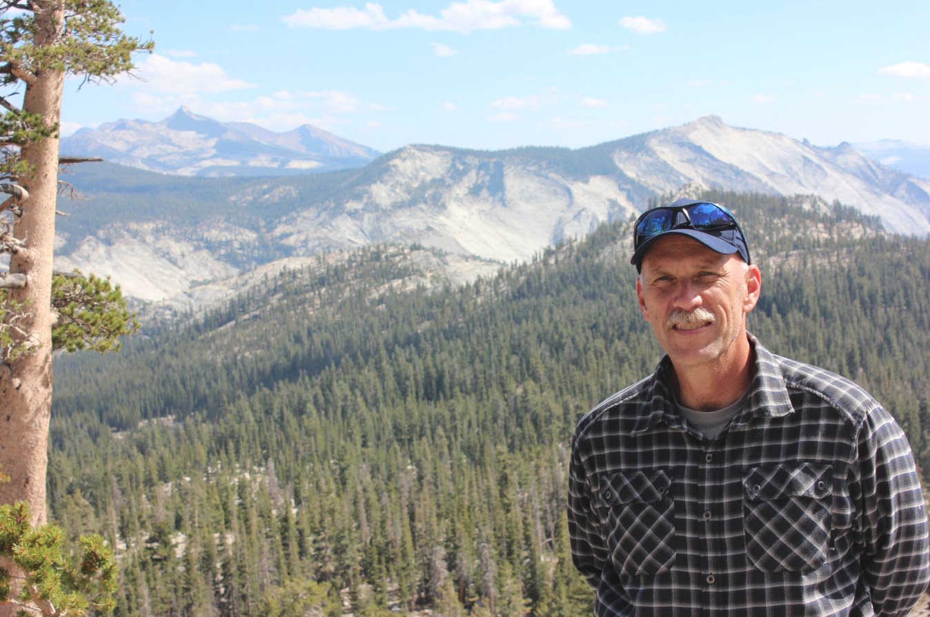
Myself at the ridge.
During the time I wasn't on the phone! |
 |
|
Since we had the 'meals only'
option for the trip, this was my accomodation for the week.
It was GREAT! |
 |
|
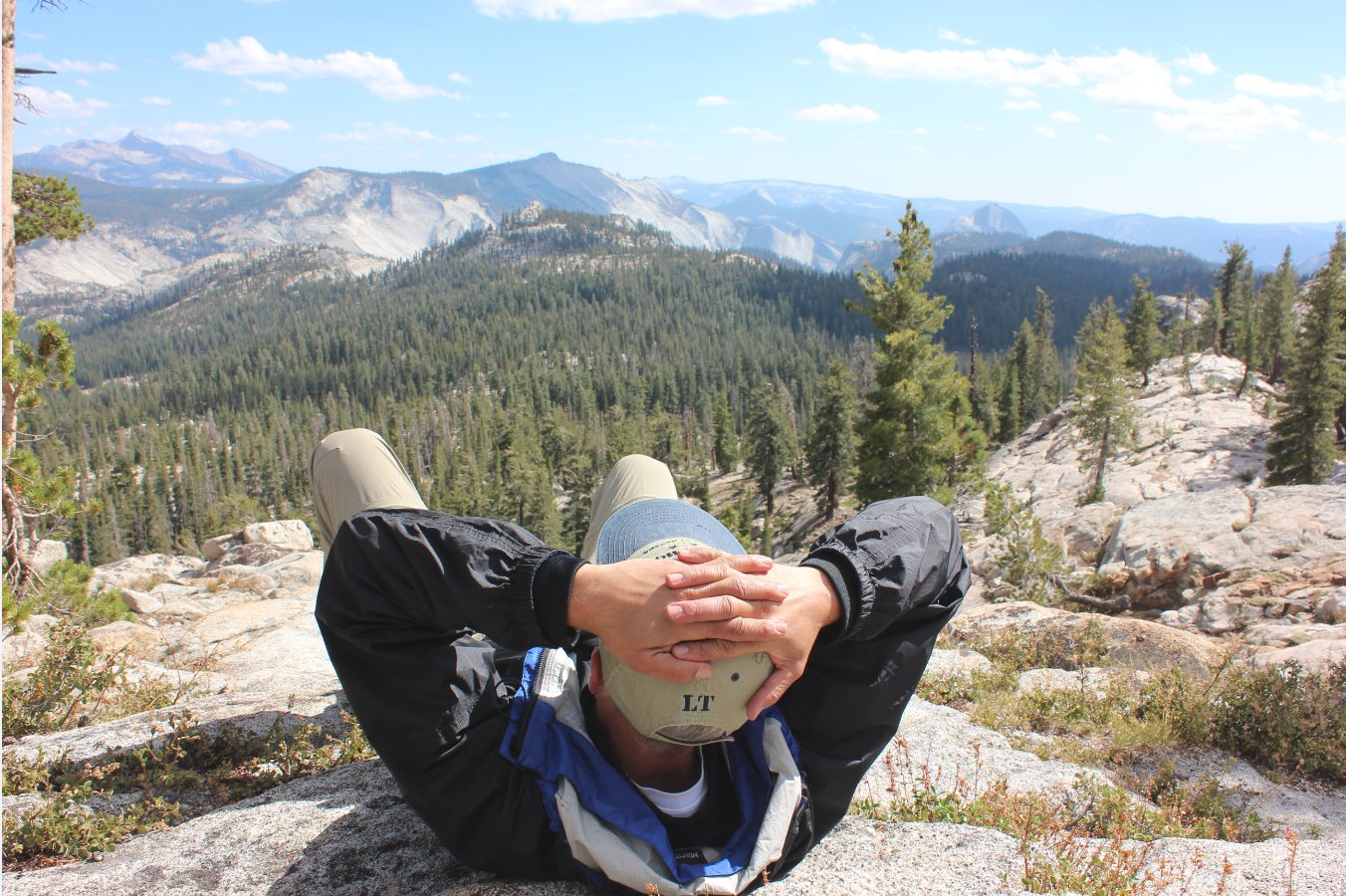
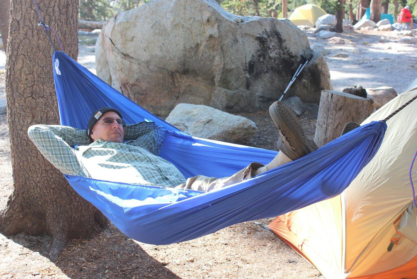
Brent getting a chance to
relax at camp and enjoy the end of another great day. |
 |
|
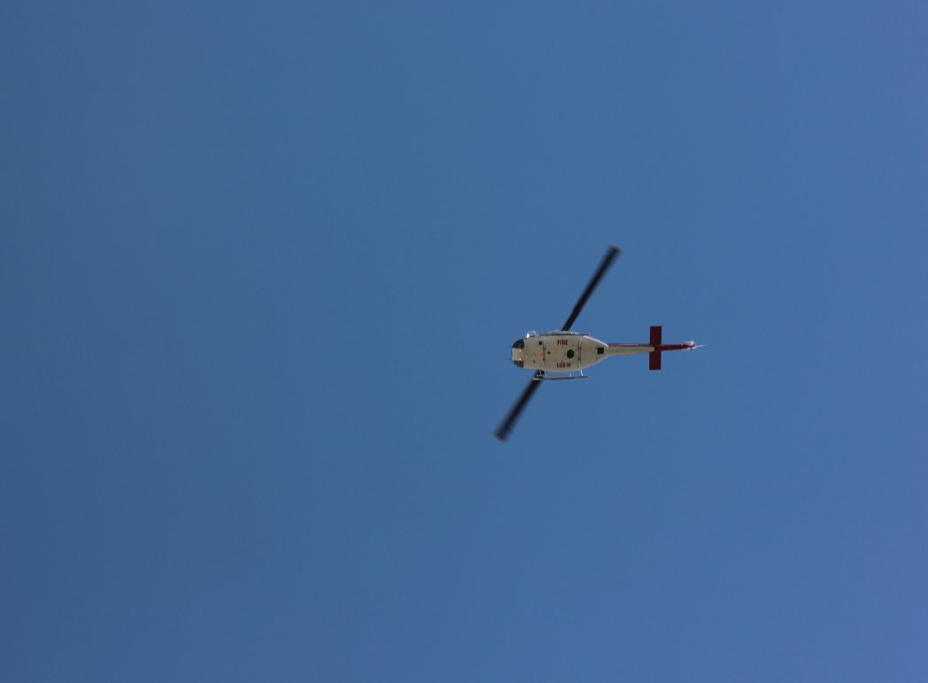
Search and Rescue Helicoptor
on their way to help out someone. |
 |
|
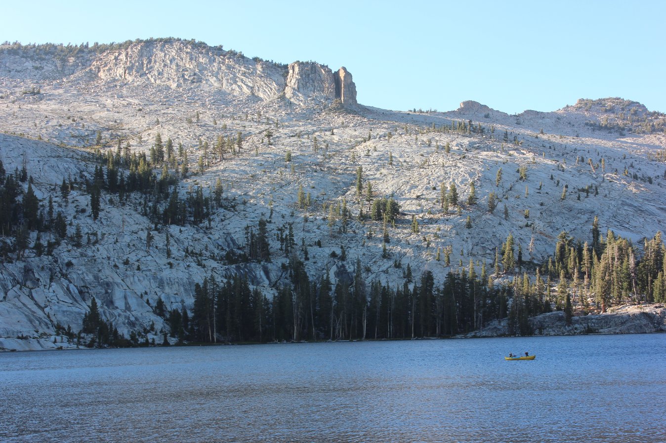
Boaters enjoying one last spin
on the lake before sunset. |
 |
|
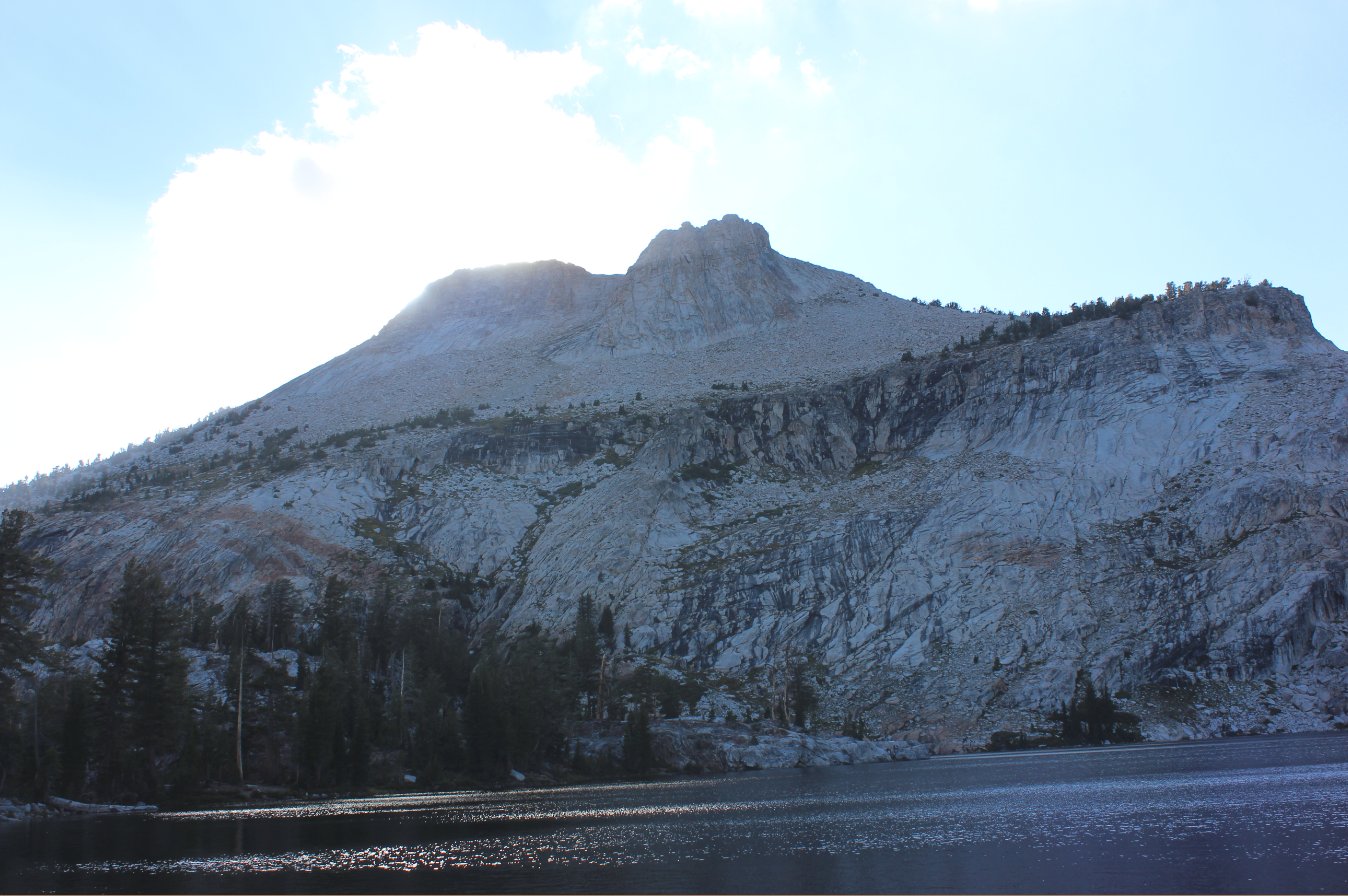
Mt. Hoffman just before sunset
hit the camp. |
 |
|
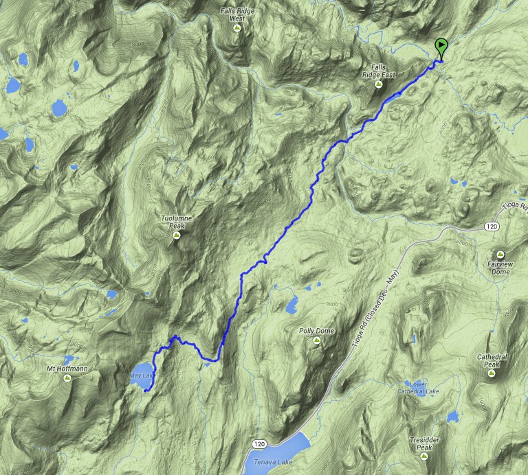
GPS Track of the full hike. |
 |