|
|
Wheeler
Lake Hike
|
|
Trip Date: 8/28/2020
Distance:
10 Miles
Vertical Gain:
1300'
Group Size:
4
Hike Rating: Easy
Moderate
Hard
Strenuous |
 GPX for
this trip
GPX for
this trip
|
|

|
Start Coordinates: |
N 38 30.899, W 119 55.706 |
|
End Coordinates: |
Same as Start Coordinates |
| Car Shuttle
Req'd: |
No |
|
Parking
Directions: |
Take
Highway 4 from the east side where it starts at the junction with
Highway 89 (at the start of Monitor Pass.) Follow the highway
for about 15 miles until you reach the parking area for the Sandy
Meadow trailhead just to the west of Mosquito Lake on the south side of
the highway.
|
| Hazards of
Note: |
Lesser
visited trail that will have little to no others on it. There
will be some route finding necessary if taking the 'loop' back out
along 19E54.
|
|
Crowd Factor: |
Minimal.
The Sandy Meadow trail that heads in from the highway, marked as
19E53 might have a hiker or two on the first couple miles, but the old
no-longer-maintained trail 19E54 that we took on the way back will have
nobody on it. |
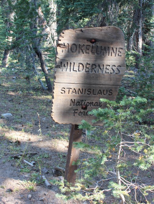
General Notes:
From
the parking area near the campground, head toward the trailhead kiosk
and continue west past the gate which blocks vehicle access from this
trail. This was an old jeep trail before the area become part
of
the Carson-Iceberg wilderness as evidenced by older maps showing this
feature. You will enter the wilderness area almost
immediately,
passing one of the iconic wooden wildness name signs. The
trail
mostly follows a gradual slope up along the way, following the north
side of the creek for most of the way. Much of the first 3
1/2
miles are trekking through the forest in the river canyon, but every
once in a while there are nice views toward Mineral Mountain and an
unnamed sharp, pointed peak to the south.
Past
the 5 mile mark the trail bends sharply to the right and begins a
short, steep climb for about 200 feet, and at the top of this section
is an old barbed wire gate that is still intact and able to be easily
passed through by slipping the catch off of the gate post.
Once
you cross over this the views really open up without as much vegetation
lining the trail, and there is a bonus of the Wolf Creek Falls to your
left. There are great views of the multiple level falls down
to
the south of the trail, including the 30' main section of falls.
As
an extra bonus, continue about 6/10 of a mile further, then navigate
off the trail about 300' to find yourself at an old, intact metal cabin
in the midst of a gorgeous meadow setting. The cabin is an
unusual feature in the Carson-Iceberg Wilderness area, and appears to
be still in use as a small peek into the structure showed some modern
items such as rope, saws, a ladder and even an ice chest.
|
|
|
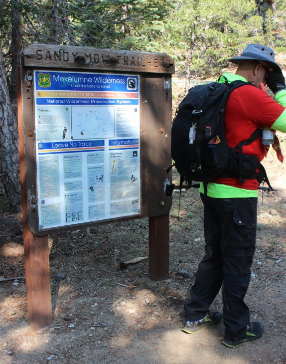
Look for this kiosk on the side of the parking area for where the trailhead will be just across Highway 4. |
 |
|
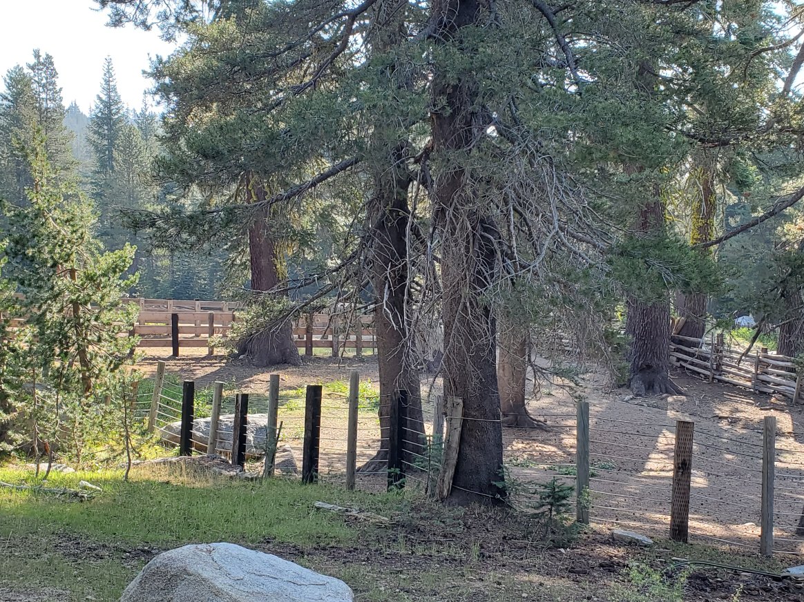
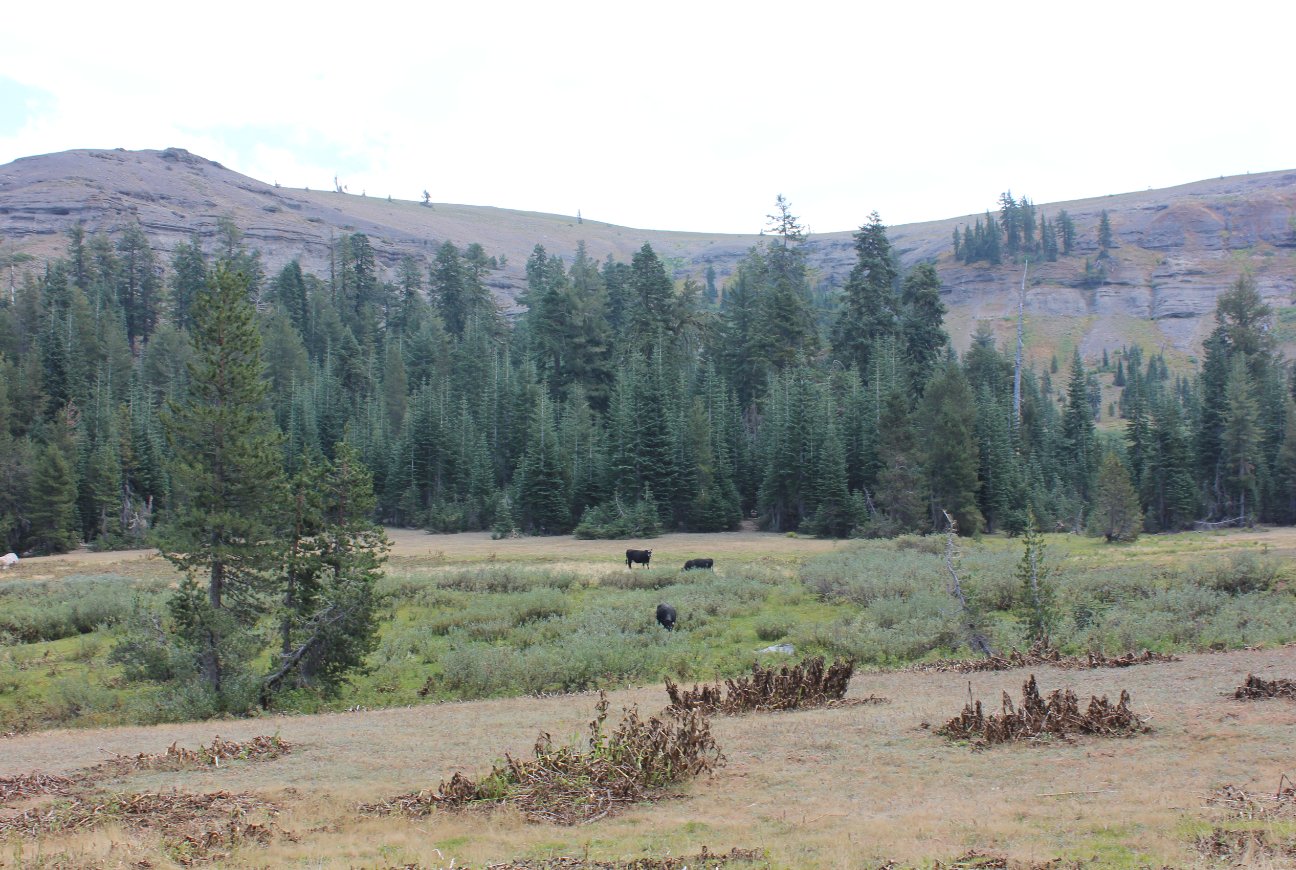
Wasn't
sure at first if this historic corral near the trailhead was still in
use, but judging by the number of grazing cattle passed along the way
it definitely still is. |
 |
|
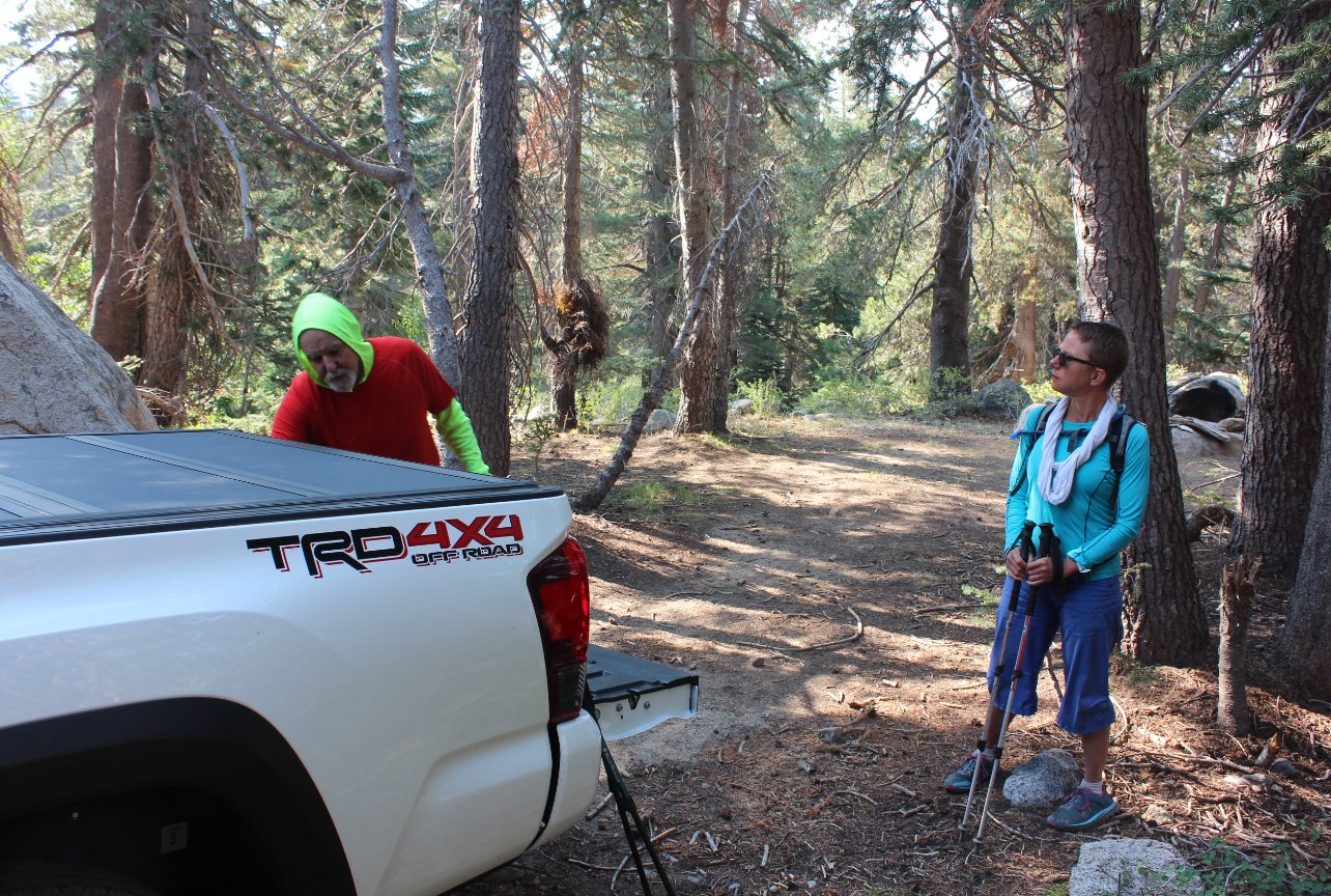
We were
the only vehicle at the parking area both when we arrived and when we
left, so this doesn't appear to be one of the heavier use trails in the
area. |
 |
|
This is the trailhead, just across the highway to the north of the of the information kiosk. |
 |
|
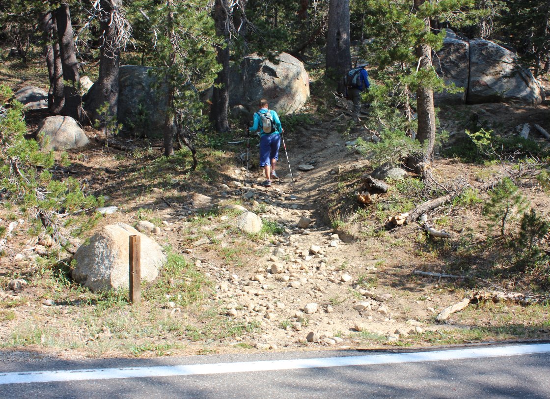
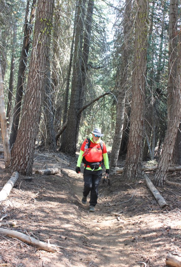
After
just about 10 minutes into the hike we were into the Mokelumne
Wilderness, and the start of a full 10 mile loop minus any other people
the entire day.
|
 |
|
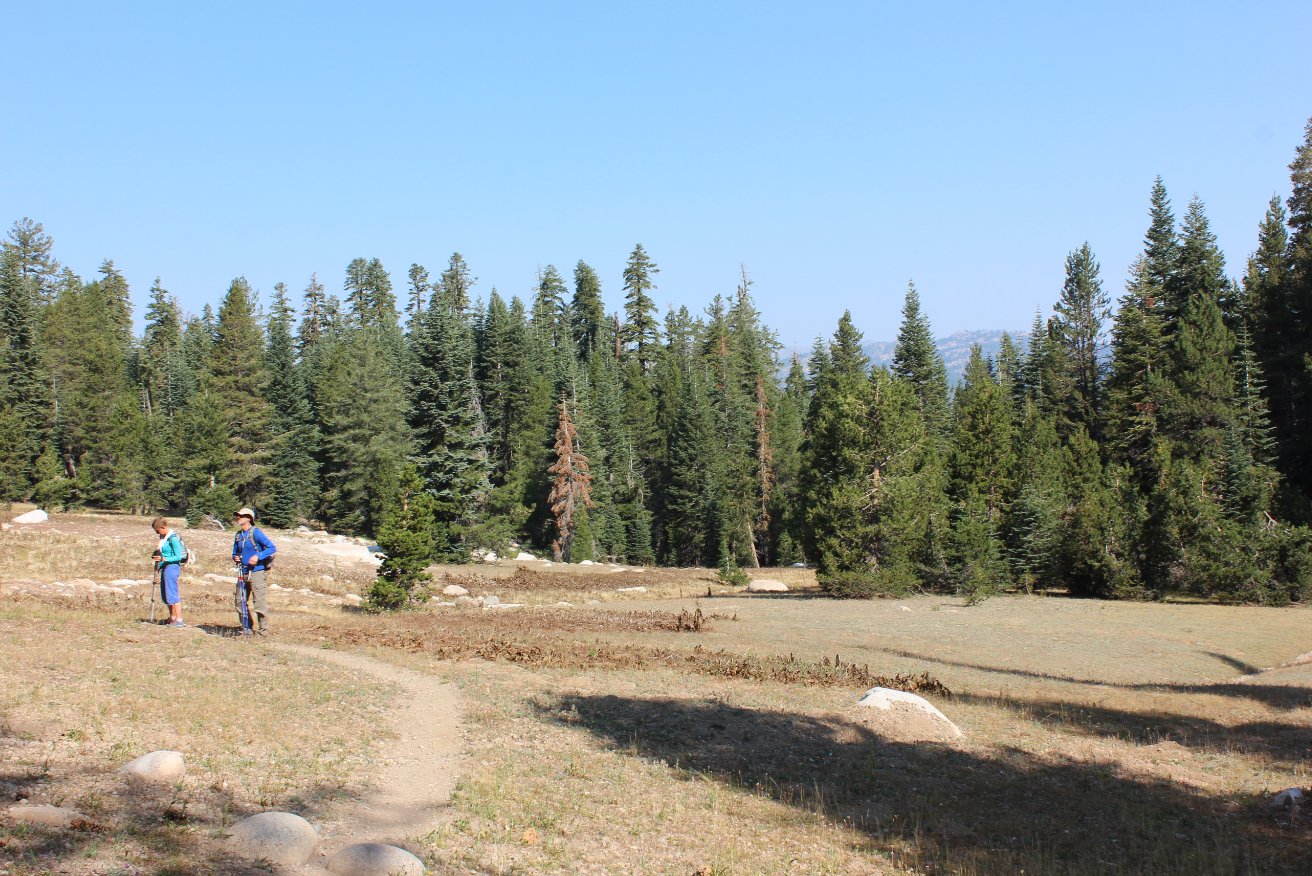
In the
first couple miles you will pass through a number of these 'sandy'
meadow areas. Not sure from the map which of them might be the
namesake of the trail, but they were distinctive. |
 |
|
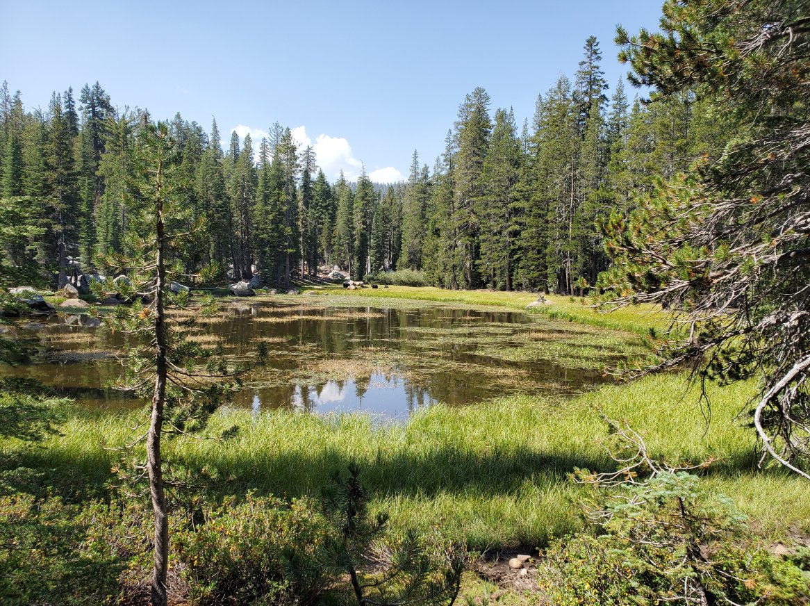
At about
the 2 mile mark we passed this picturesque unnamed lake which had a
number of grazing cows with bells on them on the far side from the
trail. It felt very Swiss along this stretch. |
 |
|
The first
four miles of the trail were in really good shape, with significant
evidence of maintenance during previous seasons. |
 |
|
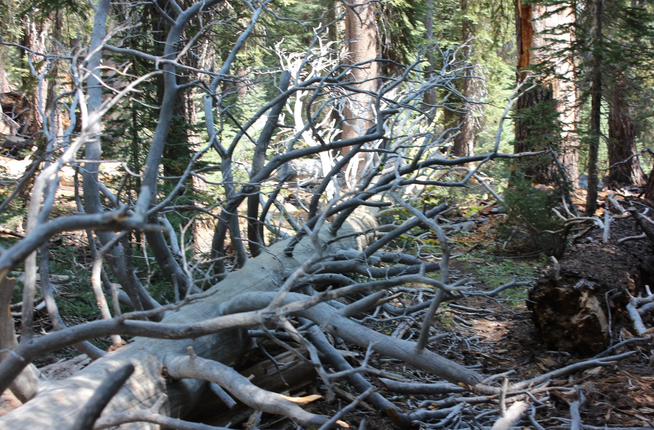
The last
mile of trail to the lake, however, looked a lot like this. At
least 10 really large downed trees, but the trail was still easy to
follow once past the downfall. |
 |
|
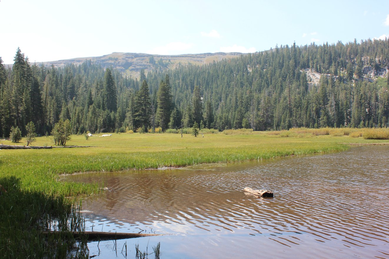
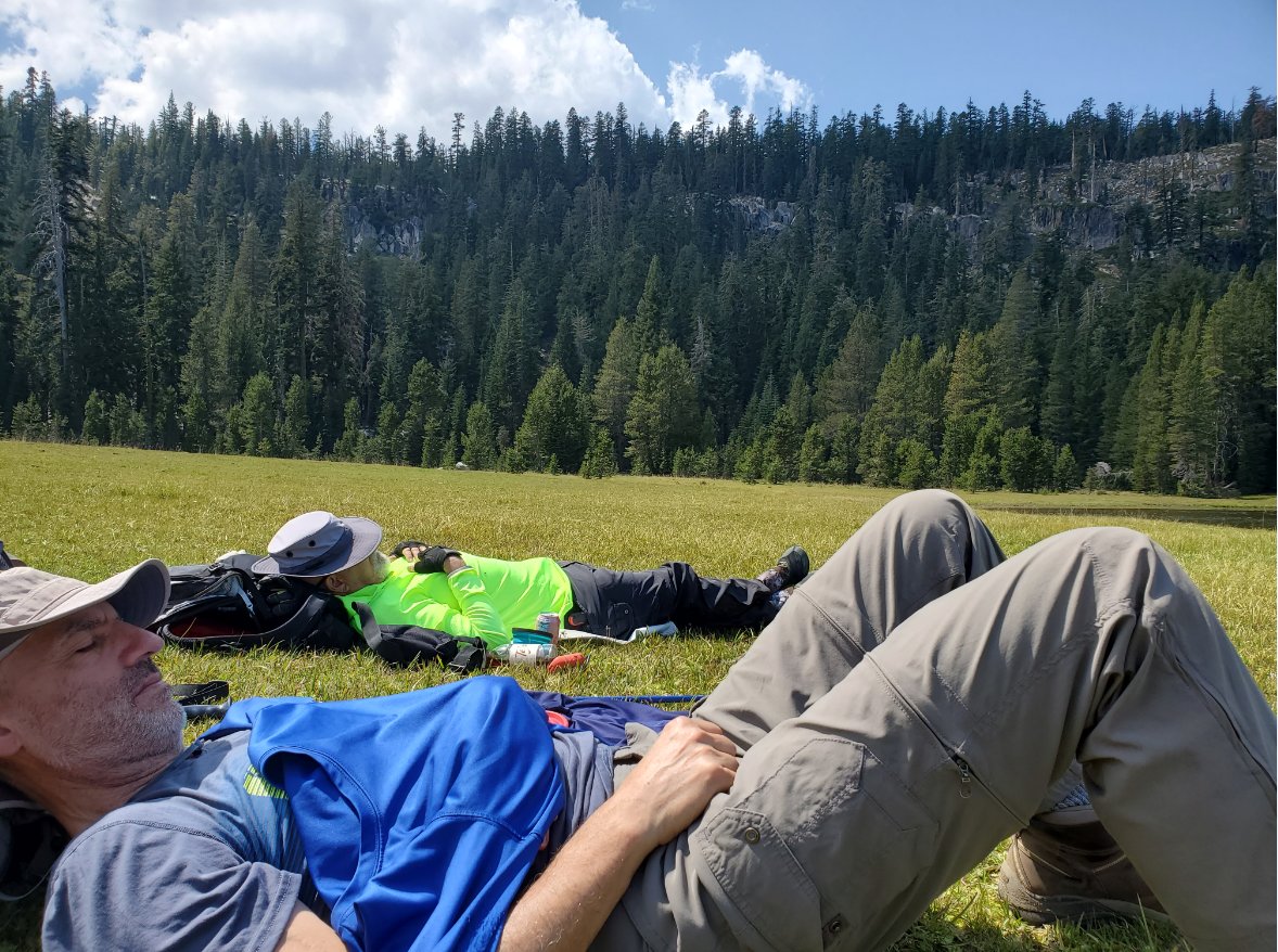
The first
view of the lake from the trail shows the southern end of the lake,
which is a grassy swamp in the early spring and summer but by this time
of the year made for a wonderfully soft place to hang out and enjoy our
lunch. |
 |
|
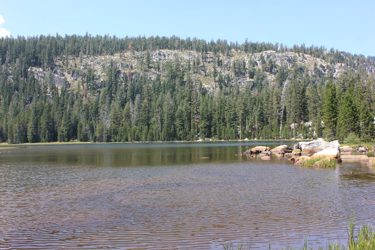
Looking northeast across the lake from our resting spot. |
 |
|
As
mentioned previously, the southern shore of the lake was a really nice
spot to take a break and enjoy the beauty of the surroundings. |
 |
|
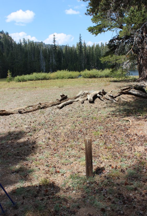
Picking
up the trail south of the lake, we found one of the smallest markers
ever for the junction to the trail up and over the southern ridgeline
and out to Highway 4 at another location. |
 |
|
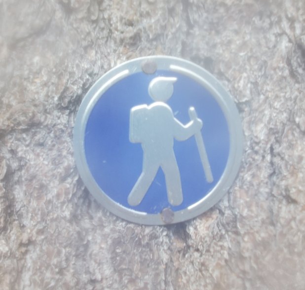
Heading
south along the trail we looked for the rumored junction with the older
forest trail (19E54) that was on one of my maps, but we didn't find
anything until we headed east across this open area (Avalanche Meadow)
and stumbled upon some very unique trail markers which none in our
group had ever seen before. |
 |
|
These
were the markers we stumbled upon to find the old forest trail that is
apparently no longer maintained. However, with a couple of
exceptions we were pretty easily able to follow them all the way back
to where they met up with the Sandy Meadow trail only a mile and a half
from the start. |
 |
|
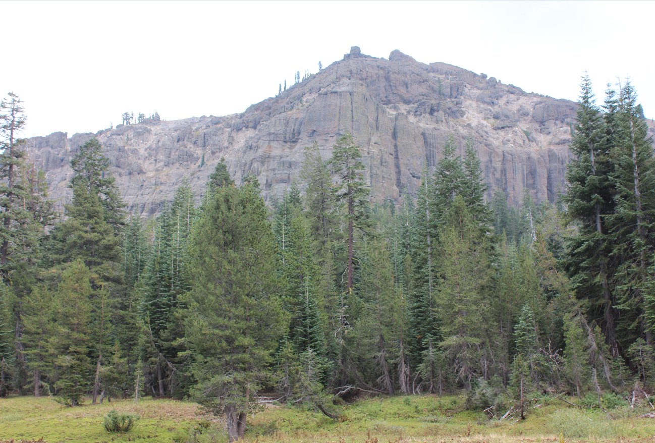
Along the
old trail we were treated to great views of Wheeler Peak, just above
the open Cliff Meadow that was one of the more difficult spots to find
the continuation of the trail. |
 |
|
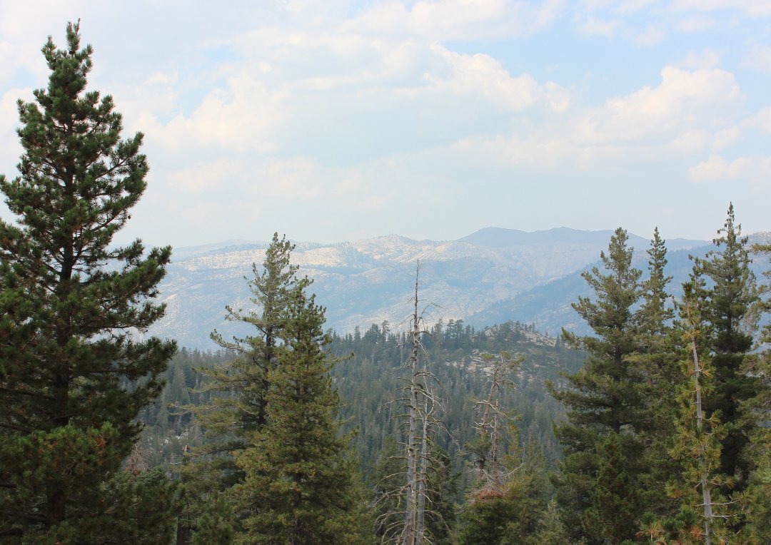
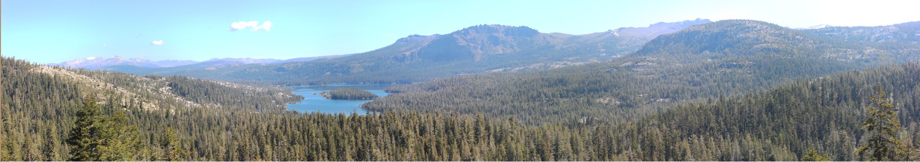
The smoke
on this day was moderate after a number of fires started in the area,
but we could still make out some of the key features to the north such
as Round Top, Raymond Peak, e.g. |
 |
|
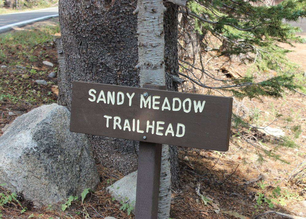
One
unfortunate aspect of this trail is that it is clearly marked by this
sign, at the end of the hike facing the wrong direction! |
 |
|
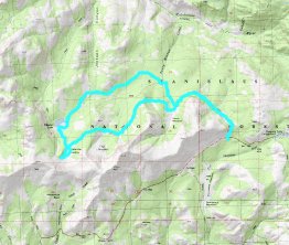
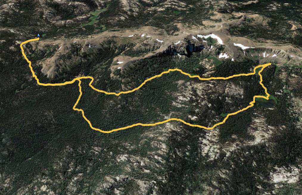
GPS Track
of our out and back hike, starting from the upper right and heading
down the canyon to the bottom left before returning the way we came. |
 |