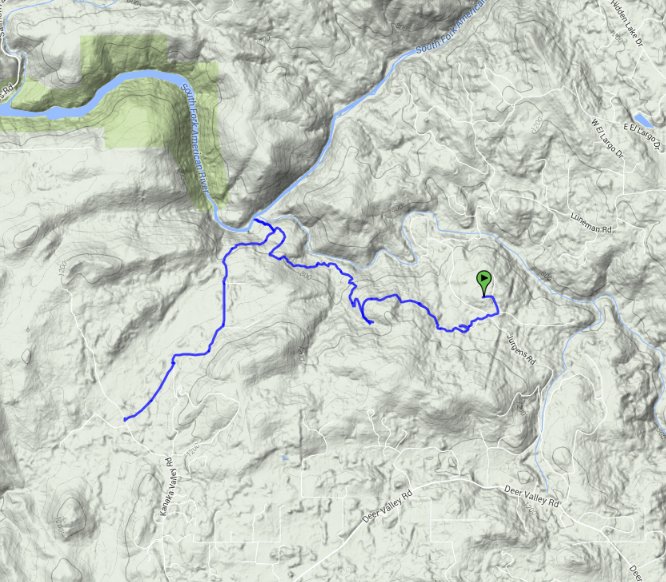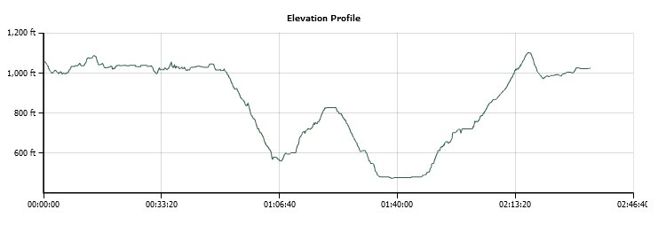
Distance: 4.8 Miles
Vertical Gain: 1000'
Group Size: 4
Hike Rating: Easy Moderate Hard Strenuous

 GPX for
this trip

| Start Coordinates: | Not available -- on private property | End Coordinates: | N 38 44.797, W 121 01.309 This is the parking area for Kanaka Valley, and is where this hike should be started from to not cross private property. Enter the Kanaka Valley preserve and head toward Weber Creek from here. |
||
| Car Shuttle Req'd: | No | Parking Directions: | Take Green Valley Road to the Deer Valley road turnoff in El Dorado Hills. Go north on Deer Valley road for a couple of miles until you reach the intersection off to the left of Kanaka Valley Road. Take Kanaka Valley road for a couple of miles to the parking area on the west side right before a 90 degree bend in the road. | ||
| Hazards of Note: | Rattlesnakes, ticks, mountain lions. | Crowd Factor: | Negligible. There might be one or two others in Kanaka Valley at some point, but you will see nobody along the Weber Creek route. In the summer, the river will we flooded with rafters. | ||
| General Notes: The hike follows old mining access roads along the Weber Creek section, actually encountering one active (Boulder) mine along the way. There are numerous branches off the trail down to the water, but once you reach the junction where Weber Creek flows into the South Fork of the American River, you can take Kanaka Valley road back up and then head to the west when you near the private parcels to enter Kanaka Valley. |
|||||
