 |
Warren Lake
Trail Loop Hike
|
|
Trip Date: 09/09/2019
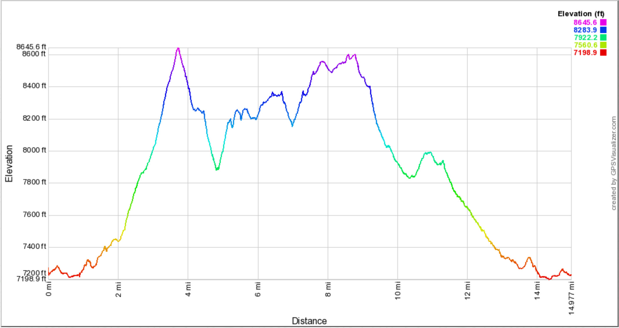
Distance: 15.0 Miles
Vertical Gain: 3300'
Group Size: 1
Hike Rating: Easy
Moderate
Hard
Strenuous |
 See
video of hike
See
video of hike
 GPX for
this trip GPX for
this trip |
|
| Start
Coordinates: |
N 39 20.375 W 120 20.579
|
|
End
Coordinates: |
Same as Start Coordinates
|
| Car
Shuttle
Req'd: |
No |
|
Parking
Directions: |
From
Interstate 80 take the Castle Peak/Boreal Ridge Road exit. Take
the freeway exit to the south, and then turn left at the T intersection
following the signs for the Sno-Park and the I80 PCT Trailhead.
Park at the lot about 1/2 mile down this road and find the trailhead
just to the left of the kiosk at the eastern end of the parking area.
|
| Hazards
of
Note: |
Navigating
the many trail junctions along the way is the most difficult part of
this hike. The trail between the Warren Lake Trail and the PCT
has steep, loose, rocky sections to be careful of.
|
|
Crowd
Factor: |
Moderate.
The Warren Lake Trail appears to be popular with trail runners doing
the loop in the reverse direction that I did, and there were bike tire
marks along the way as well. Once you reach the Peter Grubb Hut
and the PCT, there can be many hikers on that trail any day of the week.
|
General
Notes:
The
first half mile of the trail from the parking area is just an access
trail to reach the PCT as well as the new Donner Lake Rim Trail.
When you reach the Pacific Crest Trail (PCT,) turn left/north and you
will soon enter two tunnels running under the freeway which give hikers
the ability to get past the busy highway without having to attempt to
dodge traffic.
Turn right on the Warren Lake Trail, heading toward Summit Lake, and
then at the next junction take the left hand fork toward Warren
Lake. The next couple miles will be an almost steady climb, until
you reach the crest of this first hill. Take the use trail to
your right/east for a great overlook spot high above Frog Lake.
Back on the trail you will now drop down into the valley on the
backside of Castle Peak, losing almost 800 feet of elevation from what
you just climbed earlier. Another climb awaits exiting the
valley, which will be persistent for the next few miles.
Soon there is a junction for Warren Lake and Devil's Over Lake.
Take the trail to the right if you want to head to Warren Lake, but be
aware there is another 800' drop down to the lake from here which will
have to then be climbed back up to continue. Taking the left hand
junction toward Devil's Oven lake and the PCT, you will have great
views of Devil's Over and Paradise Lakes along the way.
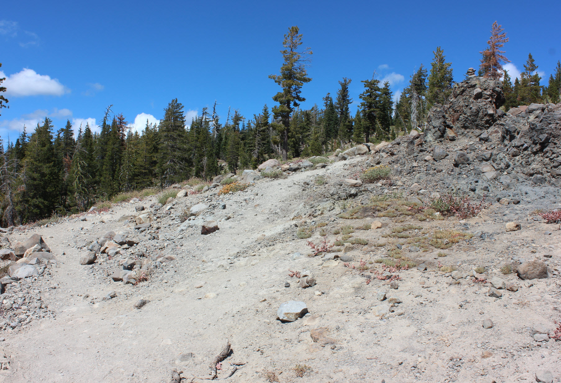
This section of trail is pretty rough with sections of loose rock to
content with, but isn't anything that isn't easily navigatable.
Reaching the crest you will start to drop down as you parallel the PCT,
eventaully meeting up with it in another couple miles.
The last three miles of PCT area relatively banal, being mostly a
forested hike with little views of any kind. The Peter Grubb
warming hut will be passed along the way, and there is a wmall lake on
your right as you near the undercrossing fo the freeway once again,
completing the loop and getting you close to the access trai where you
parked.
|
|
|
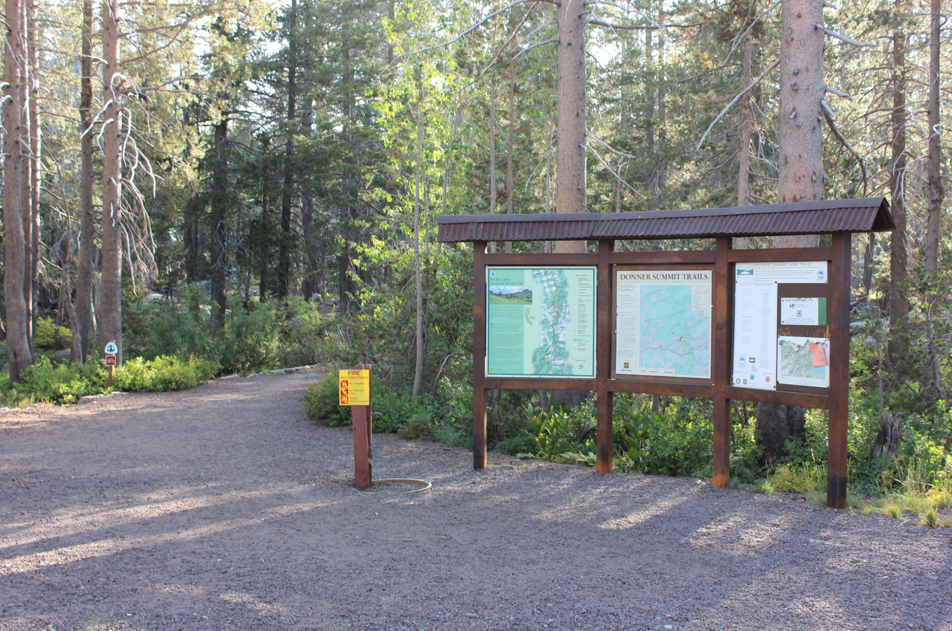
The
trailhead from the parking area described above is found just to the
left of this information kiosk.
|
 |
|
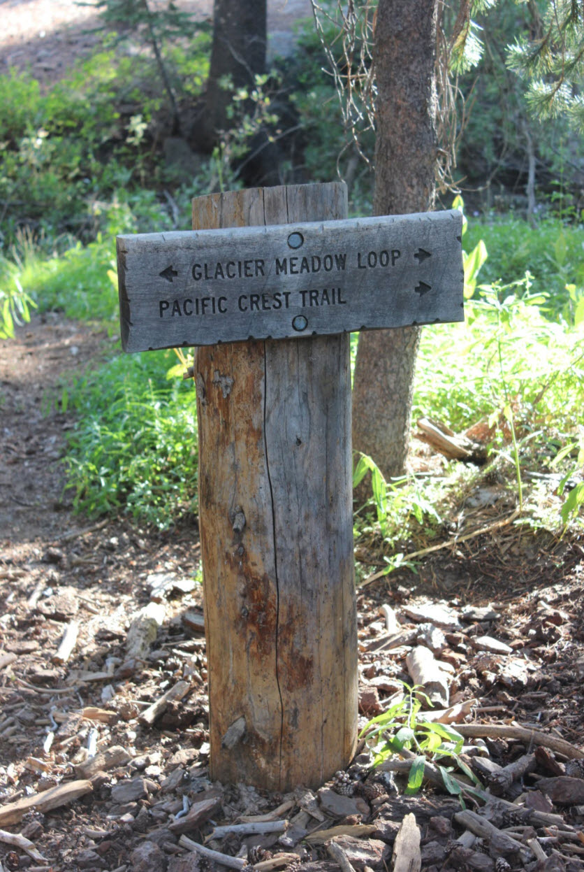
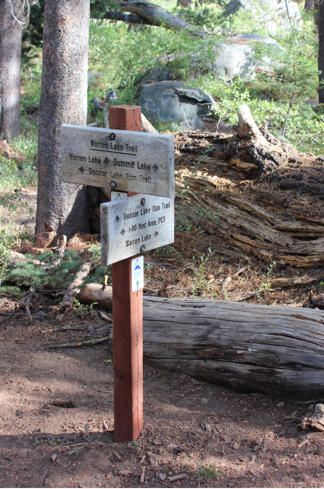
There
are helpful trail signs along the way, but it would be a good idea to
have familiarity with which trails you will navigate on this loop as
there are at least three different named ones along the way you will
travel.
|
 |
|
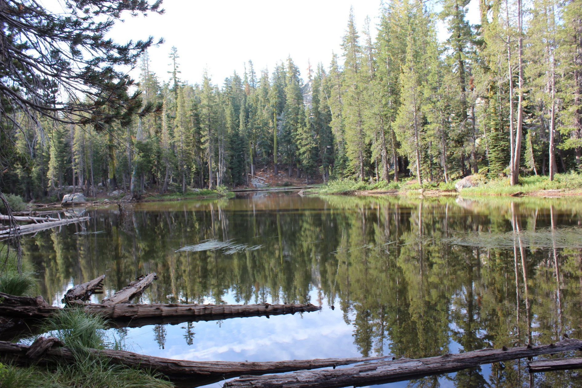
The
connector trail passes by an unnamed lake early on in the trip.
This looks like it would have many mosquitos earlier in the summer.
|
 |
|
After
the first 1/2 mile you will reach the actual PCT, and will head toward
Castle Pass as you make a turn to the left.
|
 |
|
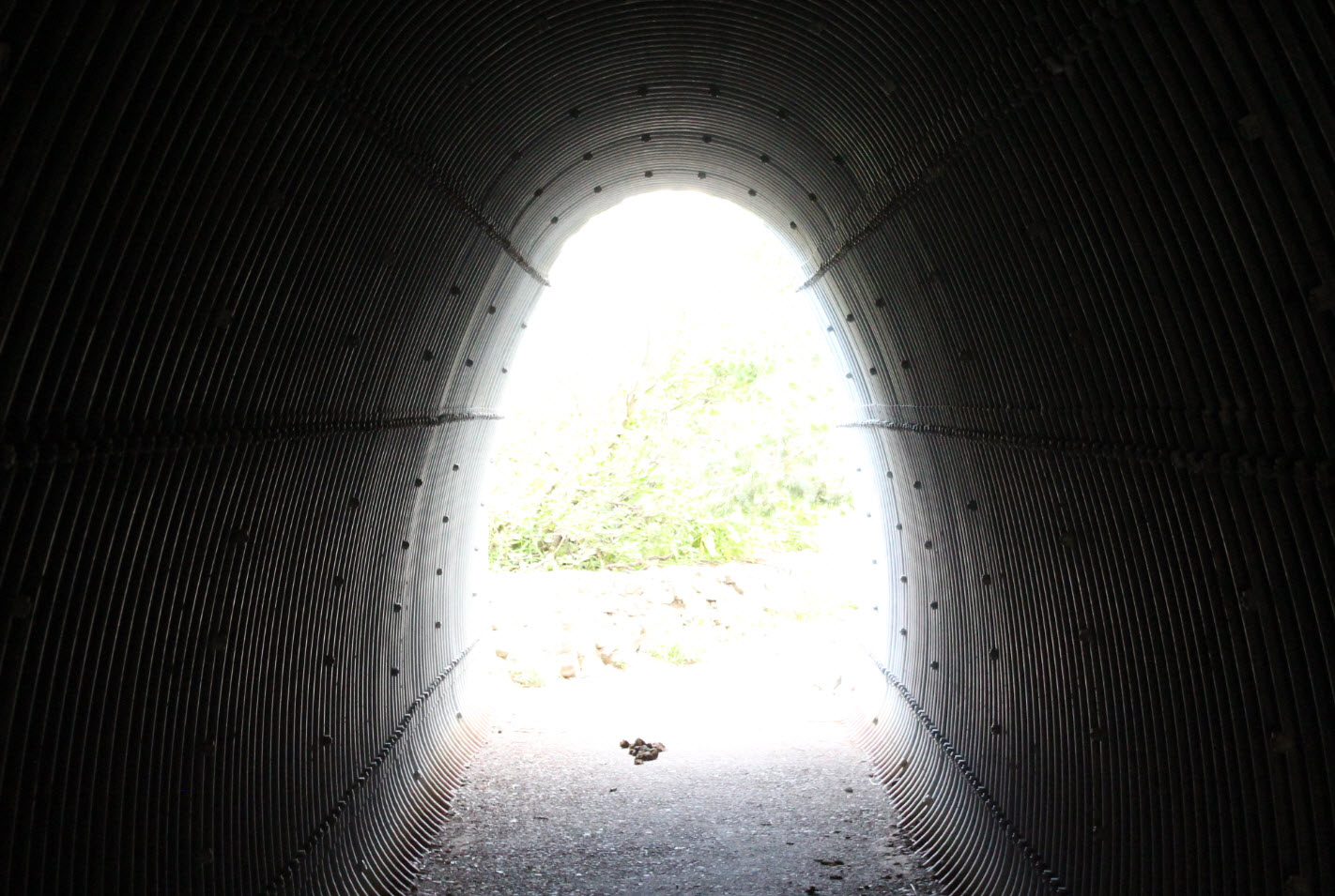
Very
helpful to have these tunnels under both directions of freeway traffic,
or nobody would be able to get past the exceptionally busy highway.
|
 |
|
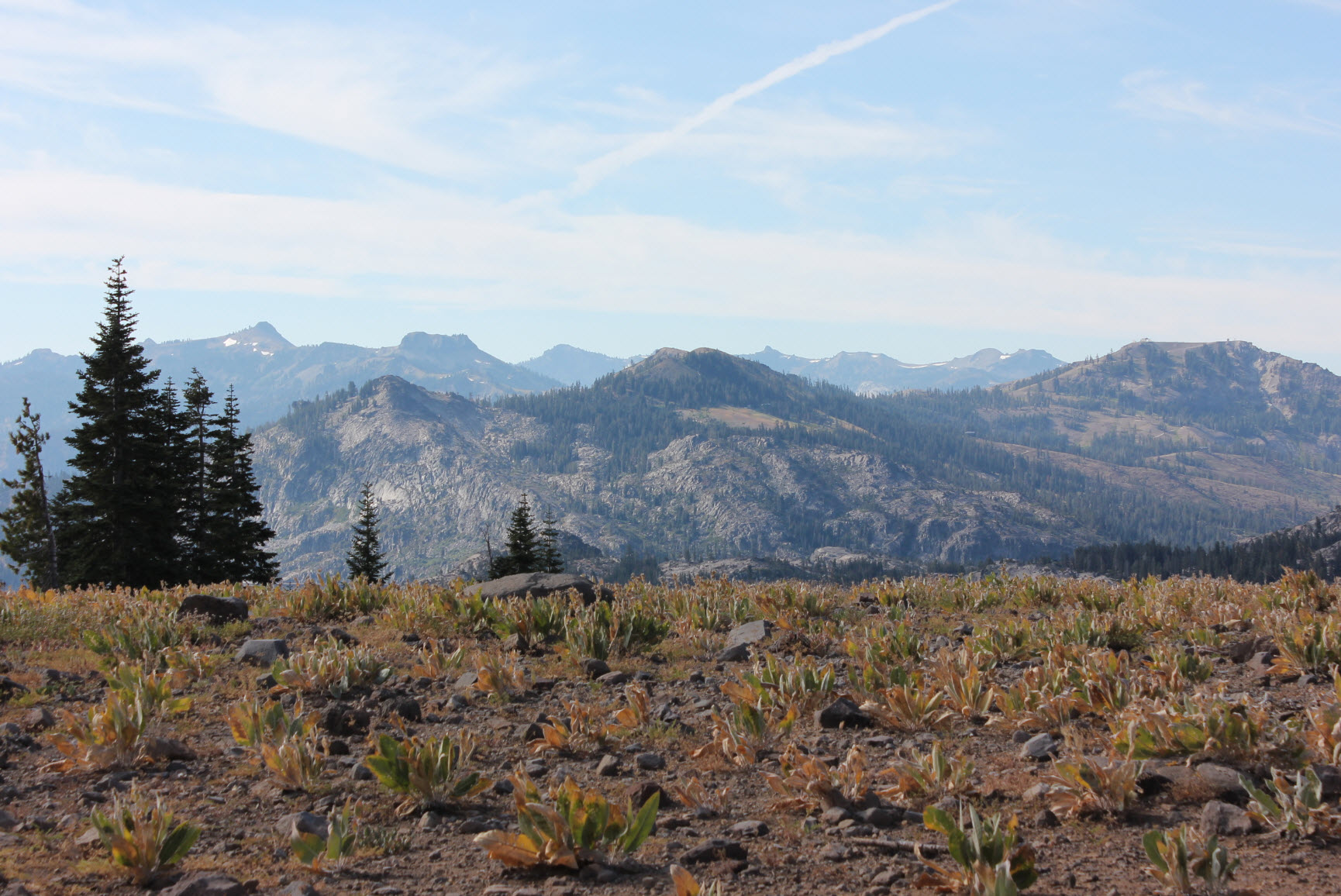
The
trail starts to climb quickly and steadily, but the benefit is that you
get great views to the south very quickly. Easily spotted from
the left are Tinker Knob, Mt. Anderson, Granite Chief, Needle Peak,
Lyon's Peak,and Mt. Lincoln above Soda Springs.
|
 |
|
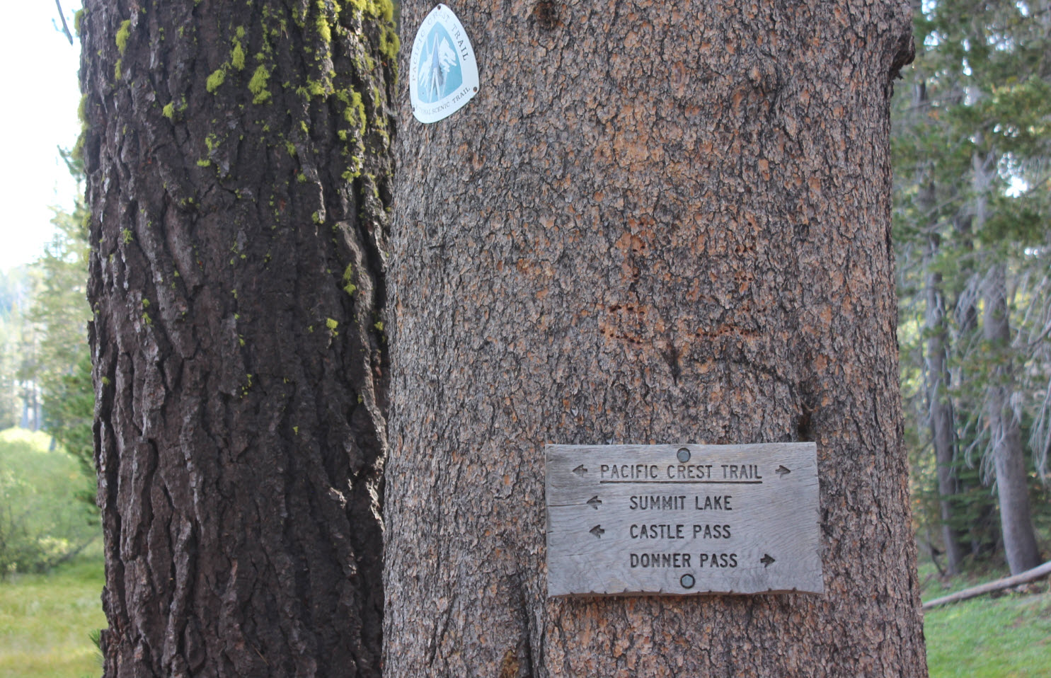
The
signpost here gives good information indication which direction to head
for Warren Lake.
|
 |
|
After
about 4 miles you reach a crest in the trail. Take the use trail
to the right for about 1/4 mile and you will be rewarded with a great
view high above Frog Lake.
|
 |
|
Back
on the main trail you can get a glimpse of the trail far below, but it
will drop even more into the bowl behind Castle Peak to the west.
|
 |
|
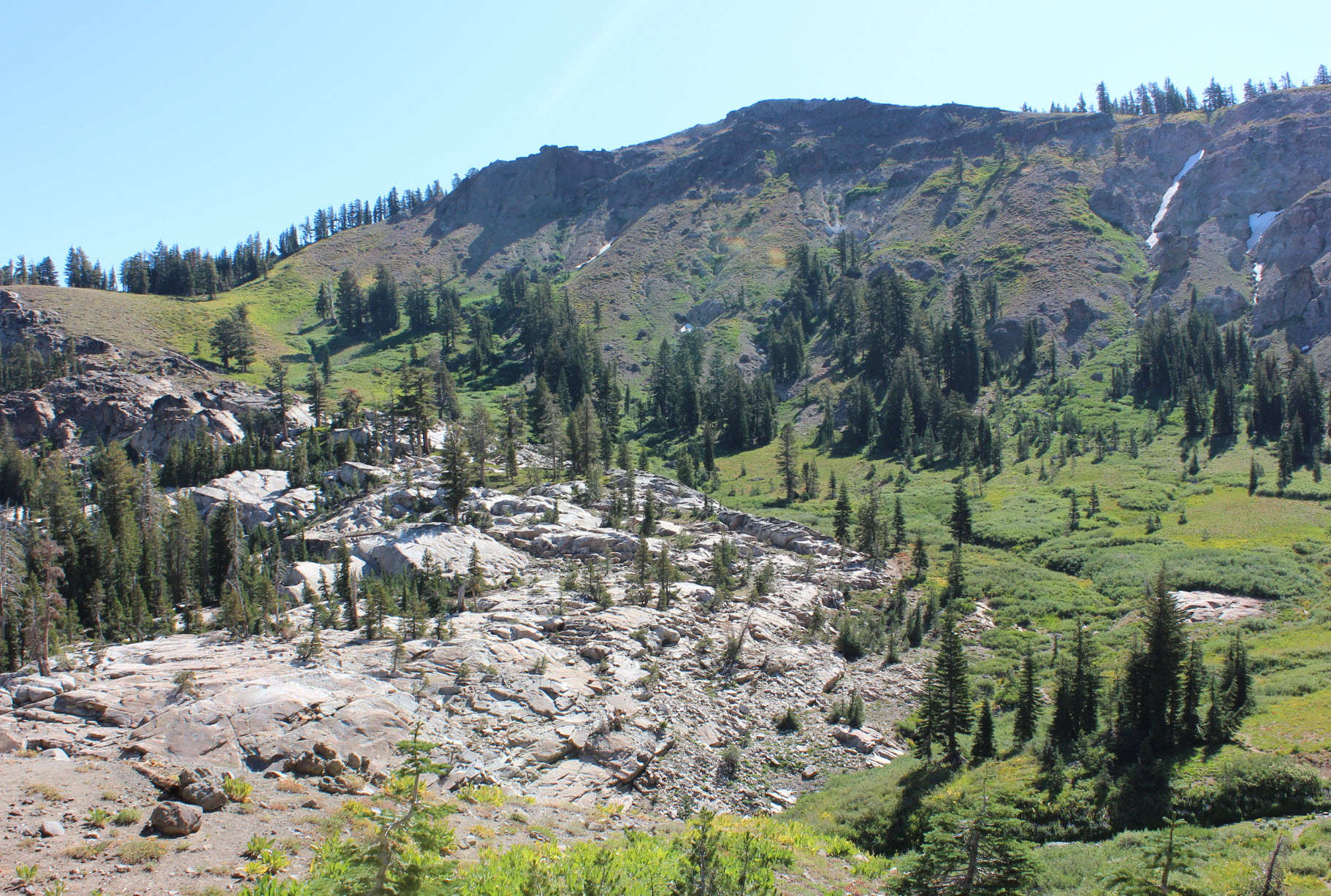
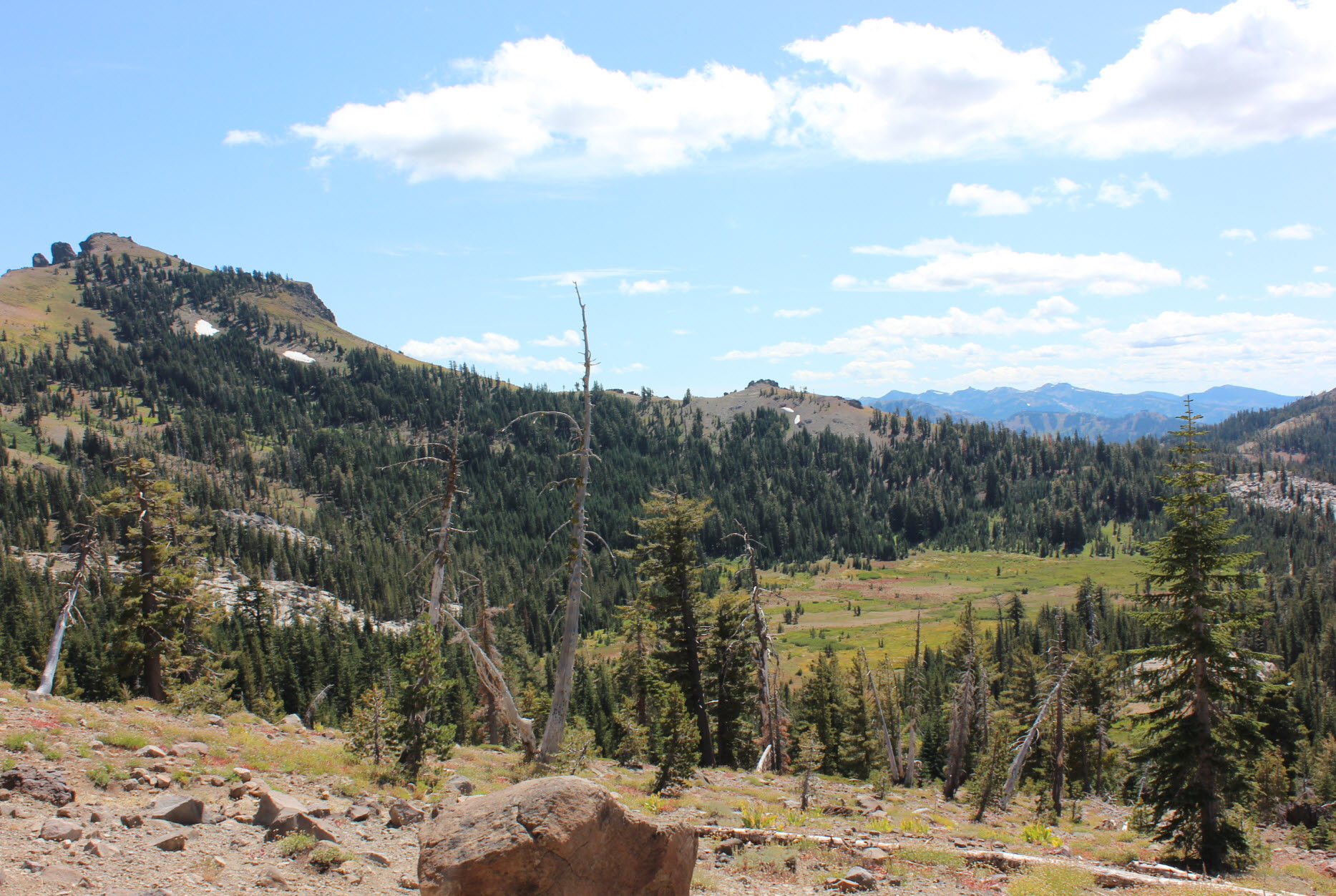
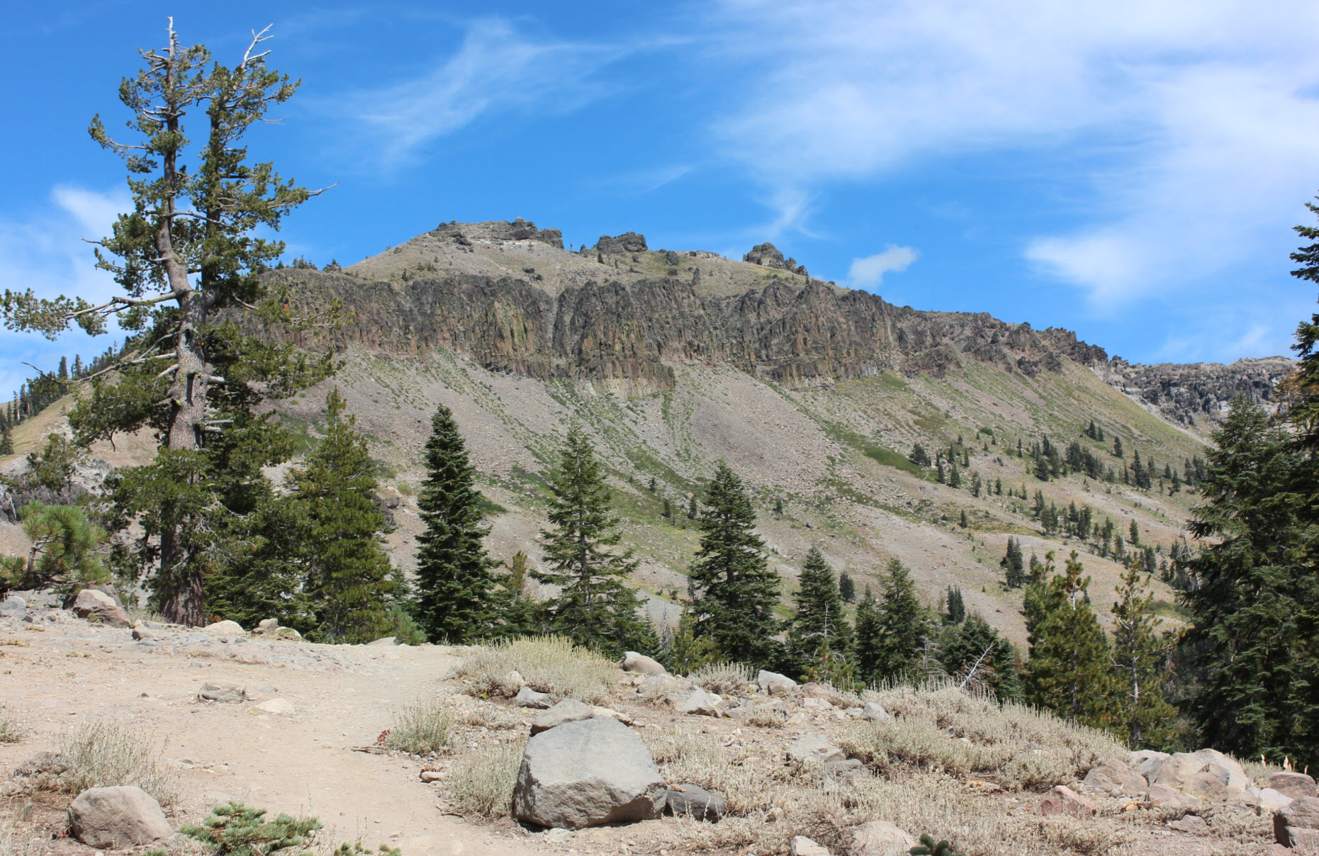
The
valley behind Castle Peak is pretty amazing, with lots of water and
late season wildflowers in abundance even into September.
|
 |
|
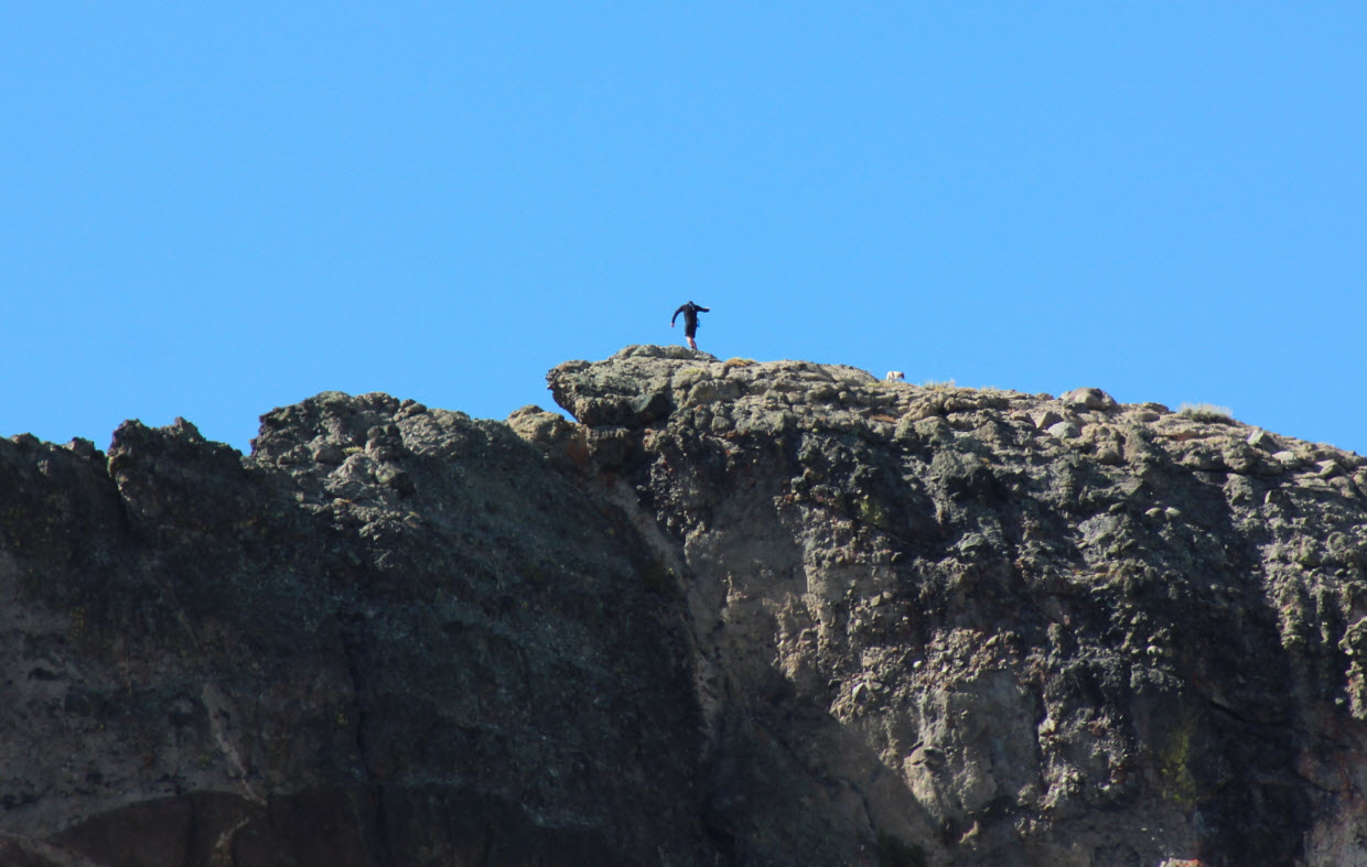
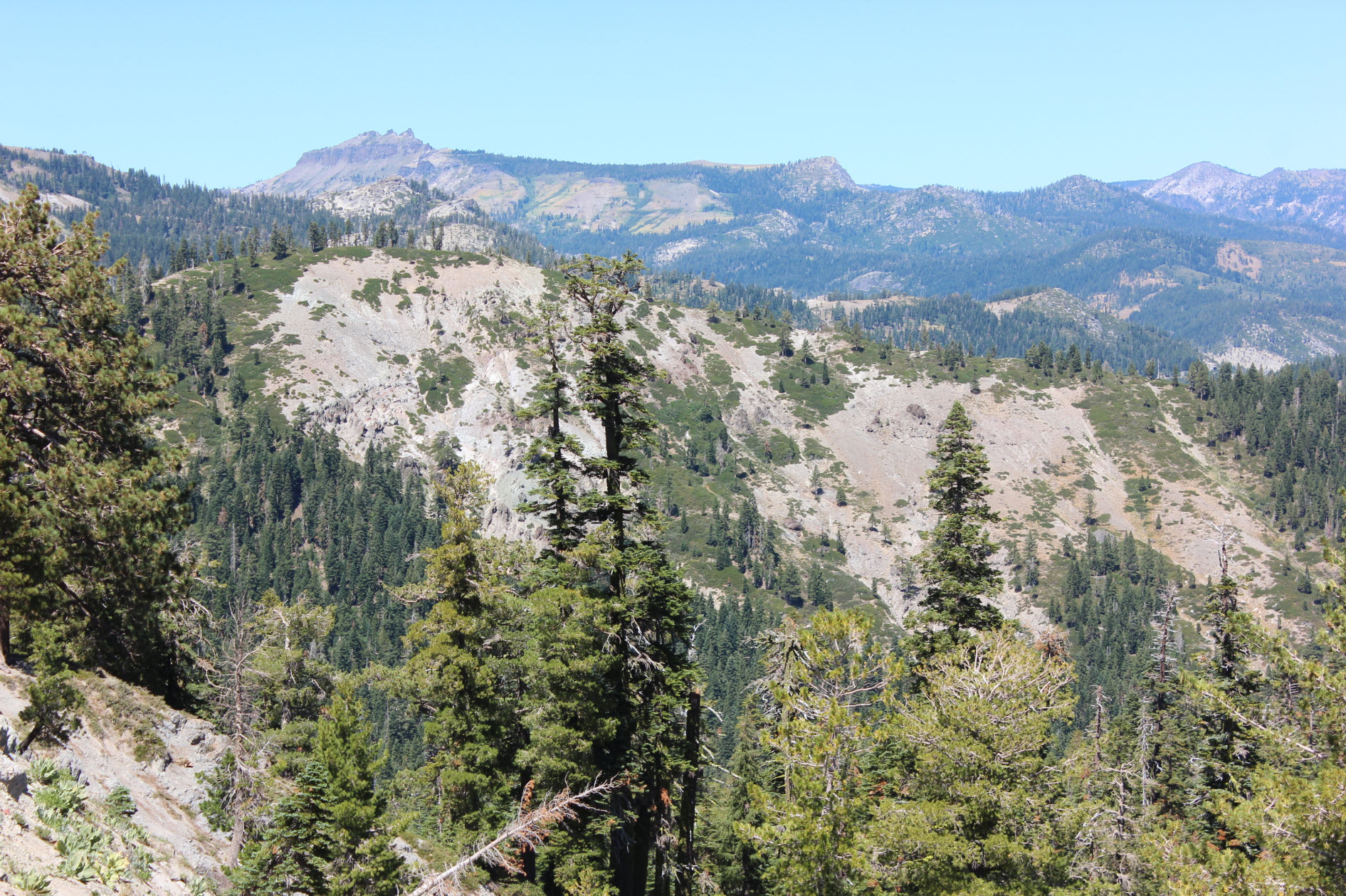
Even
managed to spot a peak bagger on top of Castle Peak from far below.
|
 |
|
After
passing through the valley here is a look back at the way we came,
dropping down from the high ridge in the middle.
|
 |
|
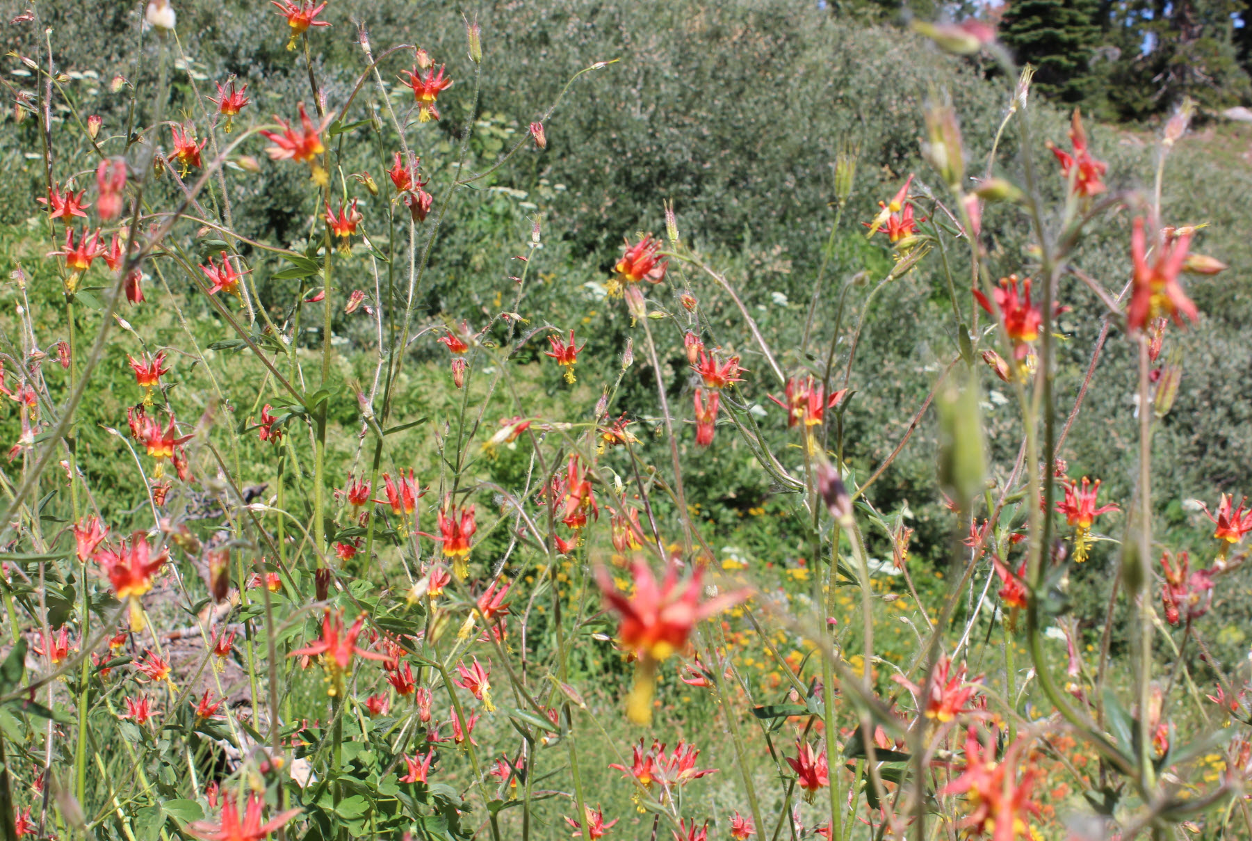
I
wasn't expecting many wildflowers this late in the season, but there
was a lot of water on the backside of the ridge and these columbine
seemed to really be thriving!
|
 |
|
A
look to the east and toward Nevada as you start another climb out of
the low spot behind Castle Peak.
|
 |
|
Taken
from a hike a few weeks earlier, you can see the terrain for Castle
Peak, as well as the Frog Lake cliffs from this vantage point. It
is an interesting perspective of the area from today's hike from
further south.
|
 |
|
At
this junction you can make a detour a long way down to Warren Lake, or
head to the left past Devil's Oven Lake to turn this into a loop hike.
|
 |
|
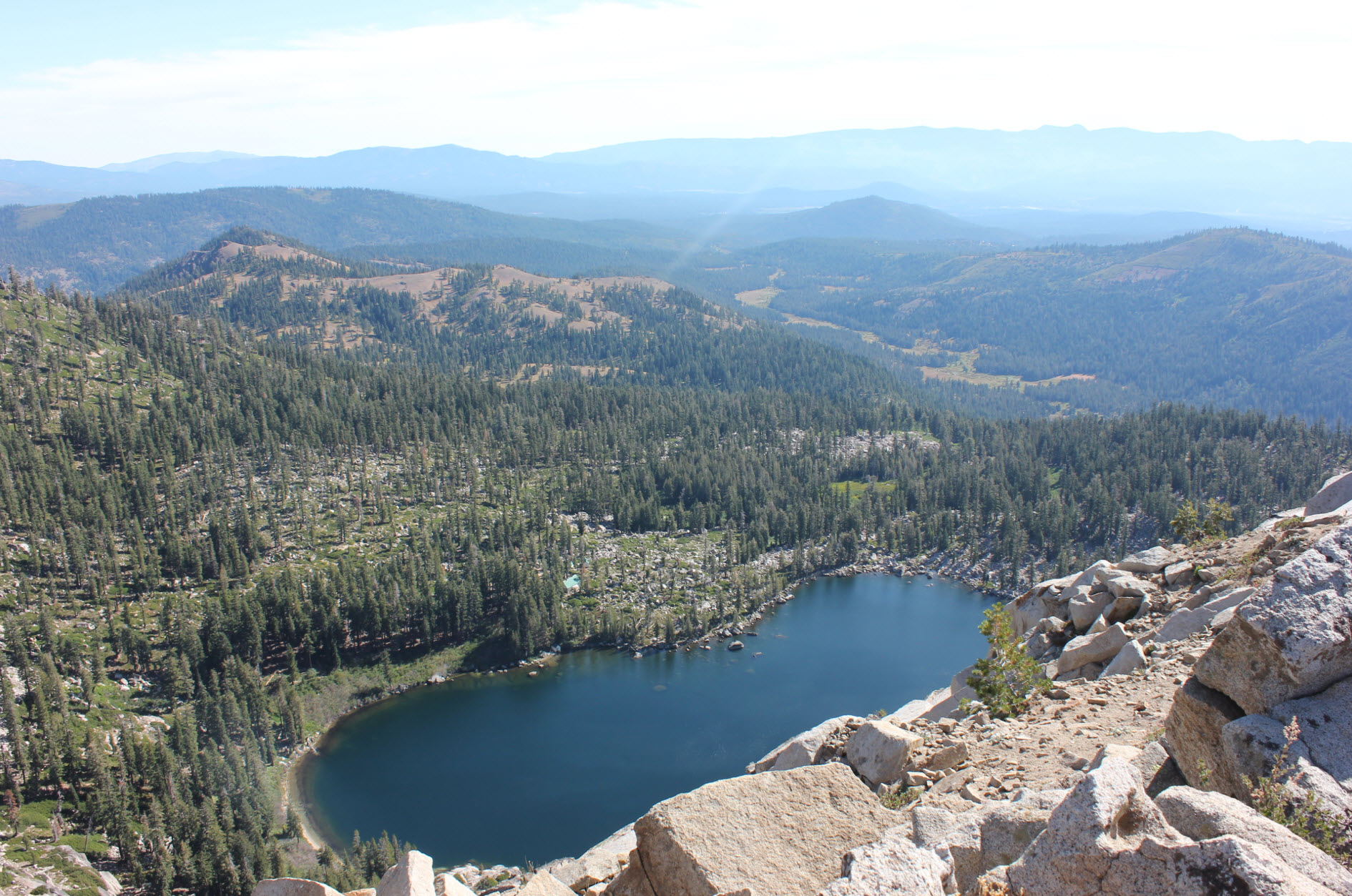
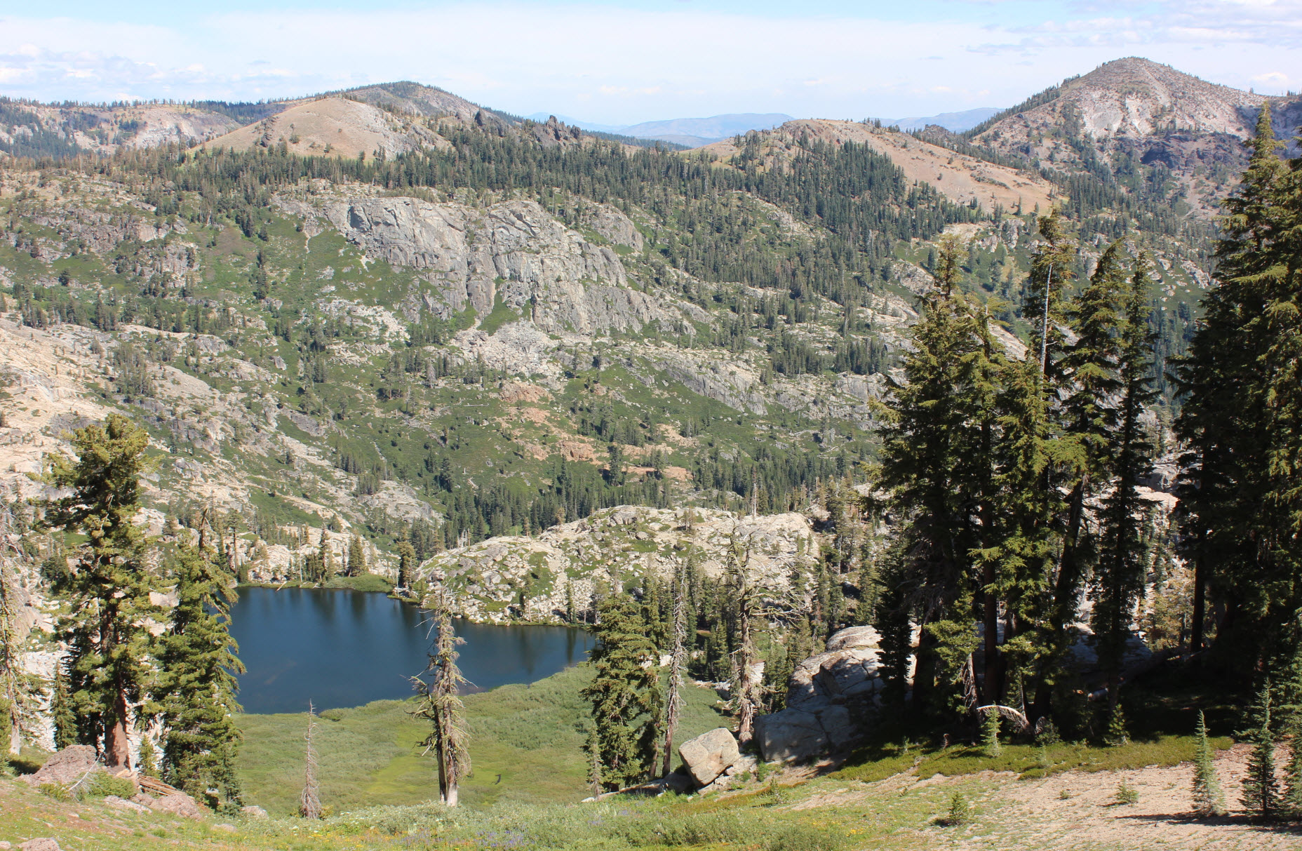
Warren
Lake turned out to be very picturesque, far down in a canyon below Mt.
Lola in the distance.
|
 |
|
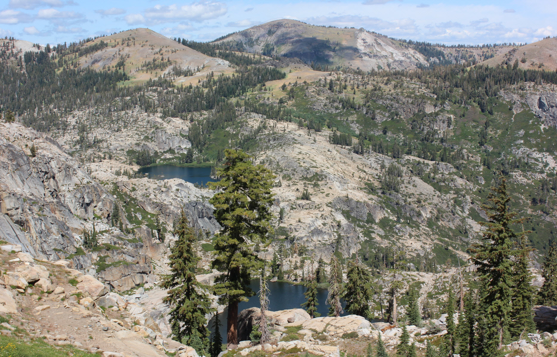
It's
impossible to not want to at least check out a lake with the name of
Devil's Oven. It was pretty nice, but again, it would be a bit of
a scramble to get down to it from the trail.
|
 |
|
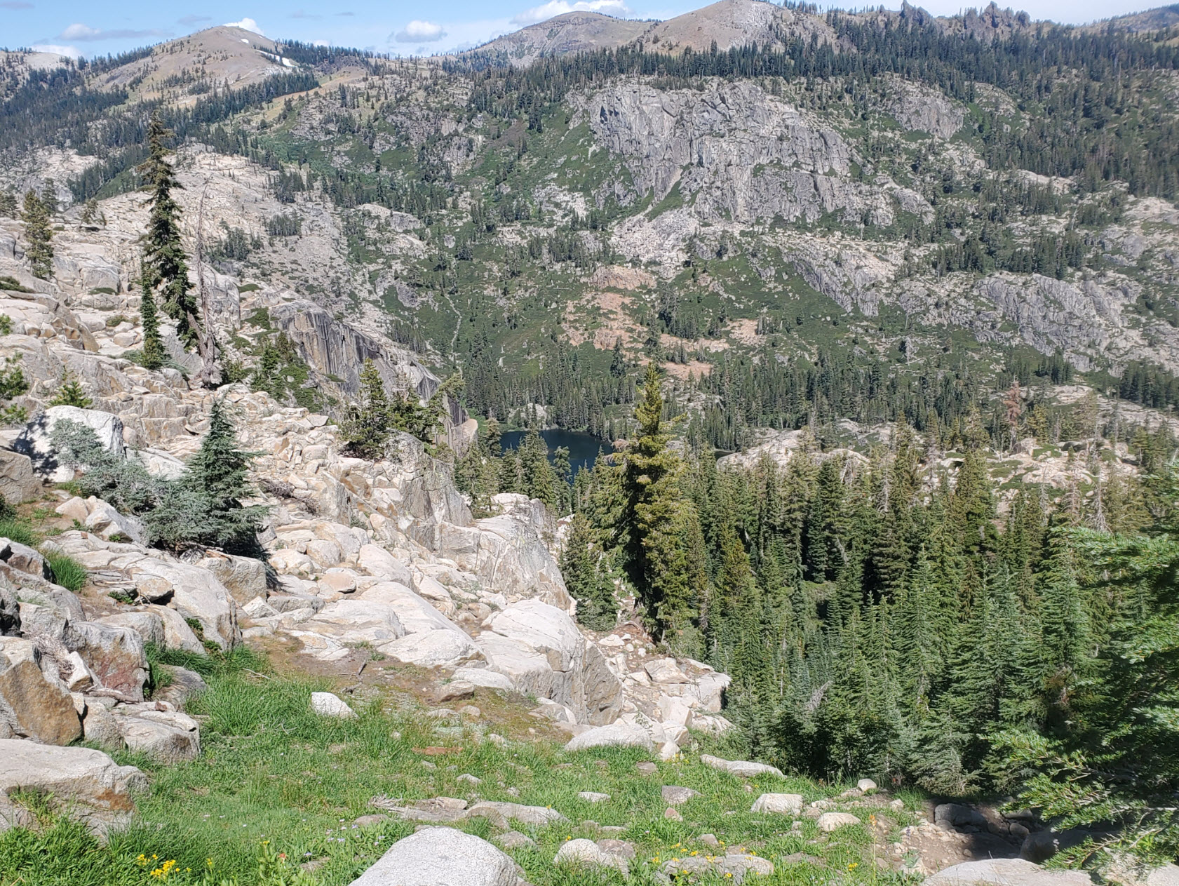
From
this vantage point we had a great look at the popular Paradise Lake on
the left, Devil's Oven Lake to the right, and Mt. Lola, the highest
point in Sierra County in the middle.
|
 |
|
Coming
up over the ridge from the lakes, we had a nice view to the west of Old
Man Mountain, Grouse Ridge and even English Mountain in the far
distance toward the right.
|
 |
|
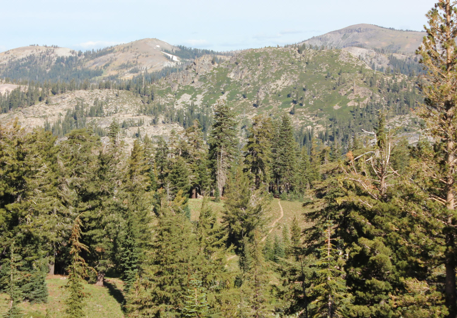
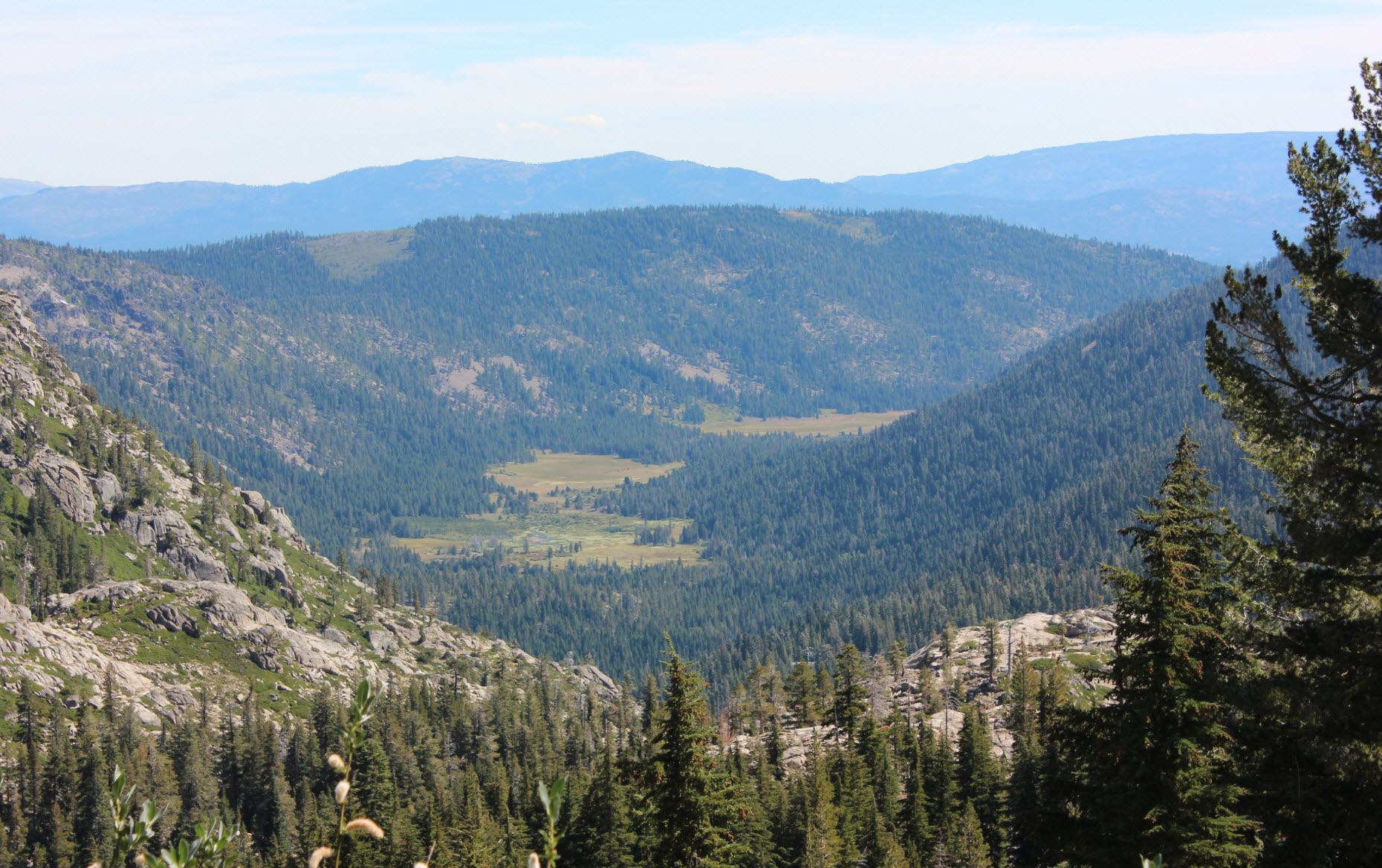
The
loop trail skirts along the western side of Basin Peak, about halfway
between the peak and the PCT below. As the trails get close to
converging, the big open meadow below Castle Peak comes into view.
|
 |
|
This
is the junction where the trail which loops around to the Warren Lake
Trail leaves the PCT. If going the opposite (clockwise)
direction, look for this junction and head upward to the right.
|
 |
|
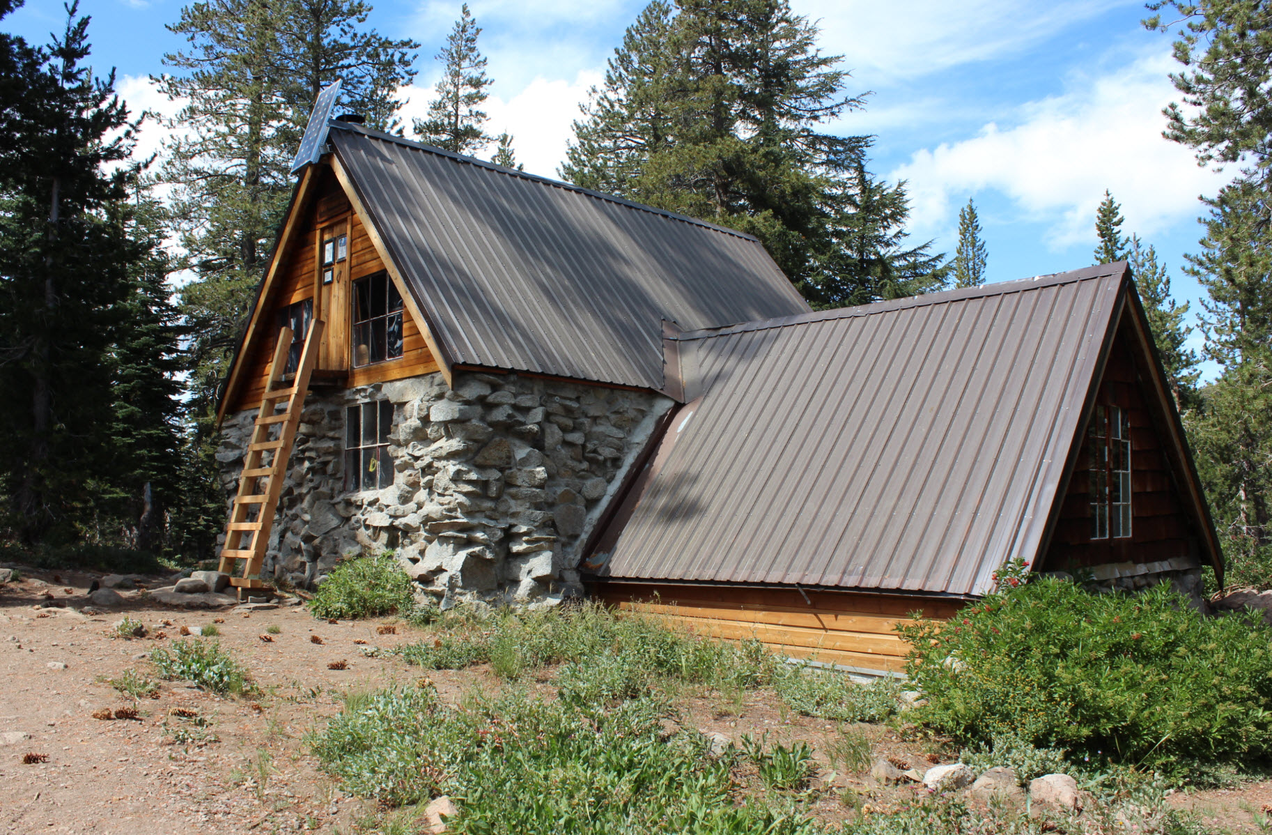
The
popular Peter Grubb ski hut is managed by the Sierra Club, and has this
second story entrance in the backfor the winter when snows will easily
be that deep.
|
 |
|
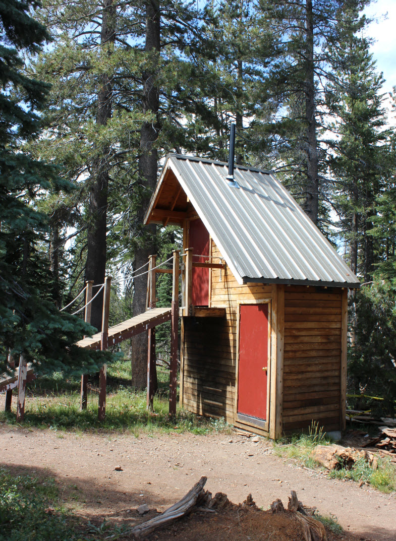
Interestingly
enough, the outhouse had the same optional winter entrance as well.
|
 |
|
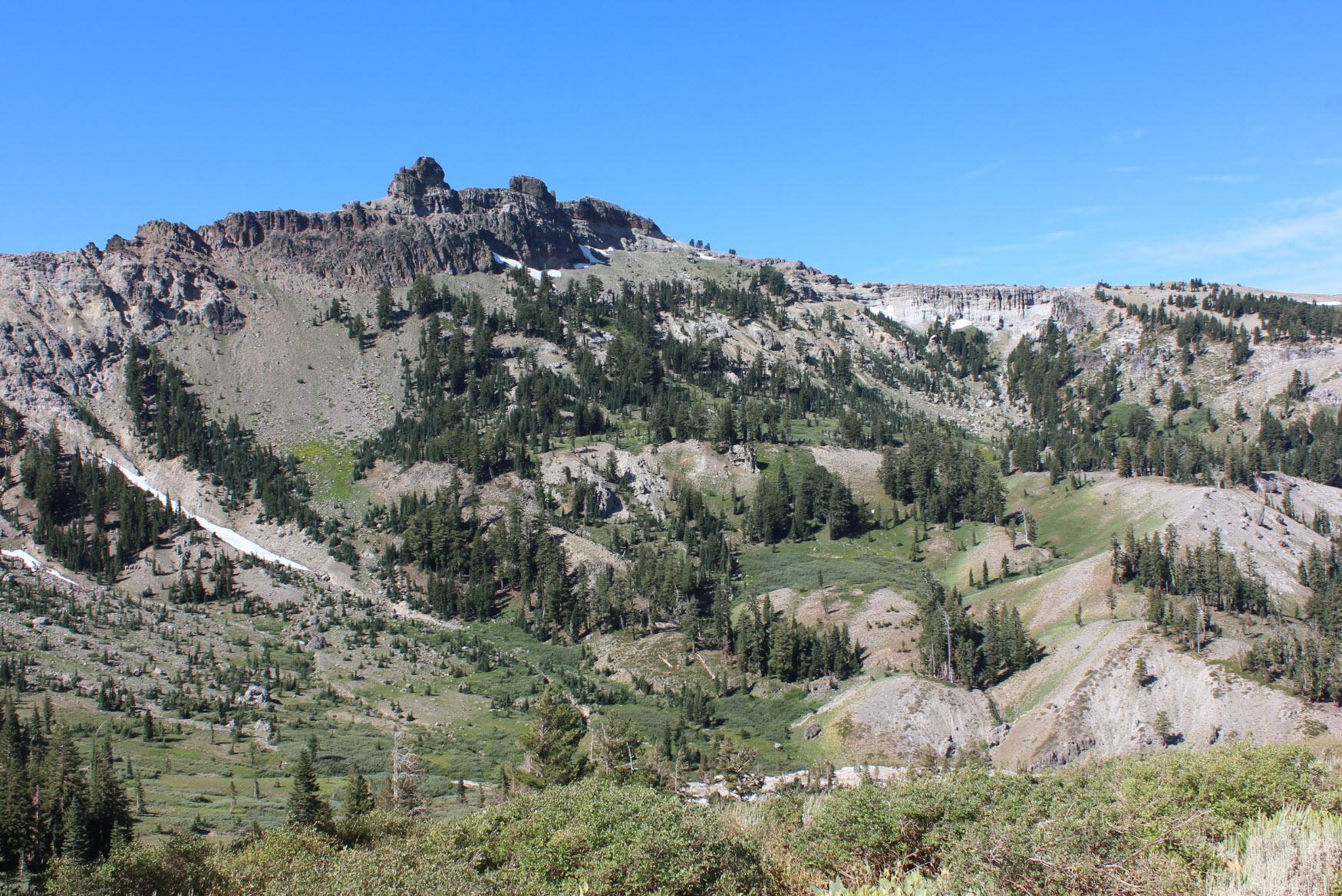
A
good view of Castle Peak from near Castle Pass, taking the junction to
the left to follow the PCT for the rest of the loop.
|
 |
|
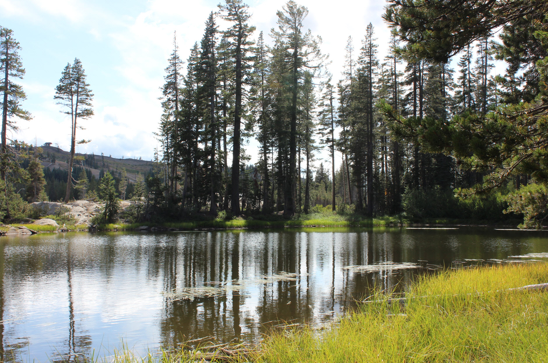
There
is a small lake not even 50 feet from the busy Highway 80 as you near
the undercrossing from the west side. A very noisy spot along the
way.
|
 |
|
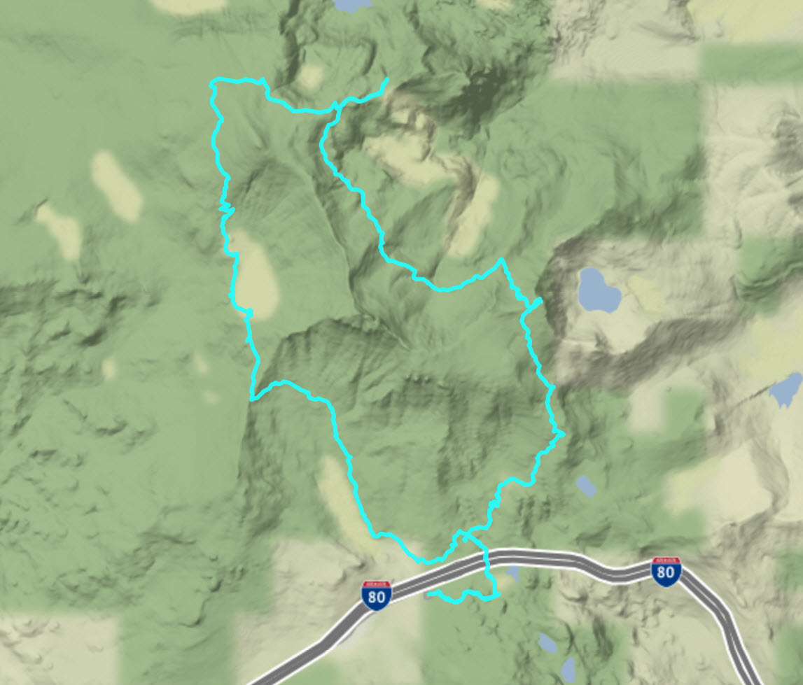
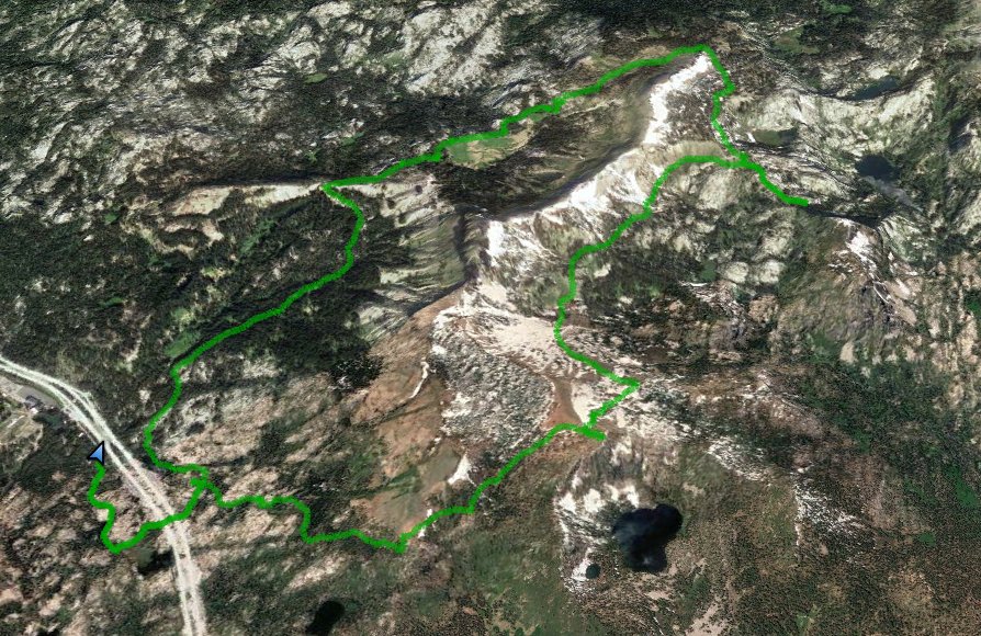
Hike
route going counter clockwise from the bottom left.
|
 |