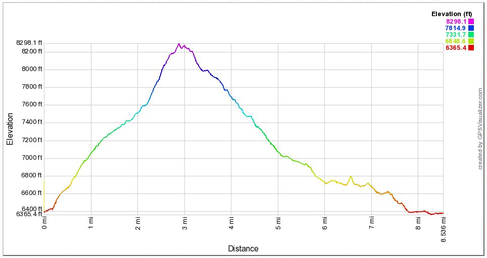
Distance: 9.0 Miles
Vertical Gain: 2100'
Group Size: 2
Hike Rating: Easy Moderate Hard Strenuous
 See
video of hike
See
video of hike
 GPX
for
this trip
GPX
for
this trip
| Start Coordinates: | N 38 50.312 W 120 01.038 | End Coordinates: | Same as Start Coordinates |
||
| Car Shuttle Req'd: | No | Parking Directions: |
Take
Highway 50 to Highway 89 south. Head down approximately 3/4 of a
mile to the turnout on the left hand side of the road at the specified
coordinates. |
||
| Hazards of Note: | Route-finding
may be required on some of the Warr trail spots as this is an older, no
longer maintained trail. Be watchful for mountain bikers on the
Saxon Creek trail who may not be on the lookout for hikers. |
Crowd Factor: | Negligible
to moderate. There will be little to no traffic on the Warr Trail
section, as this is a relatively unknown trail. The Saxon Creek
Trail can be very popular with mountain bikers. |
||
| General
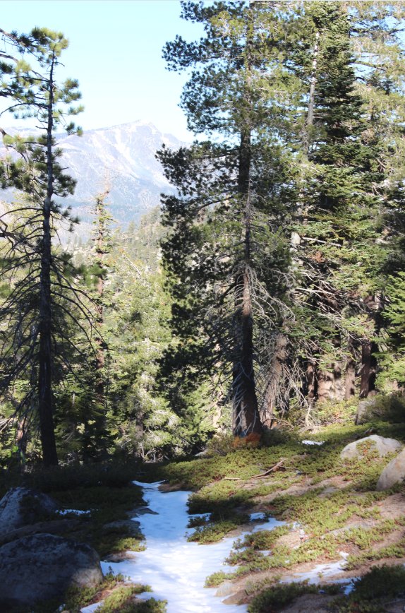
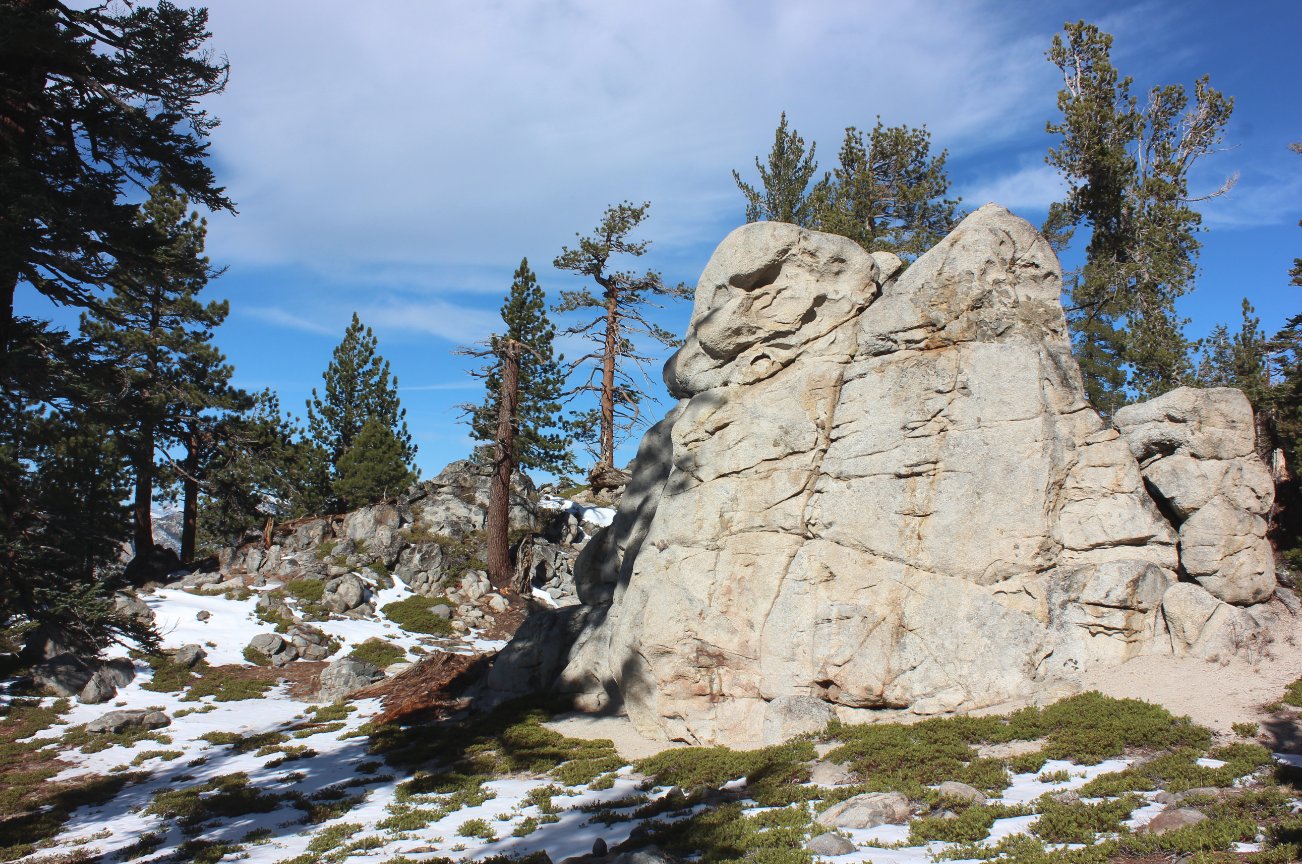
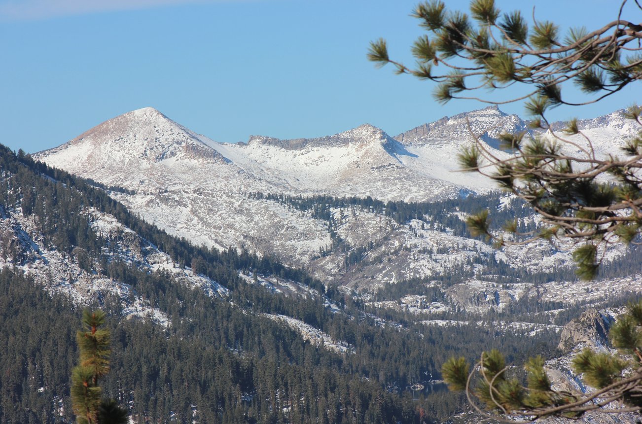
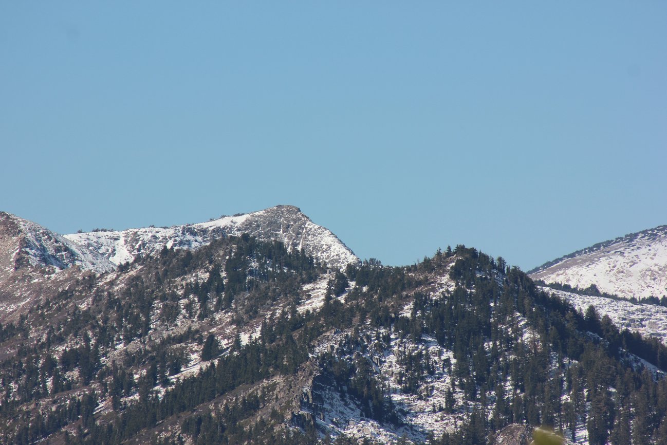
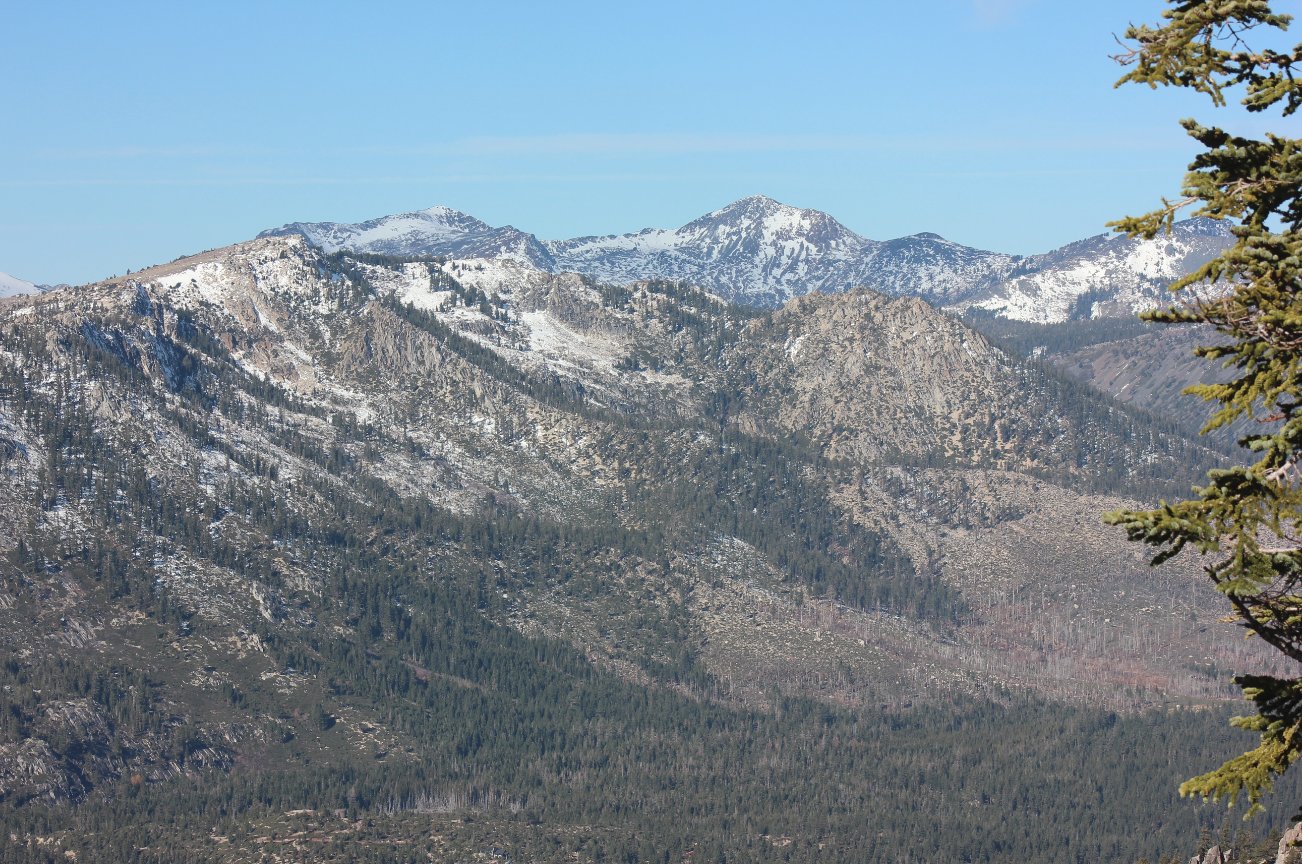
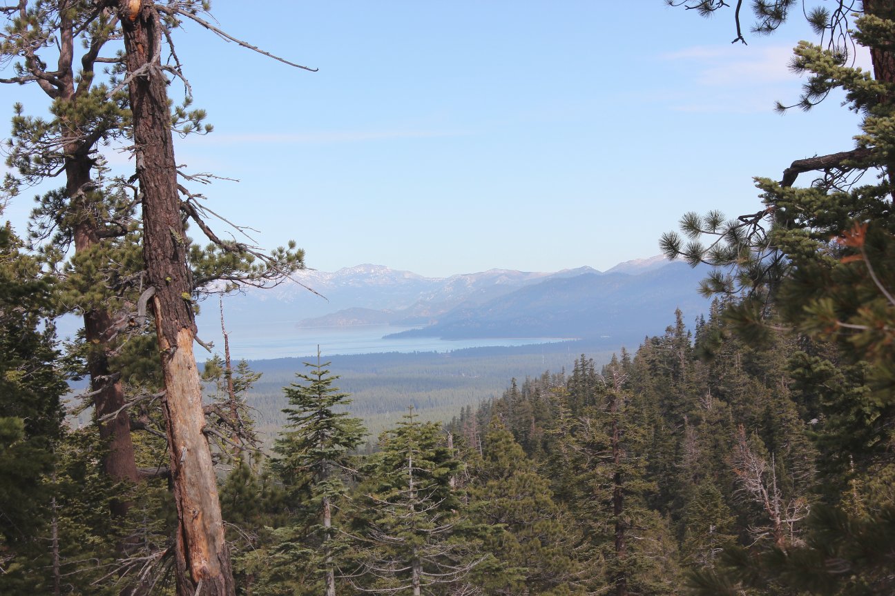
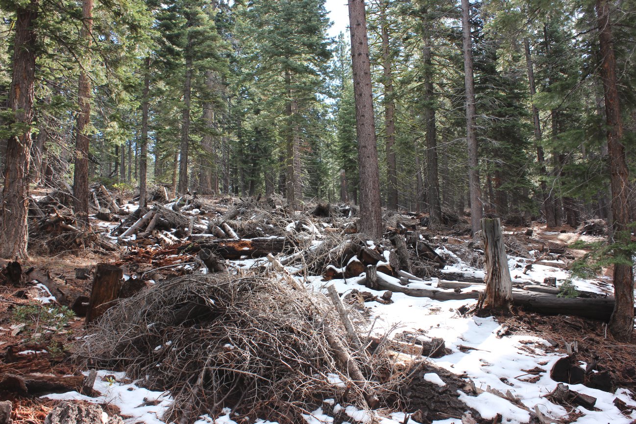
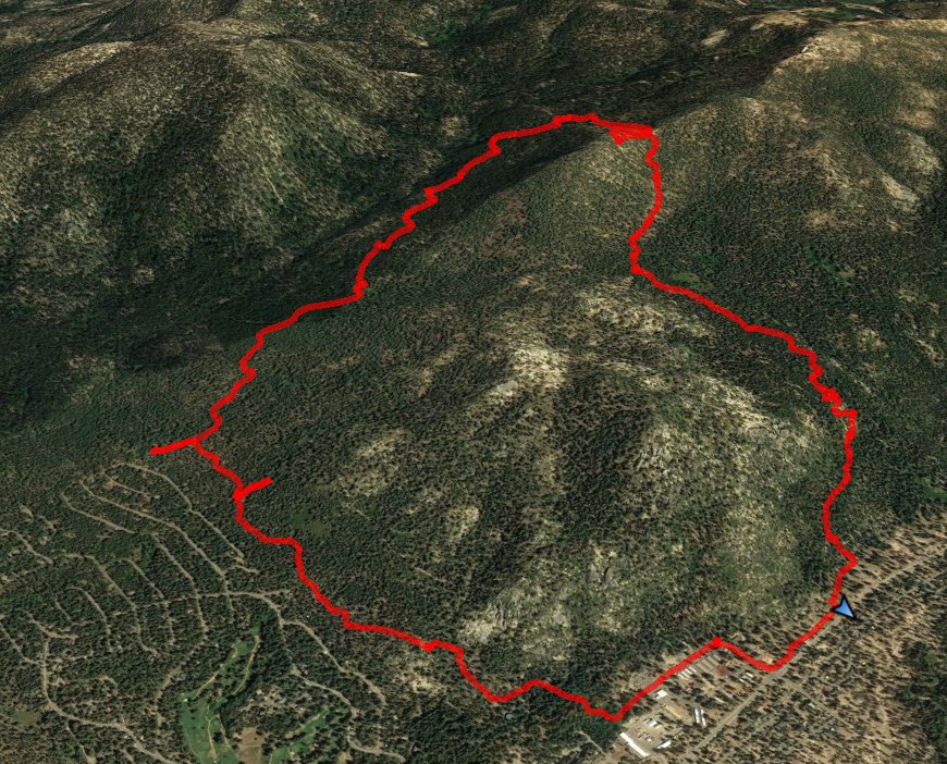
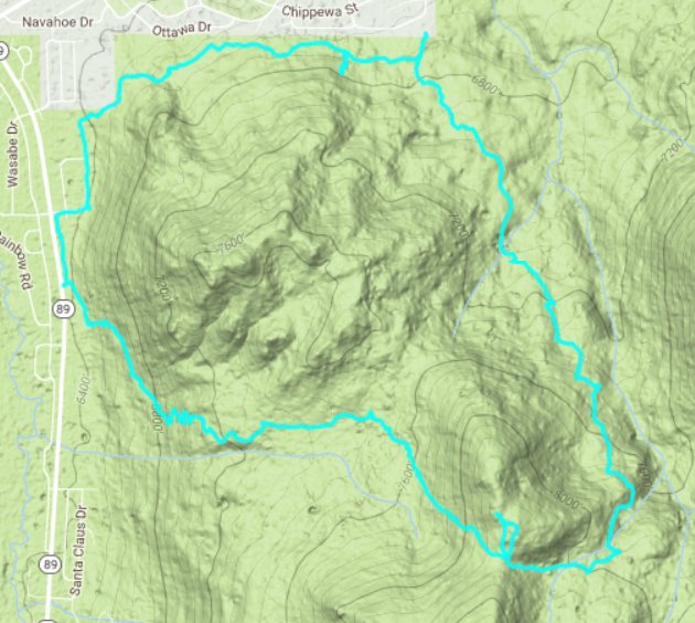
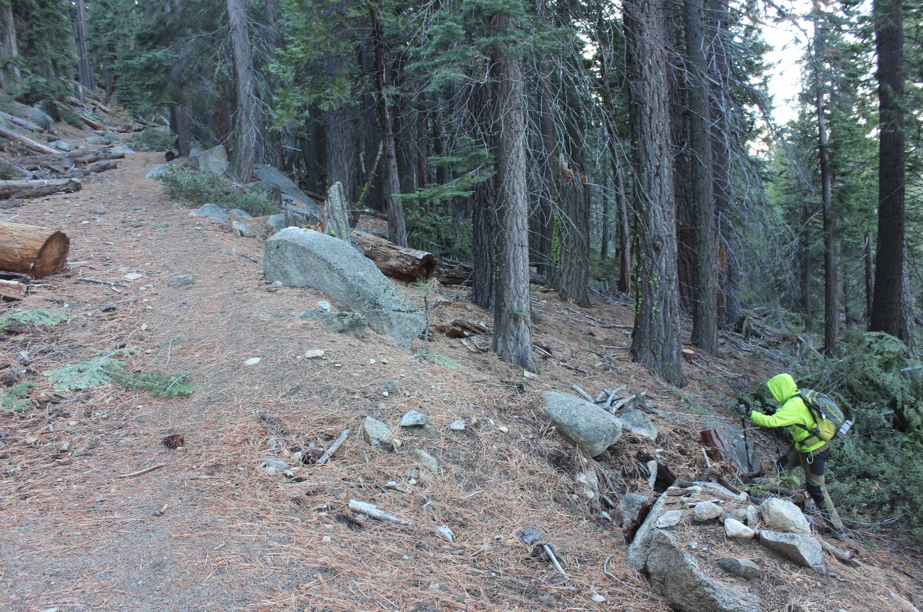
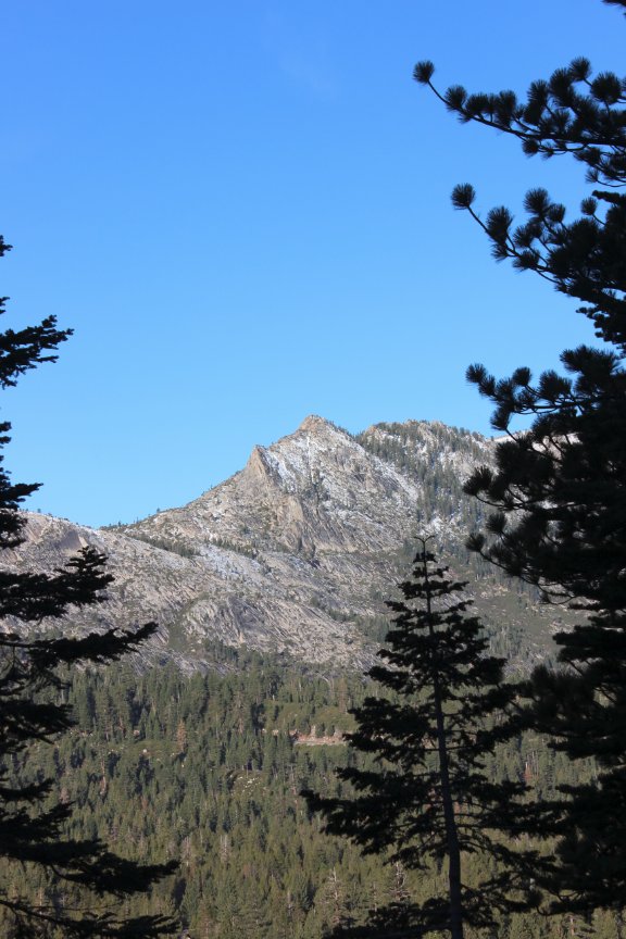
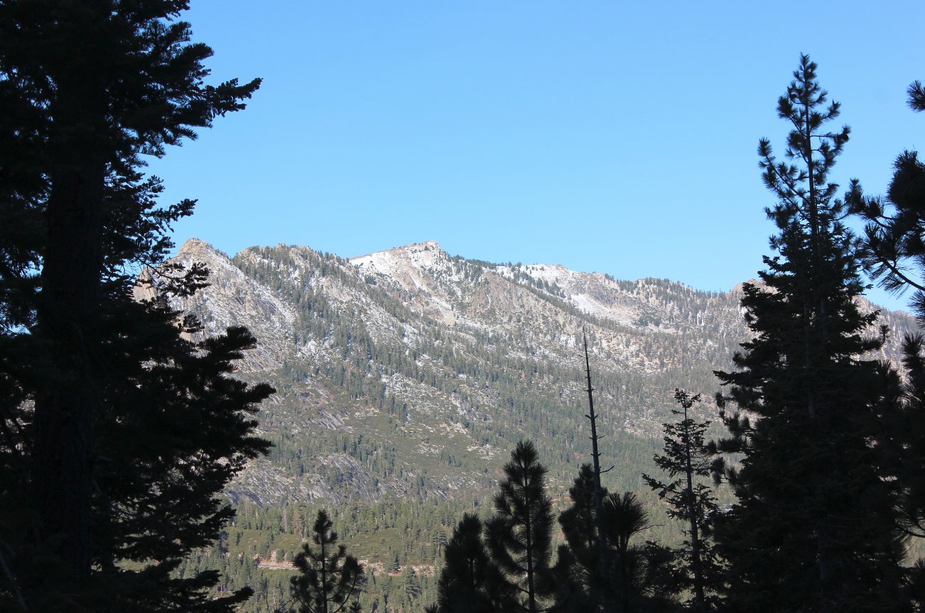
Notes: From the parking area, there are a couple of trails within sight as you head away from the highway. The actual start of the Warr Trail is just a little further north near the junction of Highway 89 and Shakori Dr, but there is no parking there for any vehicles. Finding the correct trail can be a little bit of guesswork, but make sure you get to one which heads uphill almost immediately to the southeast. The Warr trail follows what looks to have been an old jeep trail for the first 1/4 mile, and then it narrows down to a single track trail quickly after that. There area a few crossings of other trails on your way up the mountain, but just stay on the trail you have been heading up. After 2 miles of heading upward at a gradual but steady slope, you will reach an open area with a few meadows, and then over the next 3/4 mile you will have some significant uphill climb on the trail. Reaching the saddle, follow a use trail to the north toward a rock outcropping and then head to the ones furthest west for a fantastic view of the Crystal Range in Desolation Wilderness across the valley. Back to the saddle, the trail continues on to the east, and drops down significantly for the next 1/2 mile before you reach the junction with the Saxon Creek trail. There are a couple of water crossings in the section, but they are small and easy to navigate. At the junction with the Saxon Creek trail, which is unmarked, head to the left and begin a 3-4 mile journey along what is obviously a well-used bike path. Be watchful for mountain bikers who may not be on the lookout for hikers moving slower than they are. There is one good view of Lake Tahoe off to the side of the trail, at a point just about a mile into the Saxon Creek section of the hike. Past that, the trail is mostly through forest. The last 1/2 mile before you will turn left on a very slight use trail is filled with stacked logs in burn pile configurations, which seems to go on for a significant amount of time. If you reach the housing area with two large green water towers ahead of you, you have probably just missed the turn to the left. You can either walk along the residential road, or head back a few hundred feet and find the trail which will head west. Follow this around to the parking area at the start of the hike, some of which will be on the road paralleling Highway 89 in where CalTrans has a large amount of equipment. |
|||||