Distance: 20.5 Miles
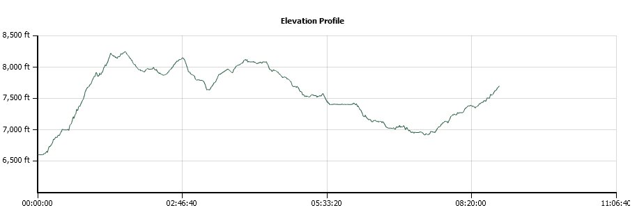
Vertical Gain: 1800'
Group Size: 1
Hike Rating: Easy Moderate Hard Strenuous

 GPX for
this trip

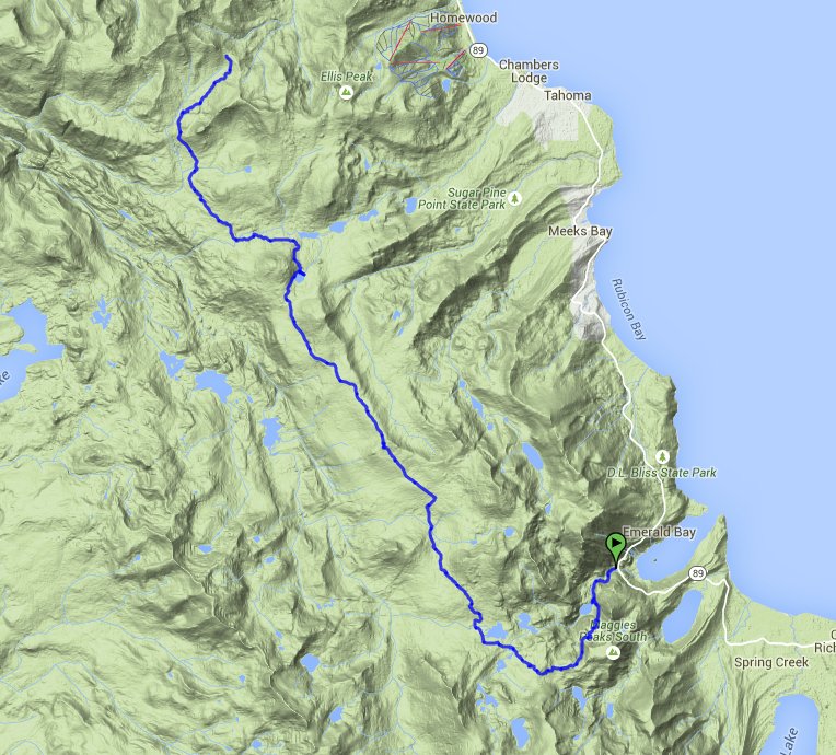
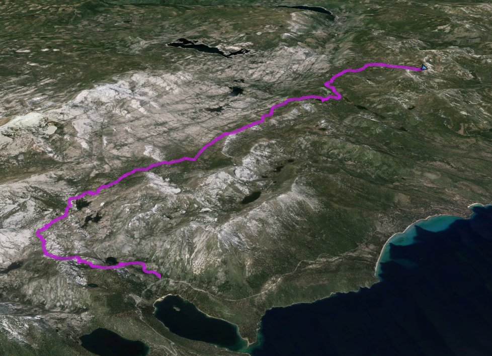
| Start Coordinates: | N 38 57.117 W 120 06.796 | End Coordinates: | N 39 04.629, W 120 14.096 |
||
| Car Shuttle Req'd: | Yes | Parking Directions: | For parking at Emerald Bay take Highway 89 to Emerald
Bay. Parking is available for a $5 fee in the Eagle Falls
parking lot, or on the street just outside of it for no charge. To get to the parking area for Barker Pass, take Highway 89 to Barker Pass Road, which is just north of the town of Tahoe Pines. Drive about 7.4 miles up Barker Pass road to the parking area on the right for the Pacific Crest Trailhead. The last half mile or so is unpaved dirt road. |
||
| Hazards of Note: | Extremely rocky trail for the first few miles toward the Bayview trail junction. The last 15 miles are in forested area with limited sightlines. | Crowd Factor: | Moderate to Minimal. The first mile to Eagle Lake is very popular and potentially crowded, but after that the trail to the Velma Lakes will have people but not as many. After turning north onto the PCT at Middle Velma Lake the number of people you encounter will be minimal. | ||
| General Notes: From the parking area at the Eagle Falls trailhead, fill out a wilderness permit at the kiosk and attach the take-along section of your permit to your backpack. The trail heads off immediately up a short rise, and then you will come to the junction of Eagle Falls to the left, and the Eagle Falls loop to the right. Stay to your left, cross the bridge over the falls (a trickle in the late summer) and head up the rocky stairs into Desolation Wilderness. Almost a mile ahead will be a junction sign, pointing to Eagle Lake to the right and the Velma Lakes to the left. A brief detour to Eagle Lake of less than 300 feet is well worth the time due to the wonderful setting for the lake with granite rises all around. Heading up to the Velmas from the junction the trail just continues to climb a total of about 1600' until it reaches a junction with the Bayview Trail. This is the most difficult section of the entire day, and in warm weather lots of water will be required to replace what is being constantly burned off during the climb. At the Bayview Trail junction turn right, and head toward the Velma Lakes. Pass by another junction for Dick's Pass and Dick's Lake heading off to the left. You will then pass by an unnamed smaller lake on the left side of the trailand after about 4 1/2 miles you will reach Middle Velma Lake off to your right. There are trees here blocking the near shoreline of this lake, and it is worth taking a minute out of the trip to head down and check out the great lake and the many islands scattered around within it. At just below 5 miles in on the trail, you will come to a junction for the Pacific Crest Trail (PCT.) Turn right, and head on into a forested part of the trail which will dominate most of the rest of your trek along this section. Initially the trail will skirt along the westernmost edge of Middle Velma lake, and then begin a small climb along the way until you reach the junction of the Phipps Pass Trail which heads on up to the right. Continue on the PCT, and back into the forested section of the trail. Every so often there is a teaser as to the views across to the west of the granite mountains that top off with Red, Silver, McConnell and Tell's Peaks, but from there trail there is never much of a view that isn't just glimpses through the trees. Five miles ahead the trees will clear enough to spy a little bit of Rockbound Lake to the northwest, and this was a good spot to stop and enjoy some food and a rest from the fairly non-changing look of this long section of trail running north and south. The next dependable source of water past Middle Velma Lake is Richardson Lake, which is approximately 6 1/2 miles from the end of this segment and a mile past the northern boundary of Desolation Wilderness. The LudLow hut can be found on the northeast side of the lake, and continuing on past this you will soon cross the infamous Rubicon Jeep trail. At this point it is past the technical area and mostly just a dirt road. The last section of trail to Barker Pass is just like the previous segment of the PCT, until with about a mile left you will see Barker Peak and the trail will generally head toward it and a little bit to the east. When you finally reach Blackwood Canyon Road just next to the finishing parking area, cell service magically is available, but disappears again as soon as you start the long drive back down the canyon. |
|||||

