|
|
TRT
- Segment 4b - Kingsbury North to Kingsbury South (Daggett
Connector)
|
|
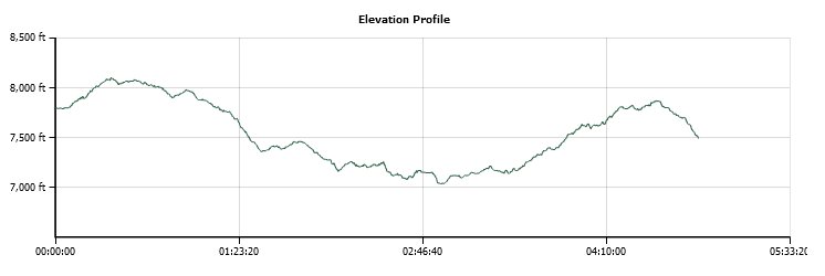
Trip Date: 07/19/2015
Distance: 8.6 Miles
Vertical Gain:
1600'
Group Size:
2
Hike Rating: Easy
Moderate
Hard
Strenuous |
 GPX for
this trip
GPX for
this trip
|
|
|
Start Coordinates: |
N 38 59.779, W 119 53.794 |
|
End Coordinates: |
N 38 57.639, W 119 53.200
|
| Car Shuttle
Req'd: |
Yes |
|
Parking
Directions: |
For parking at Kingsbury
North, take Highway 207 east from Lake Tahoe
Blvd for a couple miles, and then turn left on N. Benjamin Dr.
Follow this road around (it turns into Andria Dr at one
point) until you reach the end of the pavement and the parking area
for the Tahoe Rim Trail hike.
For
parking at Kingsbury South, take Highway 207 east from Lake Tahoe Blvd
for a couple of miles, and then turn right on Tramway Drive (just past
Benjamin Drive.) Follow Tramway until it bends to the left,
and then continue on Quaking Aspen Lane as it doubles back the way you
came. Find the TRT parking area on your right at the
coordinates provided. |
| Hazards of
Note: |
Crossing Highway 207 at the
spot where the trail changes to the other side of the road can be
dangerous. The cars move quickly with limited sight. |
|
Crowd Factor: |
Moderate. This is a
newer section of trail connecting the TRT without going on paved roads
or through neighborhoods and the crowd factor is still a bit
limited. |
General Notes:
Starting
at the Kingsbury North trailhead, you have two options for the first
half of this connector hike. You can either take the TRT
trailhead on the west side, hike in about 3/4 of a mile and then turn
left/south on the actual TRT, or you can do what we did on this
segment, which is take the new Daggett Connector trail on the east side
of the parking area to enjoy the new trail which was just completed in
2012. It was preferable to me as it bypasses some of the
hiking on pavement through neighborhoods which was the downfall of this
area previous to this new connector being completed.
After an initial climb through the forested area, the next couple of
miles levels out and heads downhill, offering a few nice vistas of Lake
Tahoe to the West-North-West and even at some of the big resort casinos
in South Lake Tahoe just across the border from California.
Desolation Wilderness pretty much commands your view as you
look this direction as well.
About three miles in you will start to hear the sounds of the
relatively busy 2-lane Highway 207 below you, which you will eventually
have to cross to continue on the Tahoe Rim Trail toward Kingsbury
South. This is a tenuous crossing, with signs indicating that
cars are not going to be able to give you much warning with limited
sight lines at the crossing point.
On the south side of the road the trail heads back into the forest
again, and you will need to keep an eye out for official TRT trail
indicators as there are many connector trails and branches off the main
trail that lead to vista points, Van Sickle State Park and other
locations you will not want to be headed if just doing the TRT.
You will also gain about 800 feet in elevation over the last
mile and a half, and by the middle of summer there is not much water on
the trail so make sure you have enough. There is a junction
about 1/2 a mile from the end where you will need to turn back north,
and be sure to take this or you will end up continuing on the TRT past
where you want to be finishing up at for this segment.
|
|
|
Right from the start you will
have to choose whether to take the older connector trail (sign on the
left) or the new connector which was just completed in 2012.
You can also make this a loop hike by heading out one
direction and finishing up in the same place via the other, a 7 mile
loop. |

 |
|
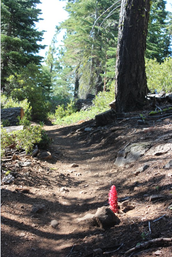
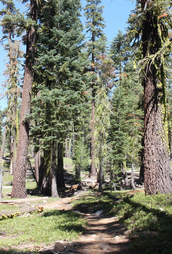
The first mile to a mile and a
half on the Daggett Connector trail is through a forested area,
skirting around some pretty impressive houses in the distance built on
top of hills.
|
 |
|
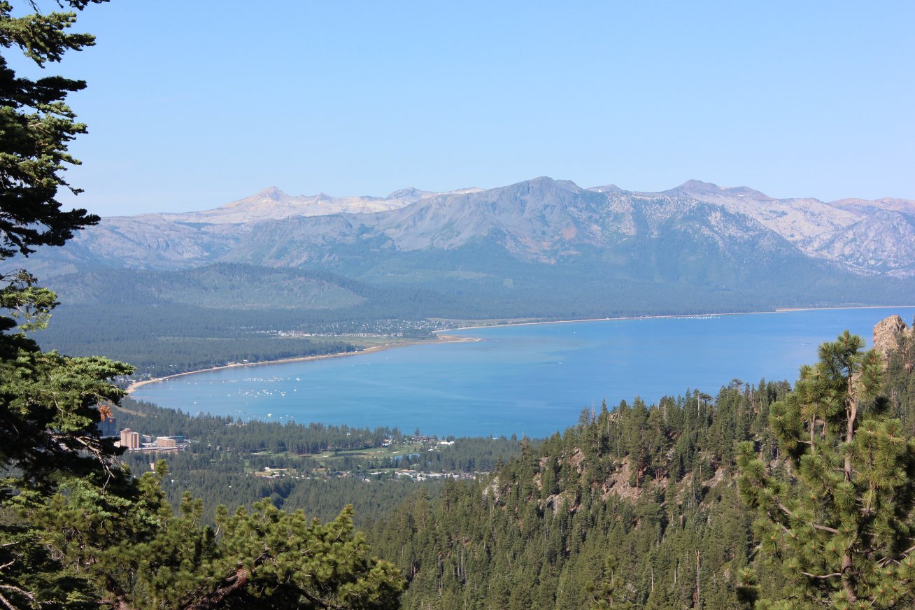
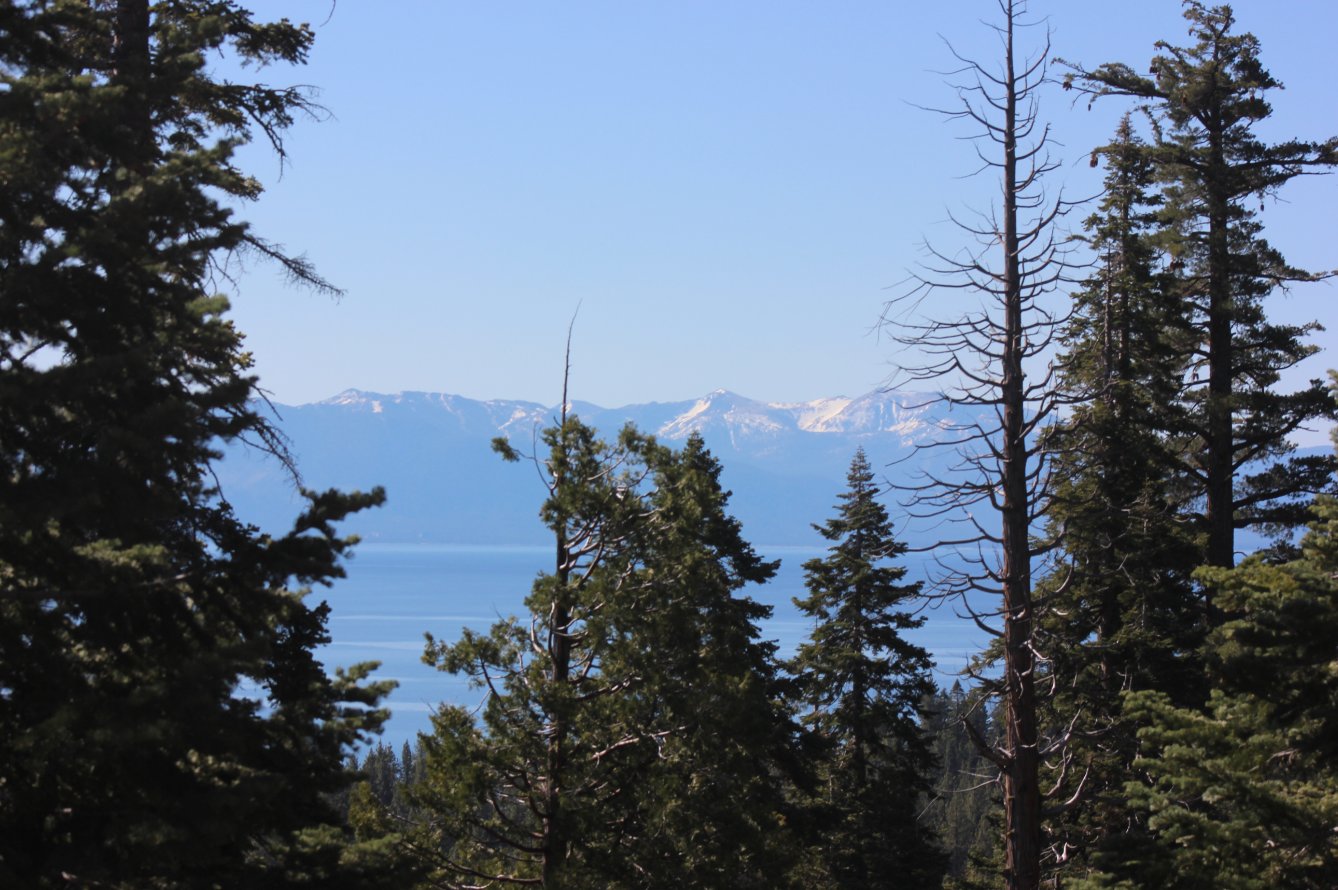
The views along this section
don't disappoint, with this one a couple of miles in overlooking the
South Tahoe casinos and Desolation Wilderness far on the other side of
the lake. |
 |
|
In the foreground is Castle
Point, which the older connector trail passes close by. |
 |
|
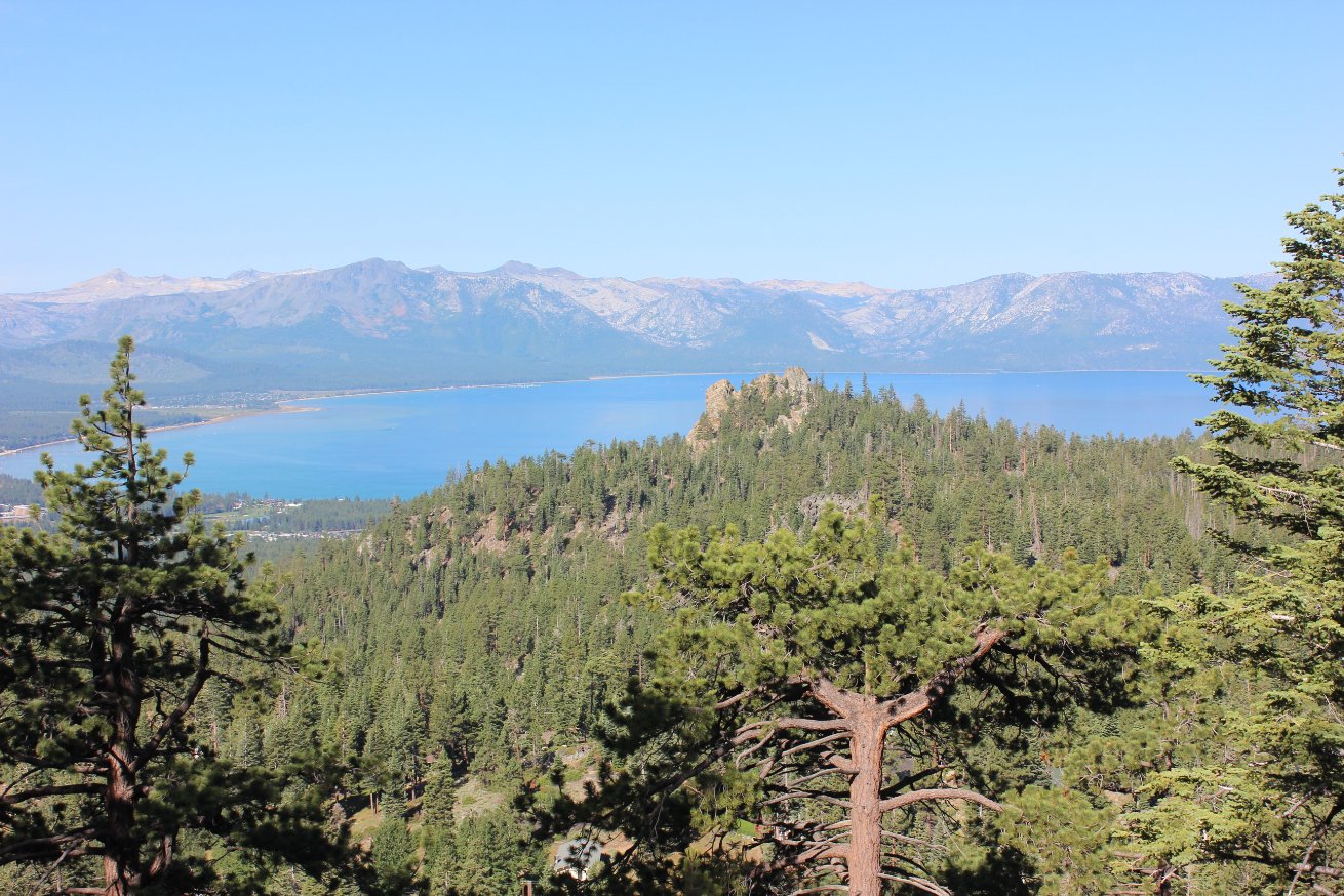
As the new trail continues to
the south, the view opened up toward Heavenly Valley's Nevada side, and
even Freel Peak and Job's Sister in the far distance. |
 |
|
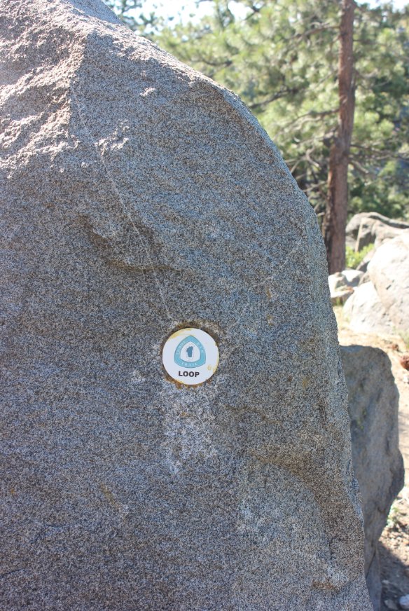
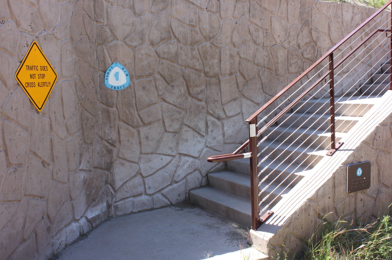
Along this new section there
were some TRT sign types I hadn't seen before, plastic circles glued to
chisled out locations in the rocks along the way. |
 |
|
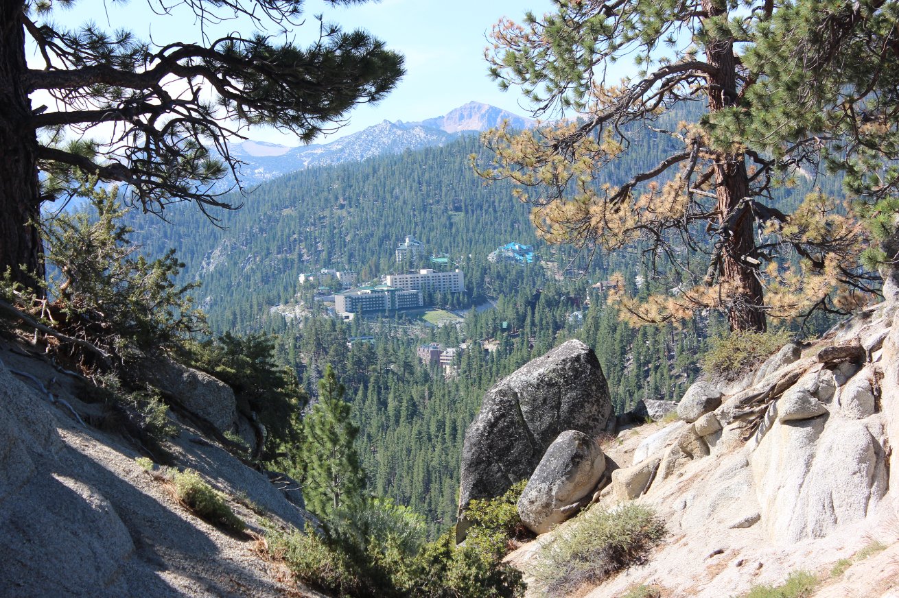
Down at the base of Heavenly
Ski area are the condos which hide the end of the trail for this
section just on the other side of them. |
 |
|
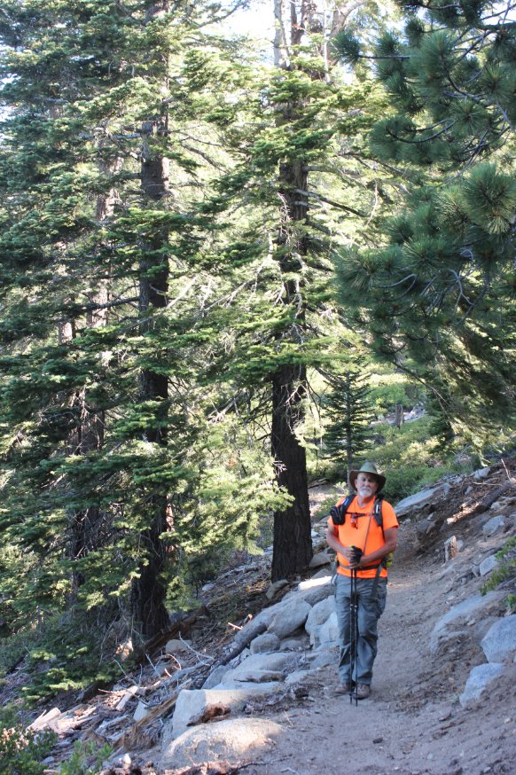
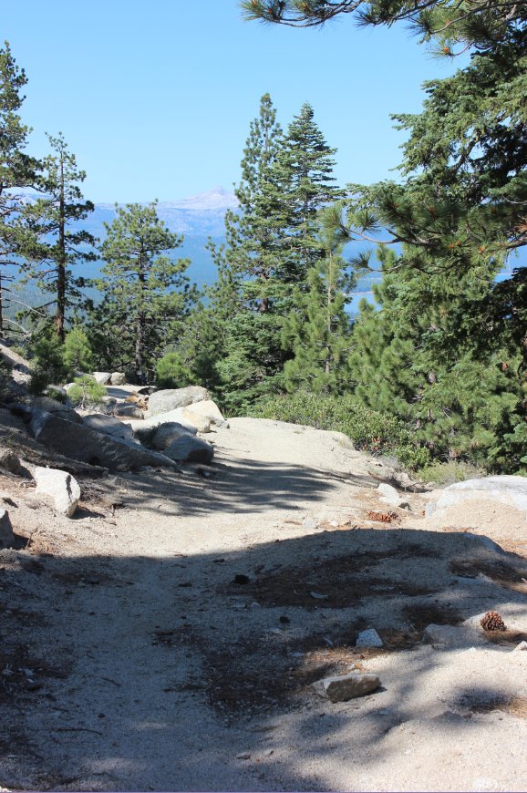
This is a pretty typical view
of the type of trail along this section, once you emerge from the
forest area early on. Views of Lake Tahoe continue to draw
you onward and are very rewarding. |
 |
|
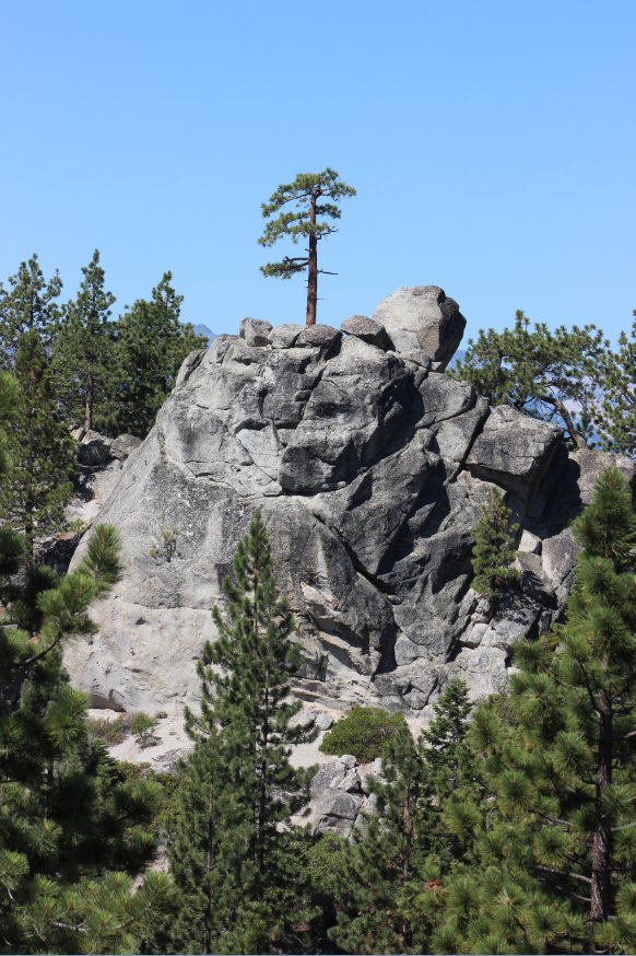
There are many interesting
rock formations in this area, and this one especially stood out because
of the tough tree which appears to have conquered it. Other
formations similar to this along the way actually have homes on them. |
 |
|
The first road crossing on
this segment is this one across North Benjamin Dr. The side
we emerged from was very well marked, but there was no indication of
whether to turn left or right. We decided to go right, away
from Highway 207 and ended up choosing correctly. The
continuation is just out of the picture on the other side of the road,
but is not well marked at all. Bike tire marks on the road
left from gravel were the indication where to go. When in
doubt, follow the signs toward (KB S.) |

 |
|
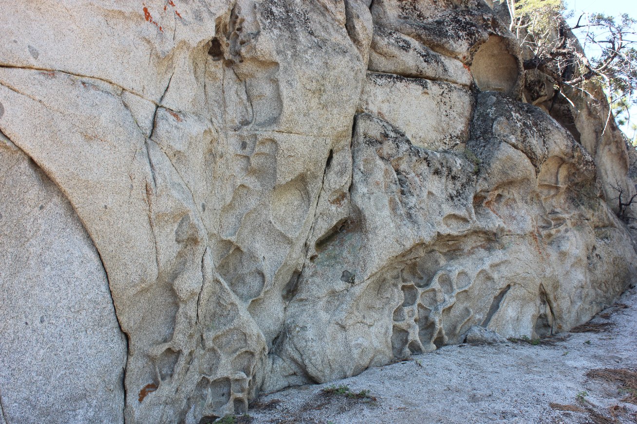
Found
these honeycomb rocks just north of Hwy 207 while looking for a cache
in the area. Evidence of water or severe wind erosion like I
haven't seen around here before. |
 |
|
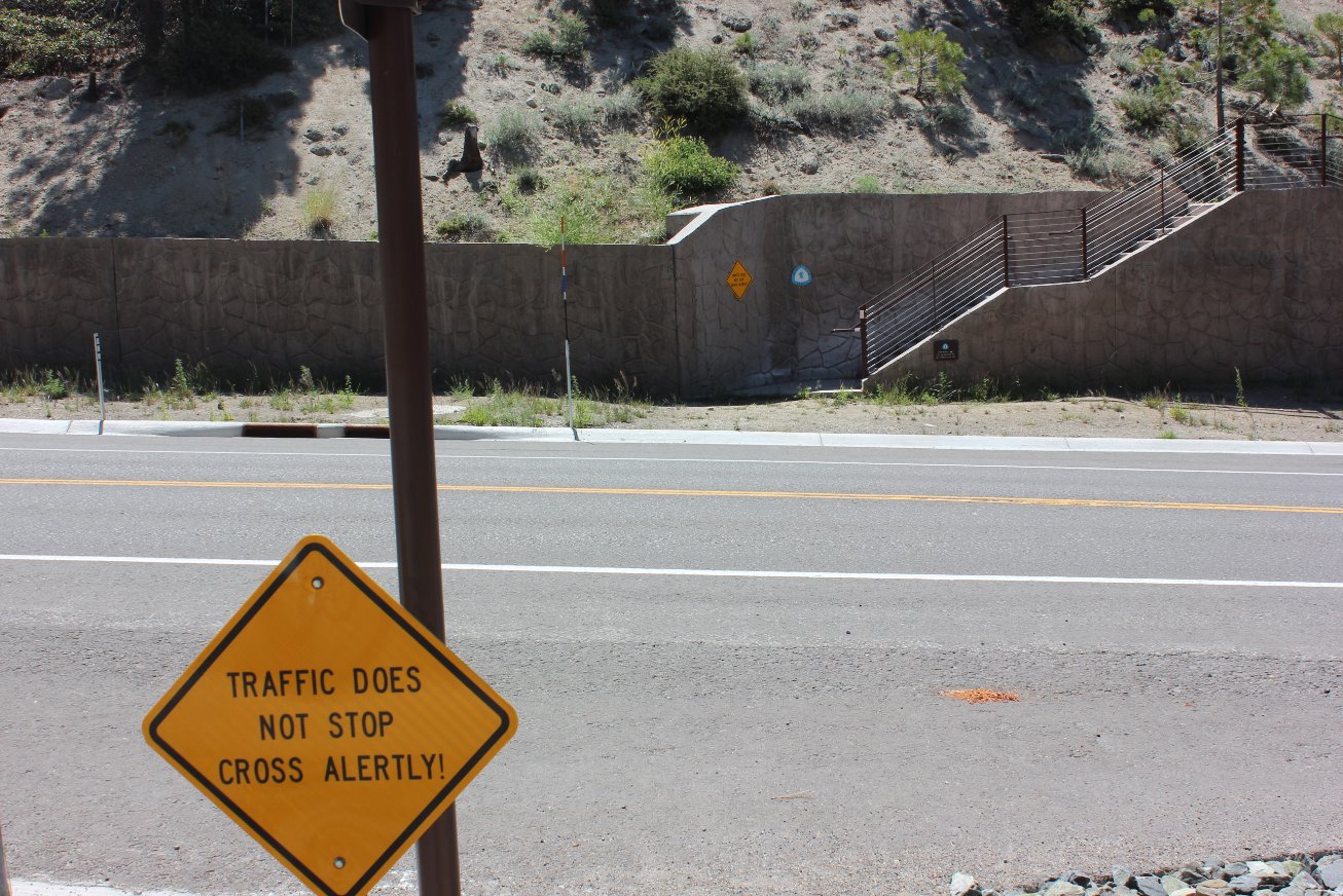
Aside
from lightning, this might be the most dangerous point along the entire
TRT. This is a crossing of a reasonably busy highway where
neither direction has much sightlines for pedestrians. Or
warning
that they may be crossing here. Hmmm. |
 |
|
All along
the TRT there are various stairs made out of rocks, wood, and dirt, but
these are definitely the nicest ones by far! There is a
little
sign to the right which points bicyclists to an access point which
doesn't require steps. |
 |
|
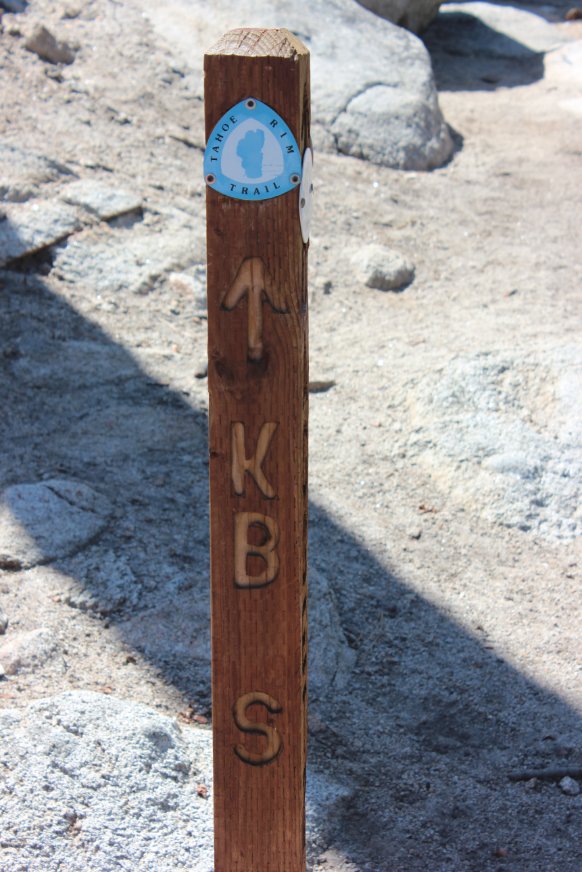
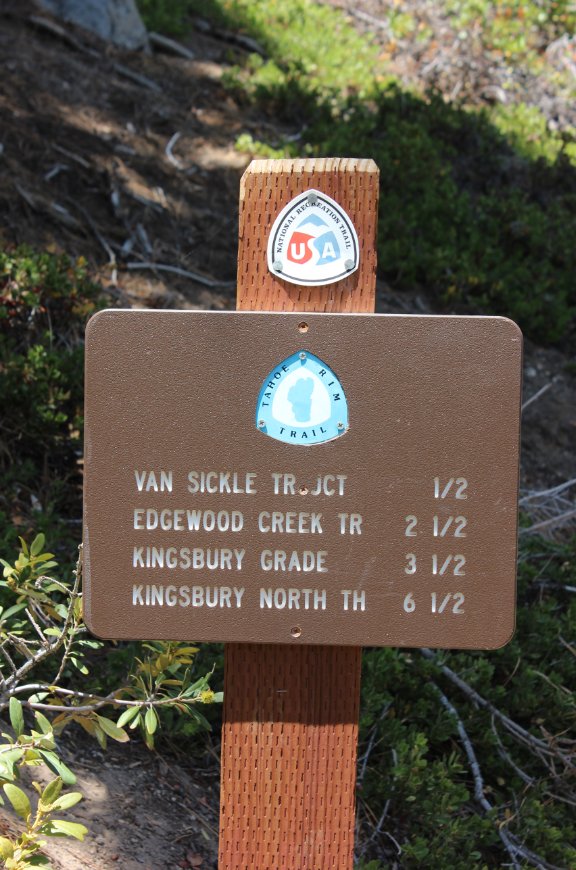
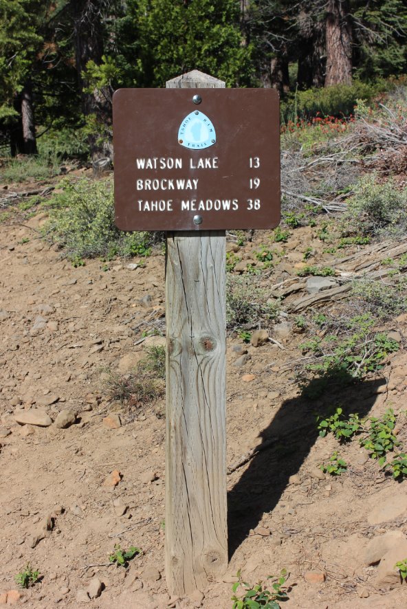
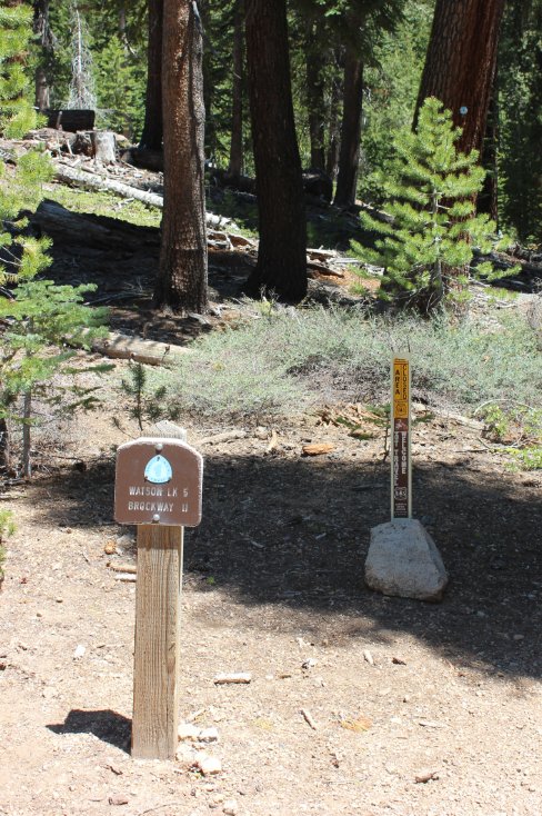
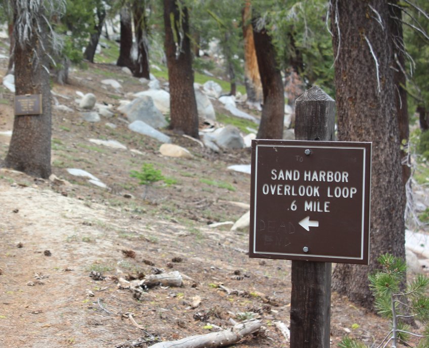
Over the
last two miles there are at least three trail intersections which can
easily lead a casual hiker astray. Make sure to follow the
signs
to KB S and look back to make sure signs you pass going the other way,
like this one, indicate you are still on the TRT and not headed to one
of the other spots. |
 |
|
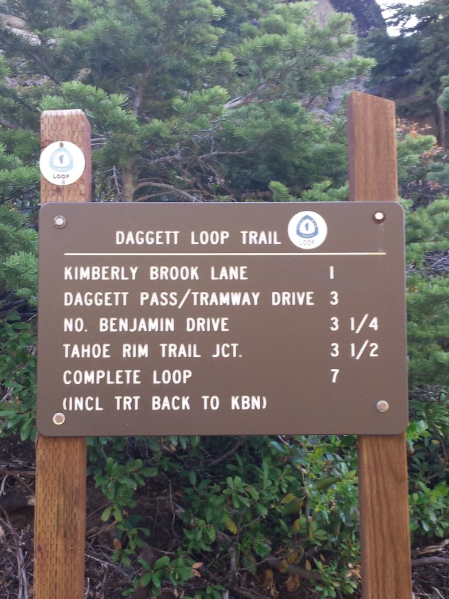
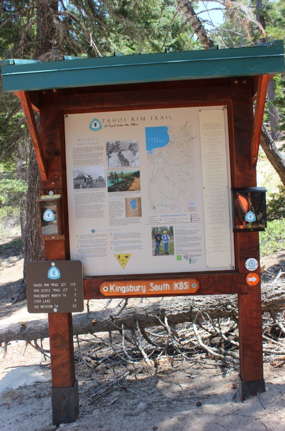
Once you
get to this sign marking the trailhead for Kingsbury South, you are
done and the parking area is just about 100 feet to the left. |
 |
|
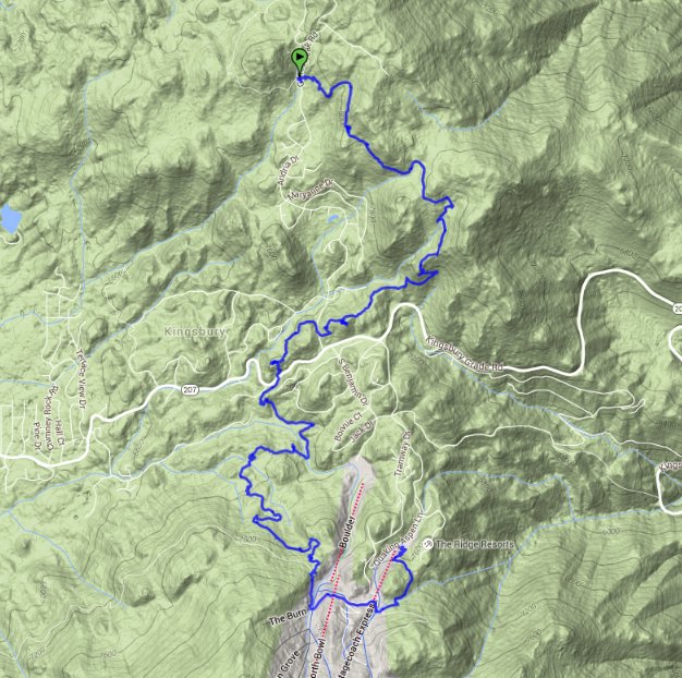
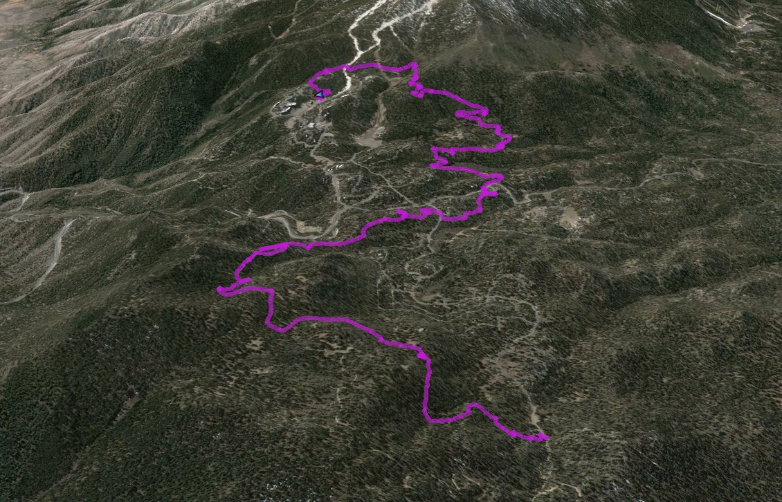
GPS track
of the hike starting in the upper left and heading down to the bottom
right. The small spur near the top is where you find the Kiwanis bench
near the base of Genoa Peak. |
 |
