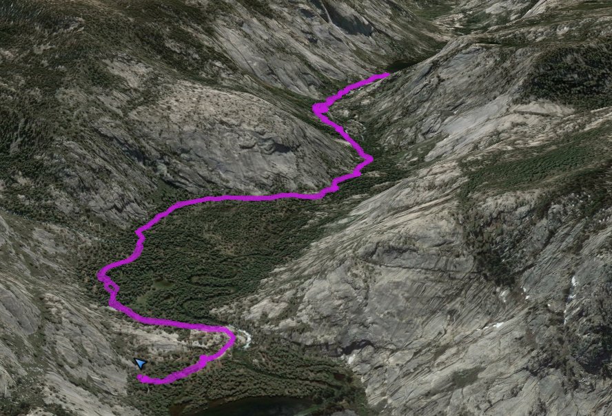
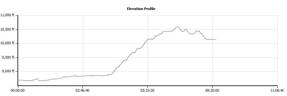
Distance: 11.2 Miles
Vertical Gain: 1800'
Group Size: 6
Hike Rating: Easy Moderate Hard Strenuous
 GPX for
this trip
GPX for
this trip
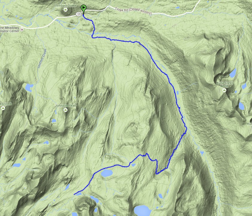
| Start Coordinates: | N 37 44.342, W 119 24.389 | End Coordinates: | Same as Start Coordinates |
||
| Car Shuttle Req'd: | No | Parking Directions: | The parking for the Lyell Canyon trailhead is at Tuolumne Meadows, just a little west of the Tuolumne Meadows Lodge. To get there, take Highway 395 south from Monitor Pass toward Mono Lake. At Lee Vining, turn on Highway 120 (Tioga Pass) and enter Yosemite Park on the east side. About 10 miles into the park turn at the Wilderness Permit area (Tuolumne Meadows Lodge Road) and continue to the parking coordinates for backpacker vehicles. | ||
| Hazards of Note: | None. | Crowd Factor: | Medium. The first 5 1/2 miles up Lyell Canyon is along the John Muir trail, and is a relatively popular backpacking area on the way between Yosemite and Mt. Whitney further to the south. Once the trail leaves and heads up toward Ireland Lake and Vogelsang High Sierra Camp, the number people you will encounter drops significantly. | ||
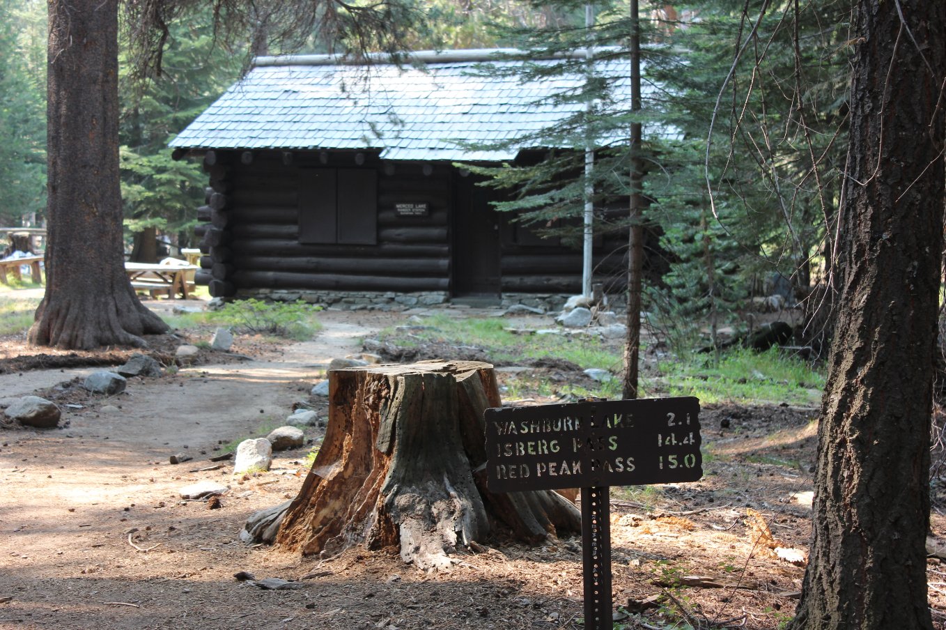
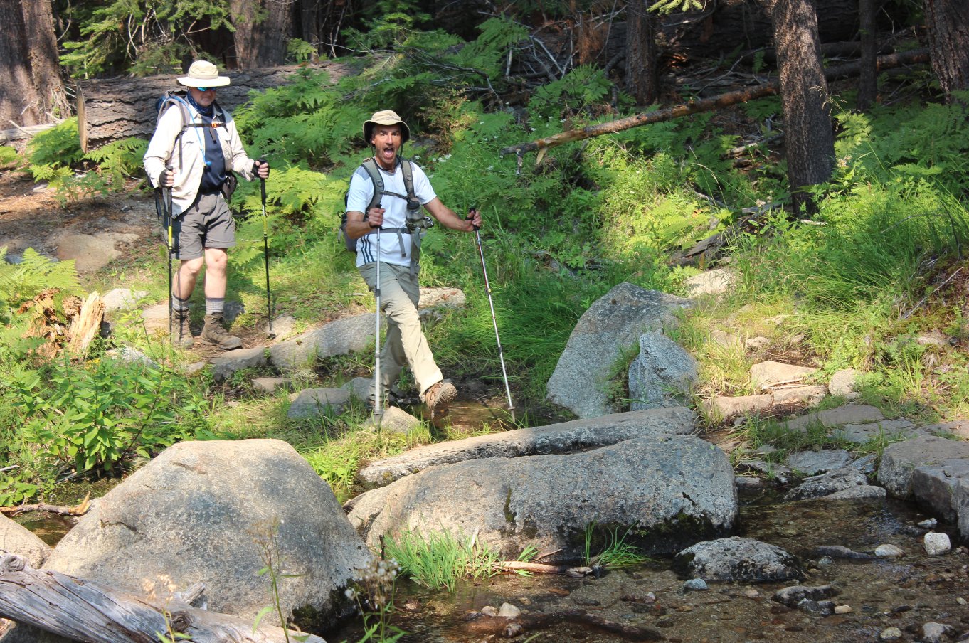
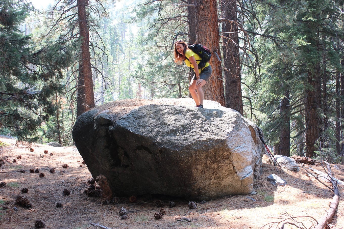
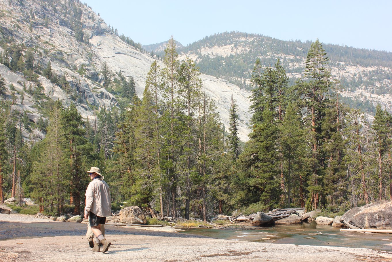
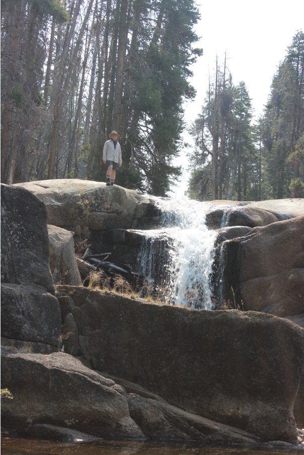
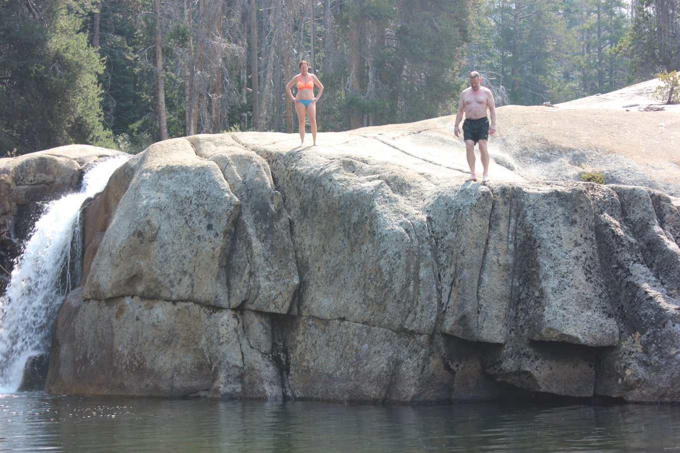
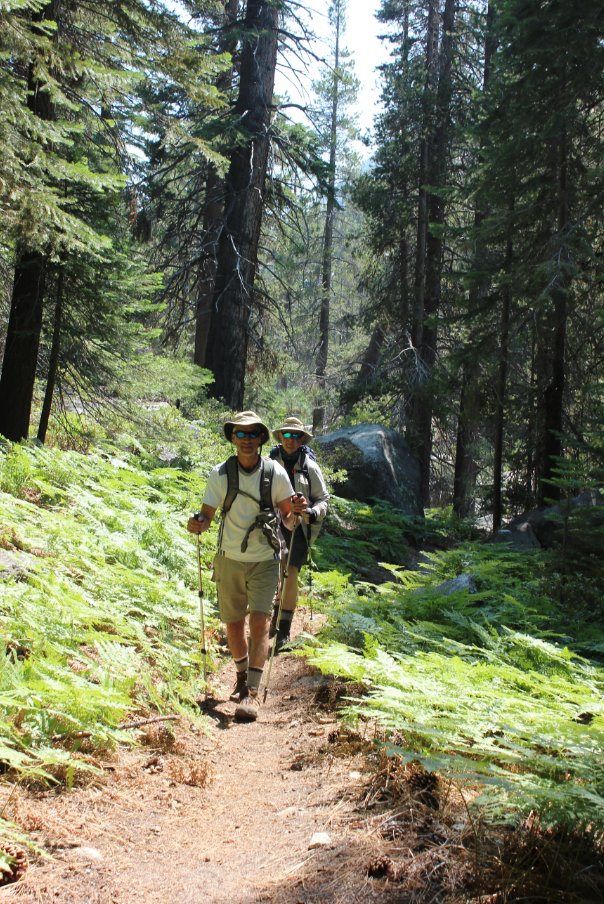
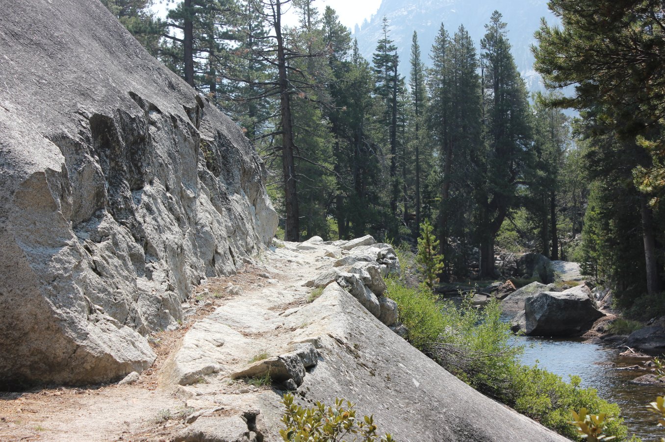
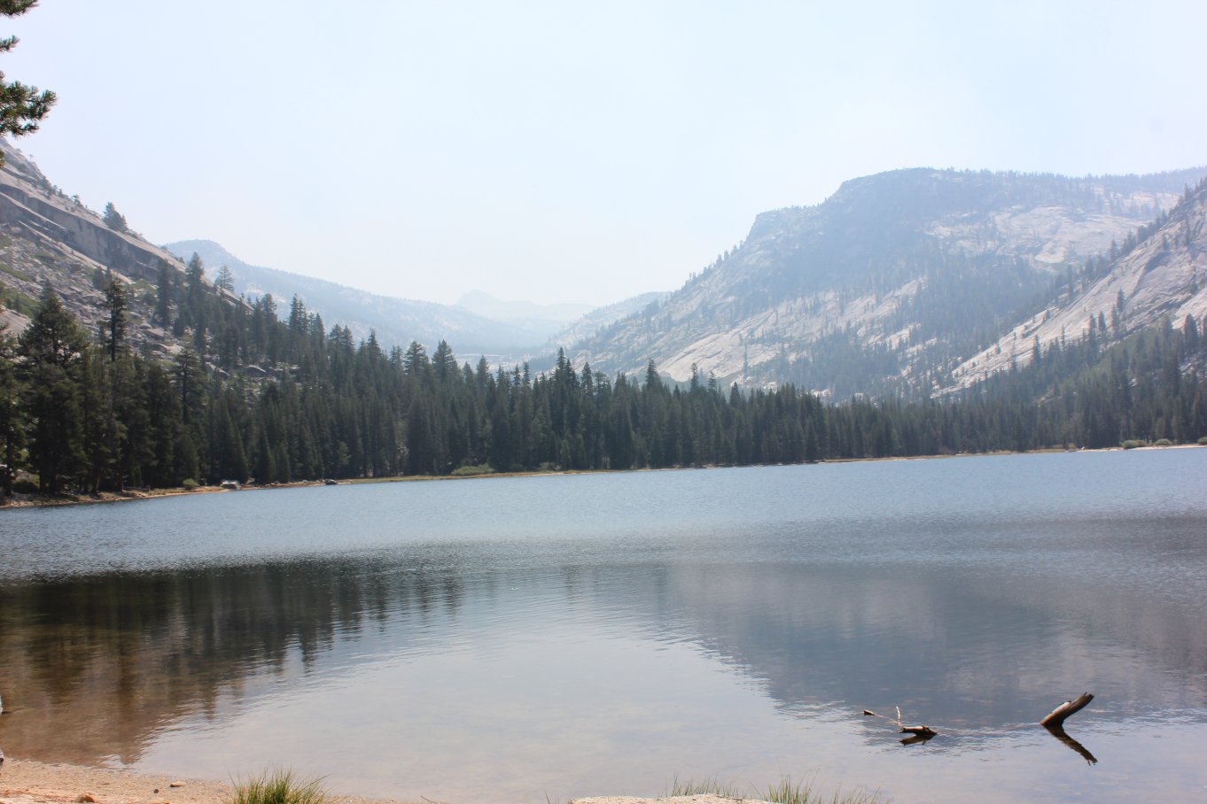
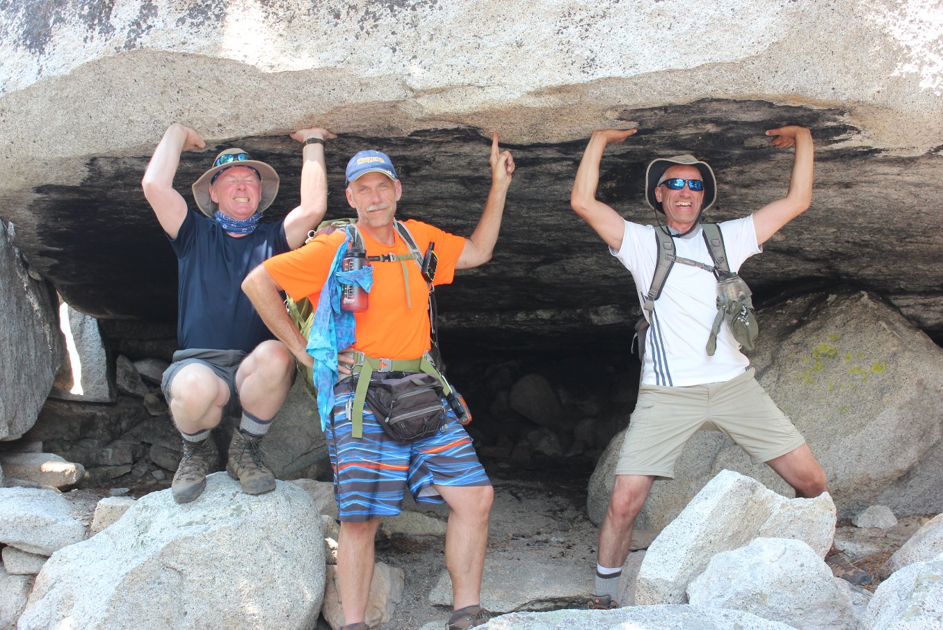
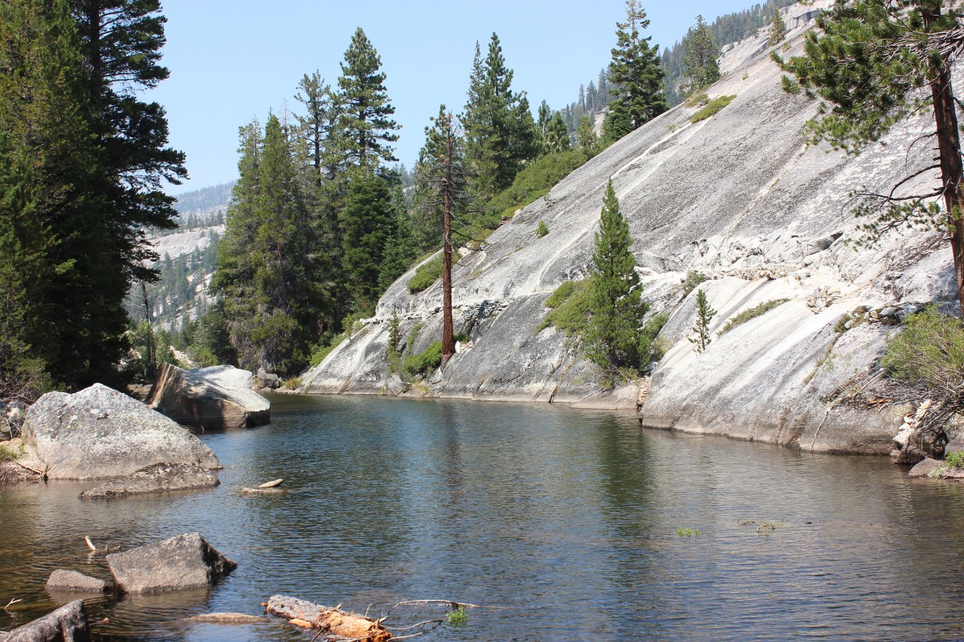
| General Notes: From the Merced Lake High Sierra Camp main camp building, head south toward the Merced River falls which are located about 2/10 of a mile behind the camp in this direction. The trail then bends to the east, heading up exposed granite rock with the trail outlined by smaller pieces of rock along the way. The way then follows along a dirt path for a bit, bending right sharply when you get to the corral where the mules and horses which pack people and supplies into the camp are housed. Three small bridges cross waterways near the ranger station, and then just before you complete the first mile you will come to a junction where the Ranger Station sits on your right and the path either goes up toward Vogelsang to the left or toward Washburn Lake to the right. Follow this junction to the right, and it will climb slowly for about a mile. There is a natural soda spring about 3/4 of a mile up this way, which can easily be missed if you aren't looking for it. The trail will be wet all year round in this spot, with a milky type of mud across your path. Find the small spring just on the north side of the trail at this point. When the trail then begins to pass through some lush fern vegetation, keep an eye out for an SUV-sized rock on the right side of the path. From here you will divert off-trail for a few hundred feet to an amazing waterfall and swimming hole. You may hear it from the trail, but it is not visible until you get close to it. Head down to the right of the rock following a visible use trail, and then it will bend back to the left and drop you off at the edge of the pool not far away. We spent time both on the way to and the way back from Washburn Lake as the spot was so idyllic. Back on the trail you will continue to the lake, walking along a section broken out from the solid granite that otherwise would make the path to the lake itself treacherous if it had not been created. At the very northern end of the lake is an impressive overhanging rock, which a number of people have built fires under over the years as evidenced by the black smoke marks on the underside of the rock. |
|||||