|
|
Spaulding
Lake Trail to Fordyce Falls
|
|
Trip Date: 02/13/2015
Distance: 10.1 Miles
Vertical Gain:
1350'
Group Size:
3
Hike Rating: Easy
Moderate
Hard
Strenuous |
 GPX for
this trip
GPX for
this trip
|
|

|
Start Coordinates: |
N 39 20.504, W 120 38.952 |
|
End Coordinates: |
Same as starting coordinates |
| Car Shuttle
Req'd: |
No |
|
Parking
Directions: |
Take
Highway 80 to the Highway 20 turnoff a couple exits west of
Cisco Grove. Follow the road back under the freeway and
continue on Highway 20 until you get to Highway 18, also known as
Bowman Lake Road. Stay on this road until you get to the
parking coordinates indicated just a little before Fuller Lake.
|
| Hazards of
Note: |
After heavy rains there can be
high water near the start of the trail. Some of this old
trail is not maintained well and is difficult to follow. |
|
Crowd Factor: |
Limited. Spaulding
Lake is a popular summer location but the further out on the trail you
go the less likely you are to run into anyone. |
General Notes:
From the parking at the trailhead, walk around the gate and find a
small sign indicating the Spaulding Lake Trail in a tree near the road.
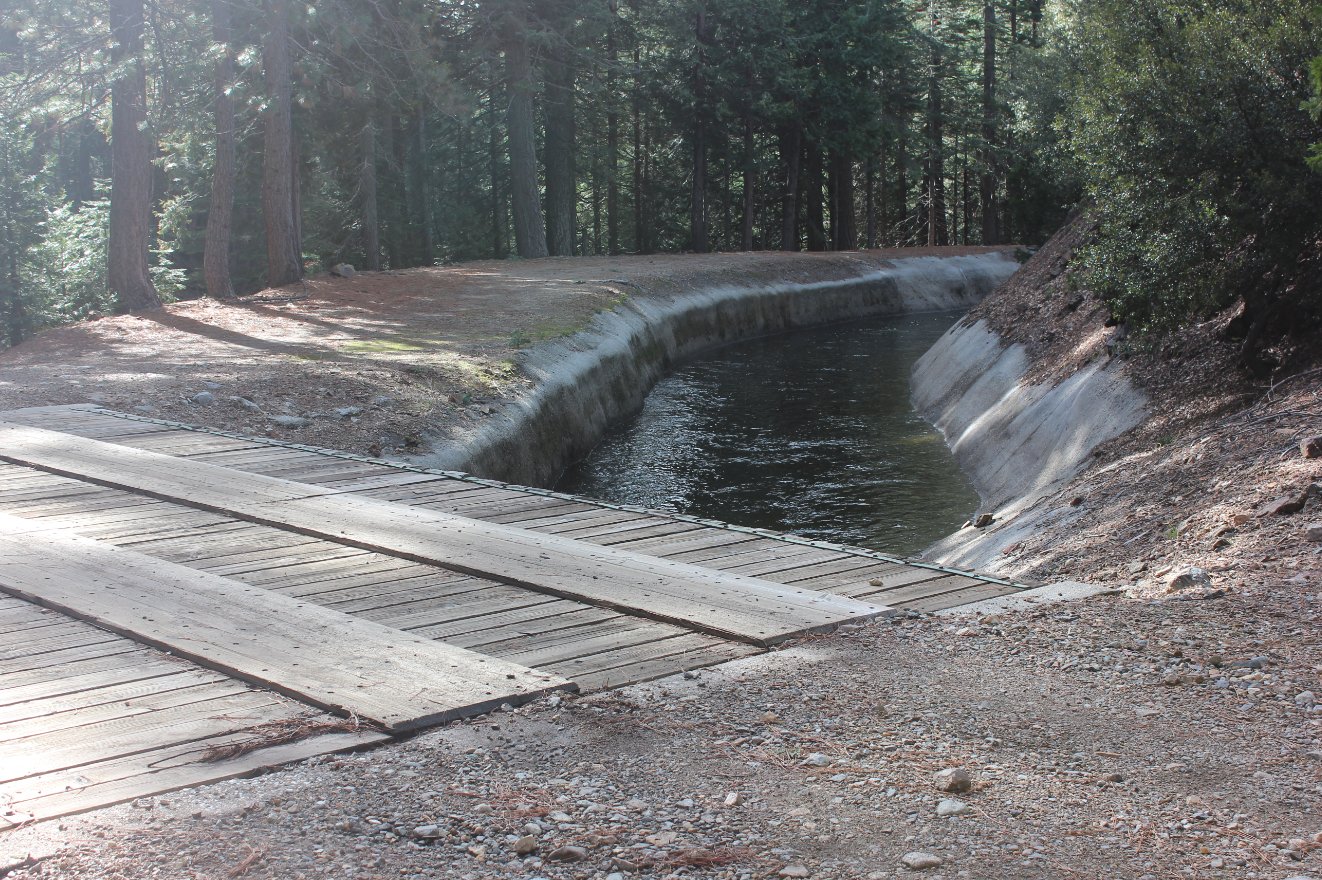
Follow this wide dirt track for about 3/4 of a mile, past the
inlet for the Zion Hill tunnel to your right as you cross a bridge over
a cement flume. Off to the left around a mile in is an open
meadow, with an old picnic bench which has completely collapsed under
the weight of many years of snow. A detour was in place to
take you around the excessive runoff from Fuller Lake a mile and a half
into the trail, with hikers needing to crawl under a large water pipe
and then immediately turning left to head across a bridge and find the
trail again a little bit further up the pipe. The next three
miles has the trail parallelling the north side of Spaulding Lake, and
once at the end of the lake the trail continues into forest for another
mile until it comes out at Fordyce Falls at the turnaround point.
|
|
|
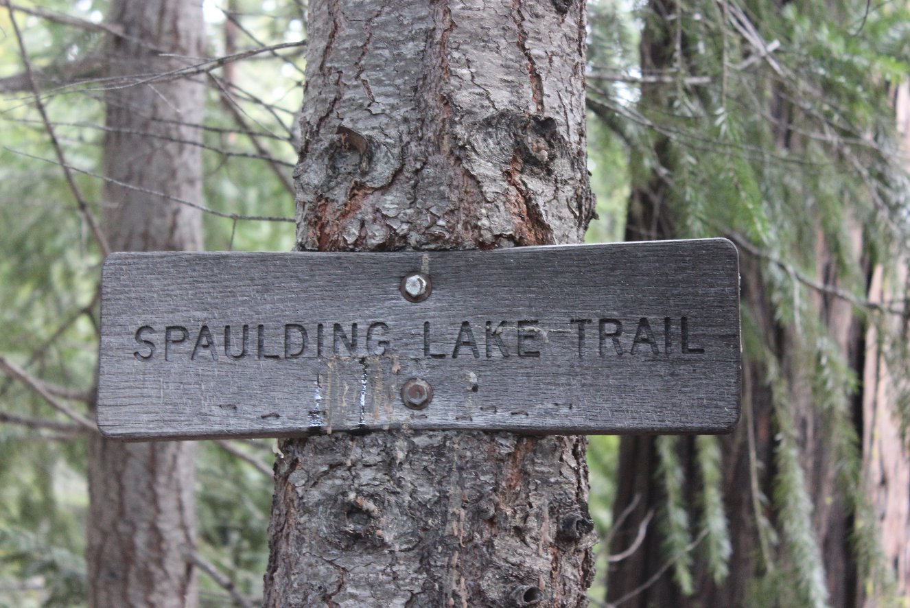
The trailhead sign for
Spaulding Lake Trail right at the gate on the road. |
 |
|
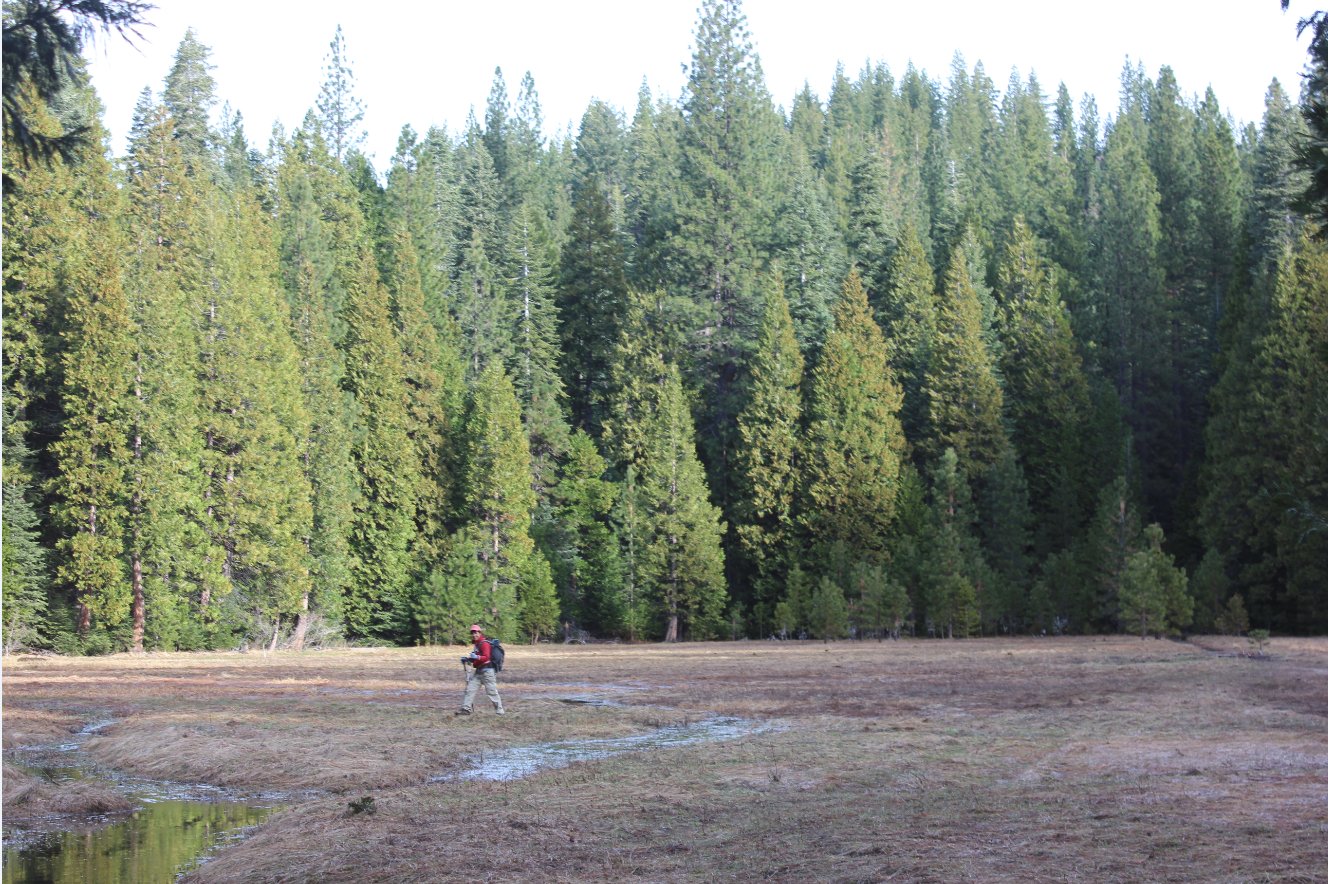
Making a water crossing at the
small meadow north of the trail about a mile in. |
 |
|
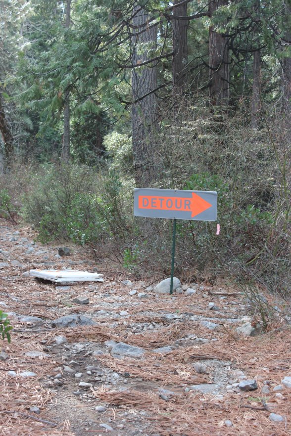
A couple of semi-permanent
detour signs routed us around some serious water coming down from
Fuller Lake about 500 feet above us. |
 |
|
Overflow from Fuller Lake high
above which was the cause for the trail detours after three days (and 5
inches) of rain over the last week. |
 |
|
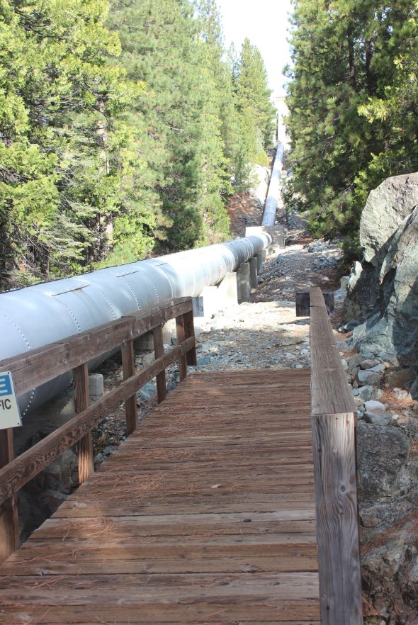
A couple of ways to get under
the water pipe on the trail detour. |
  |
|
Make sure after crossing under
the pipeline to find the trail across this bridge and before the
pipeline starts to head upward. |
 |
|
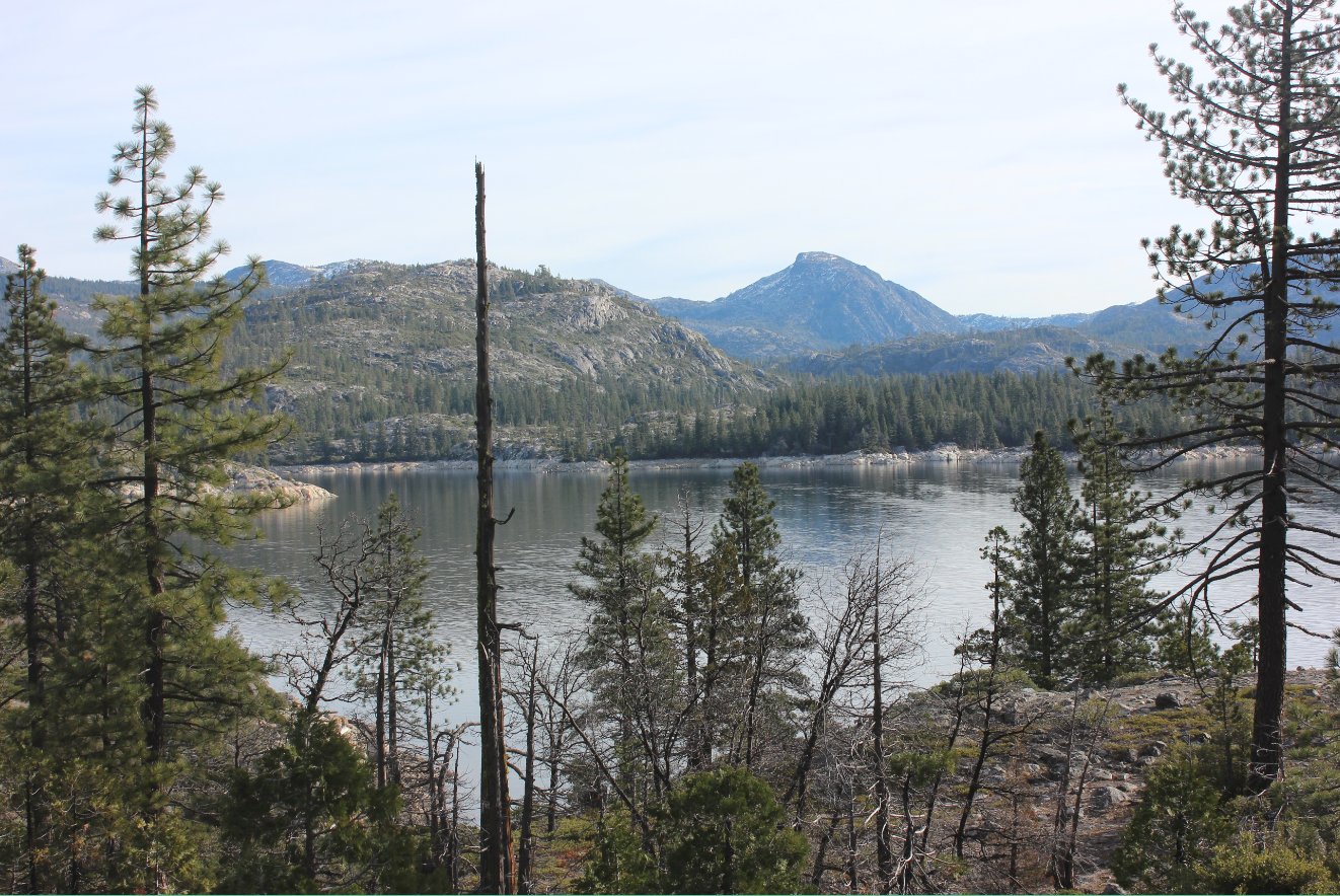
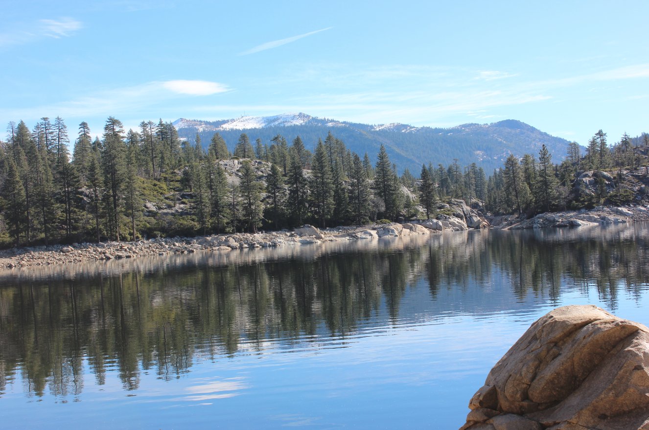
Looking across Spaulding Lake
toward Old Man Mountain in the distance. |
 |
|
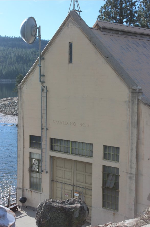
We took at slight detour off
the trail down to the water to check out the old Spaulding Power plant. |
 |
|
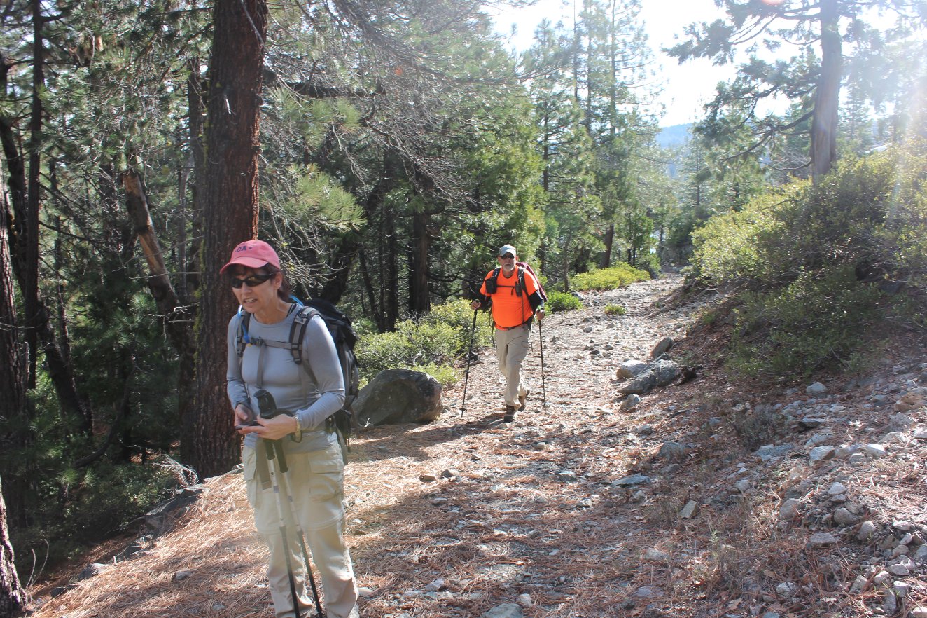
Hiking
partners along a section of the trail that we could actually follow
easily. Not always the case with this location due to water
coursing down sections of trail making them indistinguishable from
creeks. |
|
|
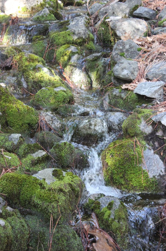
All along the trail after the
recent rainfalls we had water crossings and interesting waterfalls off
to the sides of our path. |
 |
|
Another look across the lake,
with ripples in the water from the significant inflow from Fuller Lake
after the recent rains. |
 |
|
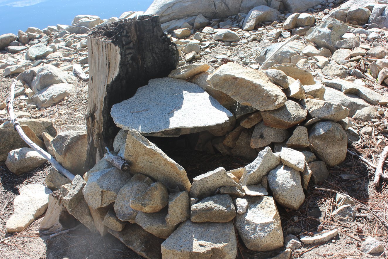
Not quite sure what this was,
but it was man-made and definitely had some time spent on it. |
 |
|
Another glimpse of the water
coming across our path, and this point this actually was the trail. |
 |
|
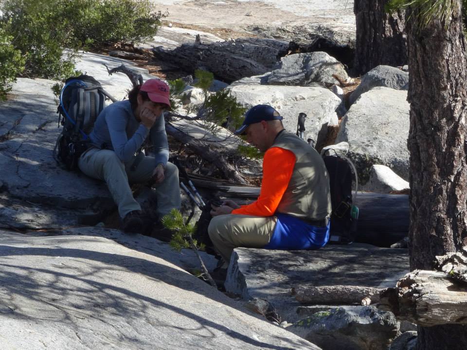
Two of us enjoying lunch and
checking out the mileage on our GPSs just above the Fordyce Falls
location. |
 |
|
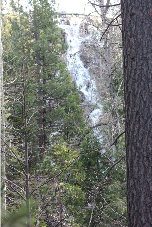
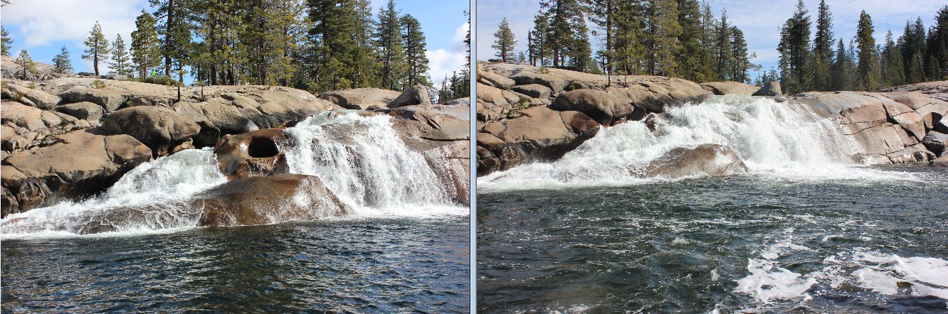
Our first
look at the Fordyce Falls this trip. Five inches of rain
since we
had visited a week before made a significant change in the look of the
falls. |
 |
|
Our first
look at the Fordyce Falls this trip. Five inches of rain
since we had
visited a week before made a significant change in the look of the
falls. |
 |
|
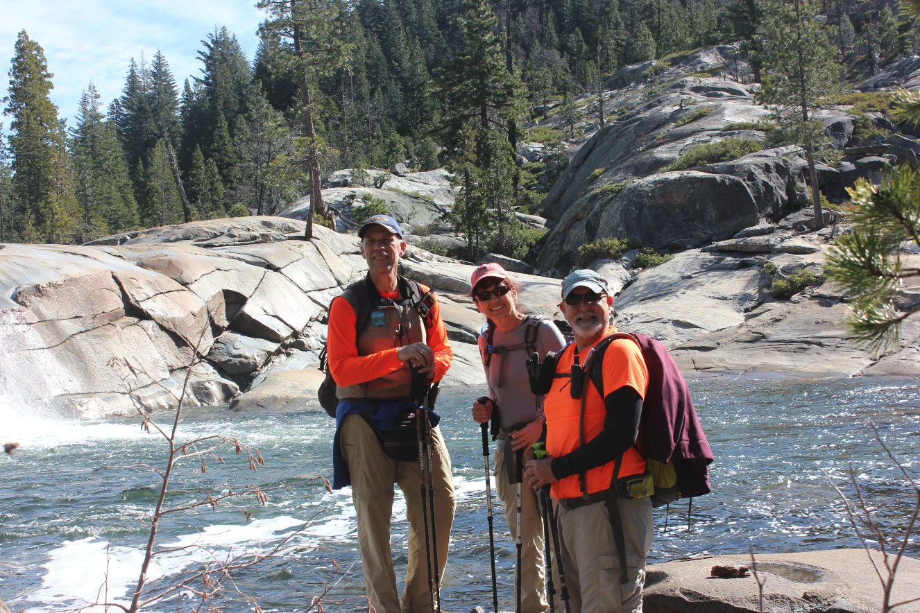
Our hiking group at the base
of Fordyce Falls. |
 |
|
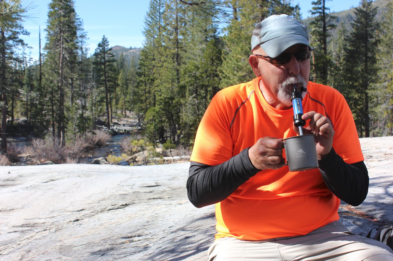
Drinking filtered ice water
out of the Fordyce Falls. |
 |
|
The bridge across the cement
flume on the way back to the trailhead. |
 |
|
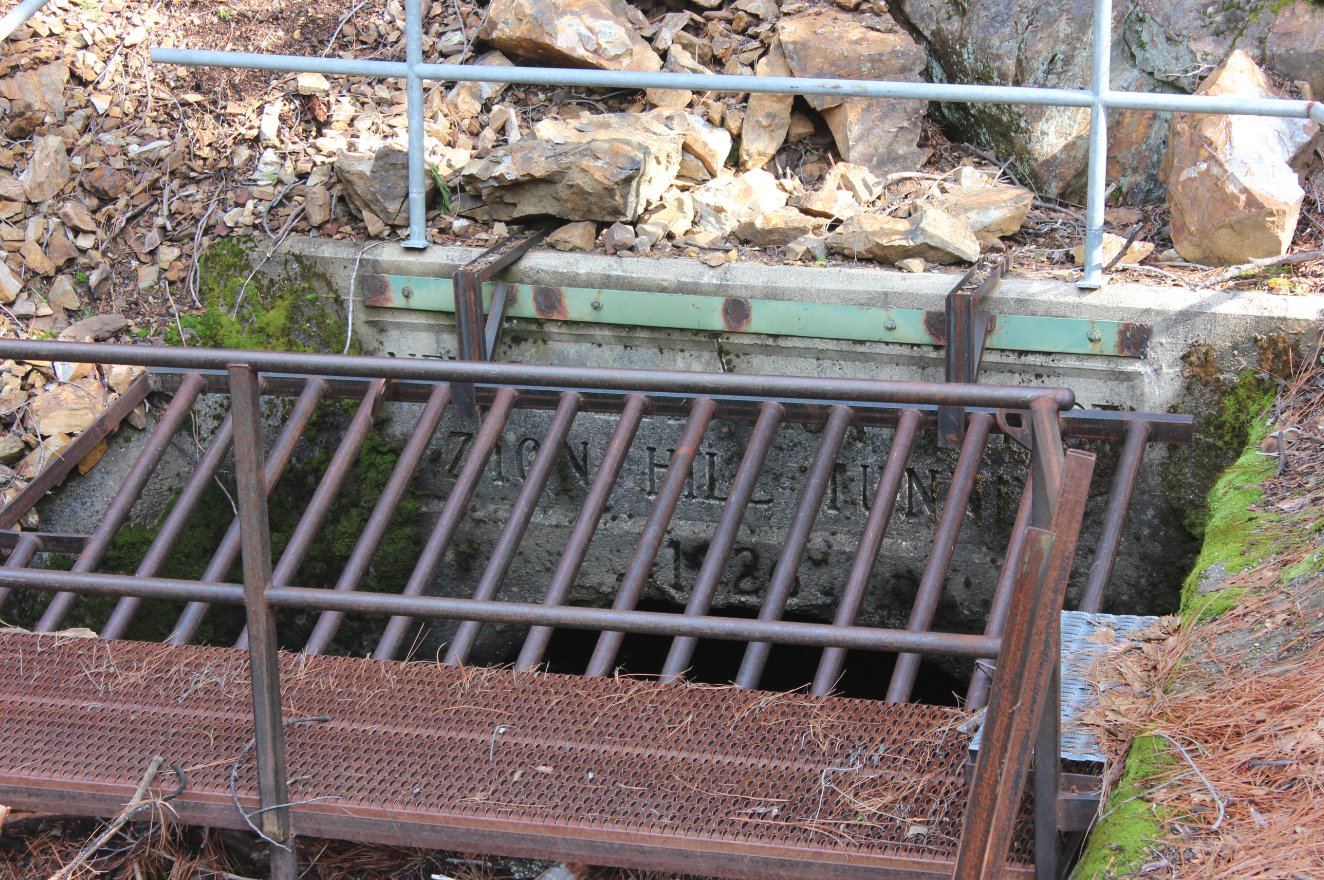
The inlet to the Zion Hill
tunnel at the end of the flume the bridge crosses over. |
 |
|
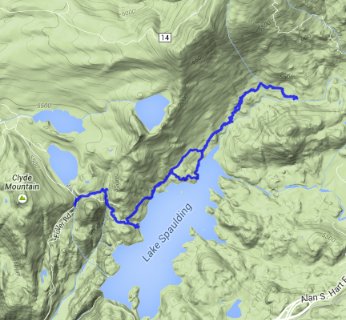
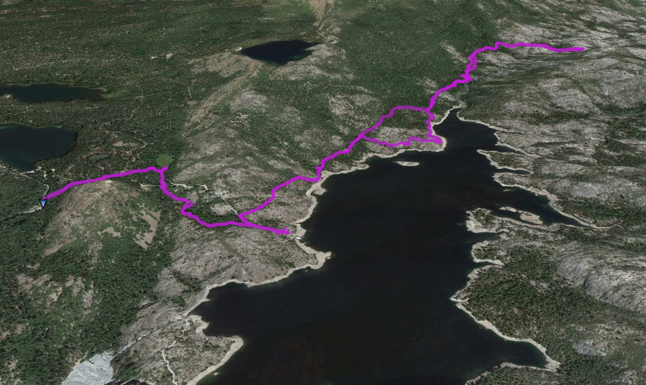
GPX image of the hike. |
|