
|
Snow
Valley Peak Hike
|
|
Trip Date: 10/07/2014
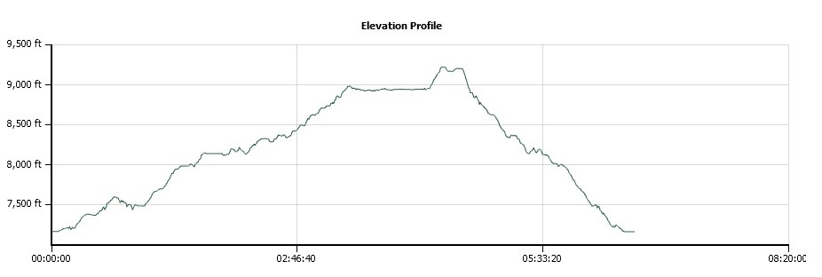
Distance: 12.9 Miles
Vertical Gain:
2000'
Group Size:
5
Hike Rating: Easy
Moderate
Hard
Strenuous |
 GPX for
this trip
GPX for
this trip
|
|
|
Start Coordinates: |
N 39 06.257, W 119 53.825 |
|
End Coordinates: |
Same as start coordinates |
| Car Shuttle
Req'd: |
No |
|
Parking
Directions: |
Take Highway 50 east from
California to Spooner Summit. Park on the north side of the
highway at the parking area provided for the Tahoe Rim Trail hike. |
| Hazards of
Note: |
Long gradual climb up 2000'
from the starting point to the top of the mountain. |
|
Crowd Factor: |
Moderate. The Tahoe
Rim Trail is very popular but this is a lesser-travelled section of it
by the general public. |
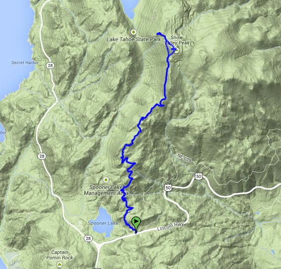
General Notes:
From the parking at Spooner Summit head north along the Tahoe Rim Trail
(TRT.) The first couple of miles will be in forested area,
climbing gradually up to the ridgeline. Once there, you have
great views of both the Lake Tahoe side and the Carson Valley to the
southeast. As you near the summit of Snow Valley Peak, you
will be hiking out in the open, will full exposure to the sun (and the
wind on some days.) Continue past the actual summit along the
base, and when you get to a trail marker for the TRT the road to the
east will lead directly to the top.
Do not pass up at this point the chance to take a 4/10 mile detour
along this same road to the left, until you get to a viewpoint above
Marlette Lake that is the highlight of this entire trip.
|
|
|
Yours truly at the trailhead. |
 |
|
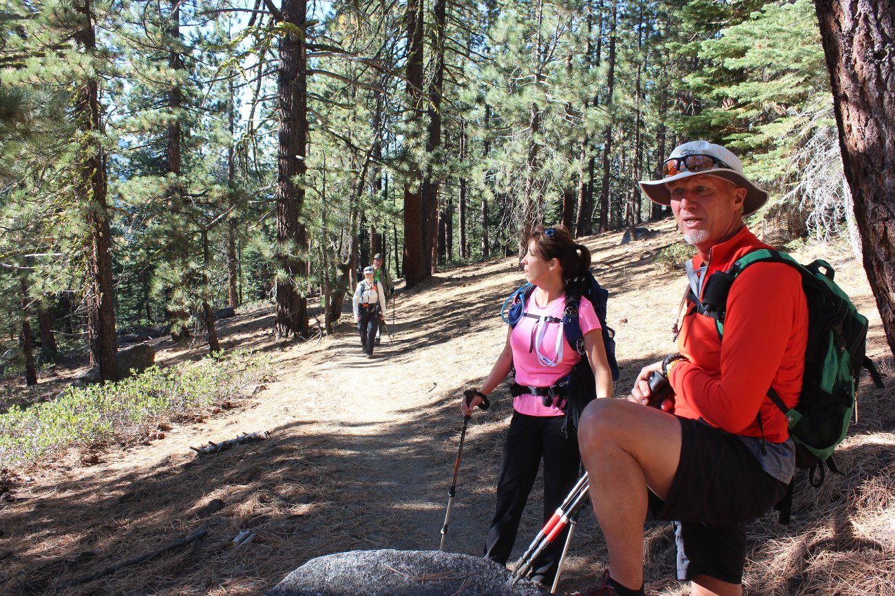
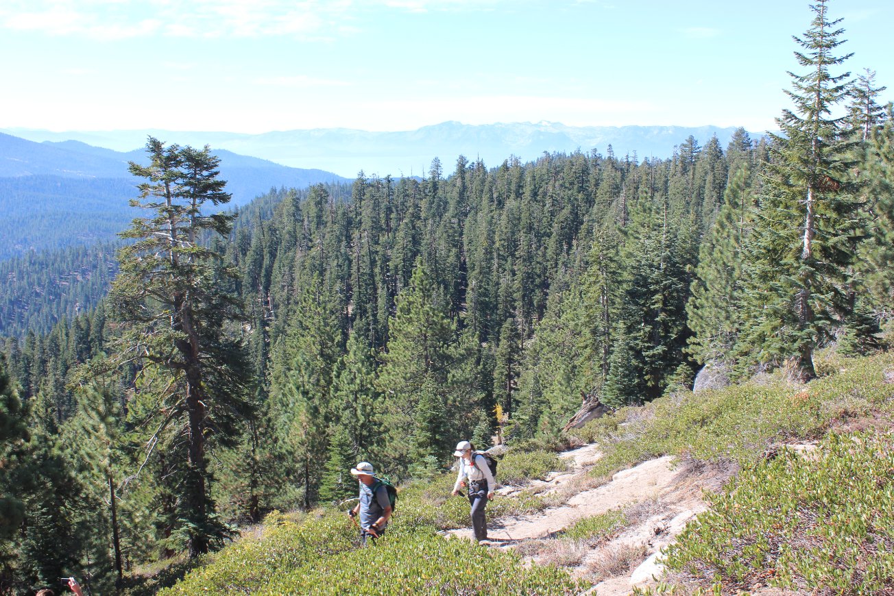
Michelle and Max checking out
some of the Carson Valley views early along the trail while we were
still in the heavily forested section. |
 |
|
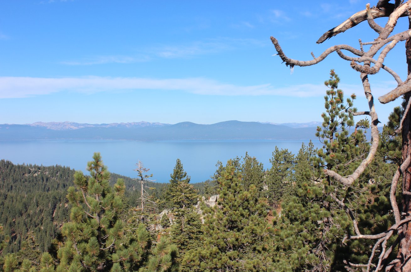
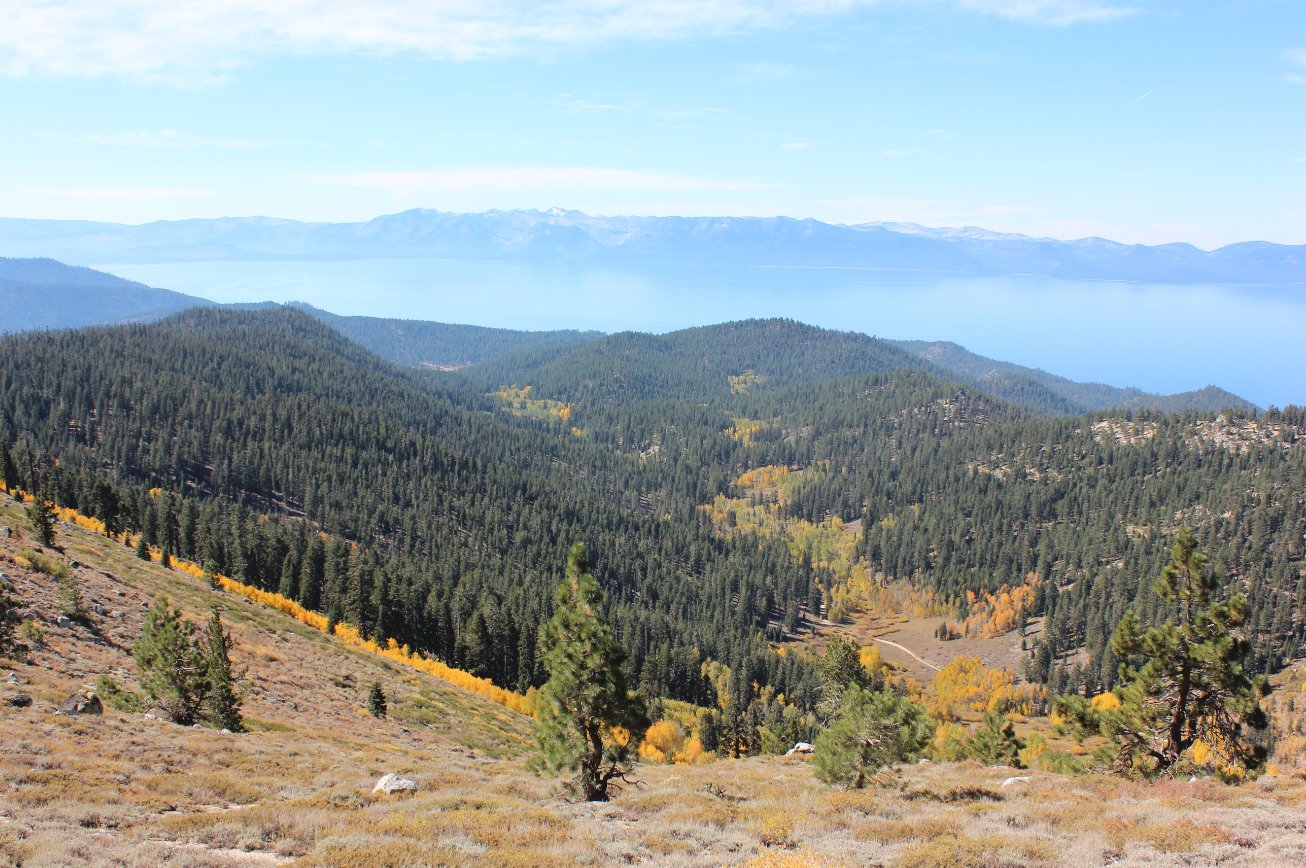
After a couple of miles we had
our first clear glimpse of Lake Tahoe, and the views would just get
better and better along the way. |
 |
|
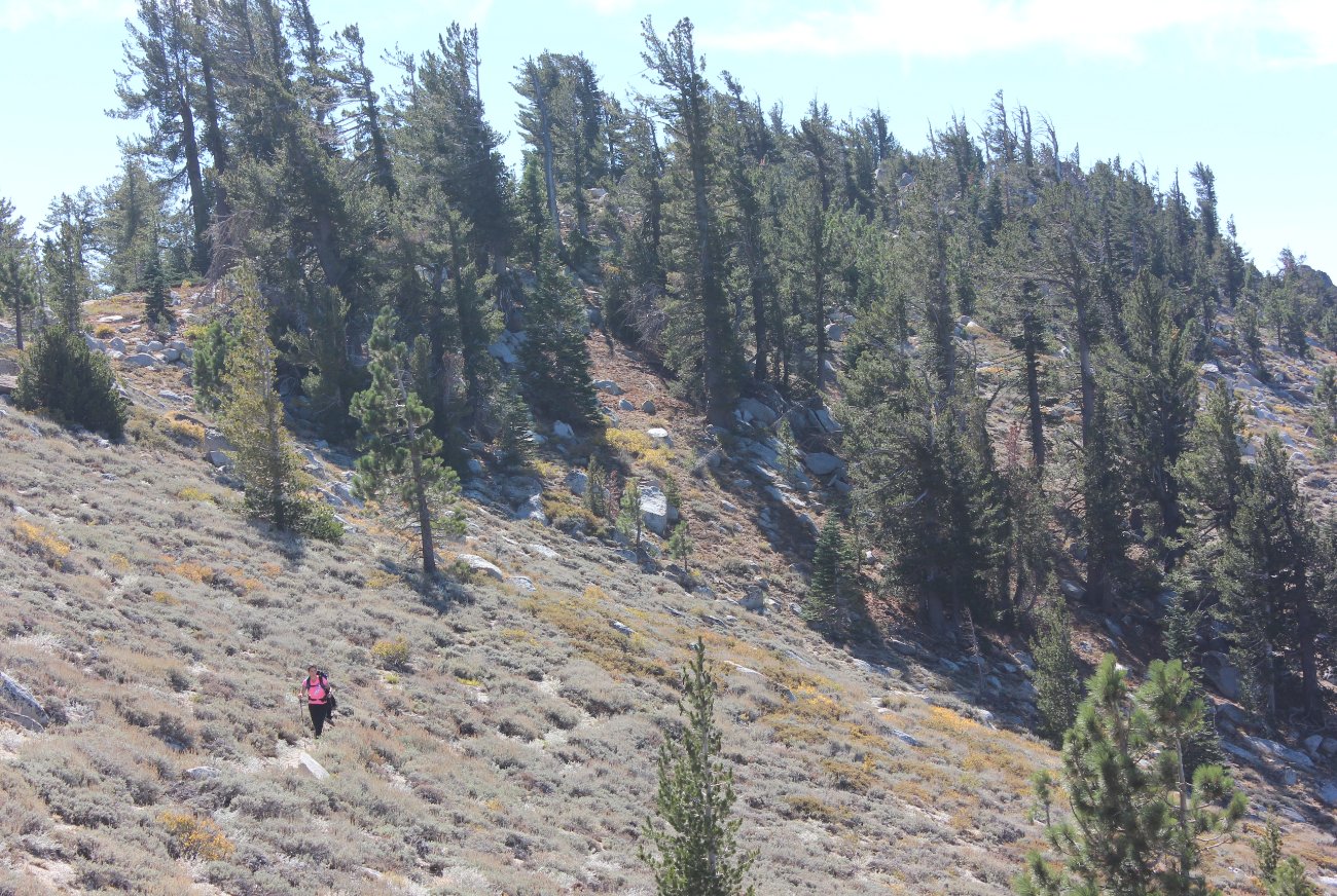
Most of the climb was gradual,
but every so often there is a set of switchbacks that let you gain some
elevation pretty quickly. |
 |
|
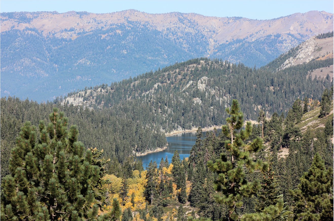
The first glimpse of Marlette
Lake about 4 miles into the climb toward Snow Valley Peak. |
 |
|
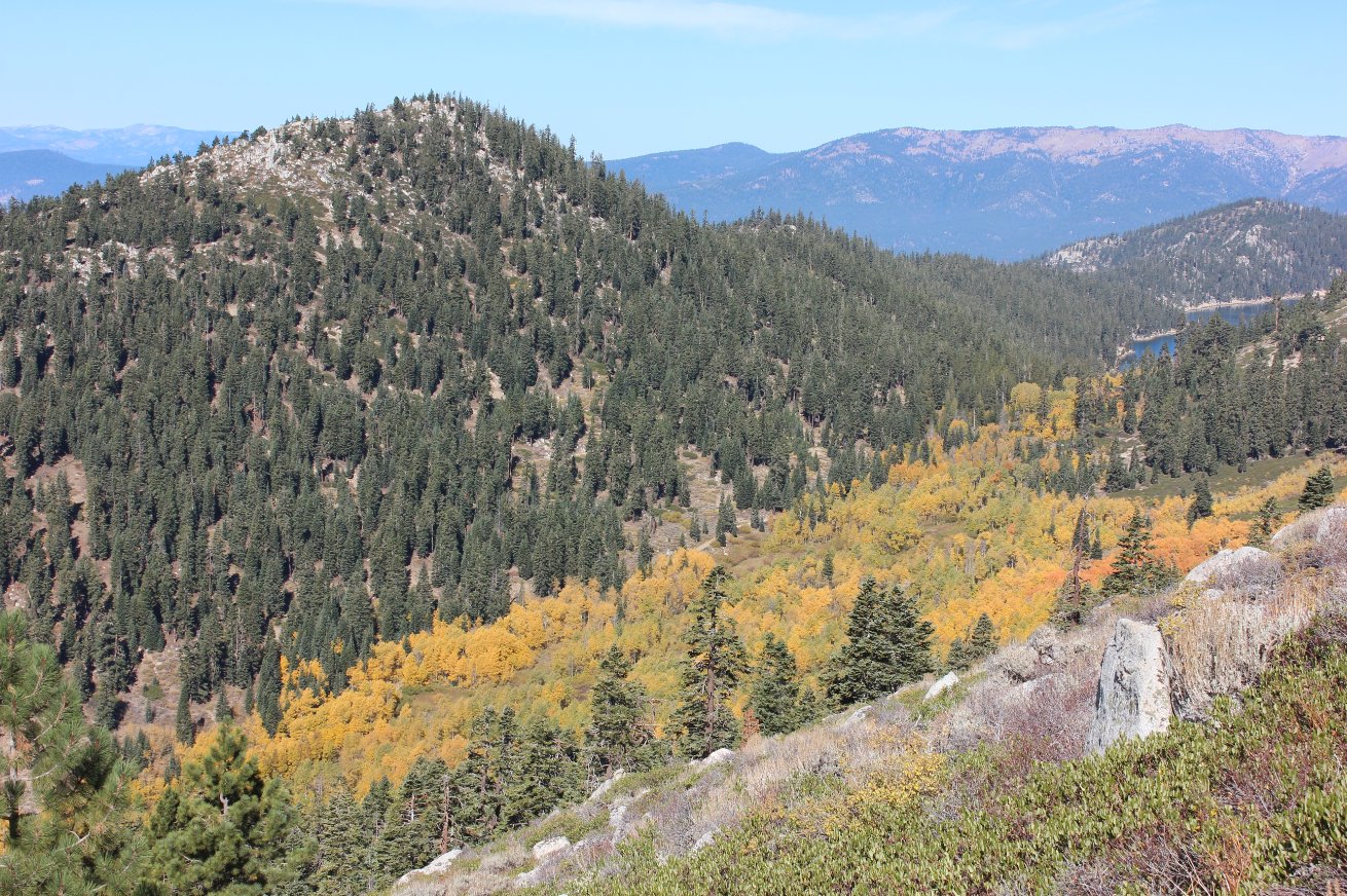
This is a great trail even in
the fall, as the colors were spectacular along this part of the
ridgeline. |
 |
|
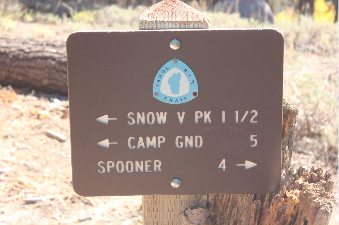
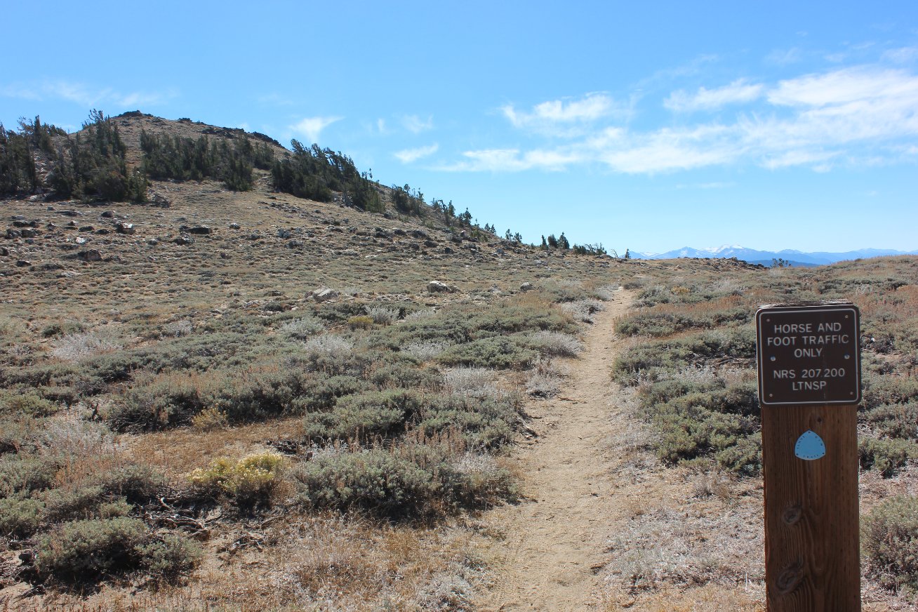
This trail is pretty easy to
stay on but there were signs here and there that provided helpful
information at the junction spots. |
|
|
Just below the peak you are
hiking out in the exposed mountain and the sun was pretty warm on this
day. |
 |
|
Looking back down the general
area we climbed provided more color displays for our eyes. |
 |
|
Looking back at this junction
is the way we came. To the left is the road to the peak and
to the right is the diversion to Marlette Lake overlook. |
 |
|
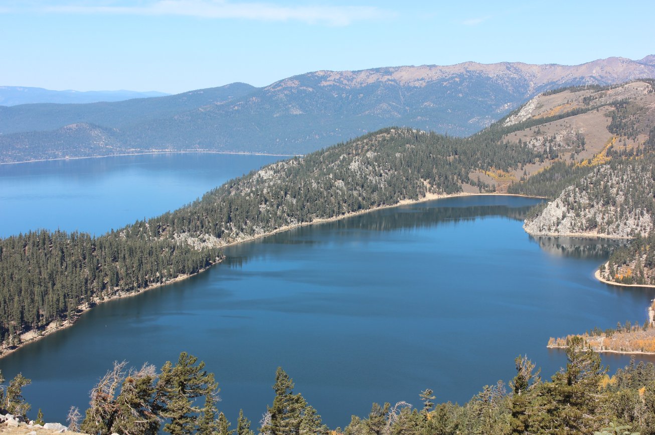
This spot is amazing.
The view of Marlette Lake and then Lake Tahoe 1000' feet
below is phenominal. |
 |
|
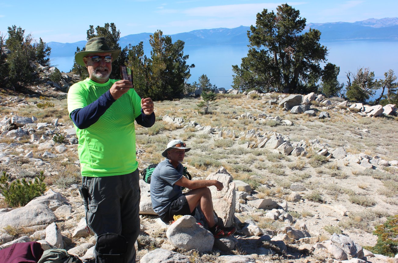
Members of our hiking group
stopping to check out the sights from high above. |
 |
|
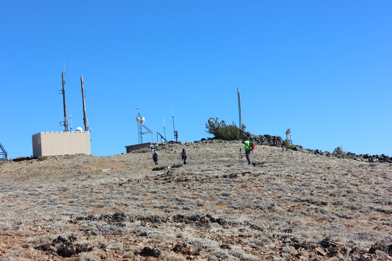
The last
climb to the peak is a little bit of cross country if you go straight
up like we did. The road to the left would be easier but less
fun! |
 |
|
Looking southeast from the
peak toward the Carson Valley. |
 |
|
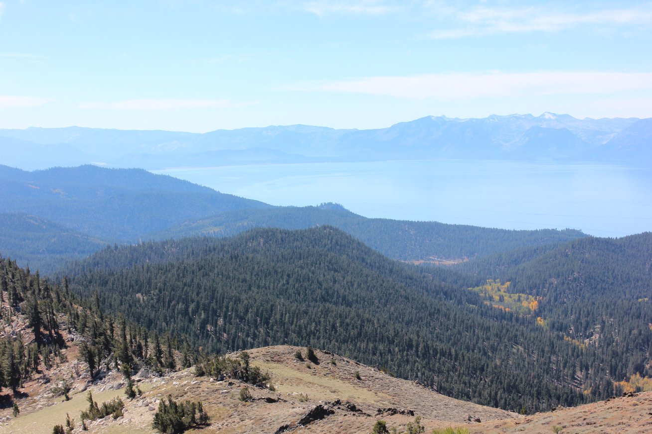
Looking southwest from the
peak toward Lake Tahoe and Desolation Wilderness on the other side of
the lake. |
 |
|
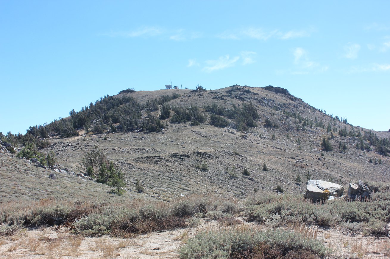
Max making his way up to the
top of Snow Valley Peak. |
 |
|
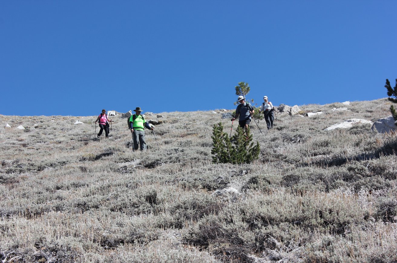
The rest of the group making
the final ascent to sign the summit register at the top. |
 |
|
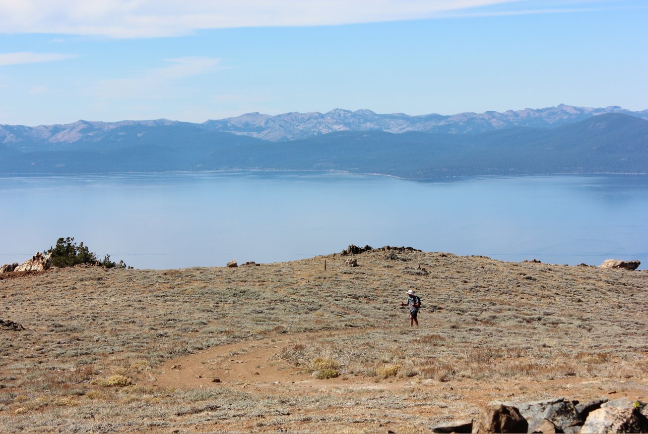
We took the fun way back down
from the peak as well to pick up the Tahoe Rim Trail a little further
below. |
 |
|
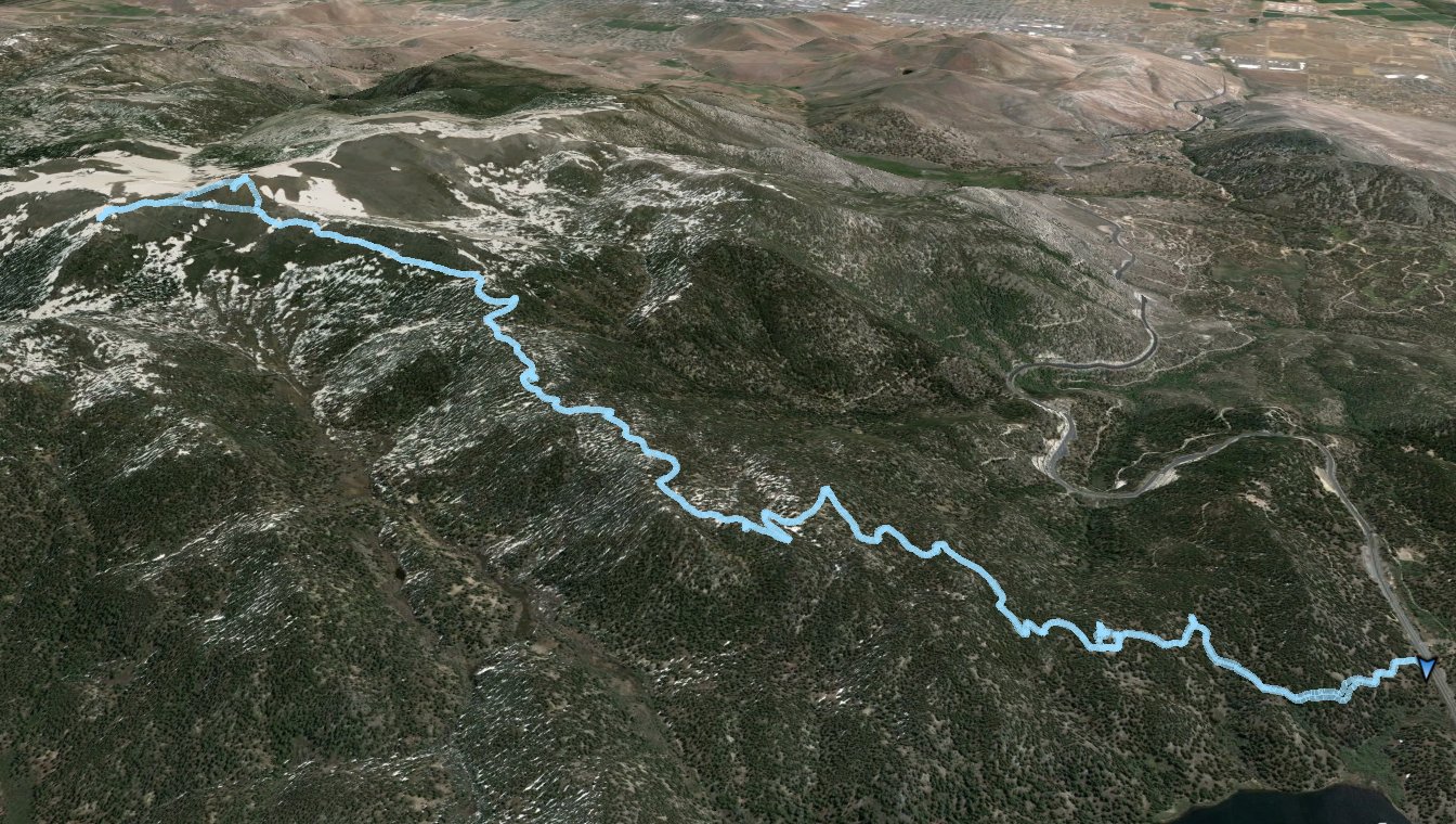
GPX image of the hike. |
|