|
|
Hike
into Sayles Canyon hike
|
|
Trip Date: 05/16/2014
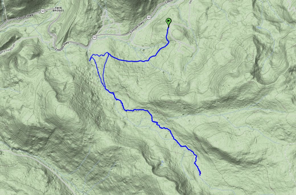
Distance: 10.5 Miles
Vertical Gain:
1500'
Group Size:
3
Hike Rating: Easy
Moderate
Hard
Strenuous |
 GPX for
this trip
GPX for
this trip
|
|

|
Start Coordinates: |
N 38 47.573, W 120 06.361 |
|
End Coordinates: |
Same as Start Coordinates
|
| Car Shuttle
Req'd: |
No |
|
Parking
Directions: |
Take
Highway 50 to Tamarack Pines Road on the south side of the highway.
Follow this up to Sierra at Tahoe resort, and then turn right
at
the entrance to continue up to the parking coordinates. In
the
winter and early spring a gate for this road will be locked, adding
another 2 miles to the hiking distance. |
| Hazards of
Note: |
None. |
|
Crowd Factor: |
Negligible.
Your chances of running into another party on this trail is
very slim. |
General Notes:
From the parking area, head up the Sayles Canyon trail, which will
start picking up elevation immediately. Great views of
Pyramid
Peak and some of the Desolation Wilderness are not to be missed behind
you as you start up the canyon trail. A couple of miles in
you
will come to a junction with the Bryan Meadow trail, and you can either
take that or continue on the Sayles Canyon trail further south.
If you want to make this a circular hike, continue on either
of
these trails for about 3 miles, and then use the Pacific Crest trail
which they both dead end into for about 2 miles to then pick up the
other trail to head back. This is mostly a forested hike, but
the
meadows and rivers along the way are wonderful environments to immerse
yourself in. |
|
|
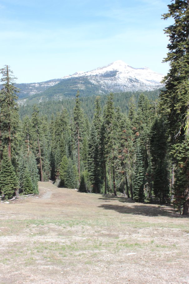
Pyramid Peak visible from
halfway up Beaver ski run at Sierra-at-Tahoe resort. |
 |
|
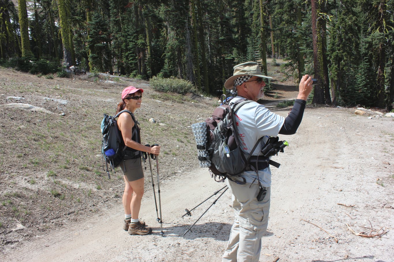
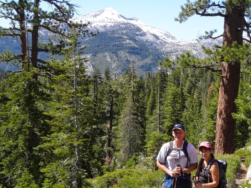
My hiking partners Gail and
Mark on the ski run taking pictures of Pyramid Peak. |
 |
|
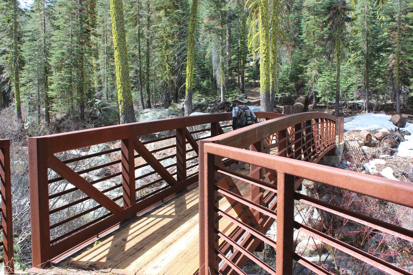
A recently constructed bridge
along the Pony Express trail at the junction where we headed south into
Sayles Canyon. |
 |
|
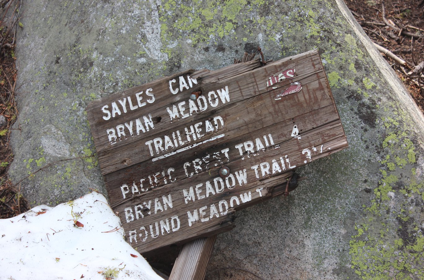
The
Sayles Canyon trailhead marker desperately needing some repairs.
This was actually 2 miles in from where we had to park with
the
access gate closed. |
 |
|
Early on the trail up we had
incredible views into Desolation Wilderness. |
 |
|
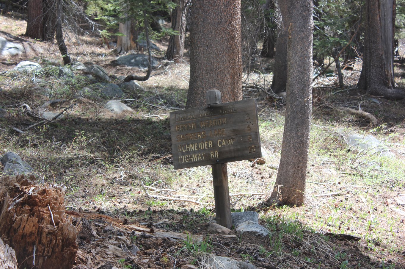
Just over
a mile from the actual trailhead, there is a branch either further into
the Canyon or a little north toward Bryan Meadow. Both of
them
connect up to the Pacific Crest Trail about 3 miles further. |
 |
|
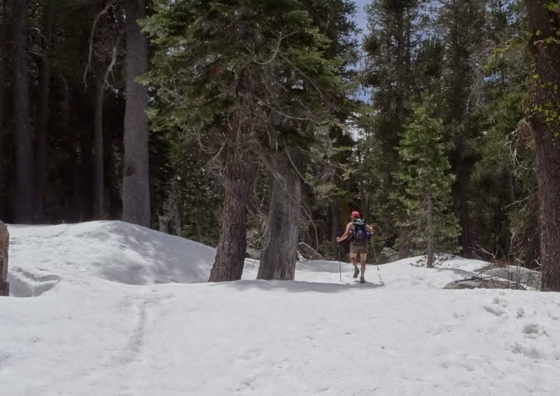
In late
May during a terribly dry winter, we found ourselves navigating through
a surprising amount of snow. In fact, about 5.5 miles in we
had
to turn back when I fell into a snow hole up to my chest.
|
 |
|
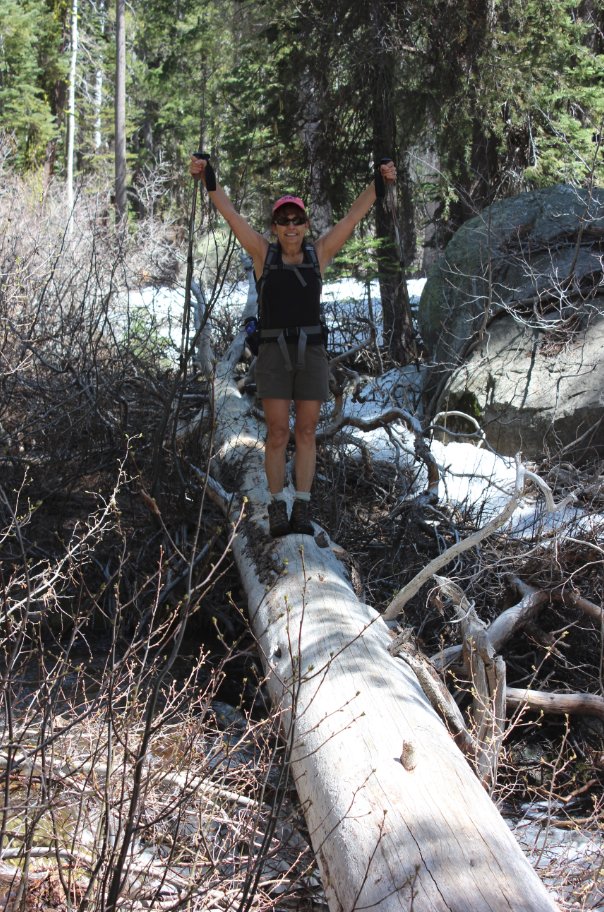
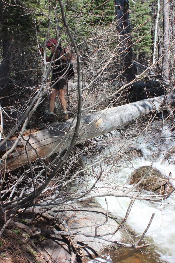
What is a wild, cross-country
snow trek without having to cross significant amounts of water on a
fallen log? |
 |
|
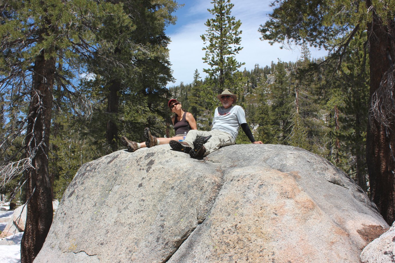
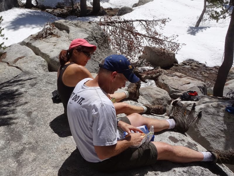
Just a
few feet back from our stopping point, we found a great rock along the
river to enjoy lunch. Even had a USAF plane buzz us flying
through the canyon while we were eating. |
 |
|
The top of the rock had a nice
flat area that had more than enough room for the three of us to chow
down in comfort.
|
 |
|
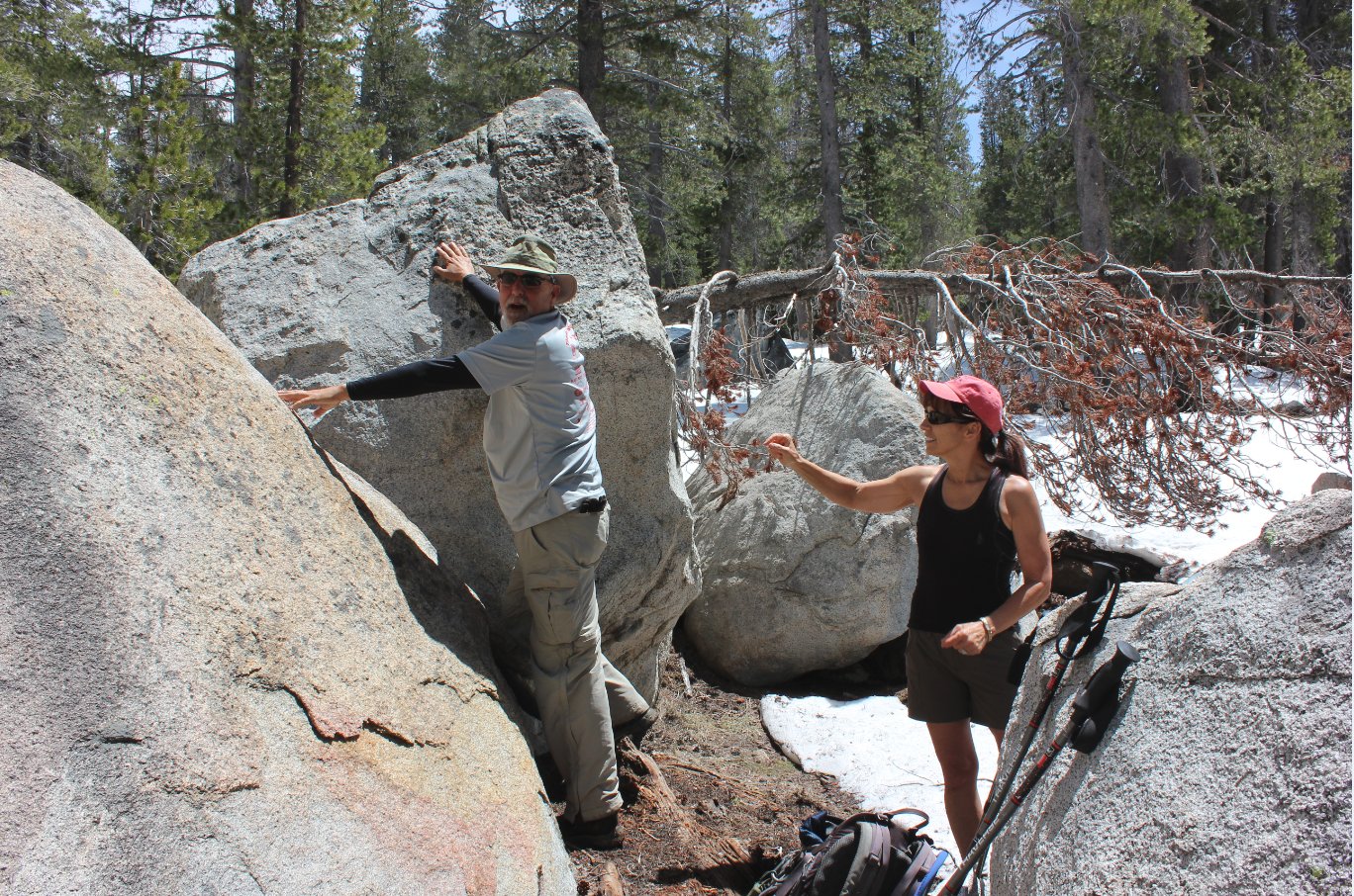
We made the most of our
relaxation spot by hiding a geocache for others to stumble across as
they navigate the serene trail. |
 |
|
One last crossing of the river
on the way back. |
 |
|
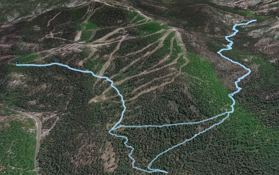
GPS Track of the full hike. |
 |