|
|
Pony
Express Trail from Lover's Leap hike
|
|
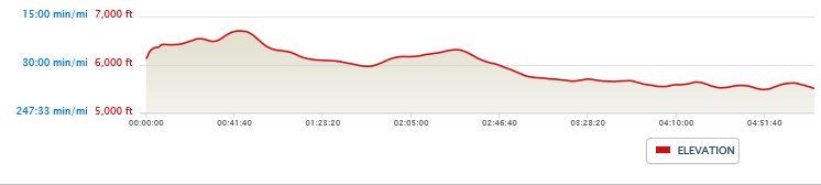
Trip Date: 05/08/2014
Distance: 9.5 Miles
Vertical Gain:
1100'
Group Size:
2
Hike Rating: Easy
Moderate
Hard
Strenuous |

 GPX for
this trip
GPX for
this trip
|
|
|
Start Coordinates: |
N 38 48.228, W 120 07.050 |
|
End Coordinates: |
N 38 47.208, W 120 12.564 |
| Car Shuttle
Req'd: |
Yes |
|
Parking
Directions: |
Take
Highway 50 to the parking area at the coordinates provided which are
just across the highway from Camp Sacramento. A second car
should
parking just about a mile up Wrights Road (from Highway 50,) at the End
Coordinates listed above. |
| Hazards of
Note: |
None. |
|
Crowd Factor: |
High
early, then Negligible.
You will probably run into other people near Lover's Leap and
Strawberry, as this is a popular rock climbing location.
After
this, however, your chances of running into another party on the pony
express trail is
very slim. |
General Notes:
From the parking area, cross back over Highway 50 and head up into the
Camp Sacramento area. Head to the west side of the camp, and
you
will see a sign indicating the start of the hike toward Lover's Leap.
Within the first mile is a junction to either continue on to
Lover's Leap, or head off to the right on the Pony Express Trail.
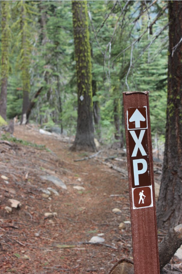
You can verify you route with the "XP" markers along the way
on
the trail signs and in the trees. When you get to Strawberry,
you
will have to cross back over Highway 50 again, and then pick up the
Pony Express trail on the north side of the road. |
|
|
Starting
at Camp Sacramento, there is a split where you can either head up
toward the top of Lover's Leap, or head down along the Pony Express
trail. |
 |
|
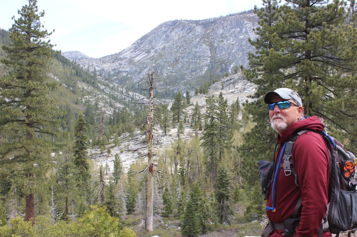
My buddy Mark at an overlook
early on the trail up toward Horsetail Canyon. |
 |
|
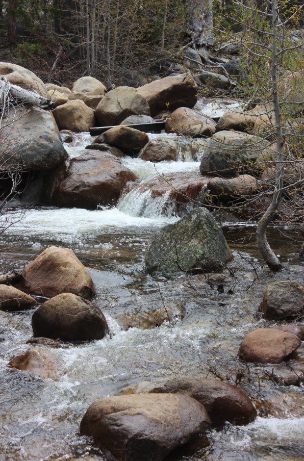
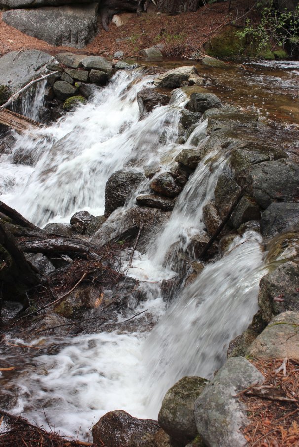
These falls were close to the
trail split, and are near a section of the trail that used to be a
water crossing. |
 |
|
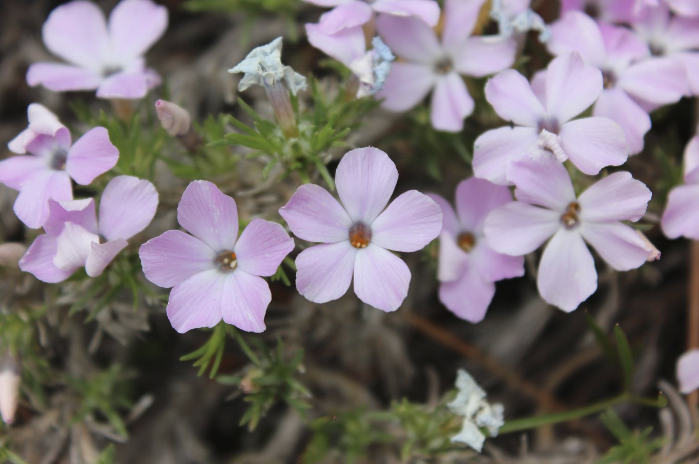
Wildflowers were everywhere on
the trail. |
 |
|
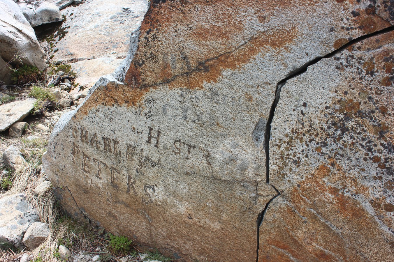
Graffiti along the trail from
probably over 150 years ago. |
 |
|
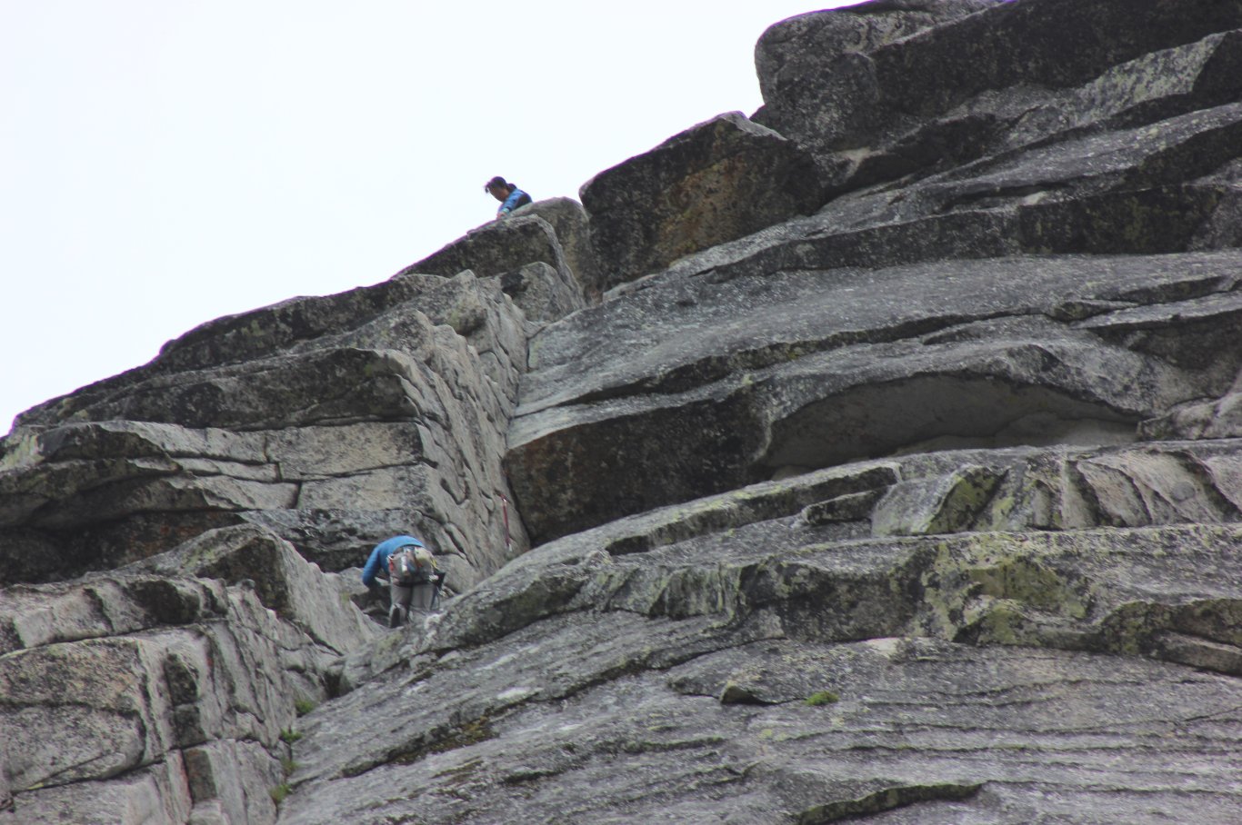
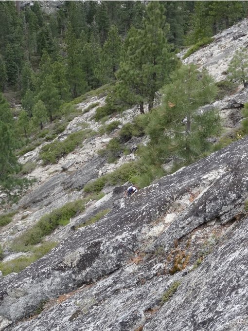
Some of the crazy climbers who
scale various parts of the Lover's Leap sheer granite cliffs. |
  |
|
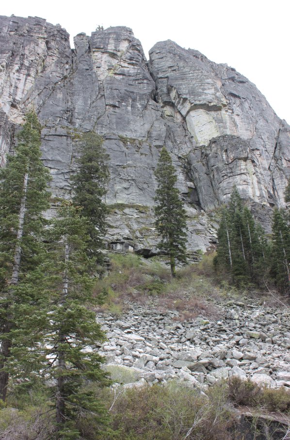
On our
way up the SW side of Hogsback, not the way I would ever recommend
going. The SE has a better route to the top that we came back
down.
|
 |
|
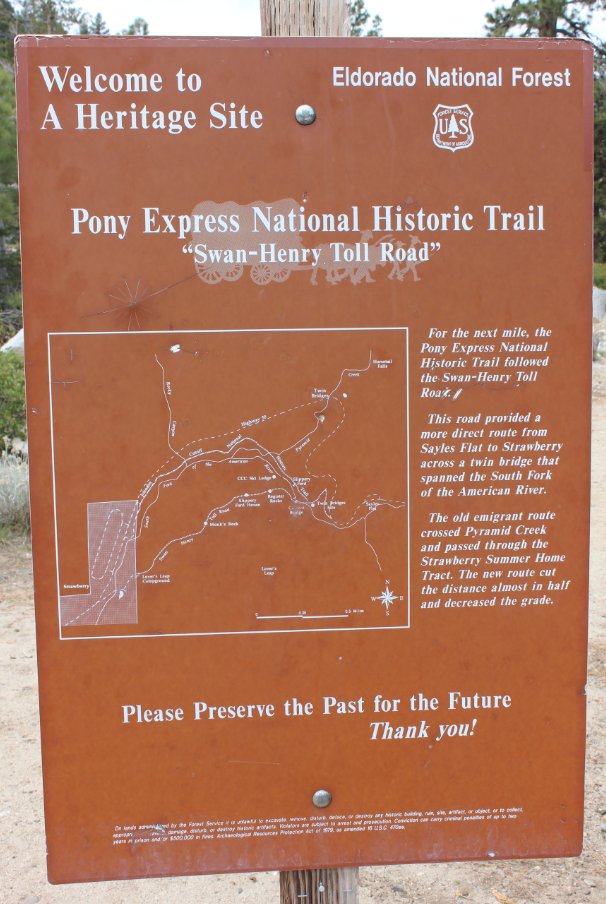
One of the many inforamtion
signs along the first couple miles of the trail that gave some of the
history of the area. |
 |
|
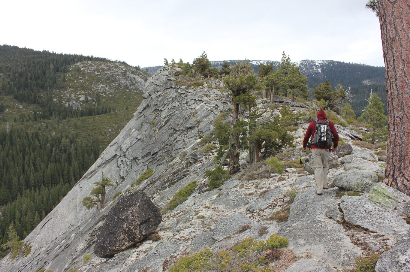
Making our way along the spine
of Hogsback toward a cache that brought us up here in the first place. |
 |
|
Here we are walking along an
order section of Highway 50 with the new highway visible below us to
the left.
|
 |
|
One of the two water crossing
locations today which were not passable due to pretty fast water. |
 |
|
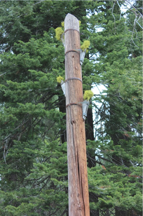
An old telegraph pole from the
Pony Express days which we found a number of along the trail. |
 |
|
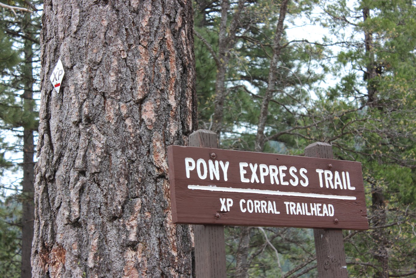
The end of our trek, with the
trailhead marker heading back up the trail.. |
 |
|
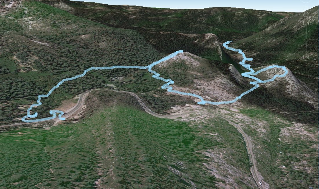
GPS track
of the first half of the hike, including two diversions up to the top
of "Lew's Folly" and then "Hogsback" to find a couple of geocaches. |
 |
|
One last selfie at the top of
Lew's Folly with Pyramid Peak in the back.. |
 |
|
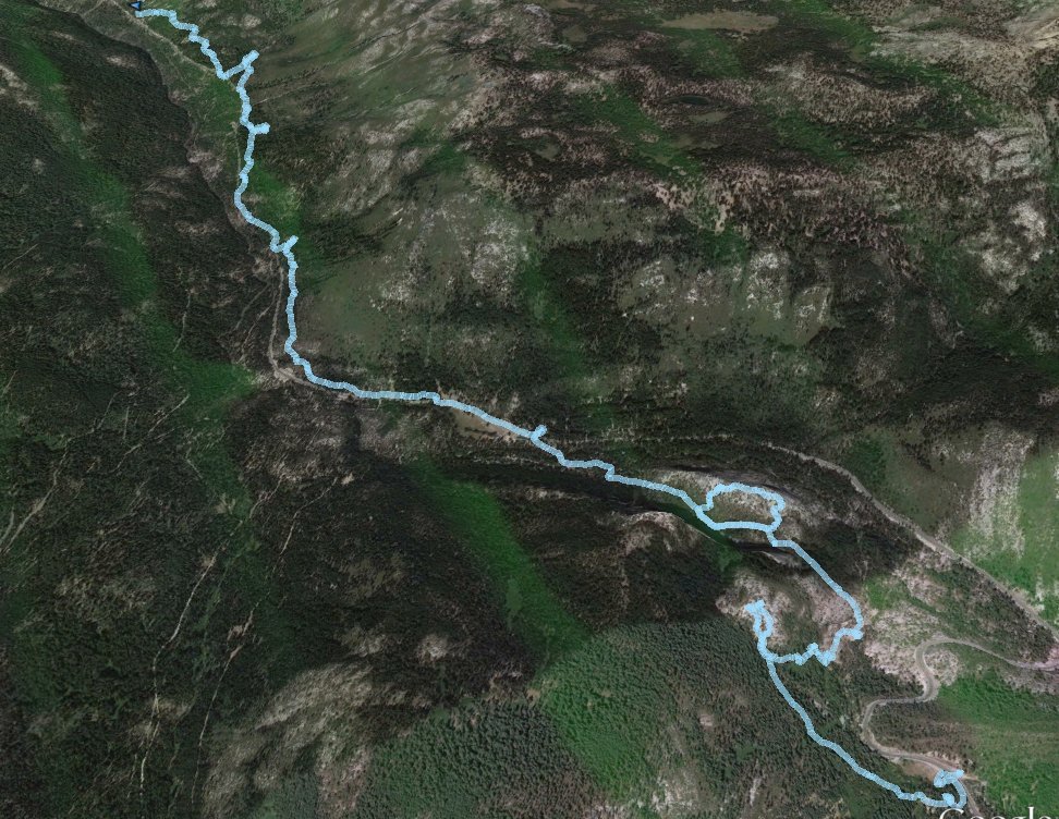
GPS Track of the full hike. |
 |