Distance: 12.9 Miles
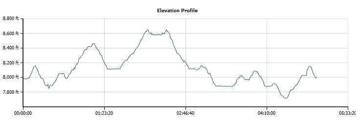
Vertical Gain: 2000'
Group Size: 1
Hike Rating: Easy Moderate Hard Strenuous

 GPX for
this trip

| Start Coordinates: | N 38 38.087, W 120 08.494 | End Coordinates: | Same as Start Coordinates | ||
| Car Shuttle Req'd: | No | Parking Directions: | Take Highway 88 to the south end of Silver Lake, and turn east into the Mud Lake Trailhead parking area. It is directly across the road from one of the Tragedy Springs access points. Follow this road for about 2/10 of a mile, and then turn right into the paved parking area for the trail. | ||
| Hazards of Note: | Bears, 4WD vehicles, and some
discerning of the faded sections of the Carson Emigrant National
Historic Trail. |
Crowd Factor: | Moderate. About 2/3 of this trek is on OHV roads, so there may be vehicle traffic on the way. However, high clearance 4WD is necessary to navigate this area, so it should be minimal. | ||
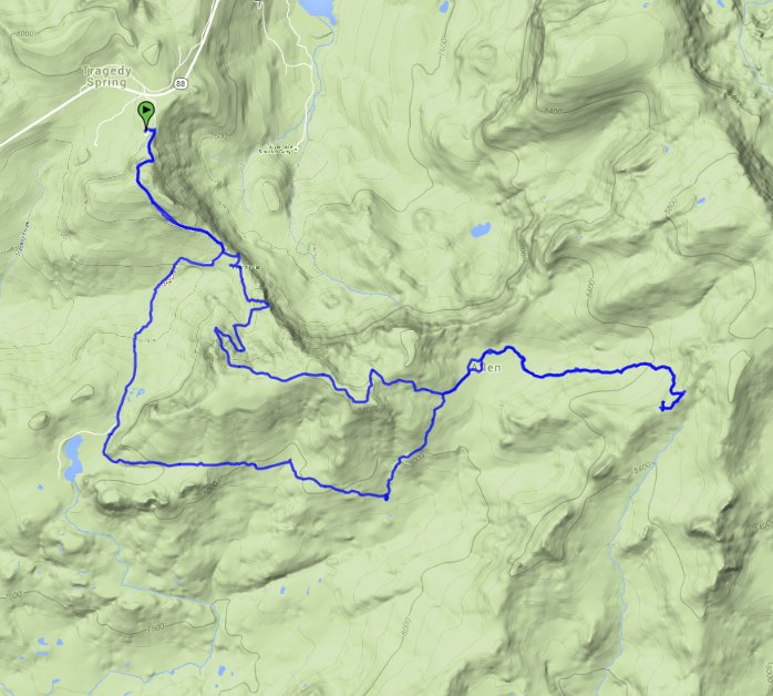
| General Notes: From the parking area head back out to the road you came in on and turn at the Mud Lake Trailhead sign. You will follow this dirt road upward for about 1/2 a mile, and then it will slope down a bit until you hit Porthole Gap. Stop and take a look at the view from this location, as it is spectacular. This is a camping area as well for hikers and OHV enthusiasts, and you may run into some here. Continue on the trail, as it heads up for the next mile before eventually dropping down in elevation as you near Allen Camp. This large meadow area is very scenic and tranquil, and you will have momentary views to the south and the towering Mokelumne Peak. Past Allen Camp you will either continue on the dirt road all the way to Squaw Ridge, or you will find a junction that will take you a mile up directly to Plasse's Trading Post location. If you continue on the OHV road, at the ridge you will find a sign pointing to the west for about a 1/4 downhill trek to the Plasse site. From here head back down to Allen Camp via either trail, and then when you get to the camp continue through on the road that bends west past the old buildings. The road will continue, and then when it suddenly bends to the north (right,) this is where you will need to head left to stay on the Carson Emigrant trail. It is very difficult to discern at this point, but rock cairns will help guide you. The next mile and a half is over this lightly-used trail, which guides you through forest and past basalt and granite rocks. Eventually you will come to an intersection with an OHV road which heads off to the right, but you will continue straight for another mile until you reach a meadow where Mud Lake is just visible at the far end. You can find a junction (Long Valley Trail) a little further up the trail past the meadow to head to the lake, or just continue on the actual Mud Lake trail until it gets you back to Porthole Gap. Then head north (left) to finish the last mile back to the parking area. |
|||||


