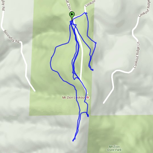
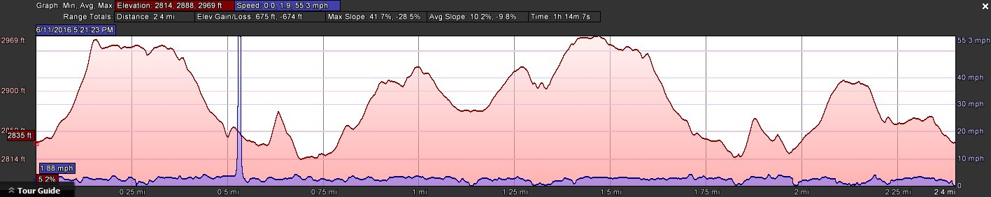
Distance: 2.0 Miles
Vertical Gain: 400'
Group Size: 1
Hike Rating: Easy Moderate Hard Strenuous
 GPX for
this trip
GPX for
this trip
| Start Coordinates: | N 38 23.628, W 120 39.208 | End Coordinates: | Same as start coordinates | ||
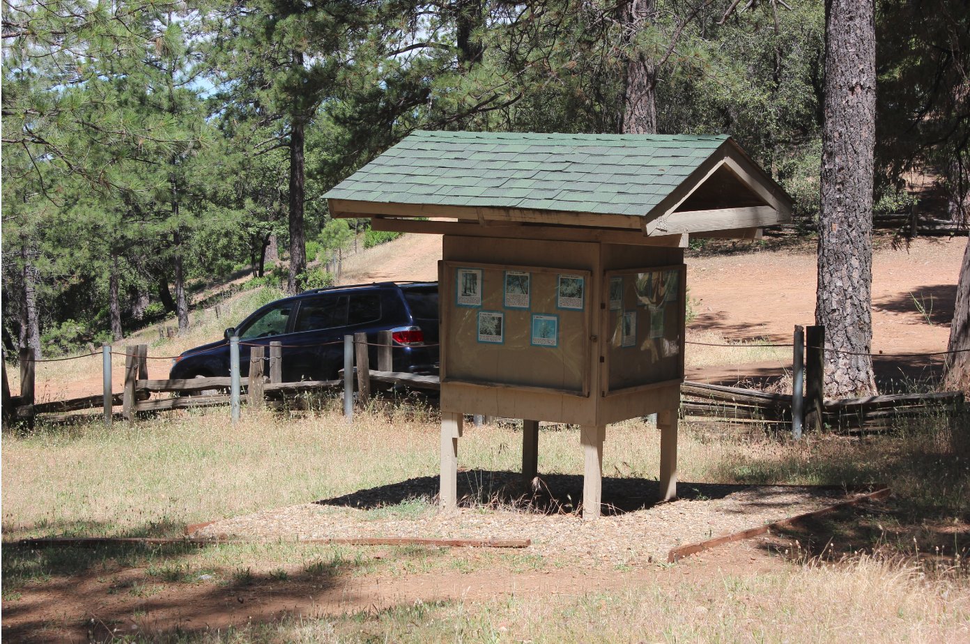
| Car Shuttle Req'd: | No | Parking Directions: | Take Highway 88 to the town of Pine Grove. Near the east end of town turn south on Mt. Zion road, and follow this approximately 1 mile to the trailhead parking at the CDF gate. Park in the dirt area where the nature trail kiosk is located on the other side of a split rail fence. | ||
| Hazards of Note: | Rattlesnakes, ticks, poison oak. | Crowd Factor: | Minimal. Dog walkers and runners particularly make use of this trail. | ||
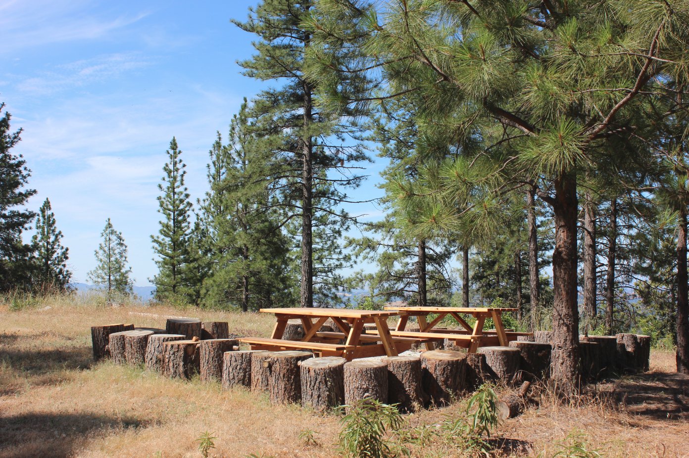
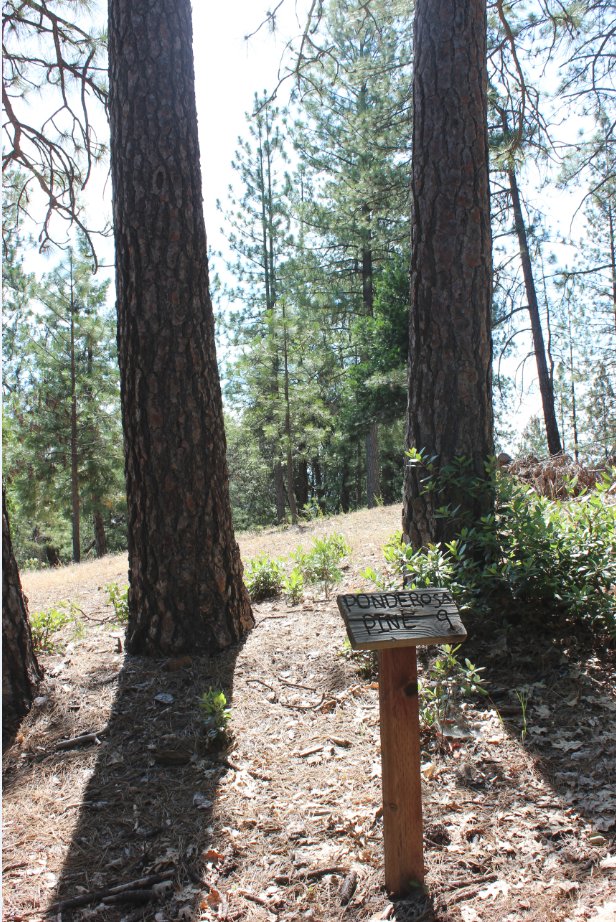
| General Notes: From the parking area you have many options, as there are three or four locations at which you can begin your journey in the area. If you want to follow the nature trail loop, head to the trail furthest to the east, and you will find the associated markers labelled 1 through 10 as indicated on the kiosk for the local plants in the area. The nature trail loop is just a little over a mile, so if you head east from the parking area down the road for about 500 feet, there is another small trailhead for a little more exploration of the area that can be used to add to the mileage in the area. N 38 23.628, W 120 39.208N 38 23.628, W 120 39.208N 38 23.628, W 120 39.208N 38 23.628, W 120 39.208N 38 23.628, W 120 39.208 |
|||||