|
|
Lovers
Leap from LL Campground hike
|
|
Trip Date: 11/11/2014
Distance: 5.1 Miles
Vertical Gain:
1000'
Group Size:
3
Hike Rating: Easy
Moderate
Hard
Strenuous |
 GPX for
this trip
GPX for
this trip
|
|
|
Start Coordinates: |
N 38 47.963, W 120 08.432 |
|
End Coordinates: |
Same as starting coordinates |
| Car Shuttle
Req'd: |
No |
|
Parking
Directions: |
Take
Highway 50 to Strawberry Lane, just to the east of the Strawberry
Lodge. Follow the road to the Lovers Leap campground area,
and
park in the day use spots. There is a $5 fee (as of 2014) for
parking in this location. |
| Hazards of
Note: |
Steep dropoffs at the top.
Keep young children away from the edges. |
|
Crowd Factor: |
Moderate. This is a
popular area for rock climbing, and the hike to Lovers Leap peak is
fairly popular with all ages. |
General Notes:
From the parking area, find the trail information sign about the Pony
Express "Swan-Henry Toll Road," which is the start of the hike.
You will travel for the first mile along a very rocky trail,
requiring careful footing to not twist an ankle on the sometimes loose
and rocky road surface. Once past the rocks the trail turns
to
dirt, and is easy going for the entire length of the Pony Express
route. As the trail climbs once you pass by the face of
Lovers
Leap, you will look for a trail junction to the right. Do not
mistake an old forest road for the trail. When you get to
this
stay on your current trail, and look for the junction in the next
quarter of a mile. A vertical plastic stake with "XP" on it
will
verify that you are in the correct location when you get to the actual
trail junction. Turn right, and head on up to the top of
Lovers
Leap along this easy to follow trail. |
|
|
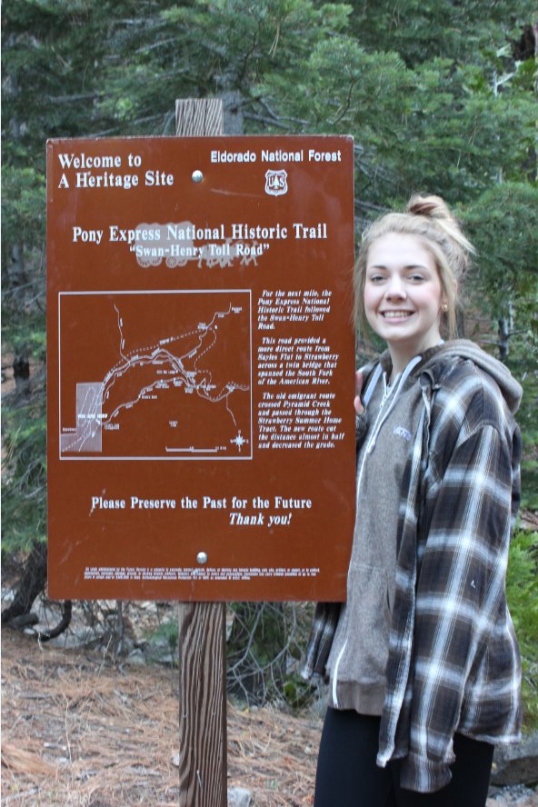
My daughter, Sierra at the
first information sign near the Pony Express trailhead from the
campground. |
 |
|
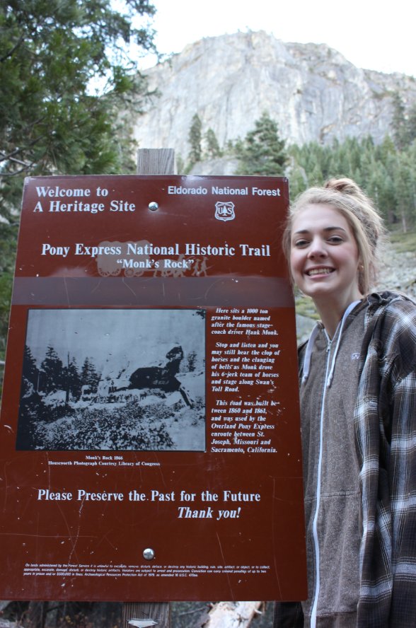
Checking out the historical
location known as Monk Rock not too far from the start of today's hike. |
 |
|
A little
bit of detail about Monk Rock, along with a background shot of Lovers
Leap towering high above this early part of the trail. |
 |
|
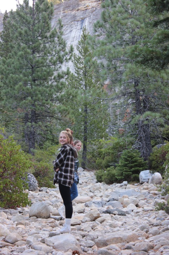
Parts of
the first mile of trail are extremely rocky. Must not have
been
much fun to be on this during the Pony Express days. |
 |
|
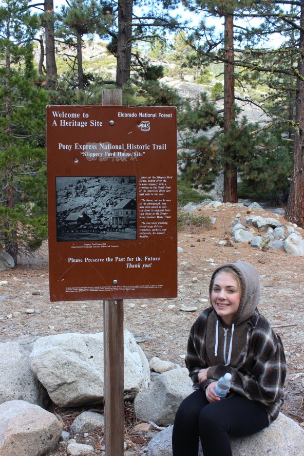
One for information sign along
the trail, this one talking about Slippery Ford just a few hundred feet
up the way. |
 |
|
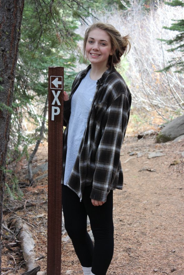
Along the way are markers
tagged with "XP," for Pony Express which point the correct direction at
junction spots. |
 |
|
No idea what this was the
remains of, but it was very interesting to check out along the way. |
 |
|
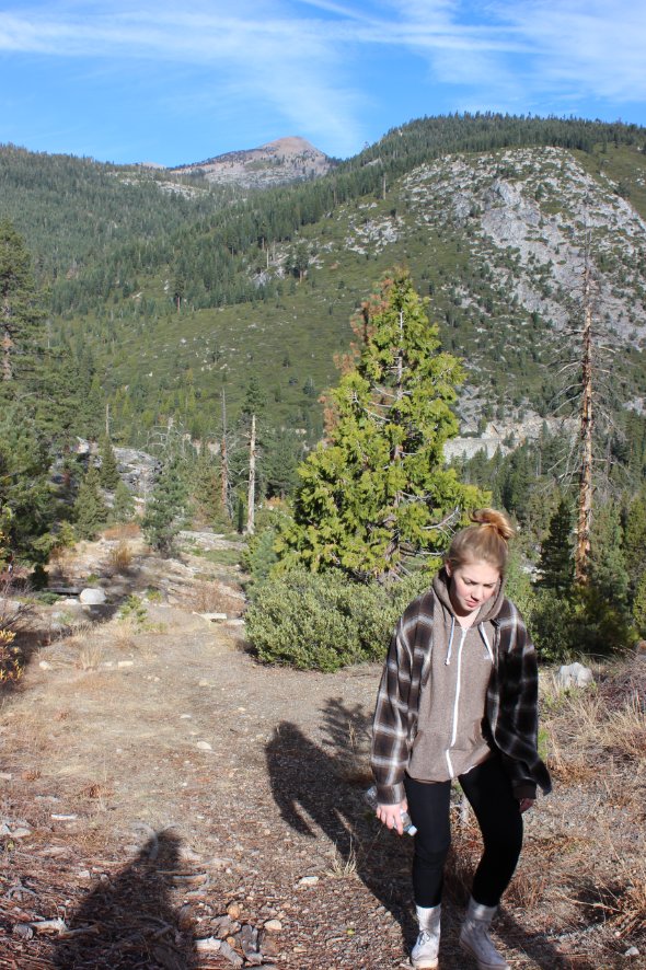
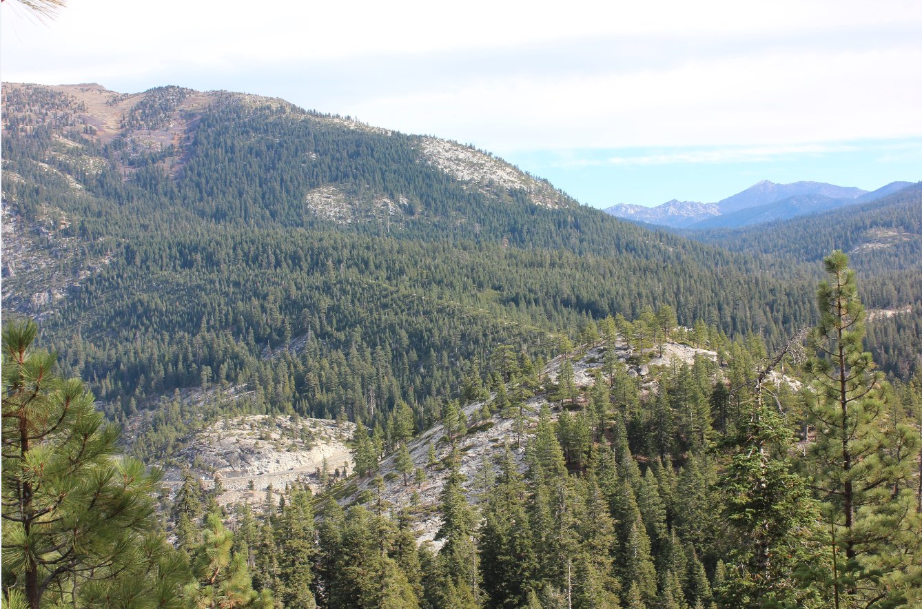
Making our way up the trail as
it started to get a little steeper, with Rocky Canyon and Pyramid Peak
in the background.
|
 |
|
The view along the trail
toward Freel Peak in the distance. Mt. Ralston can just be
seen at the top left of the picture. |
 |
|
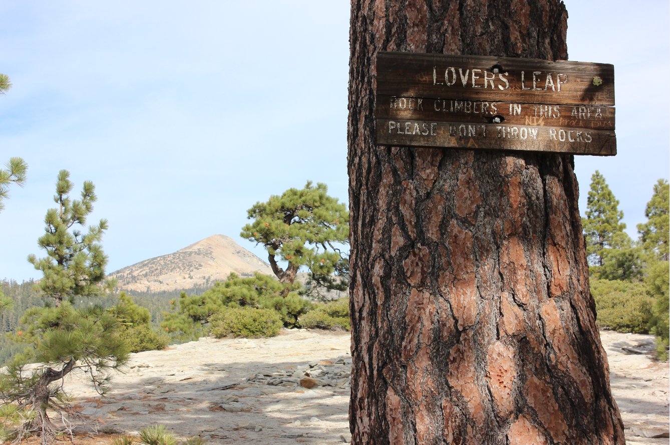
Sign marking the top of Lovers
Leap along with some helpful advice for visitors to the location. |
 |
|
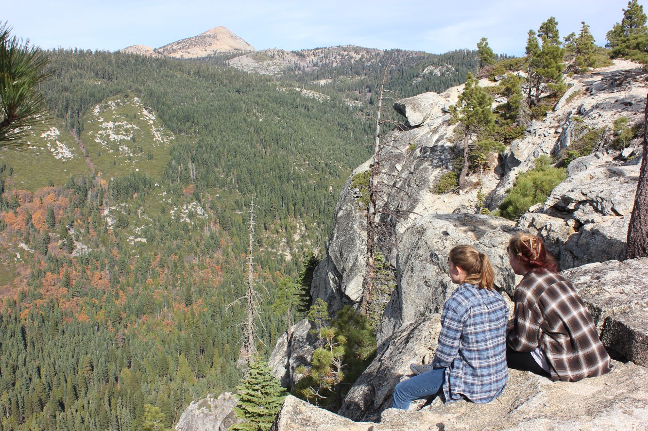
Views to the north from the
top of Lovers Leap.
|
 |
|
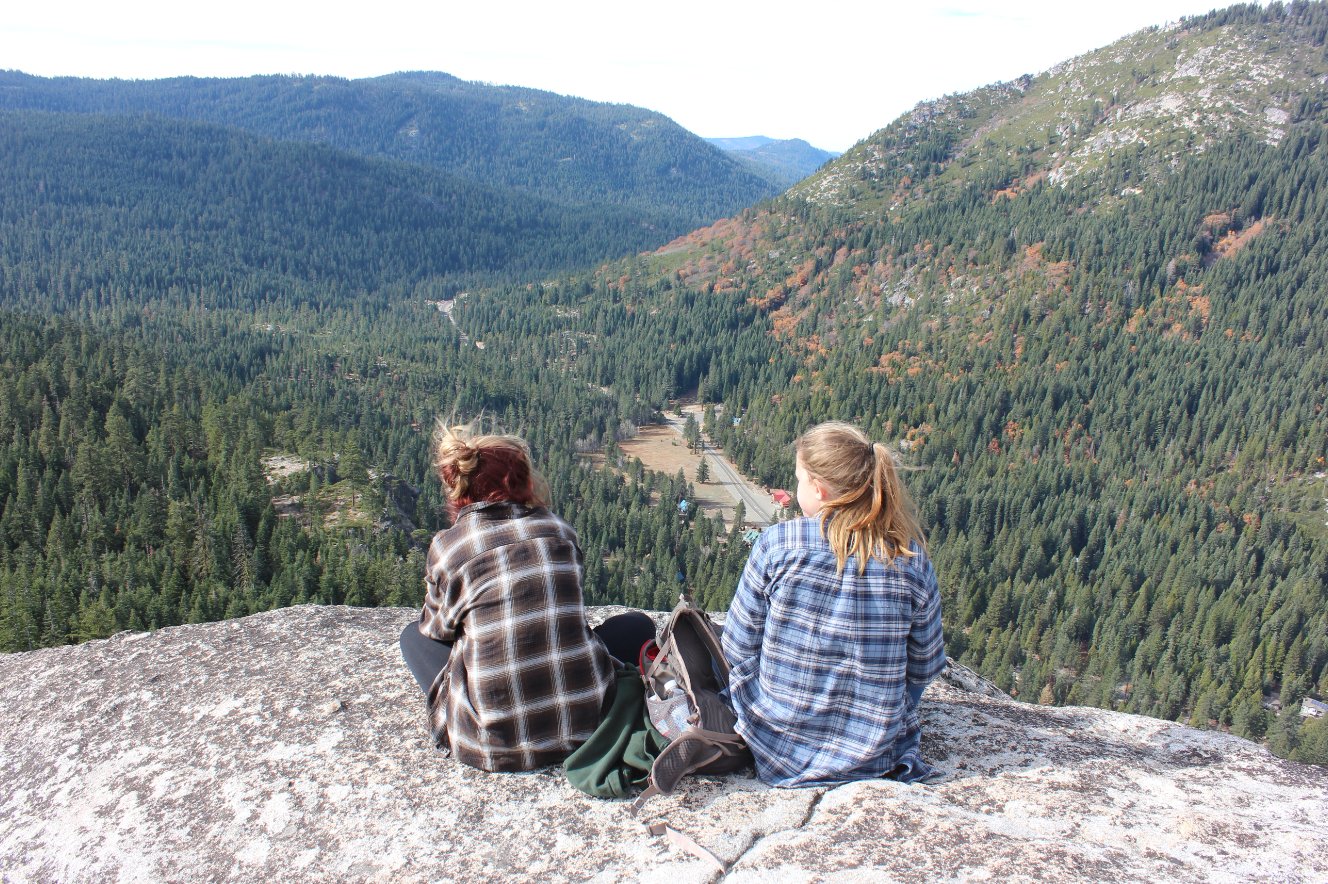
Our lunch spot looking down at
Strawberry and further west had a pretty great view of the highway 50
area. |
 |
|
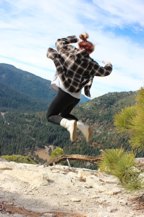
My daughter was pretty excited
to find out there would be no more uphill the rest of the trip. |
 |
|
The preservation society has
painted some of the original graffiti from the pony express riders
found on a rock along the way. |
 |
|
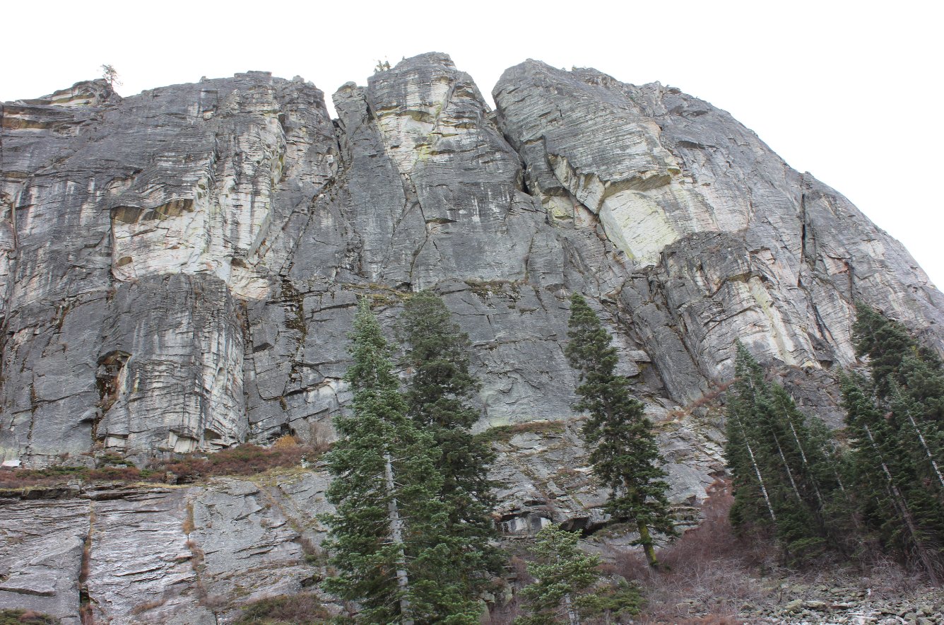
The trail on the way back
offers this great view of the rock face of Lovers Leap towering high
above you. |
 |
|
Lots of leaves on the ground
as we neared the end of the hike. |
 |
|
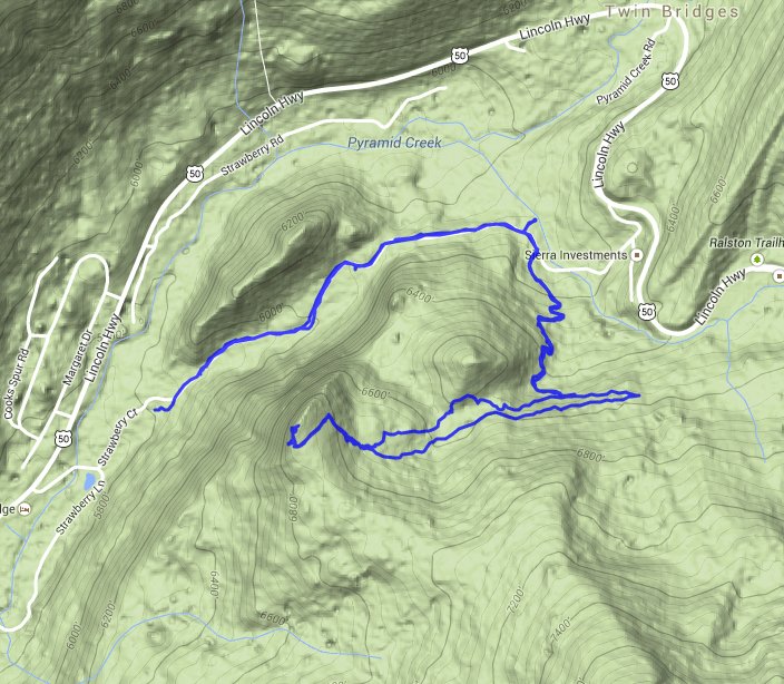
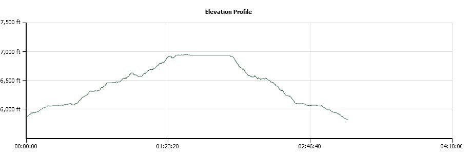
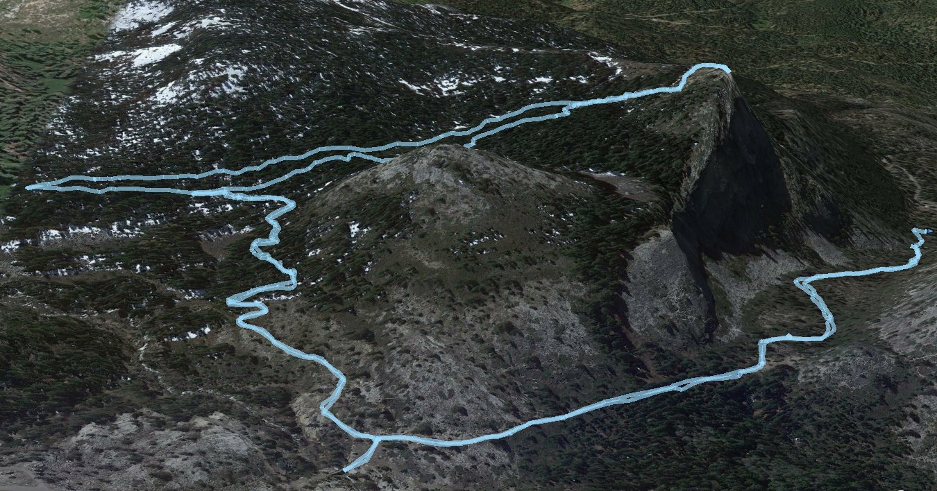
GPS Track of the full hike. |
 |