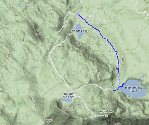
Distance: 5.5 Miles
Vertical Gain: 800'
Group Size: 10
Hike Rating: Easy Moderate Hard Strenuous


| Start Coordinates: | N 38 41.503, W 120 00.570 | End Coordinates: | Same as Start Coordinates | ||
| Car Shuttle Req'd: | No | Parking Directions: | Take Highway 88 to the Woods Lake Road just east of Caples Lake. Head down the paved road to the parking area for Woods Lake, and there is a fee to park in this location. The trailhead for this hike is just to the south from the parking spots. | ||
| Hazards of Note: | Weather in this area can
change quickly so be prepared for various temperatures and rain. |
Crowd Factor: | Moderate. This is a popular hike, especially in the spring and early summer for the spectacular wildflower displays along the trail. | ||
| General Notes: From the parking area head south for the trail to Lake Winnemucca. You will cross a wooden bridge very early on, and then head south for the bulk of the trail. There are many open areas as you climb nearly 1000 feet along this trail. The path follows a canyon up toward the lake, and there are views of Round Top Mountain to the southwest much of the way along the trip. At a trail junction very near the lake, you will head left (east about 1/4 mile) to get to the lake. |
|||||
