|
|
Lake
Pardee (Rich Gulch) East Hike
|
|
Trip Date: 4/19/2019
Distance: 7.25 Miles
Vertical Gain:
800'
Group Size:
2
Hike Rating: Easy
Moderate
Hard
Strenuous |
 GPX for
this trip
GPX for
this trip
|
|

|
Start Coordinates: |
N 38 17.156, W 120 45.439 |
|
End Coordinates: |
Same as Start Coordinates |
| Car Shuttle
Req'd: |
No |
|
Parking
Directions: |
Take
Highway 49 to Middle Bar Road. Go south on Middle Bar Road
until you cross a one-lane bridge over the Mokelumne River.
After crossing, turn right and drive up about a mile to the
parking area at the coordinates provided. NOTE: You need to
have an East Bay Municipal Utility District trail pass which are
available online at https://www.ebmud.com/recreation/buy-trail-permit/ to use these trails.
|
| Hazards of
Note: |
Ticks, rattlesnakes, poison
oak.
|
|
Crowd Factor: |
Moderate.
While the general area can have a lot of visitors, many of
them head the opposite direction for a wildflower hike closer to the
actual Pardee Reservoir. |
General Notes:
From
the parking area you will find the trailhead on the east side of the
road. Walk around by the gate and then head up the trail,
making sure to sign in at the register of hikers out on the trail.
There are a number of options for which direction you can go, but
in this case we ended up going in more of a "figure 8" direction with
the first part heading counter-clockwise, and then the second part
heading clockwise. Once 3/4 of the trail has been completed you
will end up back at the bridge you first crossed driving to the parking
area, and then the last mile is along the road to the car.
|
|
|
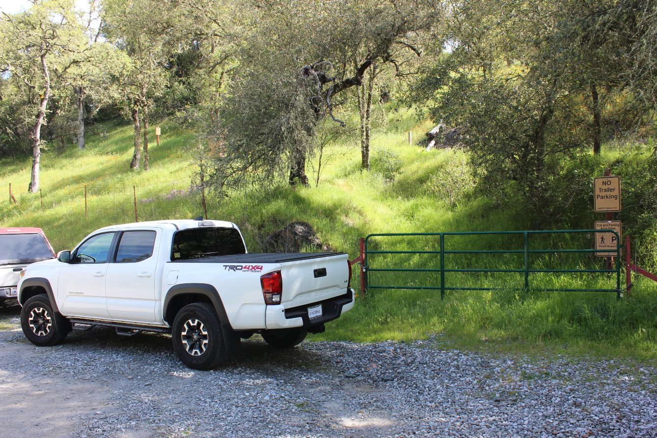
The small
turnout where there is room for a number of cars on either side of the
road. We parked on the east side, near the gate for the start of
this trek. |
 |
|
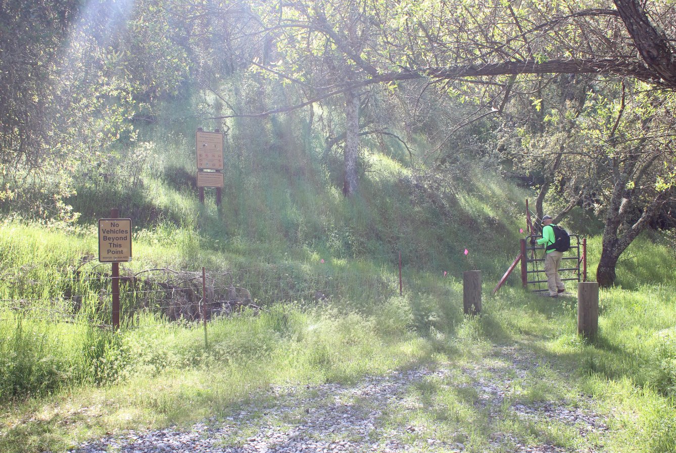
Heading onto the trail through the gate at the start of the hike. |
 |
|
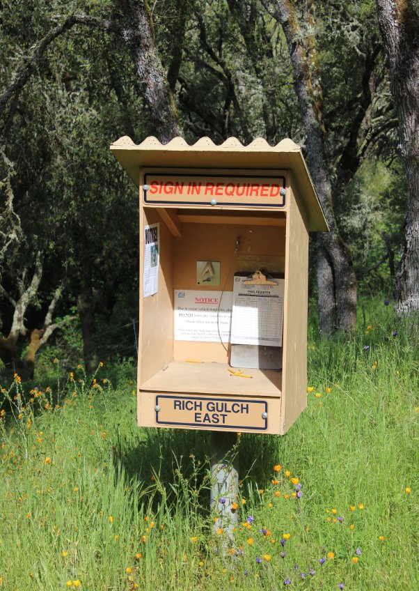
Each of
the trails in the area has a small visitor log with information about
the permits required but no actual permits available here. Make
sure to have one from the online link above before you head out. |
 |
|
An early trail view of Mokelmne Hill with the placid Mokelumne River in the foreground. |
 |
|
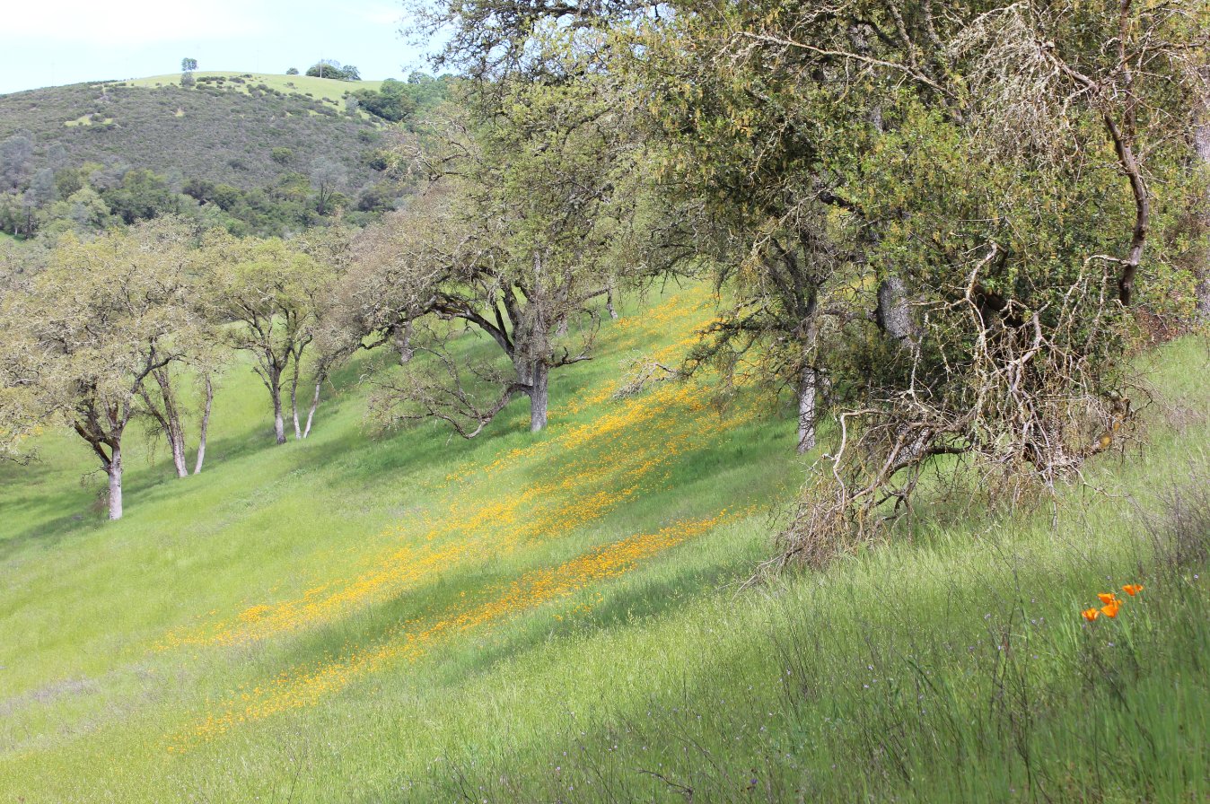
The area
was gorgeous and green on this spring day. Spring to early summer
is the best time to be out here, before the grasses dry up and the
rattlesnakes make an appearance.
|
 |
|
Great colors of green everywhere. This ravine looked inviting but was too far off-trail for this trip. |
 |
|
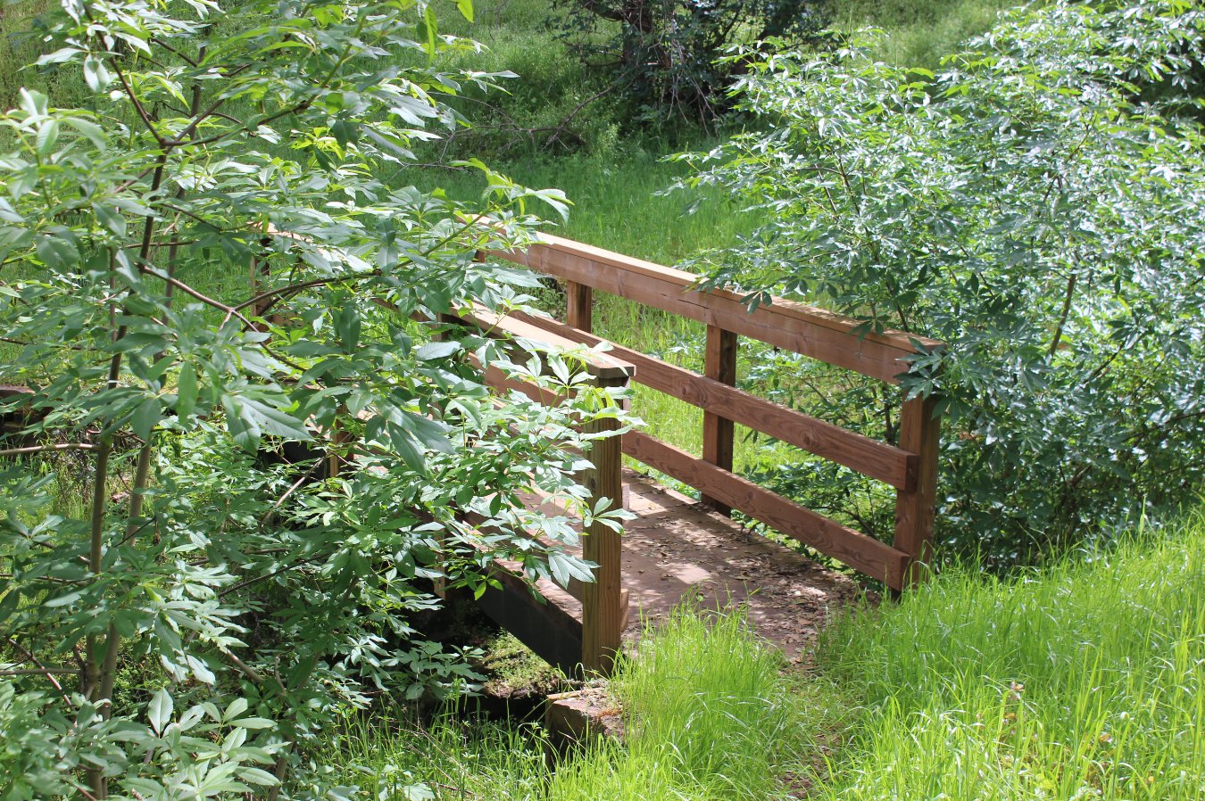
The East
Bay Municipal Utilities District (EBMUD) had done a good job of
improvements on this trail, including bridges like this one over
various creeks and washes. |
 |
|
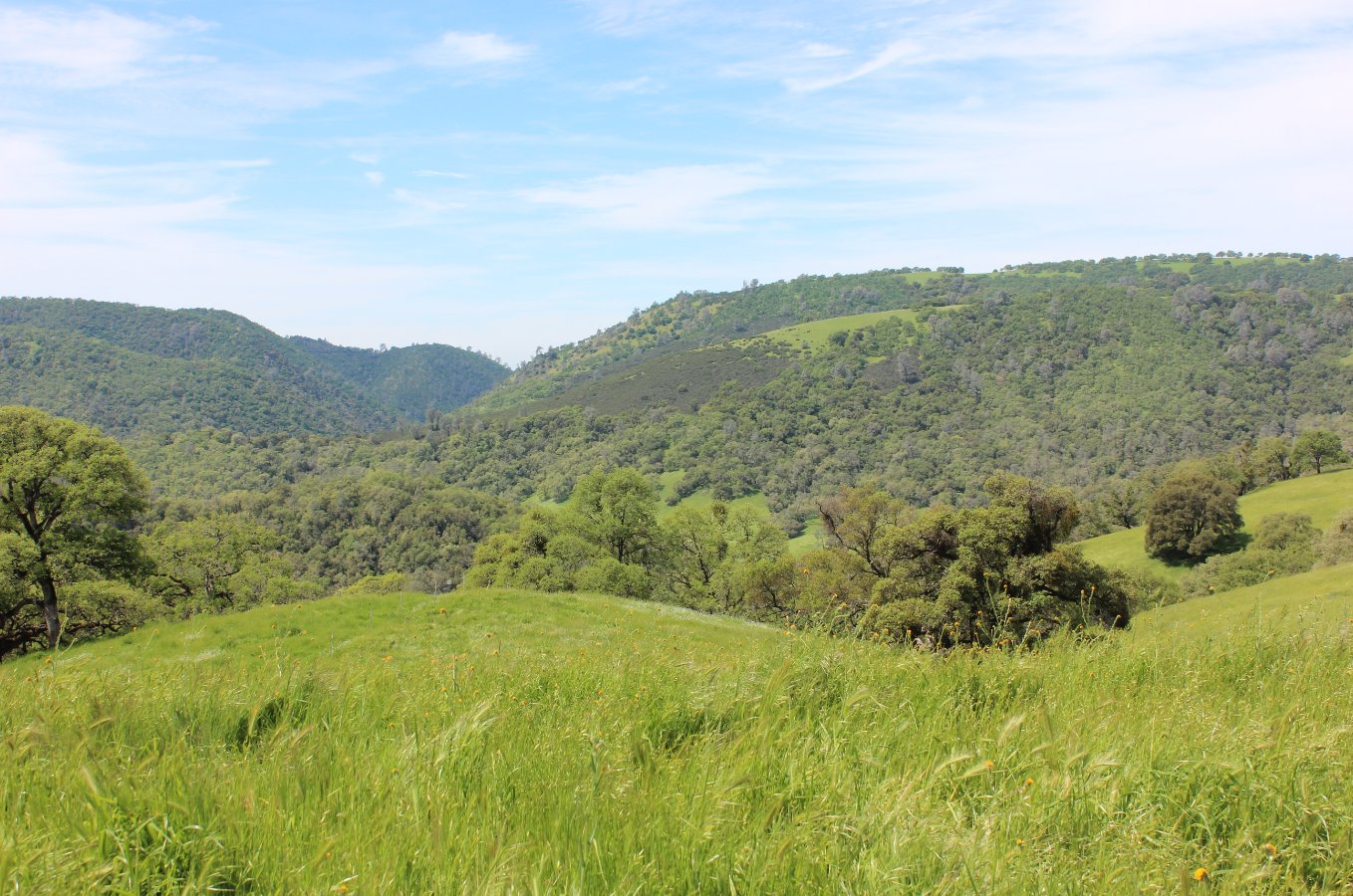
Gaining
elevation on the return section of the trip affords some nice views to
the west. Even though you can't see the lake from here, it is out
there around the bends you see in the distance. |
 |
|
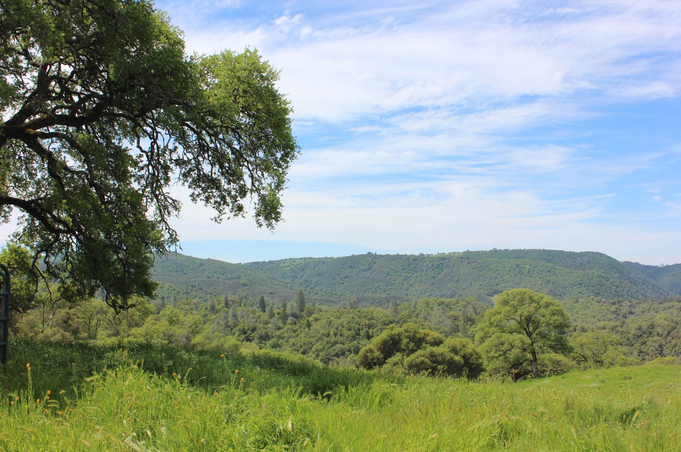
A quick glance south before the trail took a surprisingly steep dropoff for the next quarter mile. |
 |
|
On a warm
day such as this we were glad we had picked the direction that left
this on the downslope for us rather than heading up it.
Surprisingly steep! |
 |
|
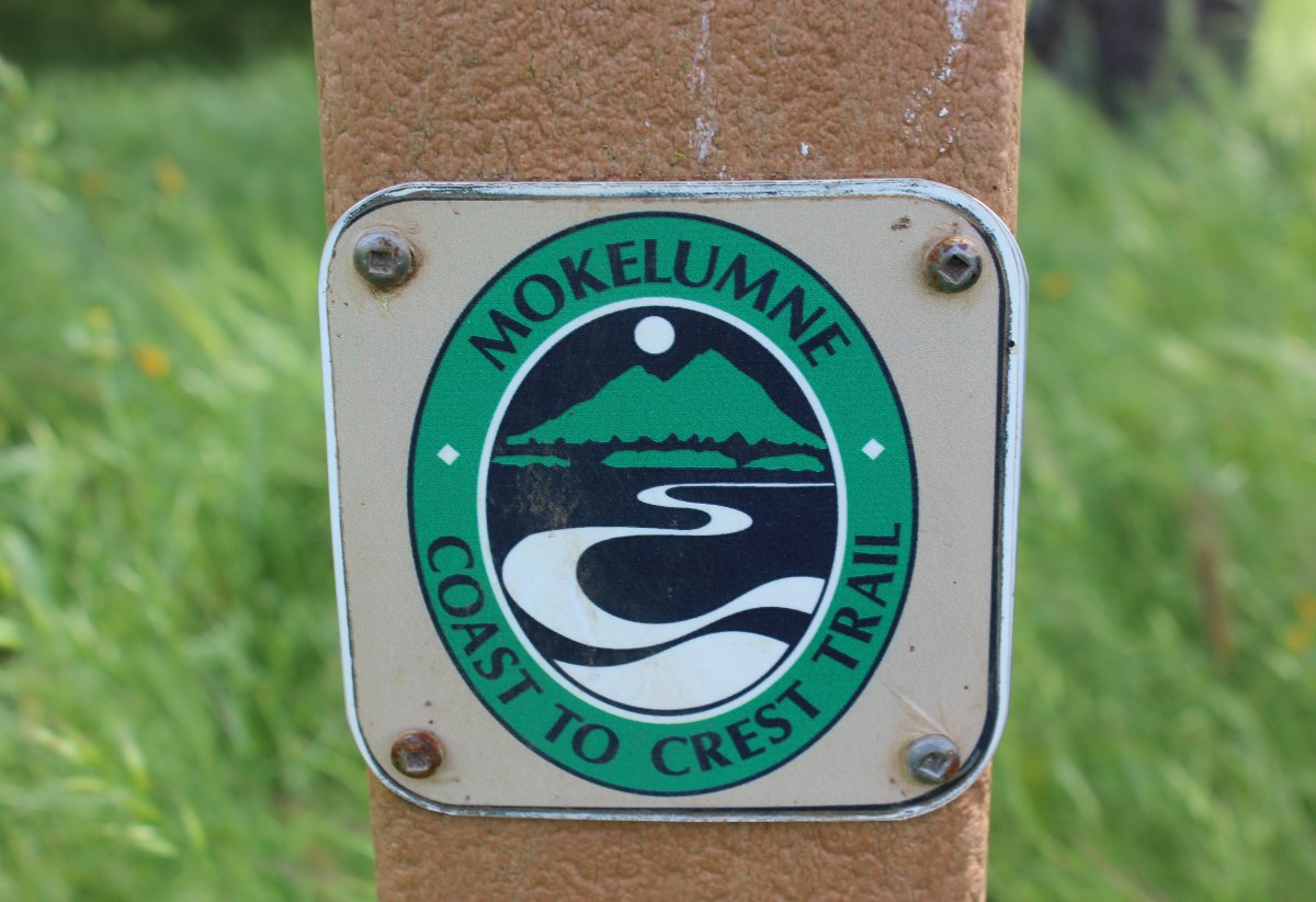
Some of
this hike is on the Mokelumne Coast to Crest route, which technically
will take you all the way from the Bay Area to the mountains between
Highway 88 and Highway 4. |
 |
|
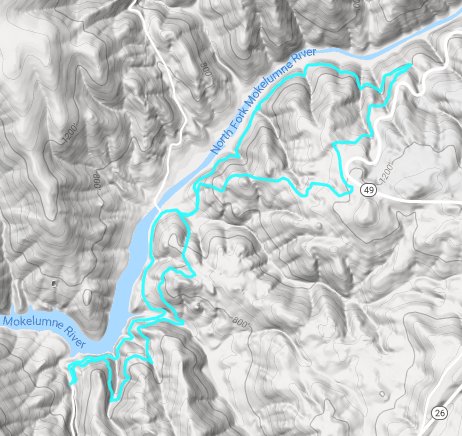
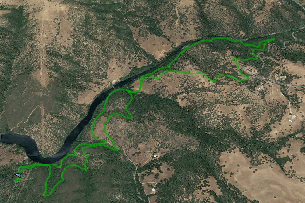
GPS Track of the full hike. |
 |