Distance: 8.5 Miles
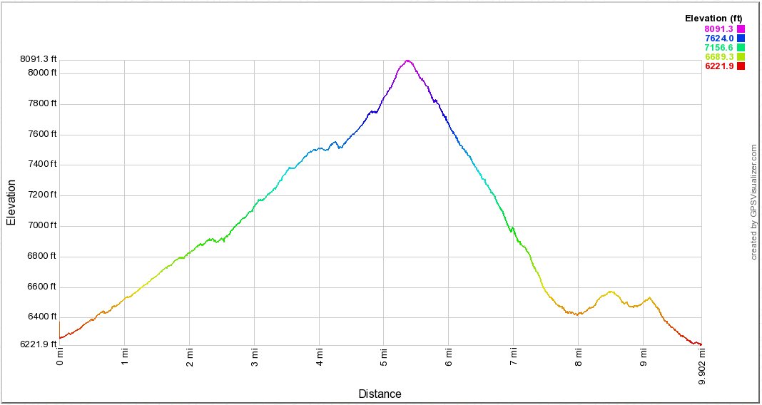
Vertical Gain: 2500'
Group Size: 1
Hike Rating: Easy Moderate Hard Strenuous

 GPX for
this trip

| Start Coordinates: | N 39 22.671, W 119 50.873 | End Coordinates: | Same as Start Coordinates | ||
| Car Shuttle Req'd: | No | Parking Directions: | To get to the Upper Whites Creek Trailhead, drive west on Mount Rose Highway (Nevada 431) for 2.8 miles from its intersection with Thomas Creek Road at Galena Market, and turn right onto Timberline Drive. Follow Timberline Drive for just over 0.5 miles before turning left onto the trailhead access road (NF-047). Continue for 0.8 miles along the high-quality, single lane dirt road before arriving at a forested parking area with two picnic tables and vault toilets. The upper trailhead is closed November through April. Parking at the base of NF-047 along Timberline Drive is necessitated during this period, which lengthens the hike by 0.8 miles each way. If parking on Timberline, please be courteous to area residents and obey the nearby no-parking signs. | ||
| Hazards of Note: | A couple of stream crossings after passing into the Mt. Rose Wilderness area. | Crowd Factor: | Moderate on Upper White trail, busy on Jones Creek trail. The Jones section (southern) of the trail is very popular with dog walkers | ||
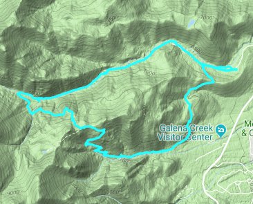
| General Notes: This hike begins at the parking area of the Upper White's Creek trailhead. For the first 1/2 mile you can either walk along the wide trail for equestrians, or find the single-track trail to the west near the creek. After about the first half mile there is a junction for the loop which includes the Jones Creek section of trail to the south, but you will continue west along this trail. After steady climbing for nearly two miles you will pass into the Mt. Rose Wilderness area, and almost immediately cross the White's stream and begin the steeper section of climb with occasional view up to the mountains to the nort of Mt. Rose itself. Almost 4 1/2 miles in the trail will turn sharply to the left/south, cross the creek over a series of logs providing a dry method to cross, and then you will begin a climb up and over a small ridge until you reach the junction for Church's Pond as the trail begins to head east. This section of the trail begins to rapidly lose the elevation which was gained on the first half of the loop, especially along some long switchbacks. About 8 miles in there will be another junction off to the left, where going straight will take you to the Galena Activity Center. As the trail turns north you will share this sections with many mountain bikers, who seem to find this trail very popular. At the final junction about 1/2 from the end you will turn right/east and follow your original trail section back to the parking area. |
|||||

