Distance: 9.0 Miles
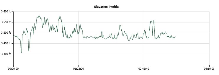
Vertical Gain: 500'
Group Size: 1
Hike Rating: Easy Moderate Hard Strenuous

 GPX for
this trip

| Start Coordinates: | N 38 43.115, W 120 34.289 | End Coordinates: | Same as start coordinates | ||
| Car Shuttle Req'd: | No | Parking Directions: | Take Highway 50 to the Sly Park Rd exit in Pollock Pines. Turn south off the highway and head down Sly Park Road for approximately 5 miles. Turn left at Mormon Emigrant Road and find the parking area on your left about 2/10 of a mile up at a small stone memorial for the namesake of the lake. | ||
| Hazards of Note: | Mountain bikers, asphalt trail at points, vehicles crossing the trail. | Crowd Factor: | High. This is a popular year-round camping destination close to the Sacramento Valley. On a weekend you will see people everywhere, especially during the summer and over holiday times. | ||
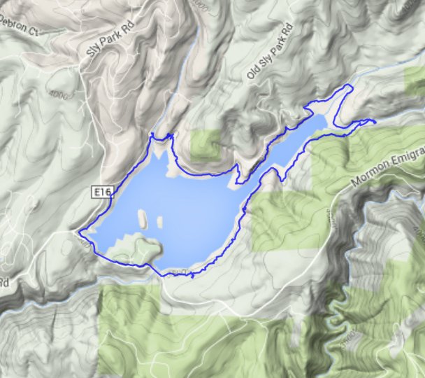
| General Notes: Start out on the hike from the parking area, dropping down onto the trail just behind the stone memorial plaque located at the parking area. The trail will follow along just next to the road for a bit, and you will walk across the first Sly Park dam almost immediately. The next section between the two dams you will cross parallels the road for most of the way, with a number of crossings where you will need to watch out for cars entering and exiting the group campgrounds in this area. Cross the second dam, and then immediately turn left and begin a long 3 1/2 mile section through mostly forest that will follow along the southeast side of the lake to the inlet of Park Creek. At the end of the lake where the trail bends to the left, make sure to check out Park Creek Falls just a few hundred yards east of where you will bend back around to follow the lake. There is also a board walk here for a meadow, with some information about the local wildlife and ecology at a viewpoint resting area. The trail back around the other side of the lake alternates between dirt track and on pavement, and often the pavement will be stamped with an arrow and the word "Trail" to indicate that you need to be on this section for the time being. This combination of trail and walk along the asphalt road will get you all the way back around to your starting point for a total of 9 miles of relatively easy hiking. |
|||||
