Back to index Horsetail Falls to Mt. Ralston Peak
Trip Date:  03/20/2015

Distance
: 8.5 Miles

Vertical Gain: 3200'

Group Size: 5

Hike Rating:  Easy   Moderate   Hard    Strenuous
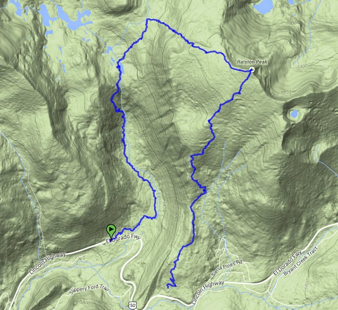
Horsetail to Ralston
Download GPX GPX for this trip
Horsetail Falls to Mt. Ralston
Start Coordinates:   N 38 48.686, W 120 07.448     End Coordinates:   N 38 48.238, W 120 07.045
Car Shuttle Req'd:   Yes Parking Directions:   Take Highway 50 to the parking area just to the east of the town of Strawberry.  This is labelled as parking for Pyramid Creek Trailhead, and as of 2015 there is a $5 daily parking fee for this area.  During winter when the parking area is closed you can park on highway 50 just west of the parking area as they will cover the "No Parking Anytime" signs.  
For parking at the end of the trail, find the Camp Sacramento parking area just a couple miles east of the trailhead parking.  Pull off on the north side of the road at the parking area with a "Mt. Ralston Trailhead" sign along the fenced parking area.
Hazards of Note:   Very little of this hike is on trail.  The path up the waterfall contains a lot of rock climbing and route-finding skills.  Some routes are extremely hazardous and should be avoided.  The cross country up to the Mt. Ralston trail from the Desolation Valley area is all cross country and very strenuous. Crowd Factor:   Busy to very limited.  The beginning of the hike is very popular, for the falls only as well as this trailhead being the quickest way into Desolation Wilderness.  Hiking up the falls will see some other people, but once you reach the top and cross country in this section of Desolation Valley, the number of people around will drop off significantly.
General Notes:
The beginning of the hike is along a very well-maintained and marked trail from the parking area, following brown diagonal hiker signs posted in the trees along the way to the base of the falls.  You will reach the boundary of Desolation Wilderness just before the falls, and will need to fill out a day use permit for groups (up to 12) that will be passing into the Wilderness area.  
Once the falls are reached the trail disappears, but the intial part of the use path follows the Pyramid Creek along the west side, until coming out on exposed granite and the necessity for rock climbing and route finding all the way to the top of the falls.  Stay generally away from the cliff edges and the actual falls, skirting a little further to the west as you make the climb before heading back toward the falls as you near the top.  
At the top of the falls you will find Avalanche Lake, and you will have to make your way across a couple of log crossings to get across the creek and begin the long, steep climb up the mountain in the general direction of NE to eventually hit the Mt. Ralston trail.  This is a very difficult, strenuous trail, and is actually a little easier in the winter or early spring to cross over snow rather than bush-whack.  
Once at the Mt. Ralston trail, there is the option to continue on to the summit of Mt. Ralston or to just head south for the last 2 1/2 miles down to the end of the trek.

Sign at the Pyramid Creek trailhead just to the east of the parking lot. Pyramid Creek Trailhead sign
I was surprised to see this marker given that I had always heard the Tahoe-Yosemite trail was 'unofficial.'
Horsetail Falls
Early morning view of the large amount of water flowing down Pyramid Creek at the base of the falls. Pyramid Creek
View up the canyon from early along the trail.  The cross country section will climb up just to the left of the visible falls, partially up the ravine and then crossing back over to the east near the top. View up the canyon
Heading up Pyramid Creek toward the base of the major section of the falls.  Staying too close to the water from this point on is not the safest route up. Heading up
We looked first at going straight up to the right along some polished, steep granite, but it turned out to be much better heading around to the left and following a draw up a little further to the west. Looking for a better way
Continuing to make our way up the rocks, with the starting area far below and Sierra at Tahoe ski resort just visible in the background. Continuing the climb
Looking across near the top of the falls is the point where we started heading back east toward the water and the top of the first climb. Upper falls
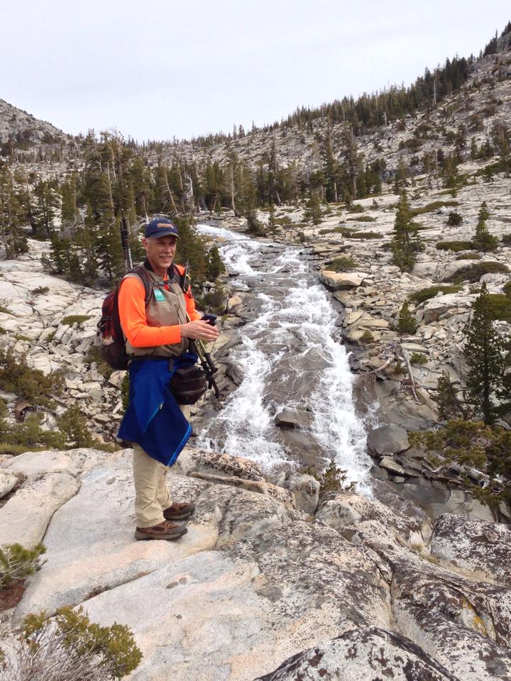
Yours truly enjoying the view from very close to the top of the falls. At the falls
Looking south at the edge of Avalanche Lake, the source of Horsetail Falls just around the bend to the right. Avalanche Lake
After the strain of the first climb, we took at good break at Avalanche Lake because the harder and longer climb was still ahead of us. Quick rest stop
Past Avalanche and Pitt Lakes the views back into Desolation get better and better as you gain a lot of elevation with every step forward. Crystal Range
The cross country climb up to the Mt. Ralston trail was very steep, and while the snow was a little icy, it was preferable to the loose scree and manzanita ahead which it covered up large sections of.  Jacks, Dicks, and Mt. Tallac Peaks are visible in the distance behind the frozen over Lake of the Woods. Steep climb
A lot of elevation is gained in this section of the hike, and while it goes very slowly, the views back toward Pyramid Peak and beyond are amazing. Climbing
One more look at a couple of our hiking team continuing up the hill with the entire Crystal Range in the background.  Ropi Lake, near where we started the climb is far below still frozen over this late in winter. One more look
Getting to the Mt. Ralston trail just below the summit was cause for another celebratory break, where we enjoyed some lunch before climbing to the summit. Another break
Looking down at the quickly thawing upper Echo Lake, with Freel Peak in the background just barely dusted with snow. Echo Lakes
Our group enjoying the somewhat cold but spectacular views from the top of Mt. Ralston. Our group
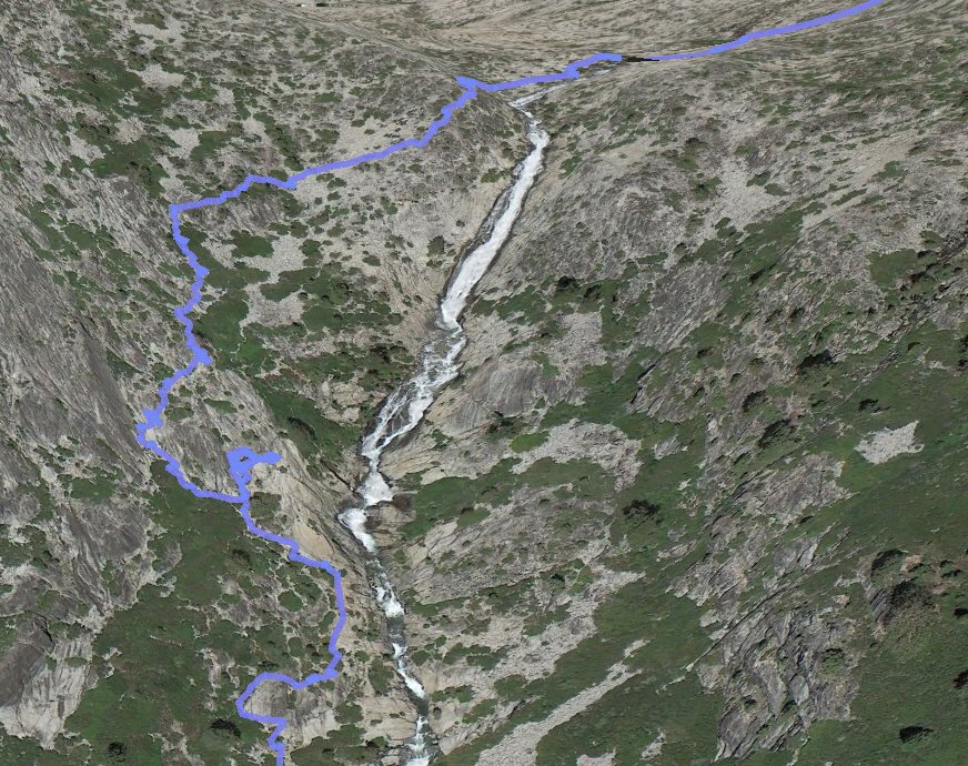
A closeup look at our track up the west side of Horsetail falls, including the one section that we decided to look for an alternate way further up. Up the falls
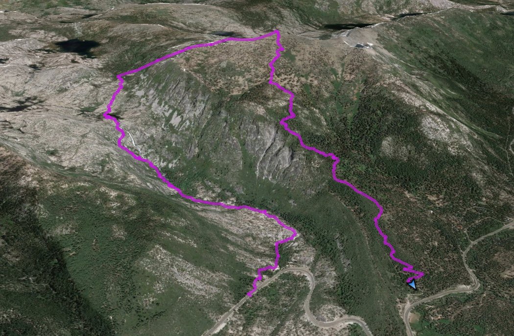
GPS track of the entire hike from the bottom left and ending at the bottom right. GPS Track of the hike