Distance: 9.2 Miles
Vertical Gain: 1730'
Group Size: 2
Hike Rating: Easy Moderate Hard Strenuous
 GPX for
this trip
GPX for
this trip
| Start Coordinates: | N 39 23.438, W 120 36.594 | End Coordinates: | Same as starting coordinates | ||
| Car Shuttle Req'd: | No | Parking Directions: | Take Highway 80 to the Highway 20 turnoff a couple exits west of Cisco Grove. Follow the road back under the freeway and continue on Highway 20 until you get to Highway 18, also known as Bowman Lake Road. Stay on this road for close to 6 1/2 miles to the junction with Grouse Ridge Rd (Road #14.) Turn right on Grouse Ridge and head 5 1/2 miles to the Grouse Ridge Campground area, and then follow the dirt road a little further to the north and park at the trailhead area at the coordinates listed. | ||
| Hazards of Note: | In early spring and summer, the Grouse Ridge campground road may be impassable due to snow. In this case the hike mileage may be considerably higher depending on how close you can get to the intended parking area. | Crowd Factor: | Moderate to busy. The Grouse Ridge area is very popular, with Glacier Lake, the 5 Lakes Basin, Black Buttes and other destinations all accessible from this location. We met over 10 backpackers on a summer weekday on their way into various locations in this area. | ||
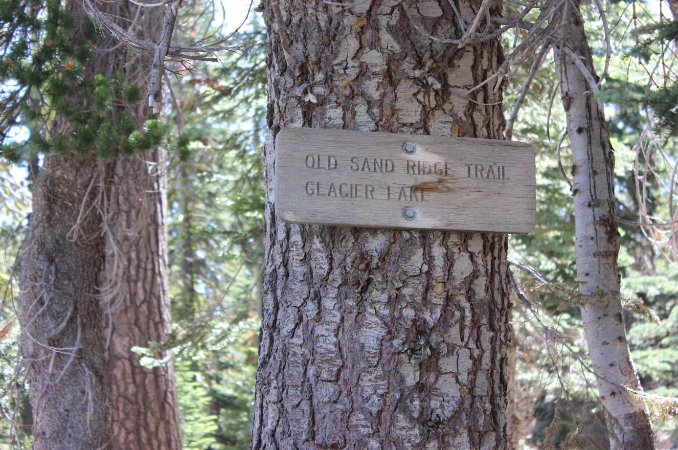
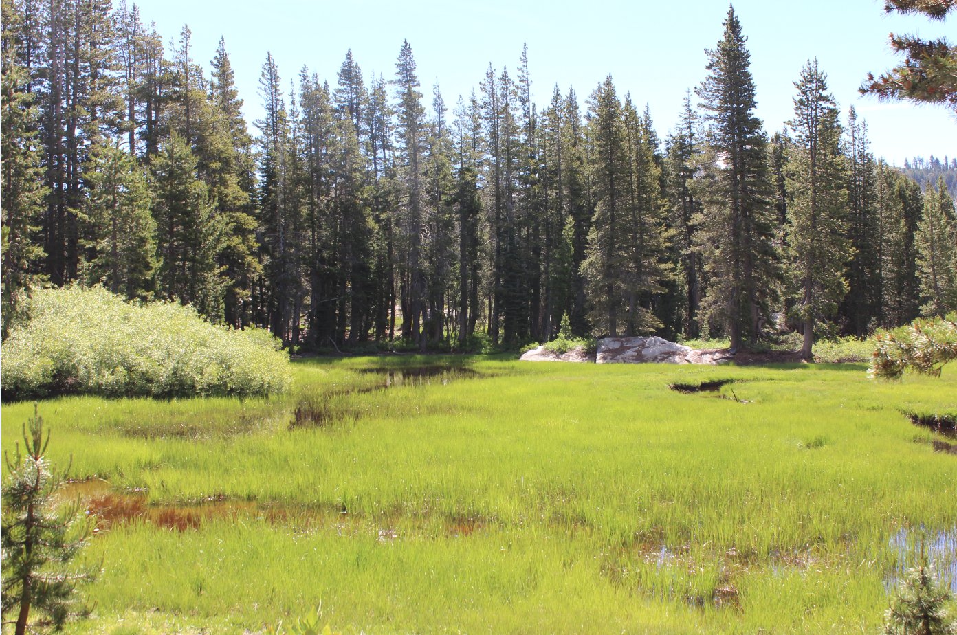
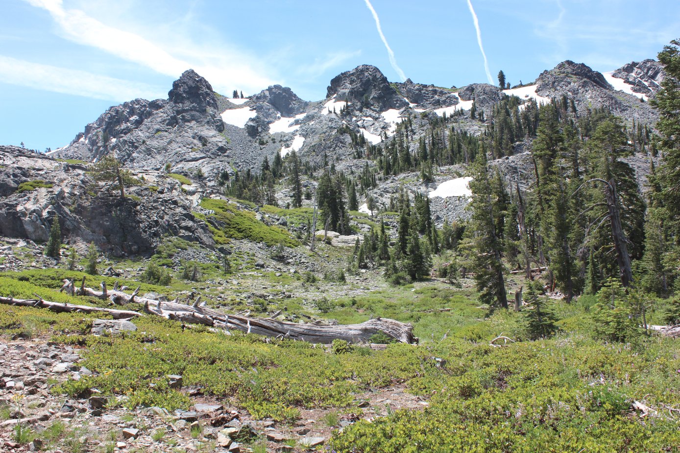
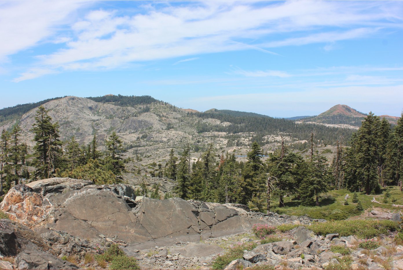
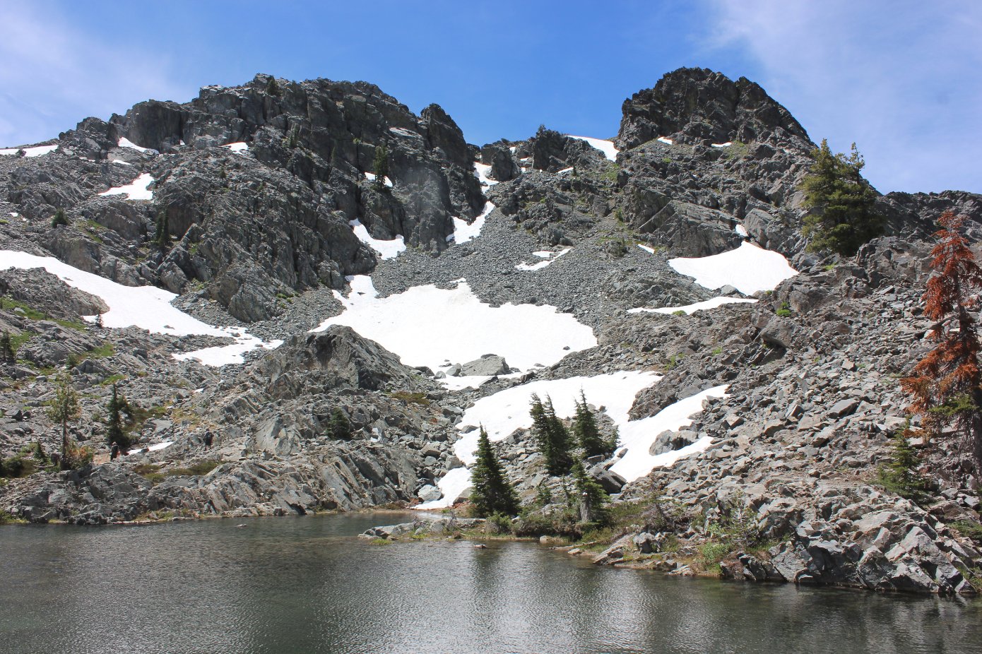
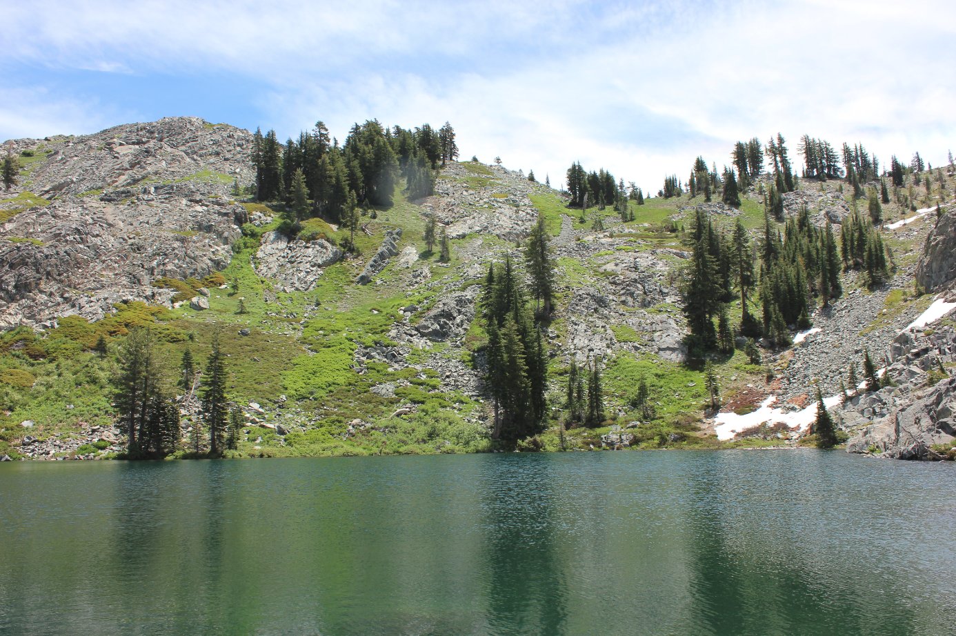
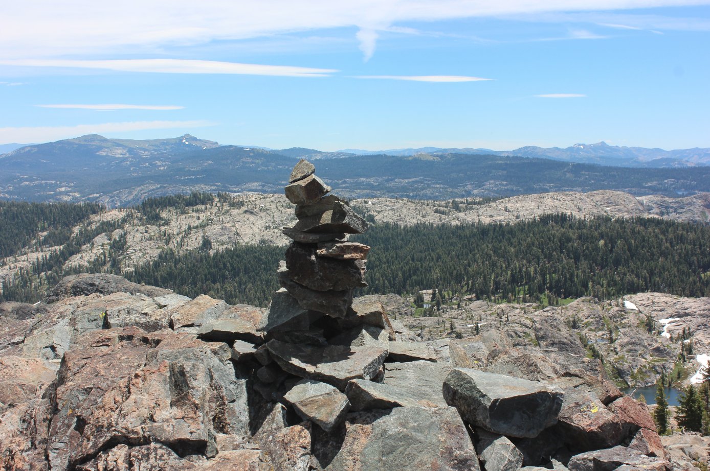
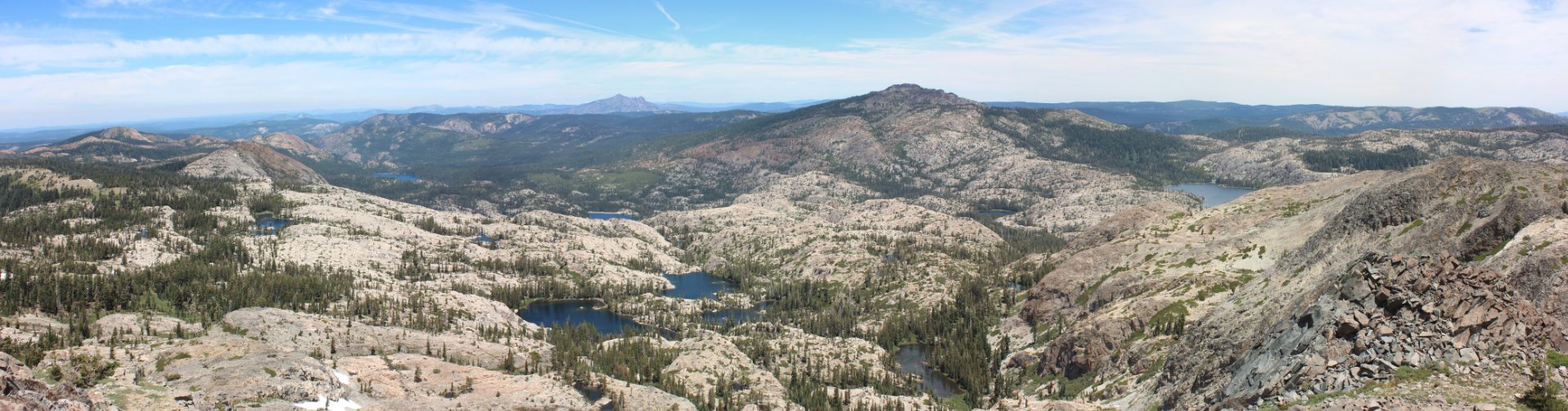
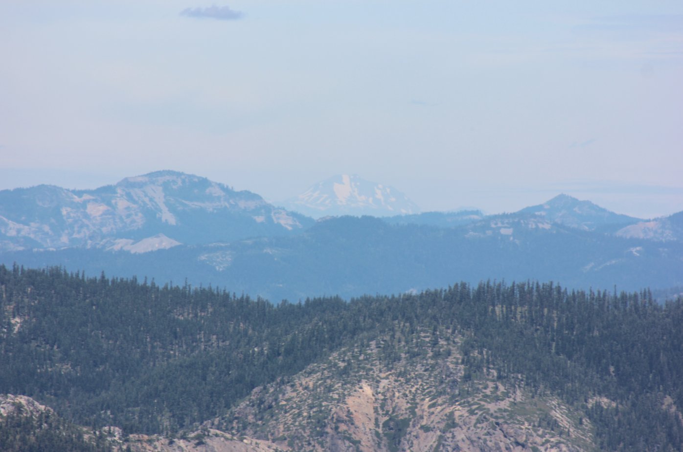
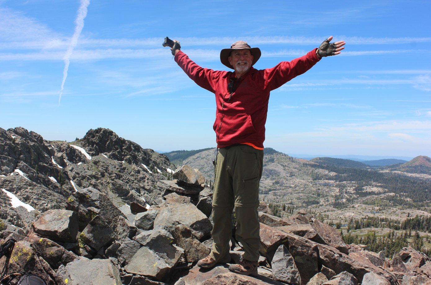
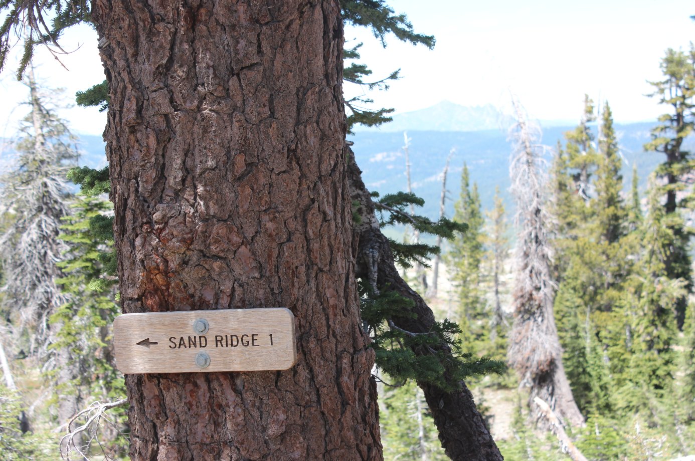
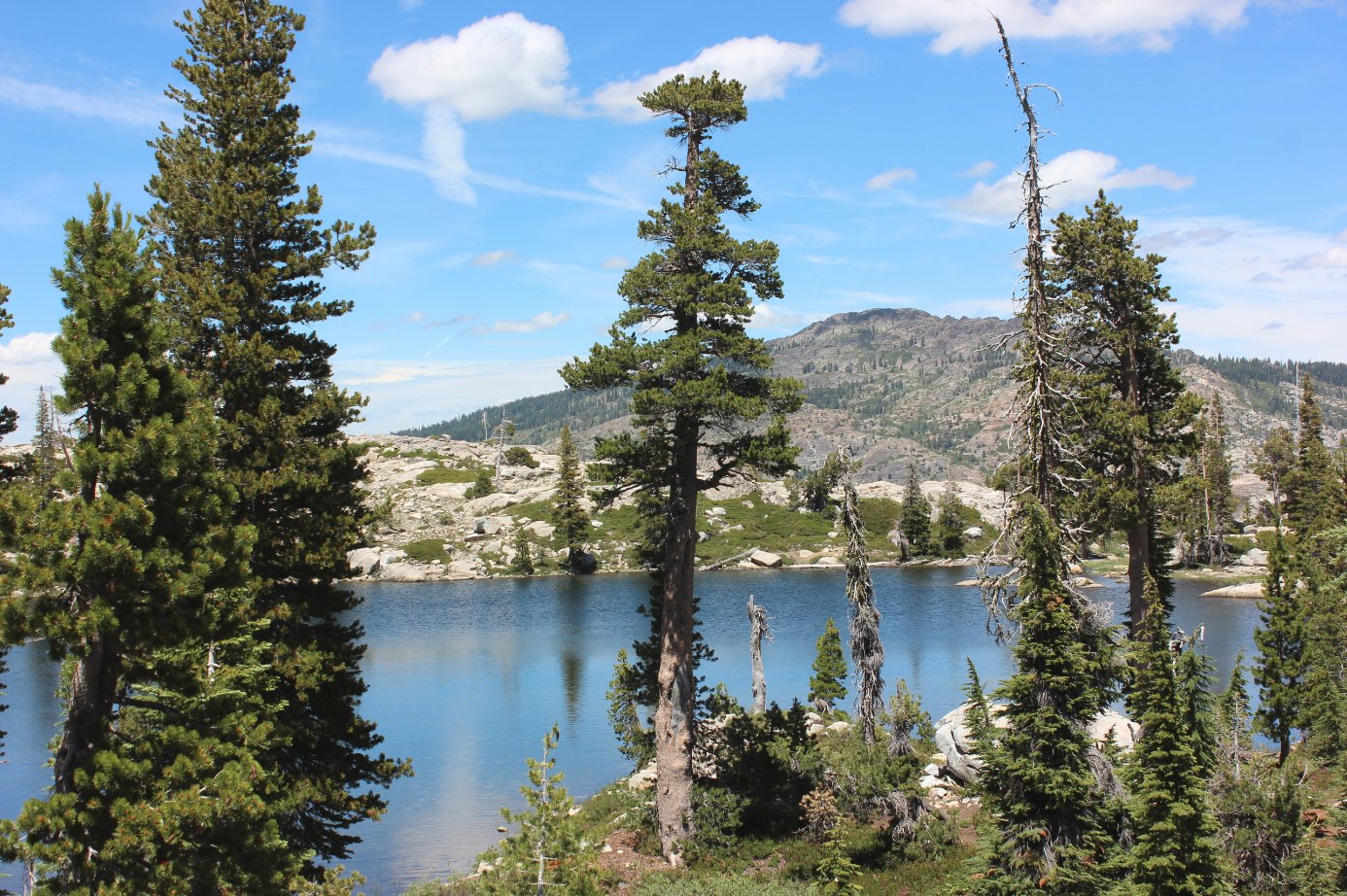
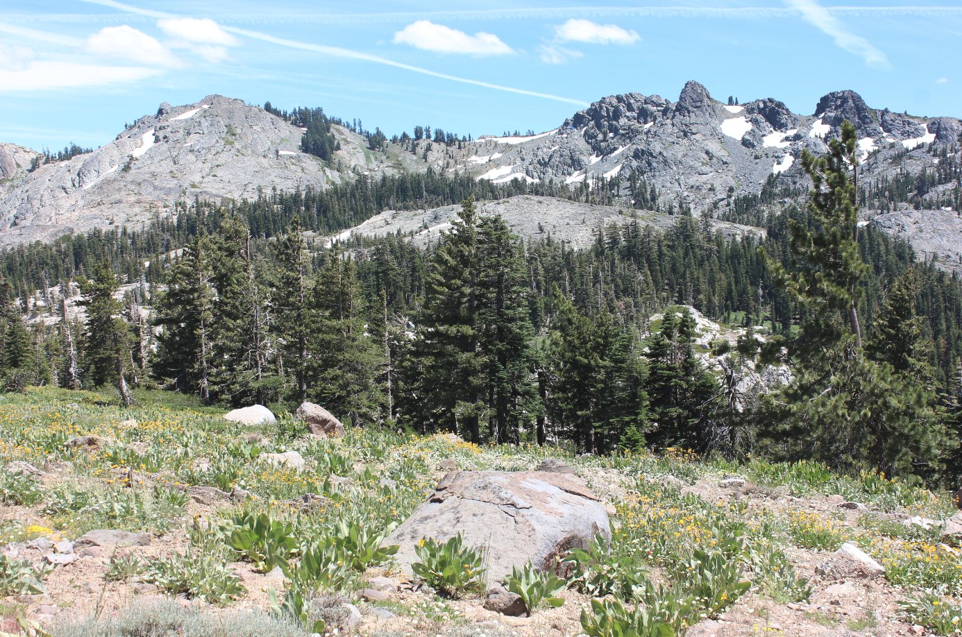
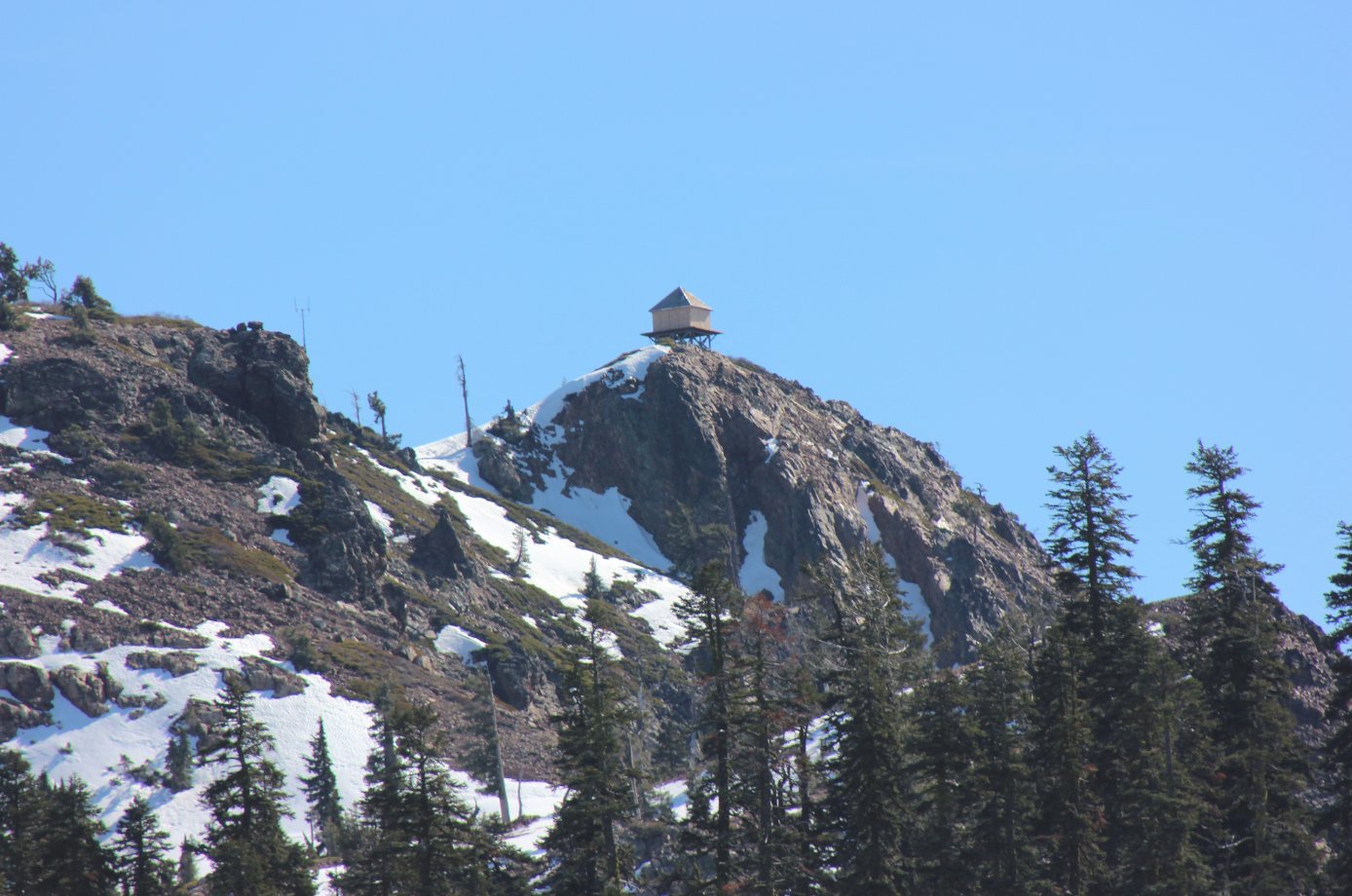
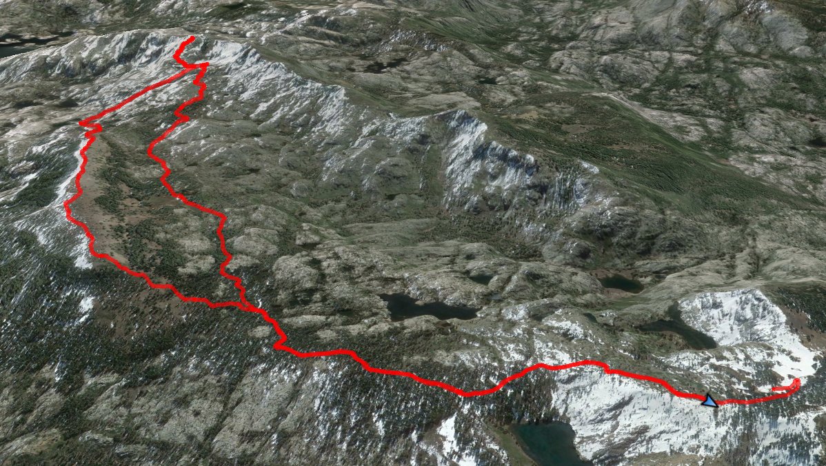
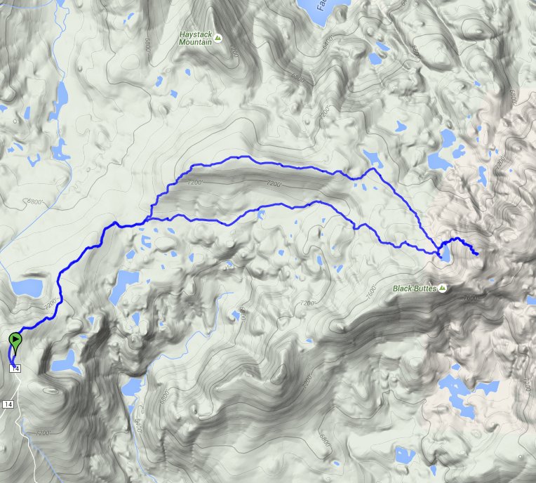
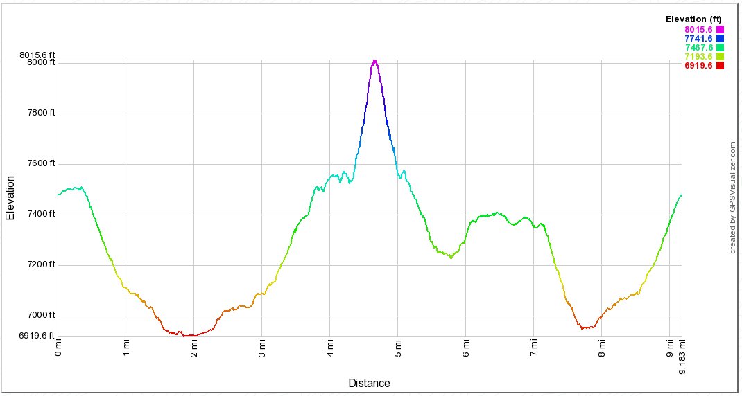
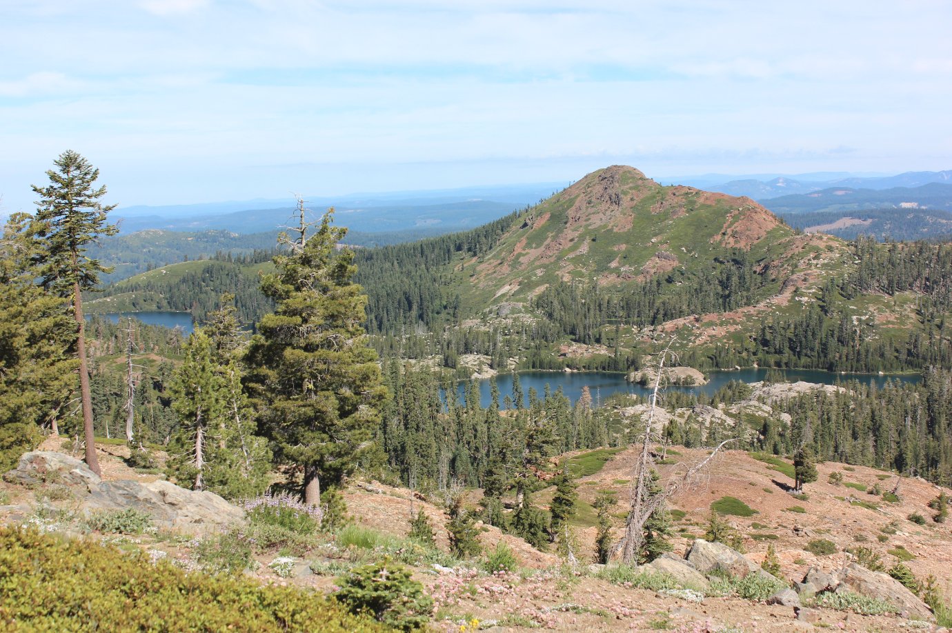
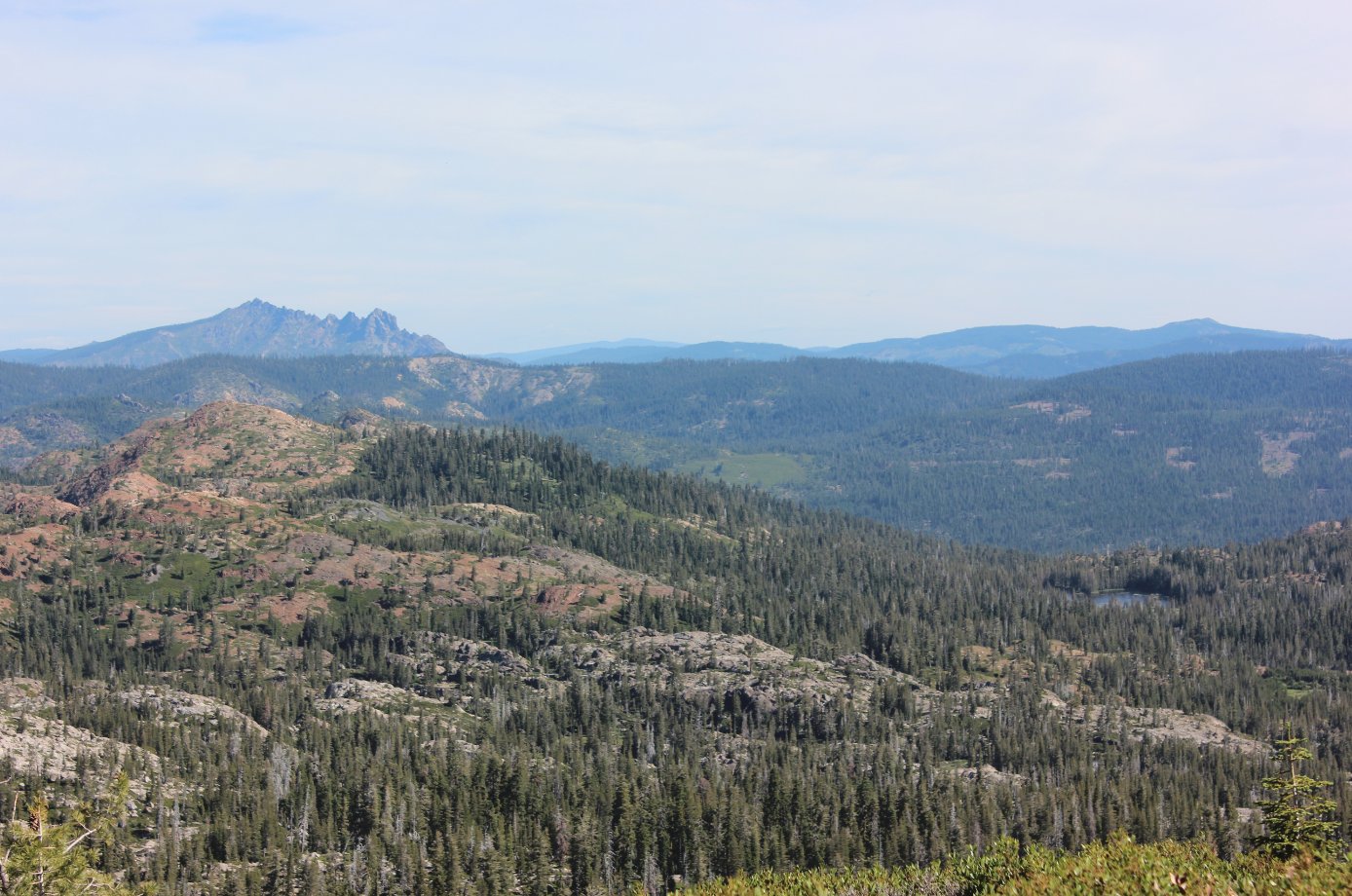
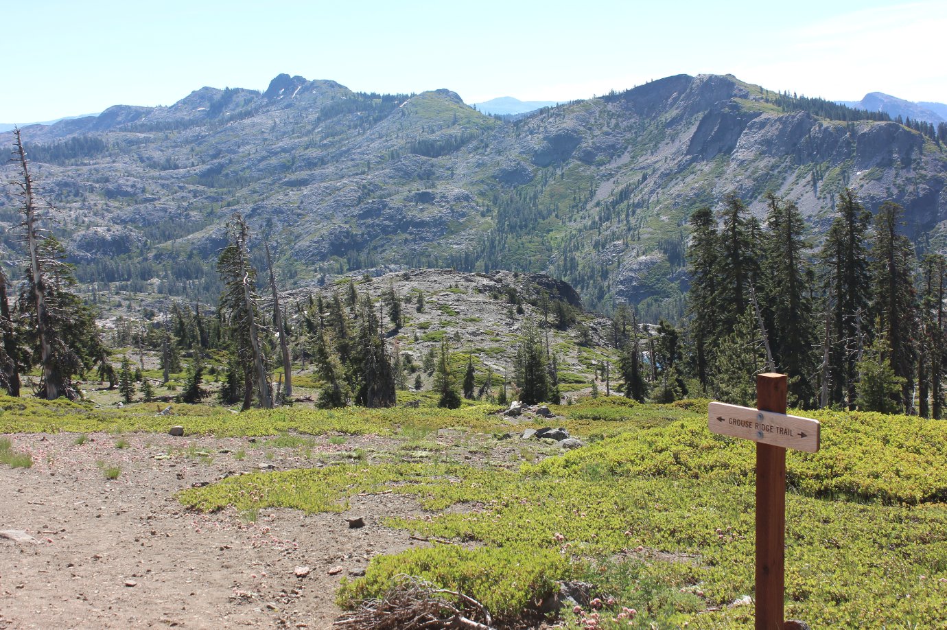
| General Notes: From the parking area at the listed coordinates. you will head to the east to find an information kiosk and the start of the hike toward Glacier Lake. Be sure to check out the views to the north right from the starting area, however, as you look down on Milk Lake seemingly directly below you. Off to the northwest you can even see Island Lake and Feeley Lake further on, with the brown ride of Fall Creek Mountain the closest large peak just beyond them. The first 3/4 mile of the trip drops you in elevation, more than 500 feet worth, causing the voice in the back of your head to remind you that you will get to gain all of this back at the end of the journey. Nevertheless, the trail is pleasant and offers a few views toward the south and your eventual destination to the southeast, but for the most part travels through forest along a soft dirt track. About a mile in you will come to a couple of junctions in the trail. For the trip out, you will stay to the right for the first one, which has the other trail leading north off to Shotgun Lake, and then also stay to the right on the second junction, which would take you up to the Sand Ridge trail. This is actually the trail you will head back on, and coming back along it is a great highlight for this trip. As you pass the junctions you will be on the signed Glacier Lake Trail, which has new signage from a local Eagle Scout project. Follow this trail though a pleasant meadow area with a number of wildflowers all around in the mid-summer season, and then as you near the 3 mile mark on the high the trail will begin to head back up in earnest, all the way to Glacier Lake at about the same elevation (7600') as where you started when you first headed out on the hike. There are a number of campsites on the western area of the lake, but the best one we found was near the lake outlet to the north, where previous visitors had assembled a cooking area, chairs, and a table out of rocks from the area. Very impressive! From here you can follow the trail north toward the 5 Lakes Basin area on your way to meet up with the Sand Ridge route back, but a very worthy and recommended diversion would be to head up to the top of the peak directly to the east of Glacier Lake (if not climbing to the top of Black Buttes just to the south of the lake.) It will take about an hour of time up and back, but the views from the top of this unnamed peak were tremendous. I counted 34 lakes that were visible from the top, and the identifiable peaks stretched all the way from Desolation Wilderness in the south up to a snow-capped Mt. Lassen far to the north. Back on the Sand Ridge trail from Glacier Lake, you will pass a couple of use trails on the right which head into the 5 Lakes Basin. Otherwise, continue on this trail as it passes by the western-most lake in the basin, and then turns west and starts a climb up to the top of the open Sand Ridge itself. This trail offered a phenominal view to the north, including the Sierra Buttes and many of the lakes north of this ridgeline. Wildflowers covered the ridge the entire way, and the views back to Glacier Lake and Black Buttes were very distracting. The trail eventually heads down sharply, and as this is not a maintained trail any longer, there are a number of places where careful footing will be required. Finally you meet back up with the original trail at the junction passed early on the trip, and the last 3/4 miles of elevation gain will have you happy to see your vehicle in the parking area when you finally arrive. |
|||||