Distance: 2 Miles
Vertical Gain: 700'
Group Size: 1
Hike Rating: Easy Moderate
 GPX
for
this trip
GPX
for
this trip 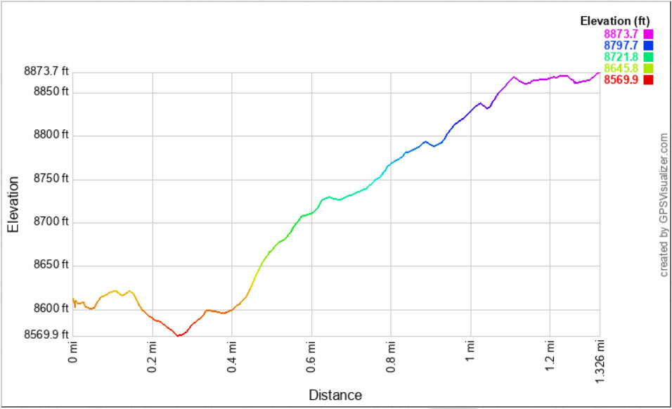
| Start Coordinates: | N 38 41.697 W 119 59.363 | End Coordinates: | Same as Start Coordinates | ||
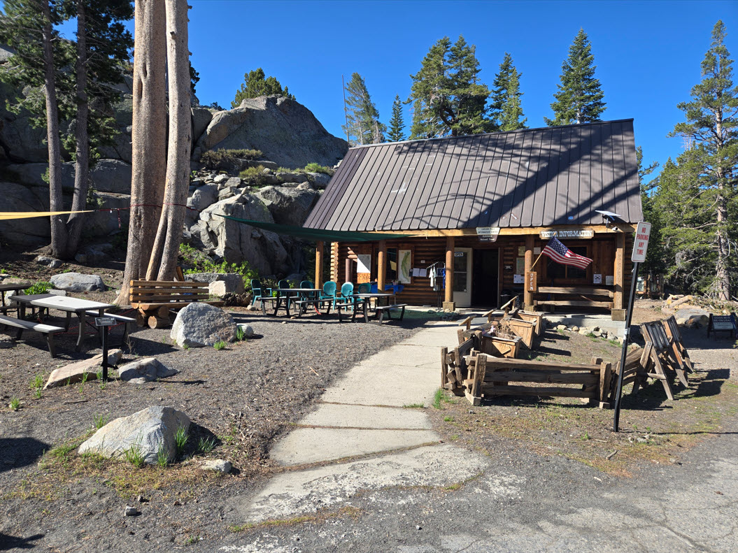
| Car Shuttle Req'd: | No | Parking Directions: | Take
Highway 88 to the parking area at the Carson Pass information station on the
west side of the road. Pay the day use fee (summer only) and
find the trailhead just to the right side (north) of the information station
itself. |
||
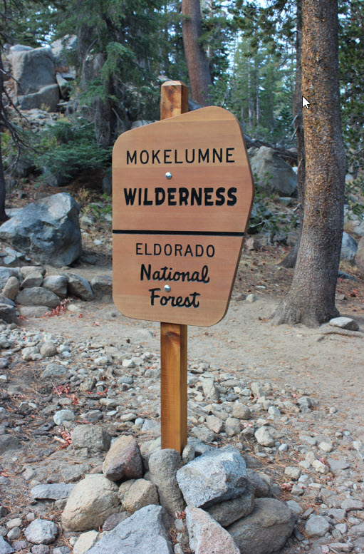
| Hazards of Note: | Be aware of very changeable weather in this area during any season. Route-finding during the winter months. Prepare for various temperatures, rain and snow. | Crowd Factor: | High. This is a very popular trail, especially in the summer
for hiking and wildflower viewing. The trail follows the Pacific Crest Trail for the entire time until you reach the turnoff to Frog Lake itself. |
||
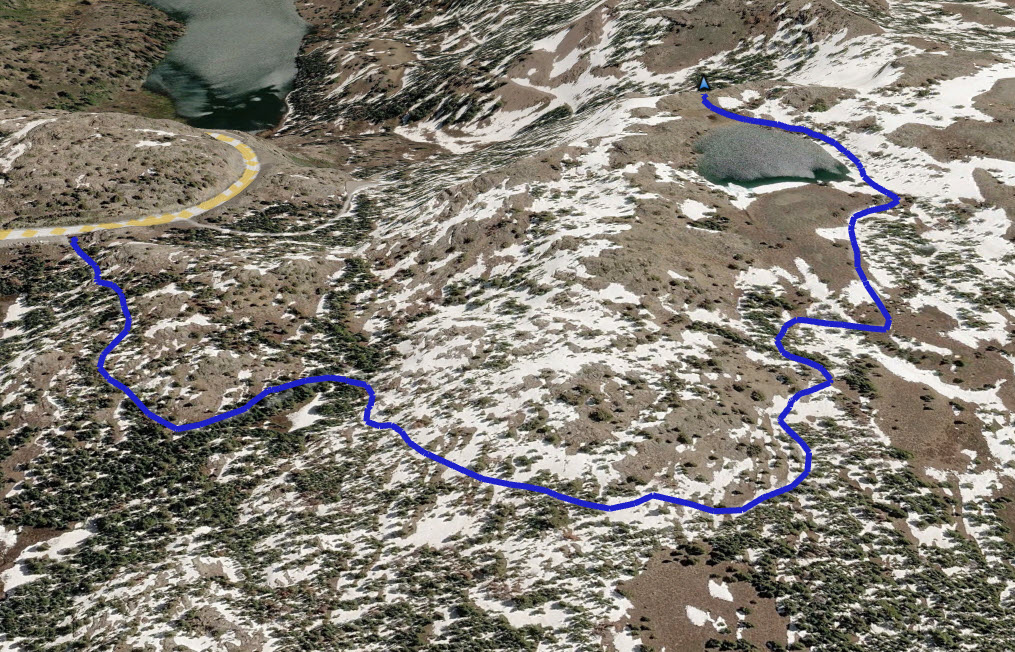
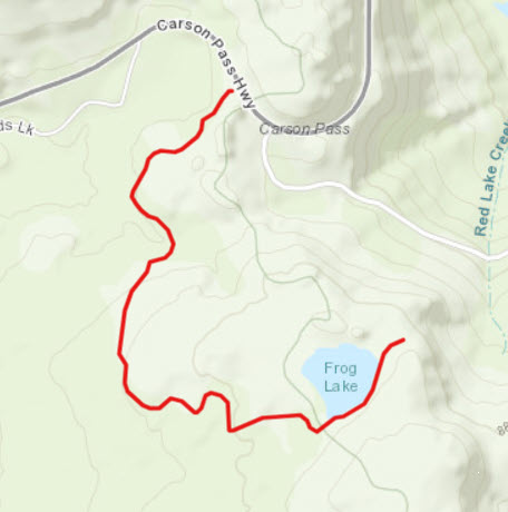
| From
the parking area on the road, head past the Carson Pass
information station building and along the along the Pacific Crest
Trail. For the mile to the signed junction on the trail for Frog Lake to
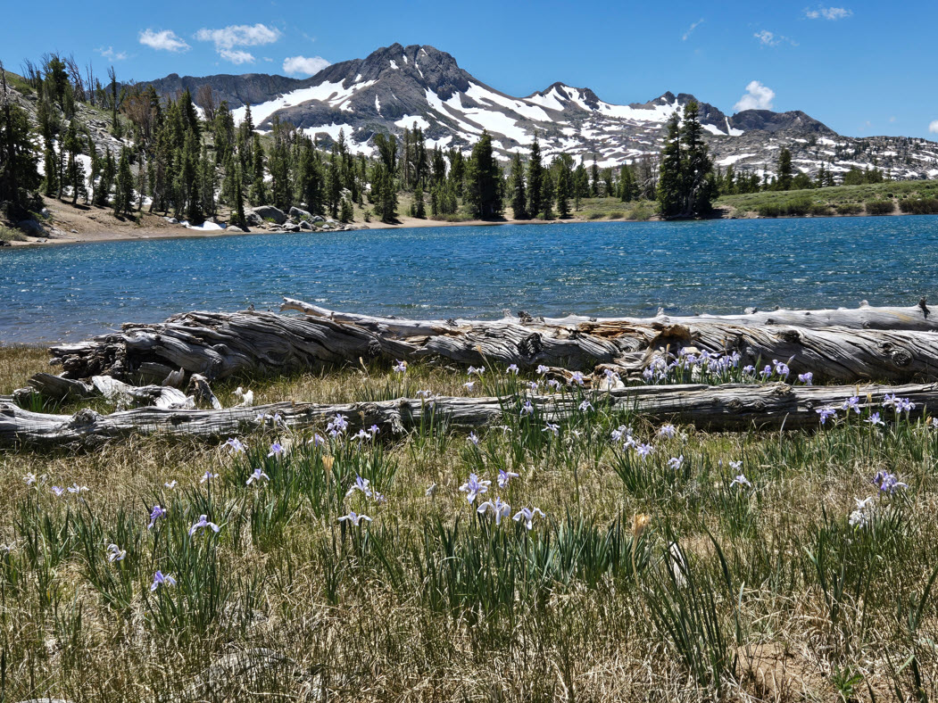
east side of the trail, you will have terrific views to the west of Round Top
Mountain and the Sisters just to the right of this 10K foot peak. Once you reach the
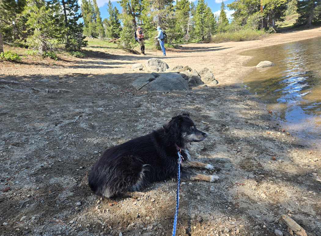
Frog Lake junction, head left (east) and walk the short distance down to the west side
of the lake. There is a use trail that follows along the south side of the lake.
Follow this to the west end of the lake for a spectacular look at Hope Valley in the
distance and the Freel/Job's Sister mountain range to the north east of this viewpoint. You can return the same way or continue to circumnavigate the lake and pick up the trail back where you first accessed the lake from the Pacific Crest Trail junction. |
|||||