Distance: 4.6 Miles
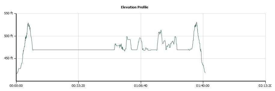
Vertical Gain: 200'
Group Size: 1
Hike Rating: Easy Moderate Hard Strenuous
 GPX for
this trip
GPX for
this trip

| Folsom
Lake (Empty) Hike |
||
| Trip Date: 01/22/2014 Distance: 4.6 Miles Vertical Gain: 200' Group Size: 1 Hike Rating: Easy Moderate Hard Strenuous |
GPX for
this trip
|
|
|
||
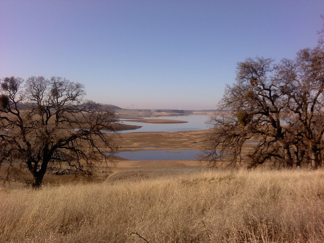
| During normal years, the lake would start just below the trees right here. | |
|
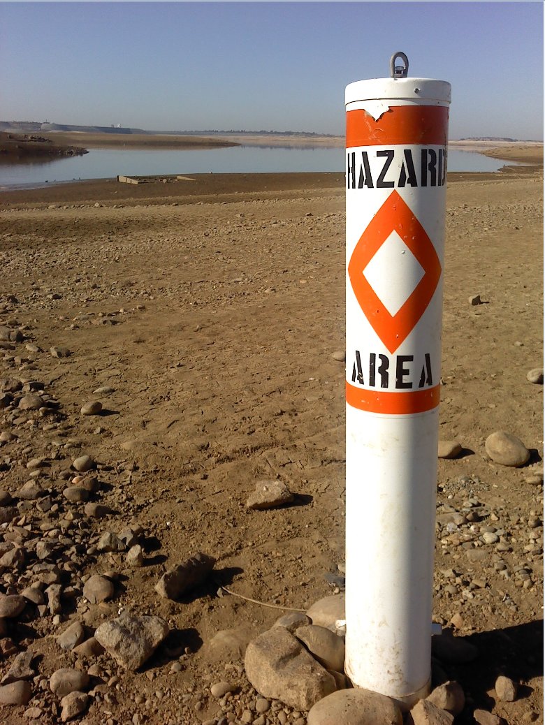
| Hazard float now high and dry. |
|
|
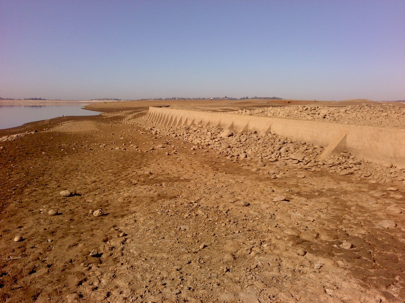
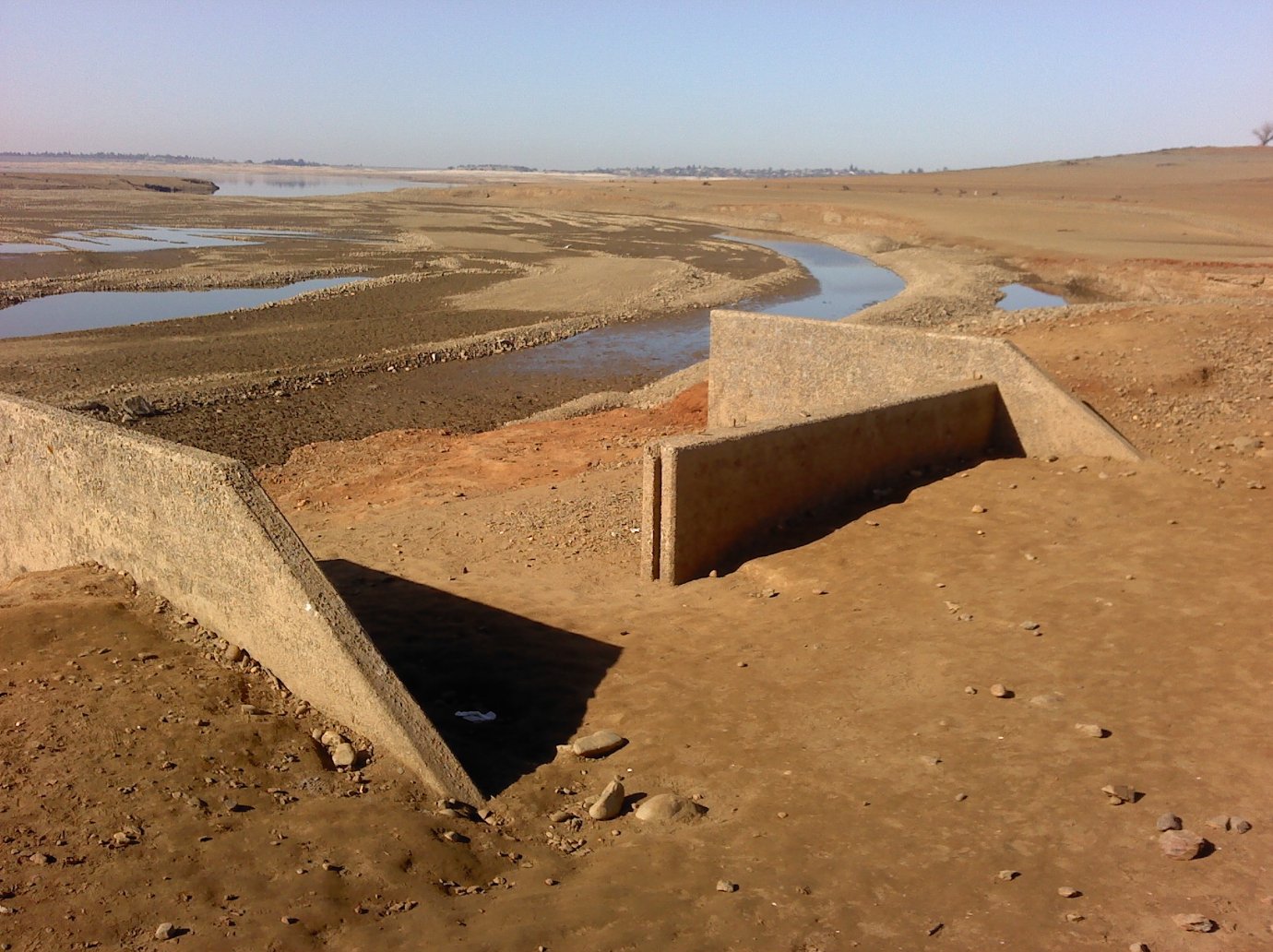
| Old retaining wall near the Red Bank area out from under 50 feet of water. | |
|
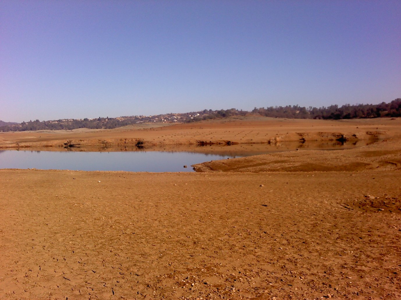
| Walking toward Red Bank in an area normally under 30 feet of water. | |
|
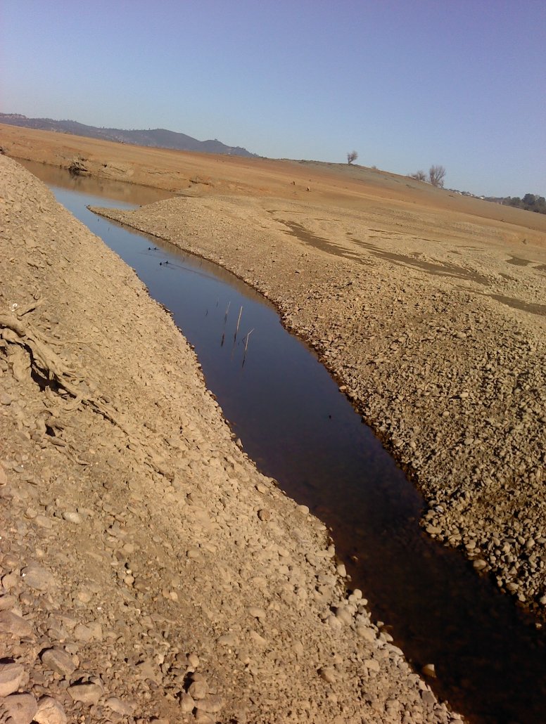
| Old dredging piles have
created some interesting canals along the way. |
|
|
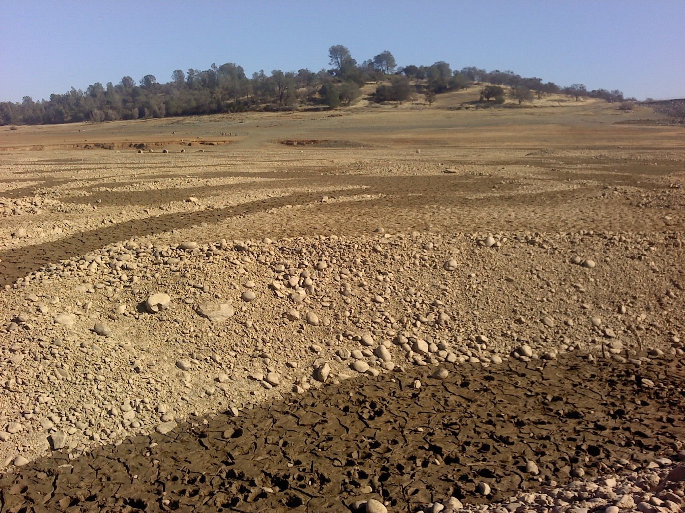
| Patterned stumps across the
water reveal the area of an old orchard. |
|
|
| View back to the trailhead
from the middle of the lake. |
|
|
| Water diversion area out from
under the deep lake. |
|
|
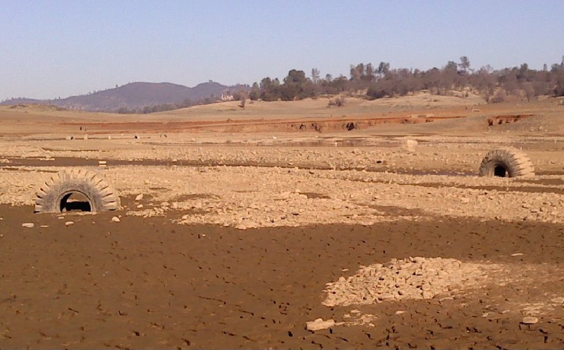
| By the end of my excursion I
must have been getting 'two tired.' |
|
|
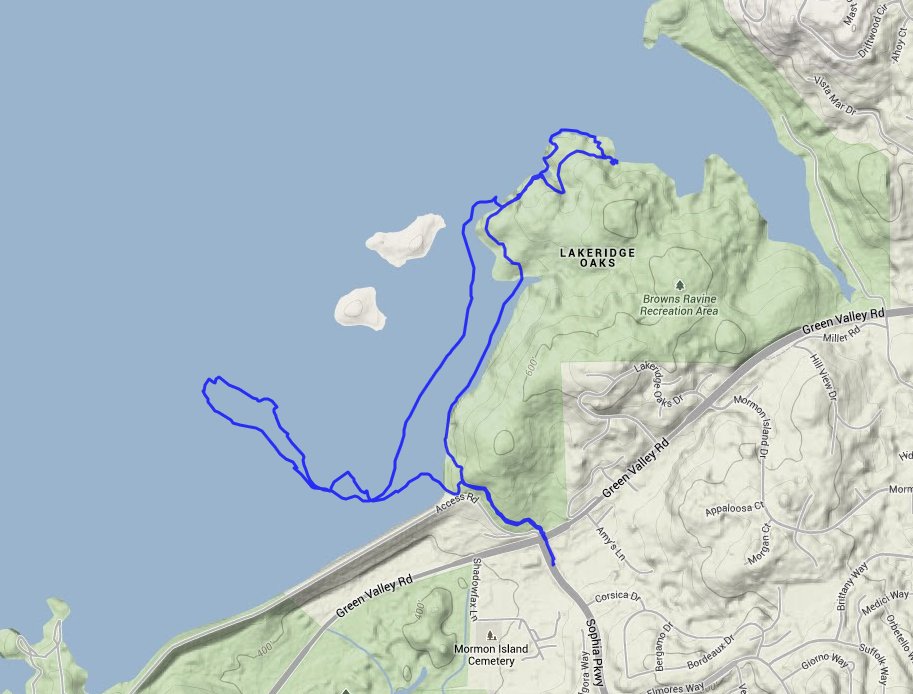
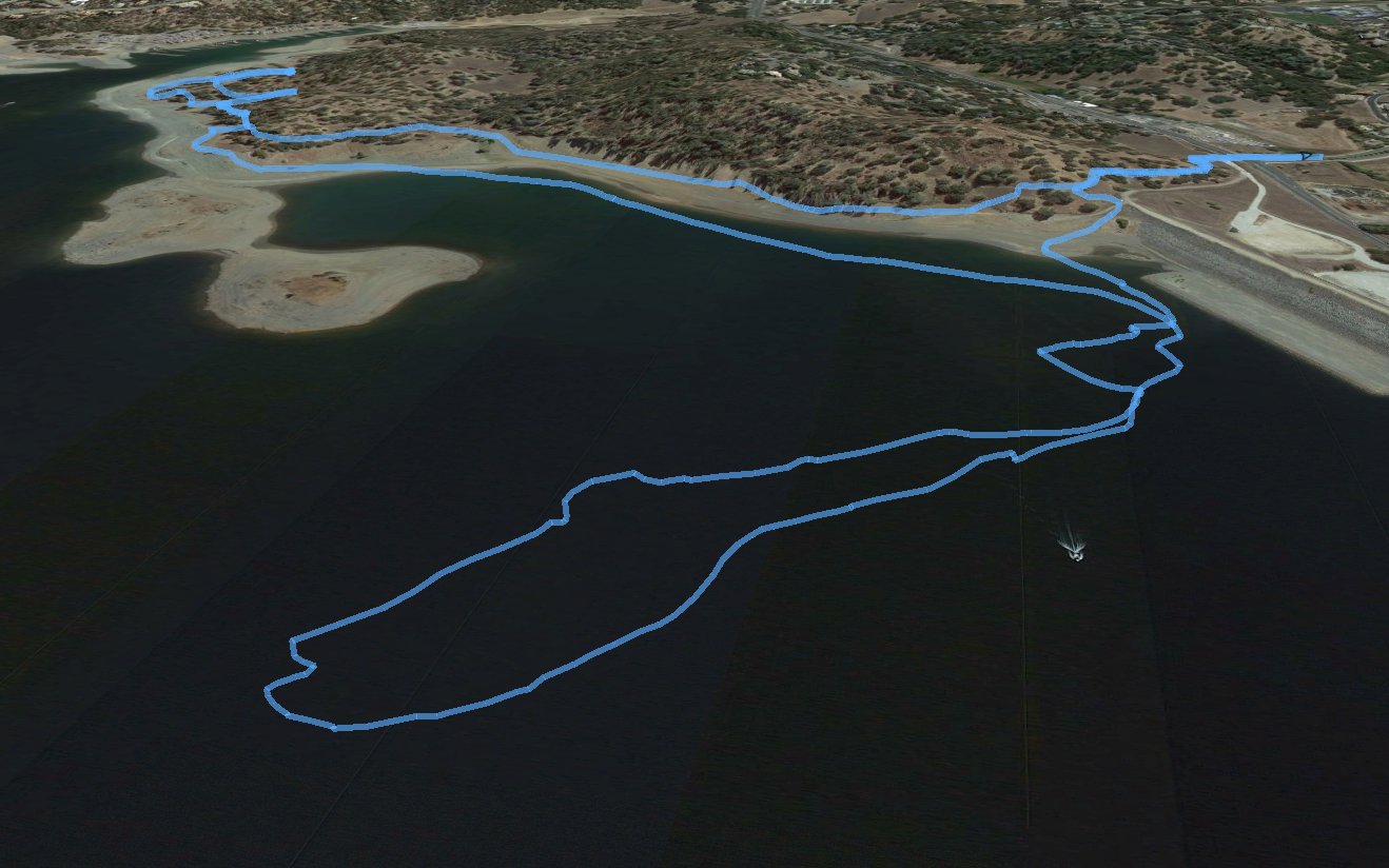
| GPS Track of the full hike. Probably the strangest ones I've ever seen for my adventures. Don't remember seeing the boat, either. | |
|