Back to index Ferguson Canyon Hike
Trip Date:  06/18/2014

Distance
: 2.5 Miles

Vertical Gain: 1100'

Group Size: 37

Hike Rating:  Easy  Moderate  Hard  Strenuous
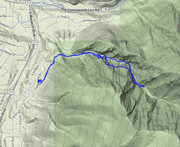
Ferguson Canyon route
Download GPX GPX for this trip
Ferguson Canyon Elevation Profile
Start Coordinates:   N 40 36.637  W 111 47.289      End Coordinates:   Same as Start Coordinates  
Car Shuttle Req'd:   No Parking Directions:   Take Highway 210 south to  the first stop light past highway 190, which is Honeywood Cove Drive.  Turn left on Honeywood Cove, then left again on S 3775 East.  Turn right on Timberline Cove Drive, and park at the designated area just up the street on the right.
Hazards of Note:   Snakes
Heat
Crowd Factor:   Moderate; popular with dog walkers
General Notes:
The trail starts at a cement ampitheatre just above the parking area, and then winds north around a large water tower until it then heads east up into the canyon.  The next mile and a half are alternately slightly uphill to steeply uphill, crossing the river a number of times on the way up.  There are numerous rock formations and other bits of evidence of the old shoreline area of the ancient Lake Bonneville that covered much of this part of Utah on west into Nevada.  Most of the trail is in trees obstructing the views back down and up into the canyon, but open up as you get further up toward the two mile point.

Our group of intrepid explorers at the trailhead ready for the adventure that awaits. Trailhead
One of our coaches pointing the way up into the canyon. Pointing the way
Rocky outcropping above the trail as we headed up the canyon. Rock outcropping
Our group heading on up the trail. Our group heading up the trail
Heading up the trail as it weaves through a deep chasm in the rocks all around. Walking around some rocks
The first really significant elevation gain along the trail. Continuing up
Continuing up, and up and up.
Hikers
Two of the players taking a quick break at one of the many waterfalls along the way. Taking a break by the falls
One of the many water crossings on the trail. One of the many water crossings
The group looking for good footing on the very steep sections heading back down from the top. Another one of the many significant elevation climbs
Looking up at one of the many waterfalls streaming down from higher up the canyon. Water, water everywhere
Three of the players making their way along the last stretch back to the car. Almost back to the trailhead
View of the mountains at the mouth of Big Cottonwood Canyon. One last look back at the mountains
GPS Track of the full hike. GPS Track of Hike