|
|
El
Dorado Trail - Camino to Placerville Hike
|
|
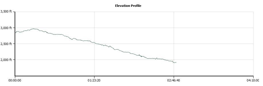
Trip Date: 04/21/2015
Distance: 7.9 Miles
Vertical Gain:
1000'
Group Size:
1
Hike Rating:
Easy
Moderate
Hard
Strenuous |
 GPX for
this trip
GPX for
this trip
|
|
|
Start Coordinates: |
N 38 43.805, W 120 42.284 |
|
End Coordinates: |
N 38 43.986, W 120 47.372 |
| Car Shuttle
Req'd: |
Yes |
|
Parking
Directions: |
For
the parking area in Placerville, take Highway 50 to the Broadway exit
if heading east. You will get off and turn right, then right
at
the stop sign and then you will turn left after crossing back under the
freeway. The parking area will be on the left. If
travelling west on 50, exit Mosquito Road, turn right at the first turn
and the parking area will be on your left.
For the Camino
Parking area, take the Camino Heights exit and then head south.
Turn left on Vista Tierra drive, then right on Camino Hills
Drive. Follow this around to Halcon Rd, and turn right.
The
trailhead is on both sides of this road about a 1/4 mile down, and you
can park just a little further at the point where Halcon and Paloma
Roads meet. |
| Hazards of
Note: |
Rattlesnakes, mountain lions,
ticks, poison
oak. |
|
Crowd Factor: |
Moderate
to Heavy. The Camino section is fairly unused, but the area
as
you get toward Placerville is highly popular and has an abundance of
runners, bikers, hikers, and even equestrian traffic along the way. |
General Notes:
From
the trailhead in Camino, head east to cover the last 8/10 of a mile of
the actual trail until the point that it ends just on the south side of
Highway 50. There are some nice sections along this trail,
and
the old railroad bed which has been removed makes for a very pleasant
and very level trail for this entire way. At the end of the
trail, turn around and head back, crossing over Halcon Dr when you
return to the starting point to cover the six miles into Placerville.
The way is just dirt for about another mile, and then the
paved
multi-use bike trail part begins, which will be the trail for the rest
of this part of the trip.
This
hike is rated as Moderate only due to the distance of it. The
elevation change and the flat, wide surface would otherwise rate it as
Easy. |
|
|
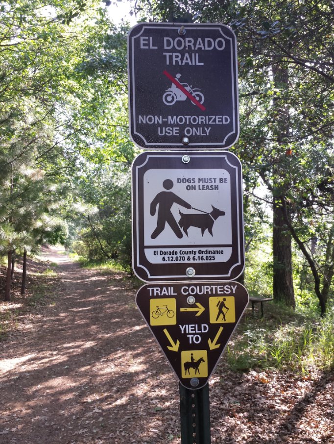
This is the sign on the east
side of Halcon Rd that indicates the start of the hike along the last
8/10 section to Camino. |
 |
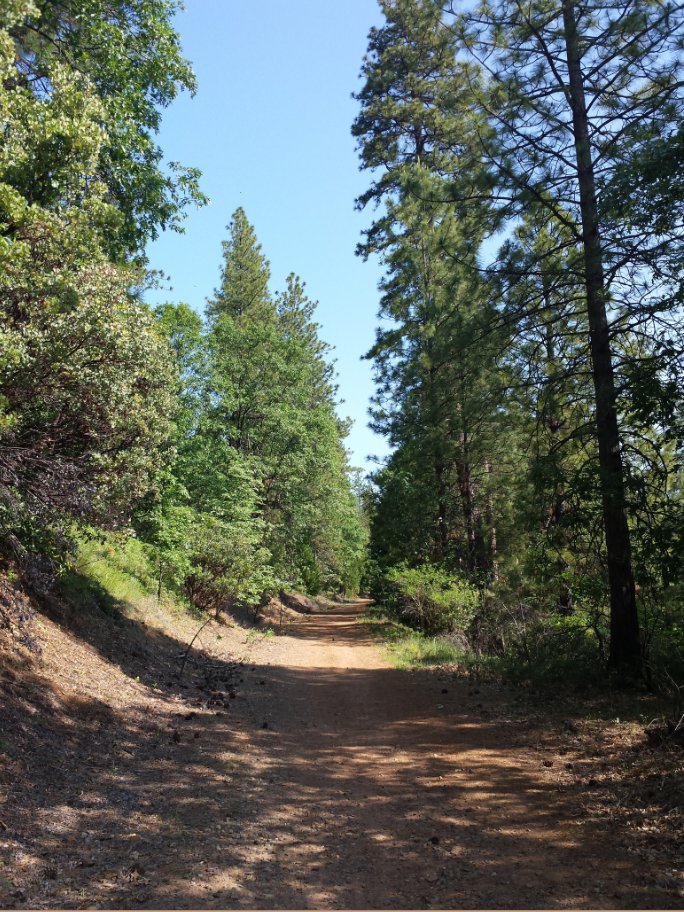
|
The trail on the way toward
the very end at Camino.
|
 |
|
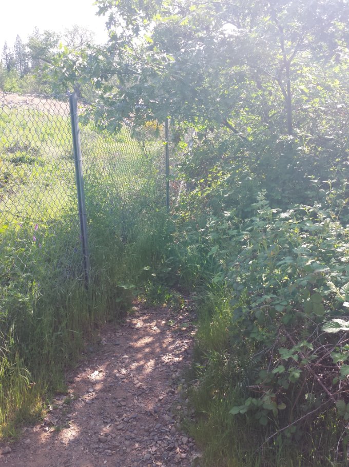
At the very far eastern spot
on the trail, it literally runs out against the fence. At
some point the plan is to connect it up to the Pony Express trail up
near Pollock Pines, but for now, this is it! |
 |
|
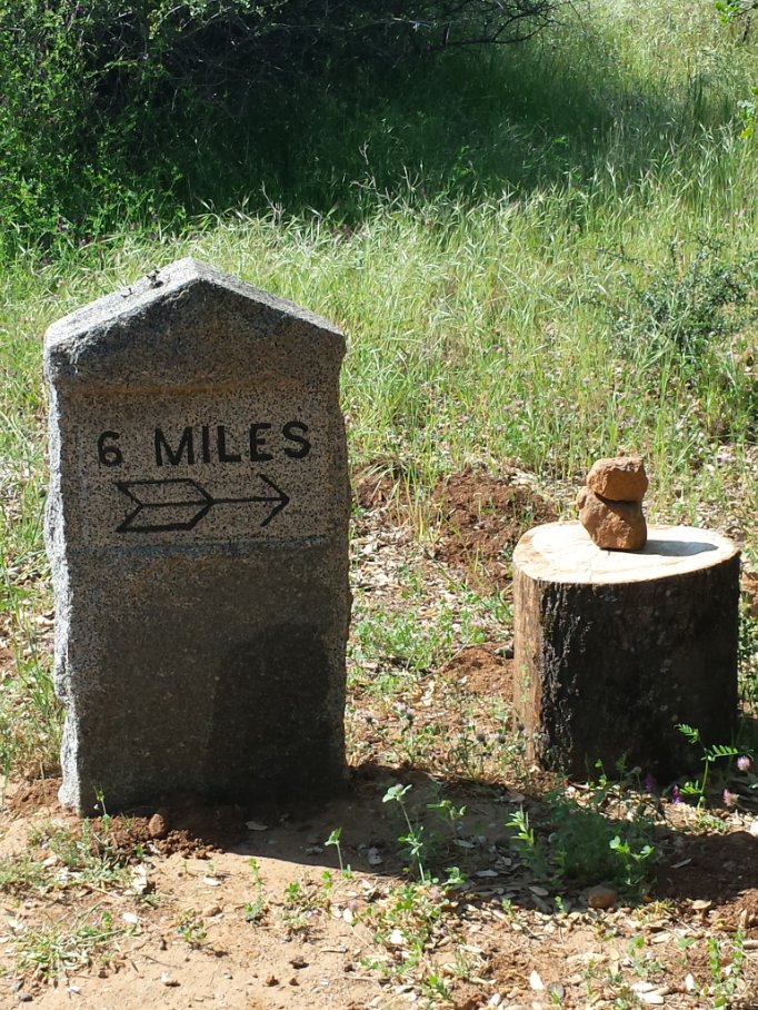
Back at Halcon Dr, heading
west along the El Dorado trail is marked with this helpful granite
stone indicating the distance to Placerville from this point. |
 |
|
Along the way, somewhere below
the Apple Cafe and Apple Hill golf course is this great open area with
a wonderful view of the mountains far off in the distance.
|
 |
|
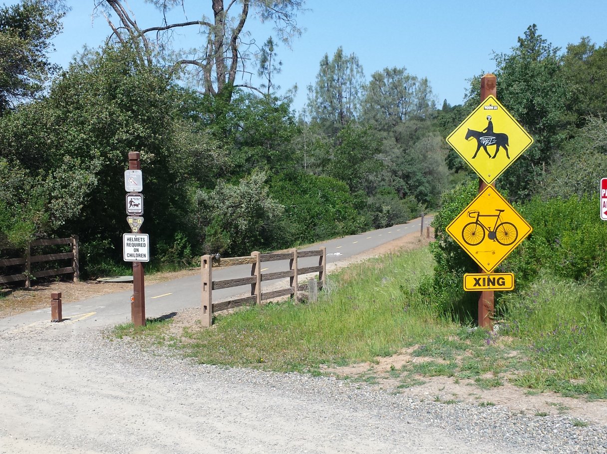
This is the point where the
paved part of the trail, which will head all the way into Placerville
(and beyond) starts out. There are lots of signs here that
almost overwhelm with instructions. Not included in this
picture are the no parking signs on both sides as well. |
 |
|
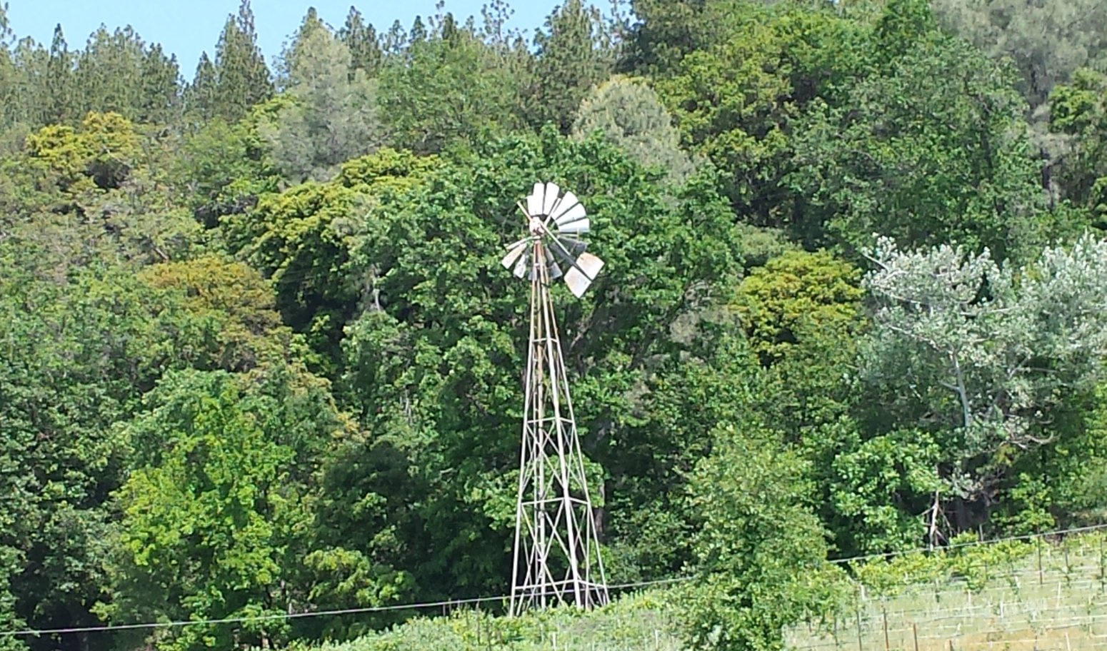
Along the way there are
interesting things to see on both sides of the trail, including this
old windmill which is not even 100 feet from Highway 50 behind the
trees. |
 |
|
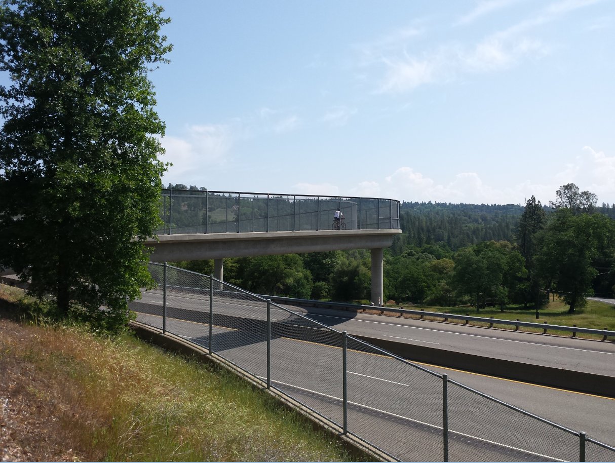
One of the nice, newer
features of this trail is that it diverts the pathway over Highway 50,
so that the game of human frogger can be avoided. |
  |
|
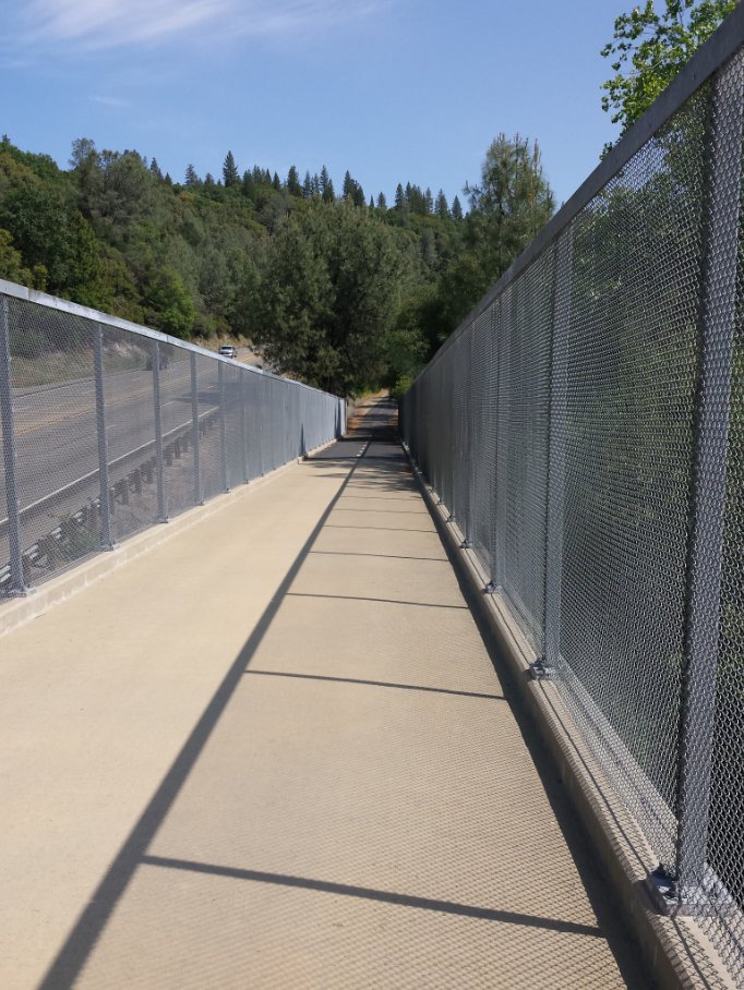
The
section just to the west of the 50 overcrossing is in really good
shape, and I had nearly all to myself on this particular day. |
 |
|
As
the trail wanders toward the parking area at Jacquier Road, the sight
of a large winery with grapes growing all over the hill above dominates
the immediate vista. |
 |
|
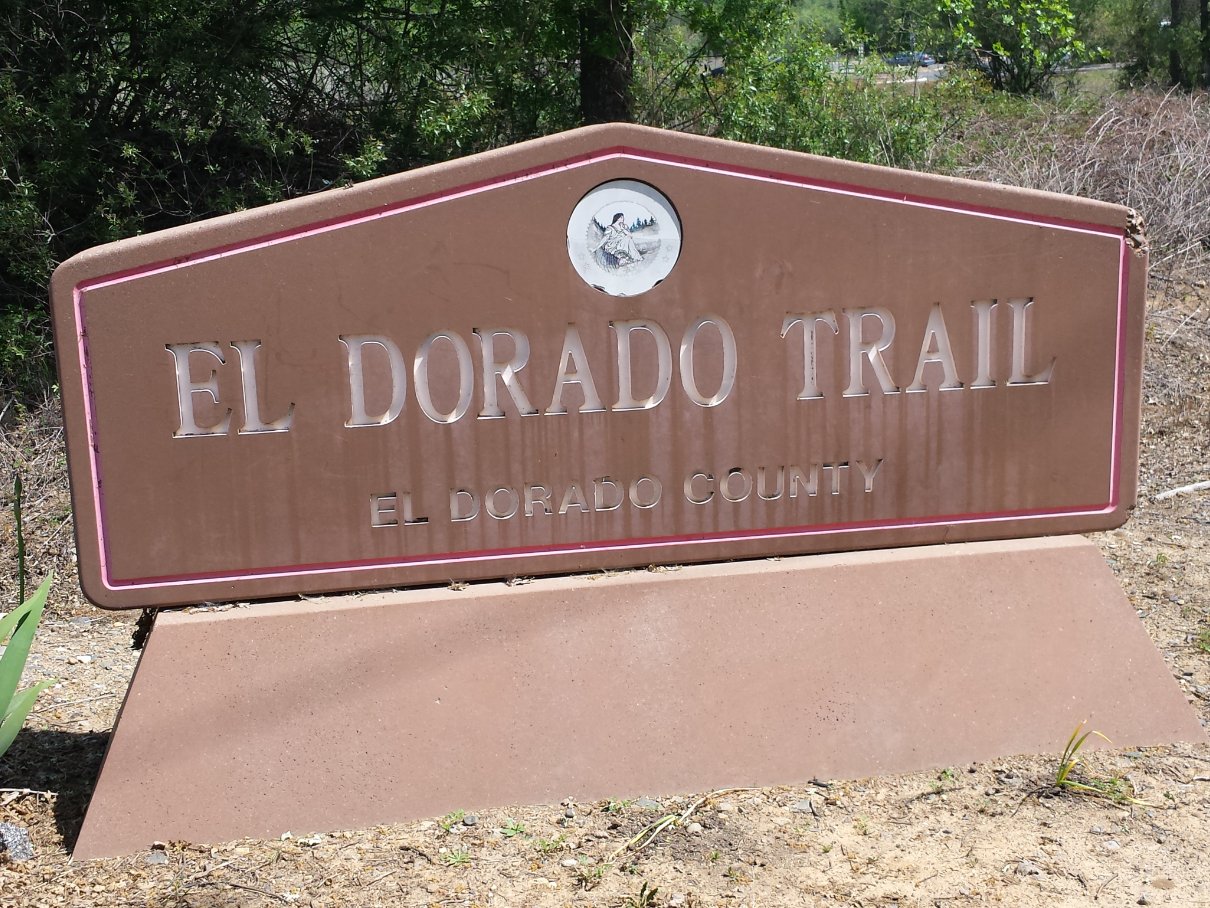
Right at the entrance to the
Jacquier parking area is a sign for the trail that leaves no doubt as
to what is here. |
 |
|
Easy
to miss, but very interesting are a series of about 10 memorial plaques
cemented into the ground which start on the trail just above the
Hangtown Grange building and head west until you reach the tunnel very
close to the end of this particular section of hike. If you
were
on your bike you would probably never see them. |
 |
|
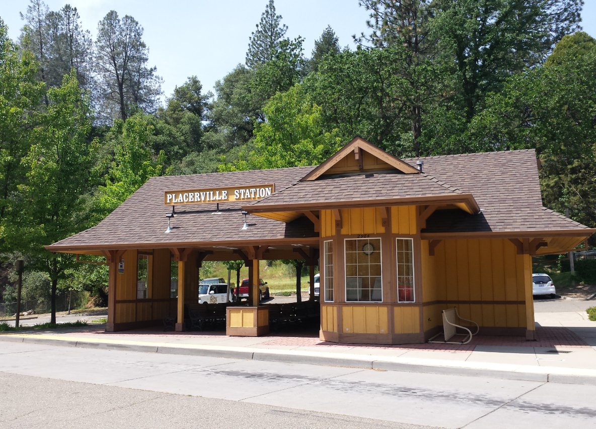
Finally,
the end of the section of trail is marked at the Placerville Depot for
busses and Amtrack shuttle service. A nice place to finish up
either this direction or coming east from the town of El Dorado. |
 |
|
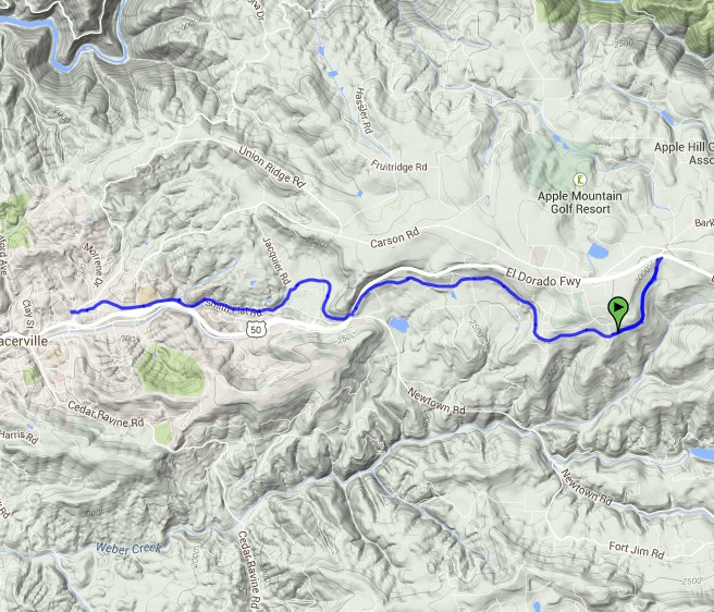
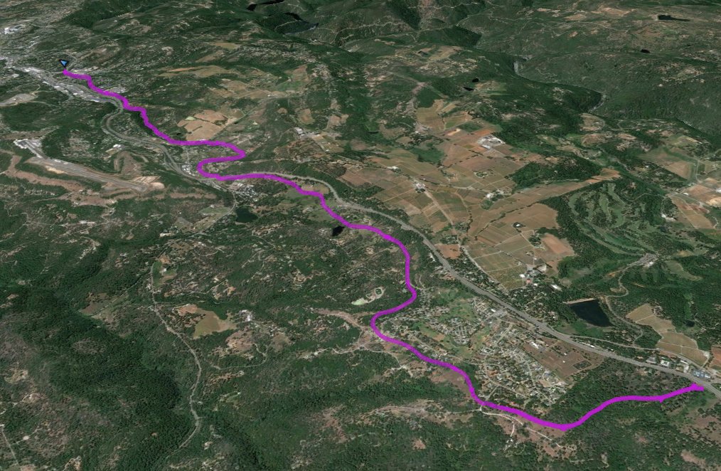
GPS Track of the full hike. |
 |