|
|
Ebbetts
Pass to Raymond Meadow Hike
|
|
Trip Date: 8/16/2019
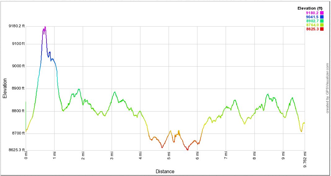
Distance: 10.0 Miles
Vertical Gain:
1200'
Group Size:
2
Hike Rating: Easy
Moderate
Hard
Strenuous |
 See
video of hike
See
video of hike
 GPX for
this trip
GPX for
this trip
|
|
|
Start Coordinates: |
N 38 32.669, W 119 48.703 |
|
End Coordinates: |
Same as Start Coordinates |
| Car
Shuttle
Req'd: |
No |
|
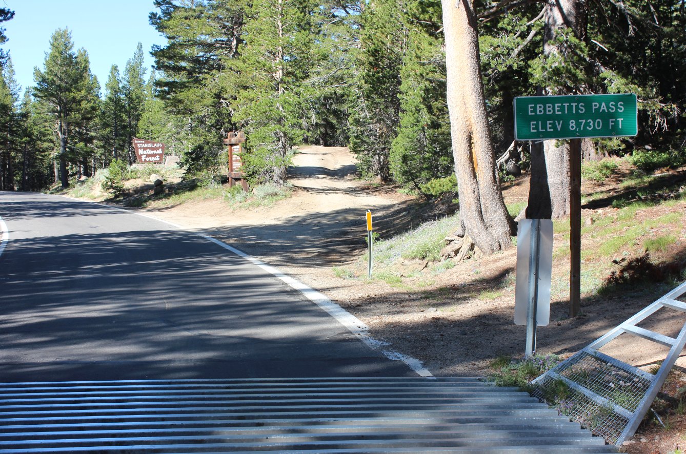
Parking
Directions: |
Take
Highway 4 to the parking area right across the road from the Ebbetts
Pass elevation sign and just east of the Stanislaus National Forest
boundary sign. There is a dirt parking lot here able to
accomodate 8 vehicles.
|
| Hazards
of
Note: |
Wilderness environment, trail finding
and loose shale if attempting the Ebbetts Peak climb.
|
|
Crowd
Factor: |
Moderate.
The first couple miles of the PCT from Highway 4 include some
popular camping lakes and you will typically find people here.
Past that you will probably only have contact with PCT through or
section hikers. |
General
Notes:
From
the parking area head across highway 4 and head up a 4WD road which
heads north toward Ebbetts Peak. There is a junction to the south
just before the base of the peak which you should take, although
continuing on straight will undoubtedly lead to the same place
eventually. If you choose to summit the peak (highly
recommended,) head up to the high point of the saddle between Ebbetts
Peak and the rise to the west, and then head upward along one of many
use trails heading up to the flag at the top. The views are well
worth the effort to reach the top.
Head
back down and pick up the use trail which heads over the saddle, and
then head back down on the north side toward Dorothy Lake until you
find open enough area to head east toward Sherrold Lake. Stay to
the north of this lake and then you will meet up with the Pacific Crest
Trail just past the lake. Head left (to the north) and be sure to
take a short junction to the right before you enter the Mokelumne
Wilderness at the signed junction with (Upper) Kinney lake. The
setting is gorgeous and you even have a view of Lower Kinner Lake from
this location as well.
Once you enter the Wilderness area you will
be in the forest for about half a mile, and then the trail comes into a
large open area on the east side of the Reynolds Mountain ridgeline as
you continue north. Raymond Peak is also visible to the
northeast. Depending on the time of year, there can be a
multitude of flowers in sections along this way.
|
|
|
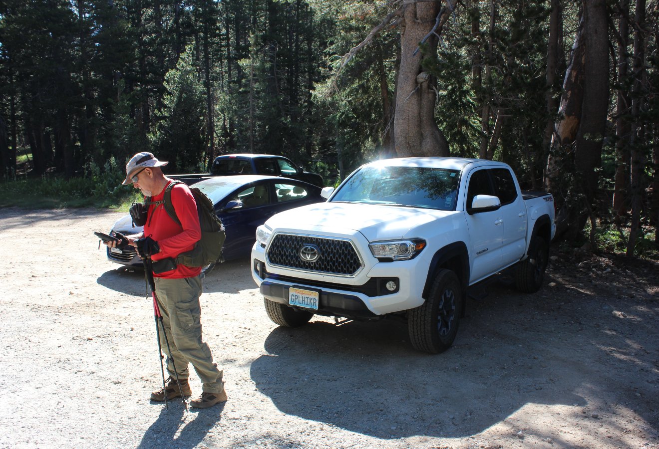
Heading
out from the parking area at the listed coordinates. There is
also an official PCT parking area about 1/2 mile to the east which has
a larger area for cars and a bathroom facility as well. |
 |
|
Crossing
Highway 4 from the parking area heading toward the 4WD road and the
start of the journey. |
 |
|
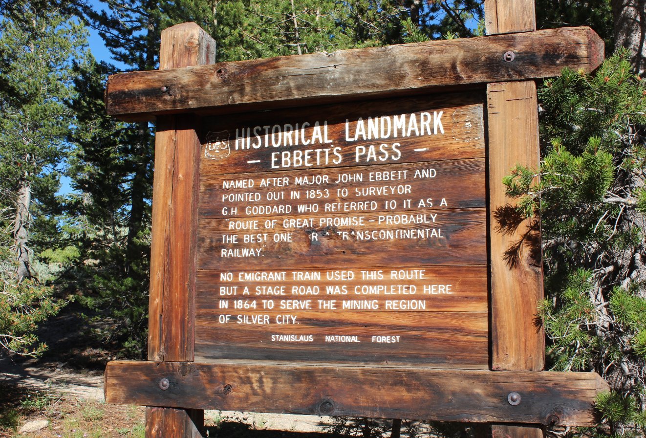
The
Ebbetts Pass historical landmark sign right at the start of the 4WD
trail. |
 |
|
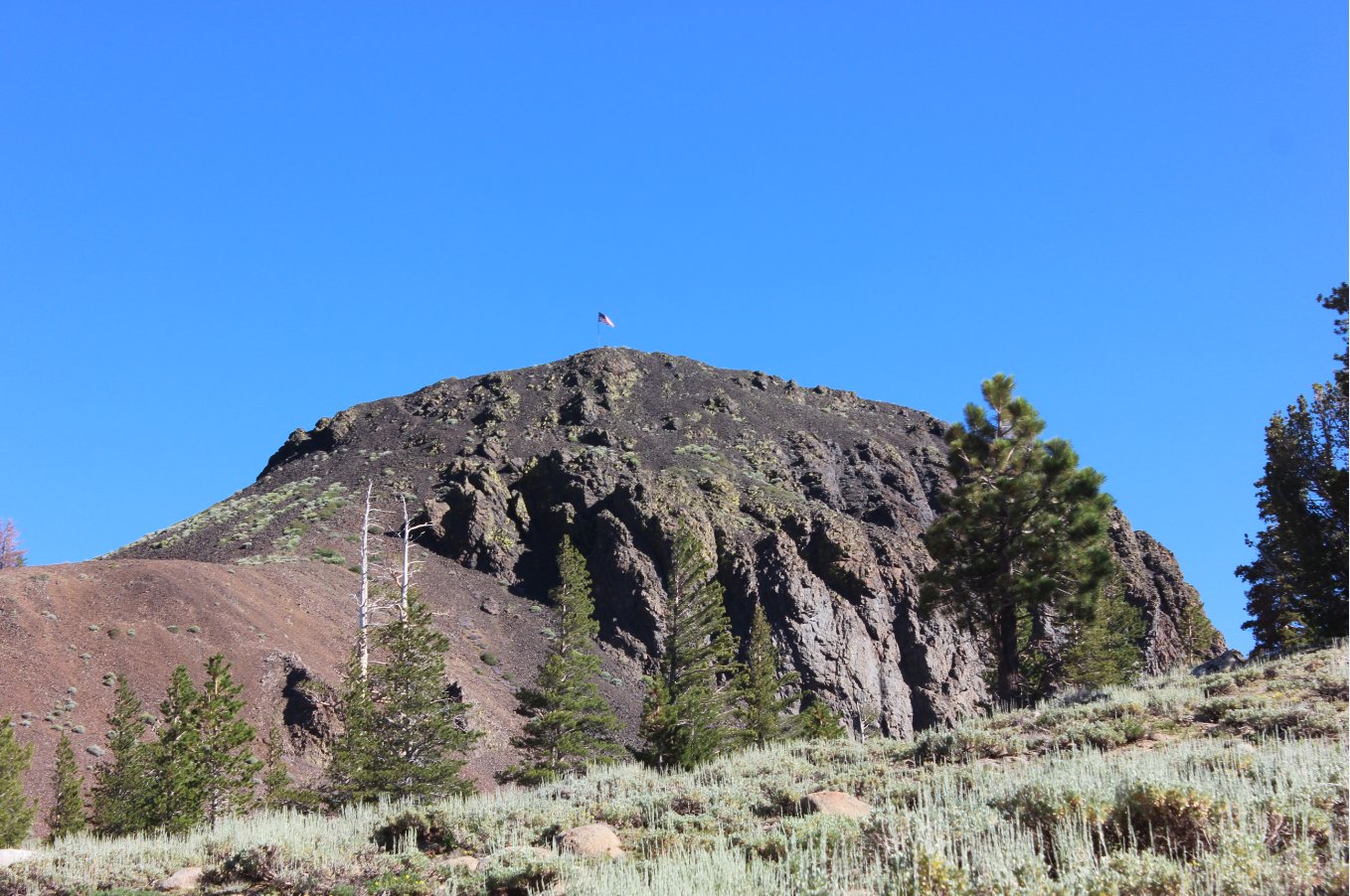
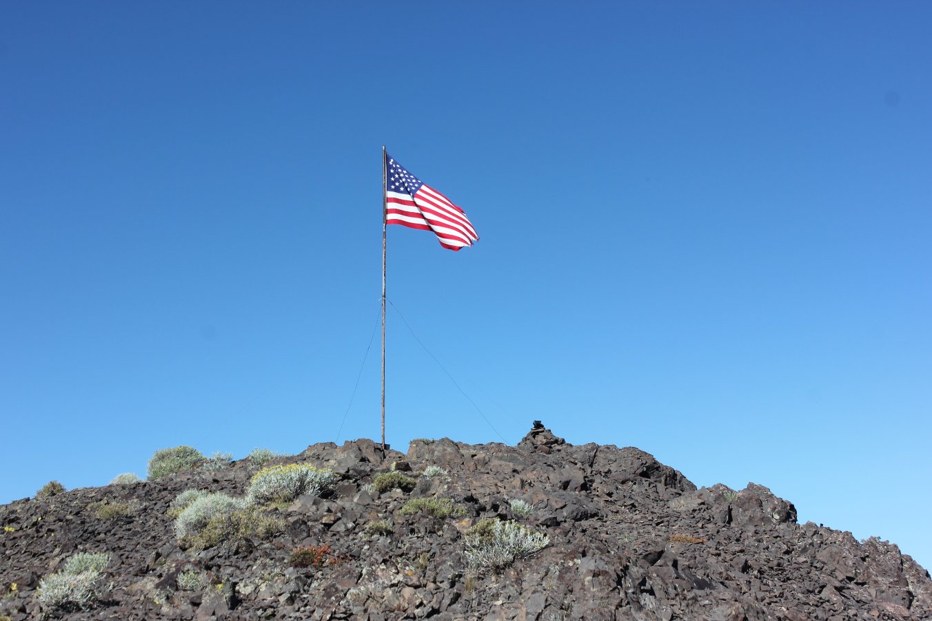
Looking
up at the flag mounted at the top of Ebbetts Peak. This is a
visible landmark from almost all of the first few miles of the journey
north. |
 |
|
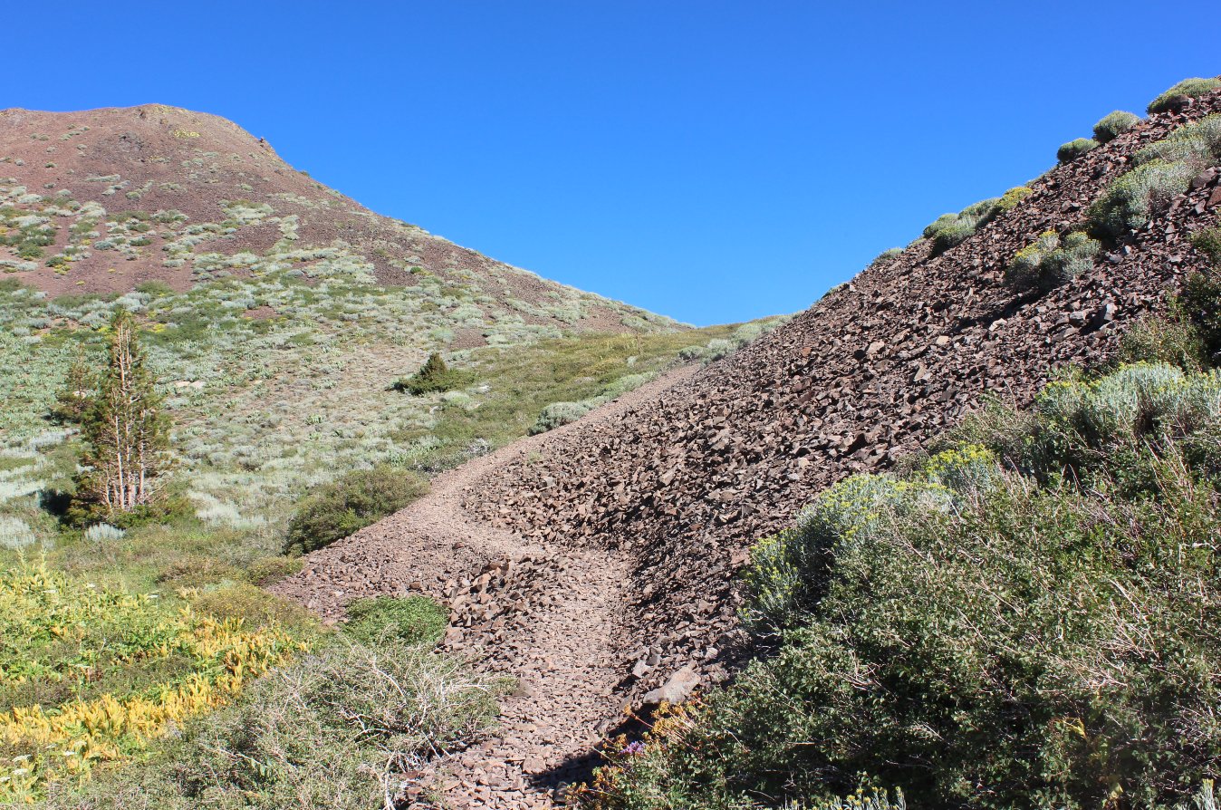
The
use
trail which heads up toward the saddle between Ebbetts Peak and the
unnamed peak to the west. Find the best way up to the peak at the
top of this saddle.
|
 |
|
A
nice
look at the view back down the use trail on the way up to the first
saddle. The mountains in the distance are in the Carson-Iceberg
Wilderness area. |
 |
|
Interesting
to find a lighted flagpole at the top of the peak. I wonder who
does the maintenance of this flag and has set up solar lights for this
to be lit at night. |
 |
|
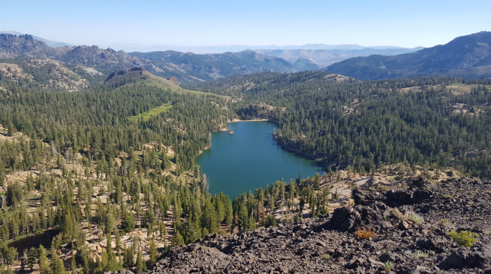
The
great view east from the top of Ebbetts Peak, with Kinney Reservoir in
the foreground. |
 |
|
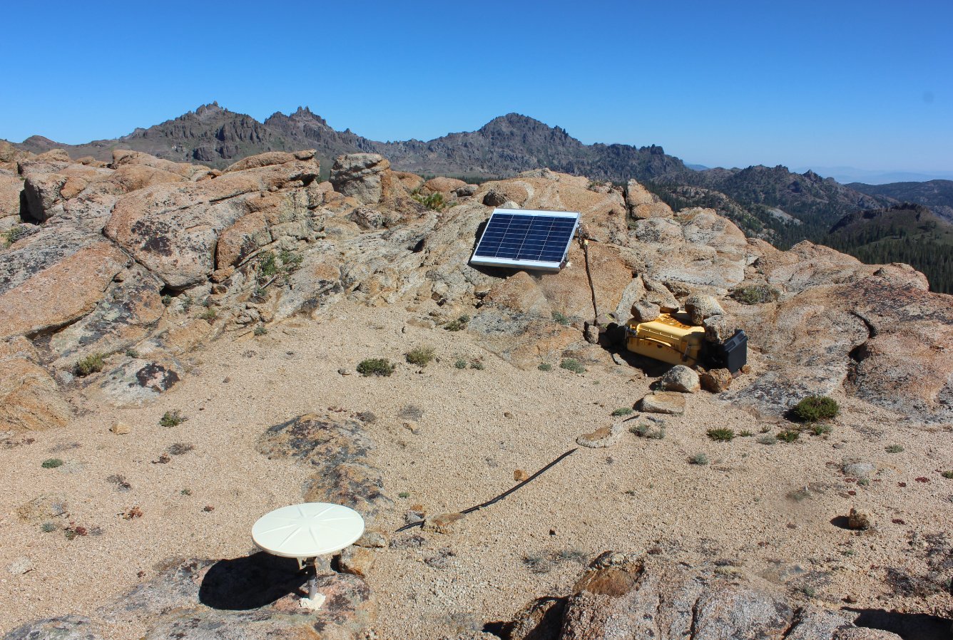
Near
the peak we discovered an earthquake monitoring station firmly embedded
into the rock. |
 |
|
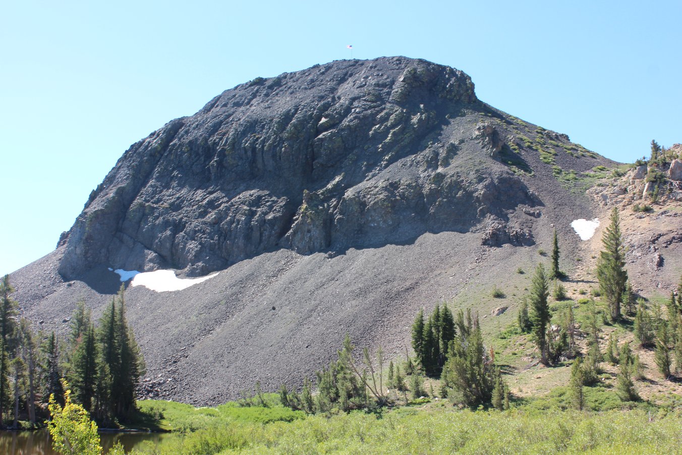
Heading
down from the peak toward Sherrold Lake, a look back at the peak
reveals a much more intimidating view of the peak and the landmark flag
atop it. |
 |
|
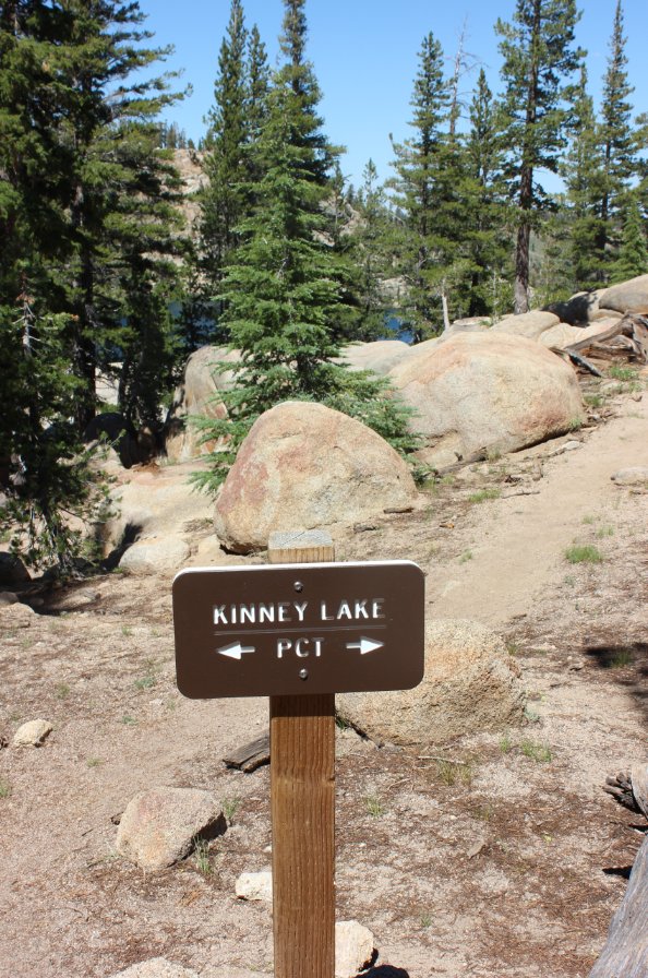
Not
only is this sign take you to a nice overlook of Upper Kinney Lake, the
trail it takes you down is a previous section of the PCT before it was
rerouted west of the lake. |
 |
|
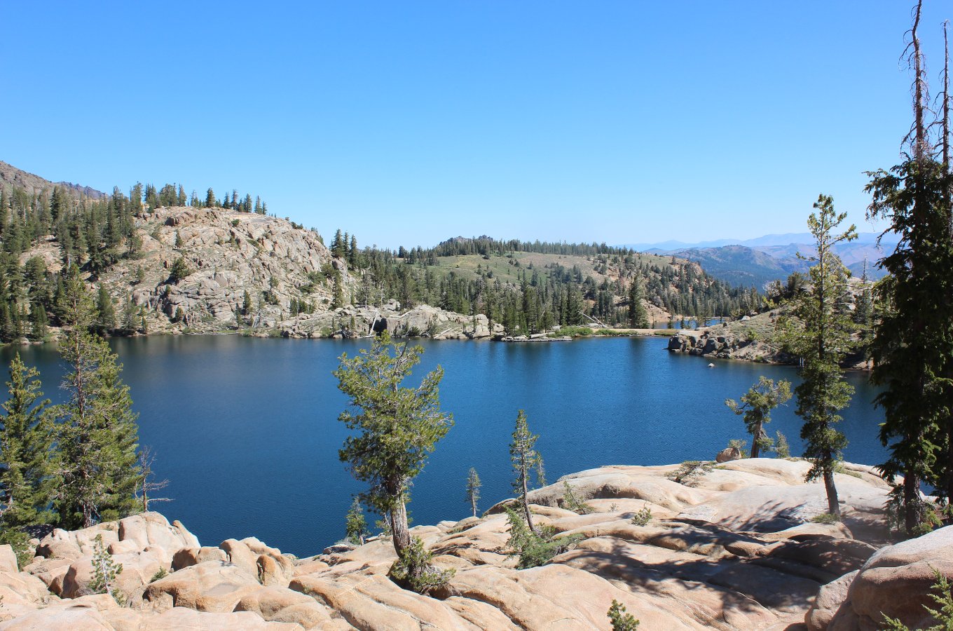
Not
far
off of the Pacific Crest Trail (PCT) is Upper Kinney Lake, at a signed
junction. The setting is amazing and you even get a glimpse of
Lower Kinney Lake from this spot as well. |
 |
|
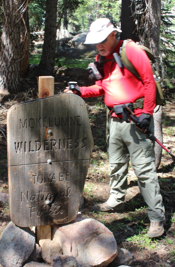
So
far this is the shortest sign we have encountered in the
Mokelumne Wilderness area. |
 |
|
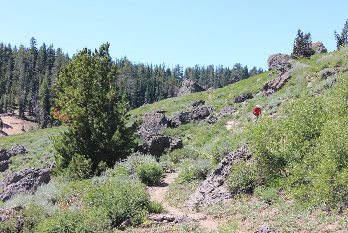
Once
out of the initial forested area, the rock formations along the
Reynolds Peak ridge to your west are fascinating. |
 |
|
Entering
Raymond Meadows and looking to the east, you get a great view of two
OGUL peaks, Silver on the left and Highland on the right. Looks
like a grand adventure for another day. |
 |
|
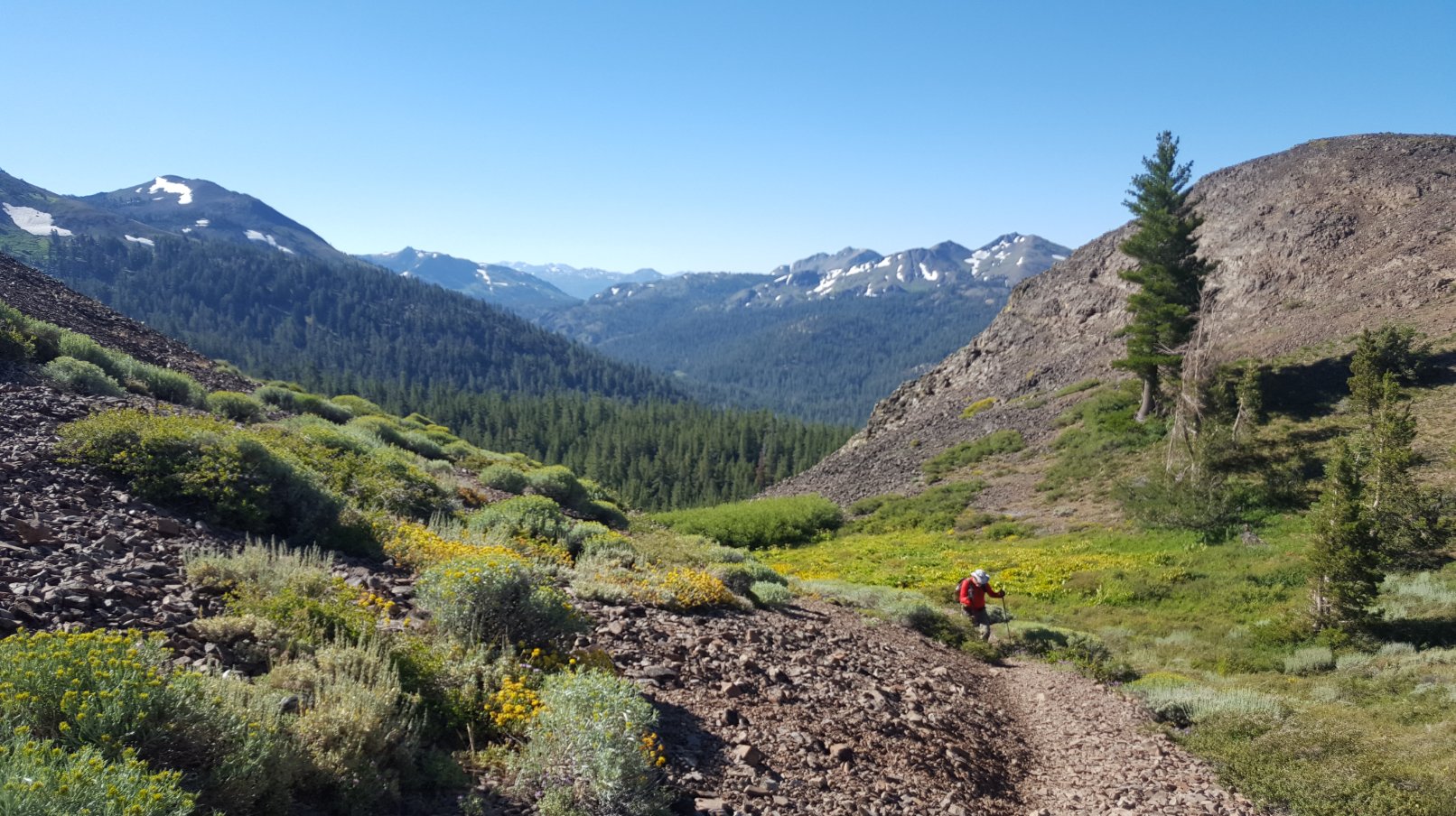
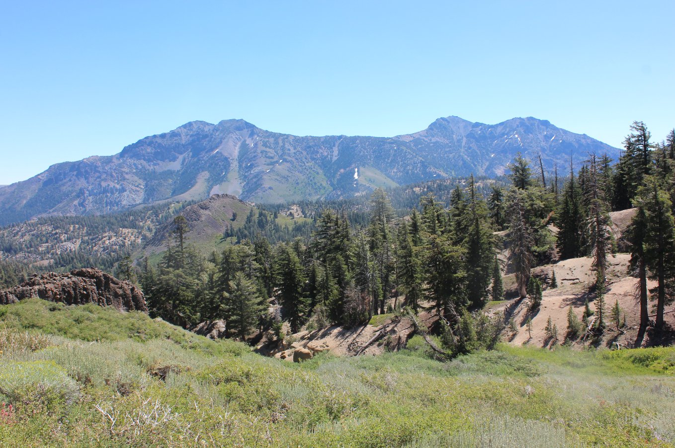
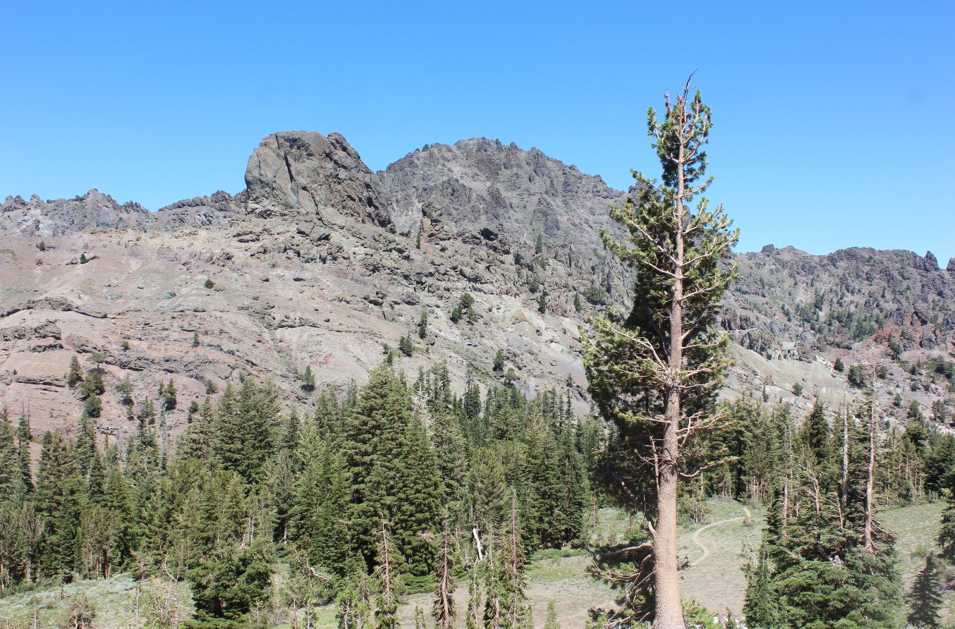
The
trail
past the forested section, for at least the next couple miles is out in
the open and offers outstanding vistas of both they Reynolds ridgeline
to the west and Raymond ridgeline to the north. |
 |
|
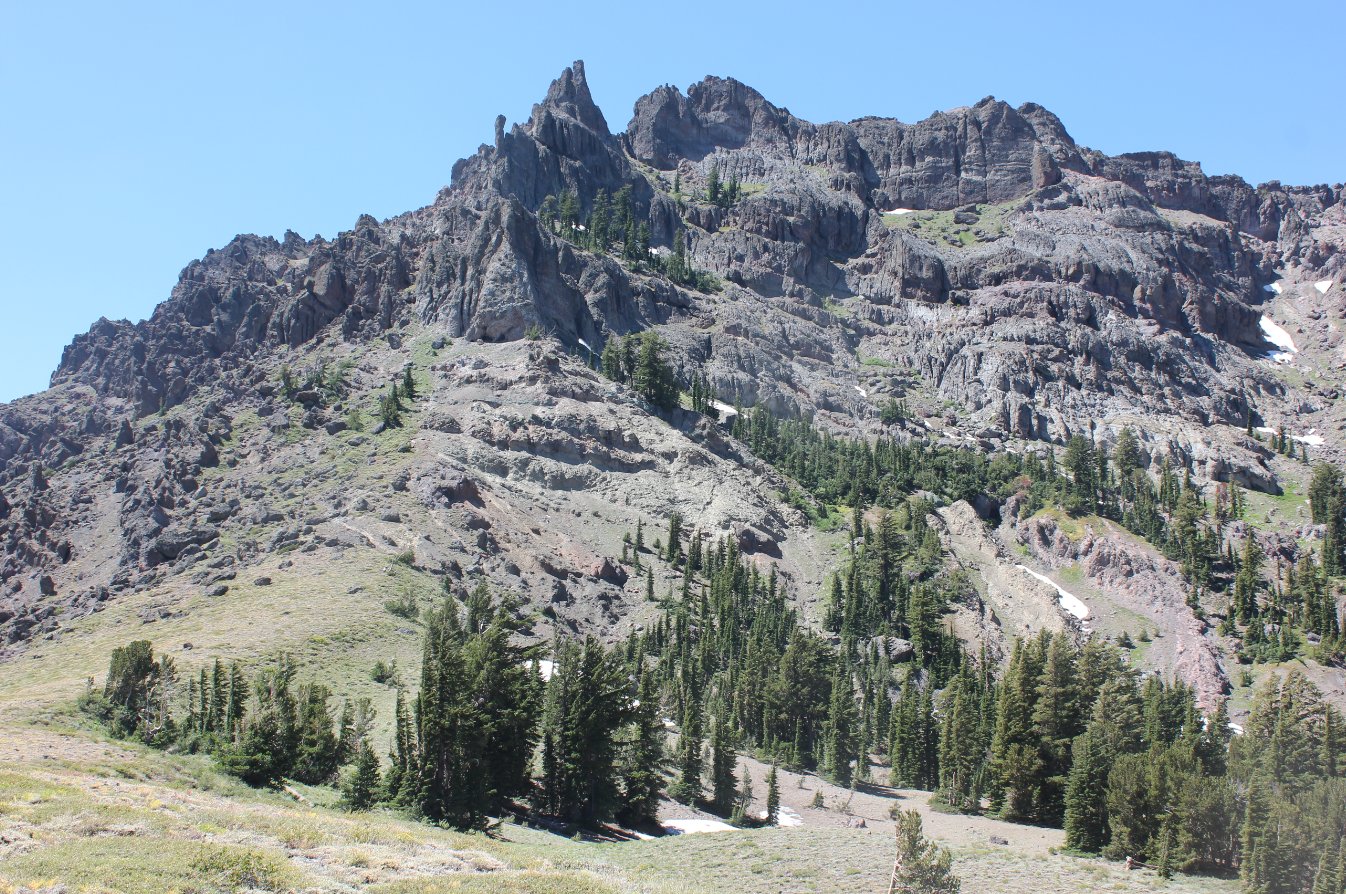
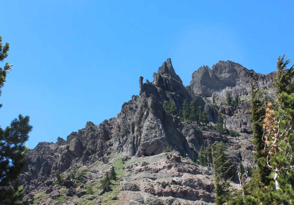
When
originally looking into this area there was the thought of climbing
Reynolds Peak, but after reading previous summit logs and then looking
at this from up close, this one will remain on my 'not gonna even try
that one' list. |
  |
|
To
the
north is Raymond Peak, and the small notch just to the left of it where
we ate lunch last summer near the summit. We were on the other
side of this two weeks ago at Raymond Lake. |
 |
|
On
the
way back there is a great view of Lower Kinney Lake just before exiting
the wilderness area. You can also see Ebbetts Peak to the right,
and Tryon Peak just past it, a popular climb for hikers in the area as
well. |
 |
|
We
found a sign with this interesting bit of history while walking on
Highway 4 from where the PCT crosses the road on our way back to the
car. |
 |
|
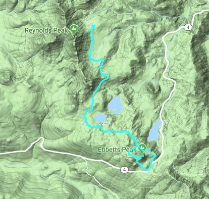
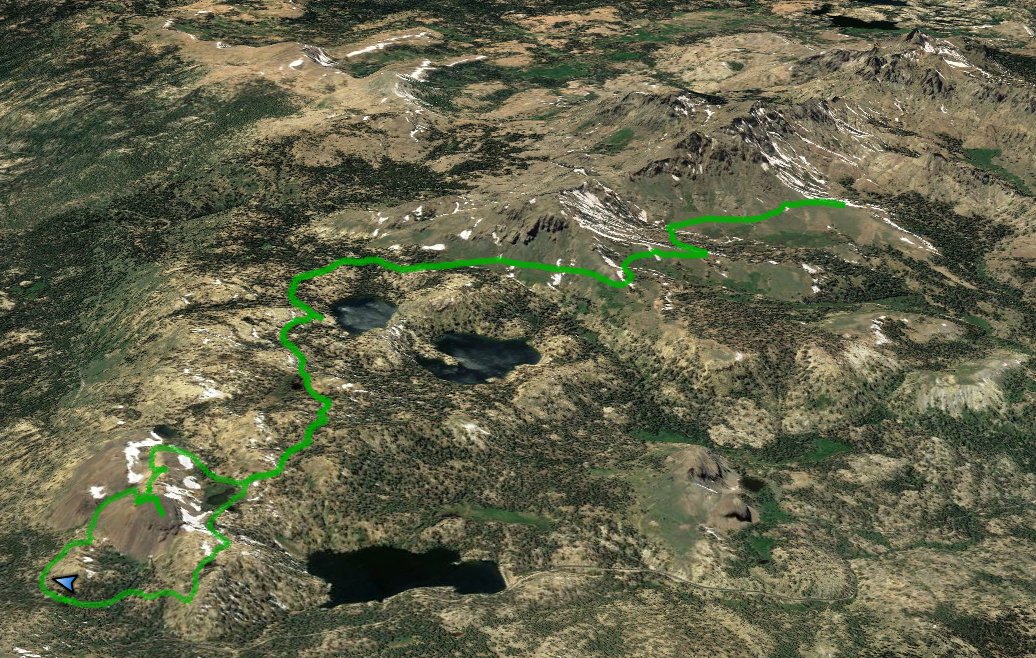
GPS
Track of the full hike. |
 |