|
|
Deadwood
Peak Hike
|
|
Trip Date: 06/26/2015
Distance: 11.5 Miles
Vertical Gain:
1400'
Group Size:
2
Hike Rating: Easy
Moderate
Hard
Strenuous |

 GPX for
this trip
GPX for
this trip
|
|
|
Start Coordinates: |
N 38 37.751, W 119 56.345 |
|
End Coordinates: |
Same as Start Coordinates
|
| Car Shuttle
Req'd: |
No |
|
Parking
Directions: |
Take
Highway 88 to Blue Lakes road and turn south. Follow the road
for
a little more than 13 miles to the parking area on the left between the
two lakes. After 11 1/2 miles the road turns to
the north,
and becomes dirt for the last few miles. Park in the dirt
lot
near the dam for Upper Blue Lake. |
| Hazards of
Note: |
Bears, limited shade after the
first two miles, a steep final climb to the peak.
|
|
Crowd Factor: |
Moderate for the first 2 miles
and then negligible past Granite Lake. |
General Notes:
From
the parking area you will immediately cross over a metal bridge,
spanning the overflow for the Upper Blue Lake. Soon after you
will see a sign for the start of the trail, pointing you off to the
left through a forested area. There is a water crossing over
a
log fairly soon in the hike, but it is easy and has been well
traversed. The trail turns to the left again after this
point,
and continues through the forested area. After about a mile
you
will pass a small, unnamed lake on the right side of the trail, and
then start a gradual climb of about 300' over the next mile to Granite
Lake. The trail passes along the south end of Granite Lake
within
inches of the water, and then look for the rock cairns (stacked stones)
which indicate about halfway around the lake where you will turn left
and head up to continue on the Grouse Lake Trail. About a 1/2
mile ahead you will pass through the greenery watered by the first of
four natural springs which cross the trail between Granite Lake and
Deadwood Peak. The trail crosses the spring and then meanders
back and forth for the next couple of miles, gaining a good deal of
elevation including up two slippery steep draws which don't appear to
be the trail at first glance but are. When the trail finally
leaves all trees behind between miles four and five, look for a final
rise which then offers a pretty straight-forward walk up a draw just to
the left of the actual peak. Climbing to the top of this gap
then allows a walk-up to the peak to the east. There was no
summit log, just a small pile of rocks indicating the actual location
of the summit.
|
|
|
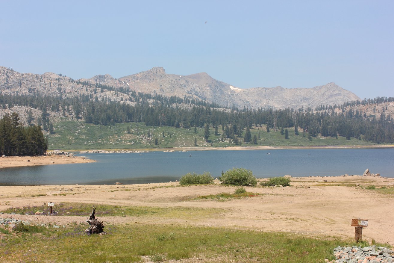
Upper Blue Lake, near the dam
at the south end which is the starting point of the Grouse Lake Trail. |
 |
|
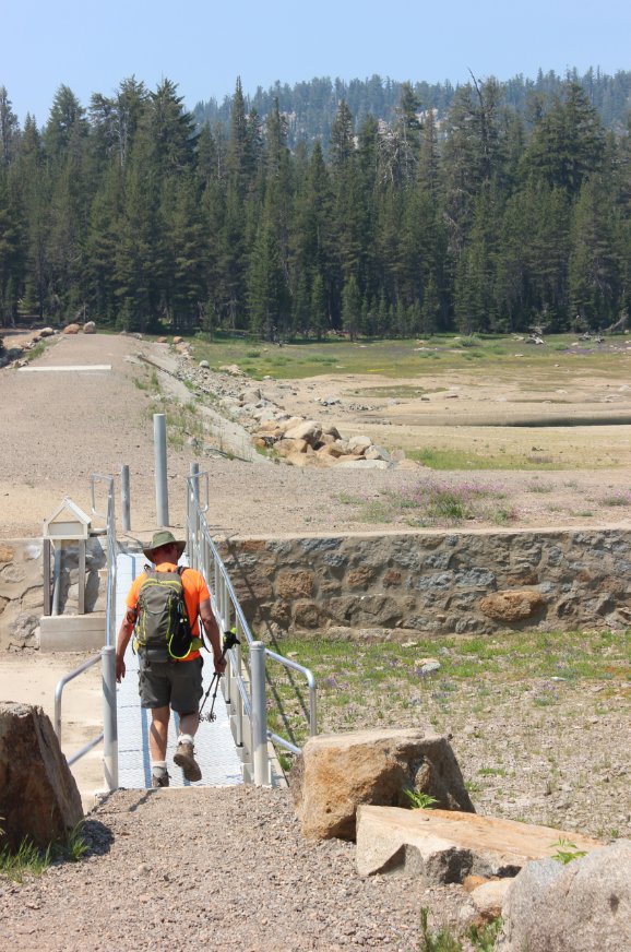
Heading
across the spillway at the south end of Upper Blue Lake.
Don't
continue along the dam from here, but make a left at the sign just
across this spillway bridge. |
 |
|
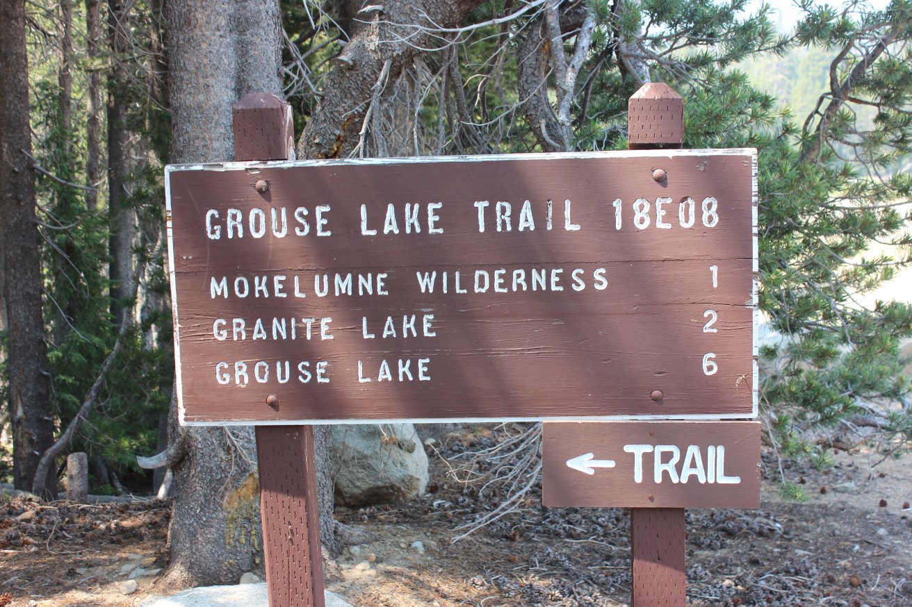
The start of the actual trail
just across the spillway. |
 |
|
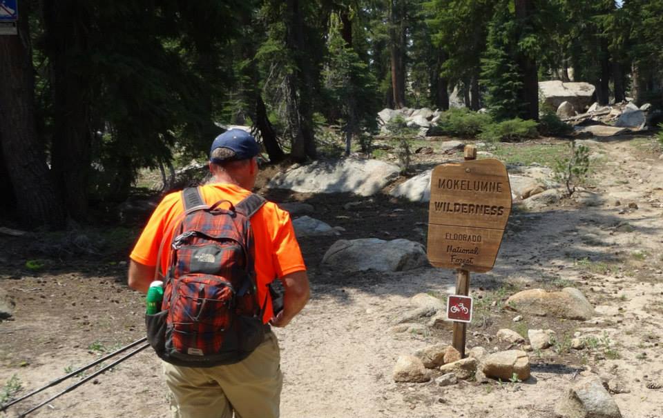
A mile into the hike is where
you officially cross into the Mokelumne Wilderness. |
 |
|
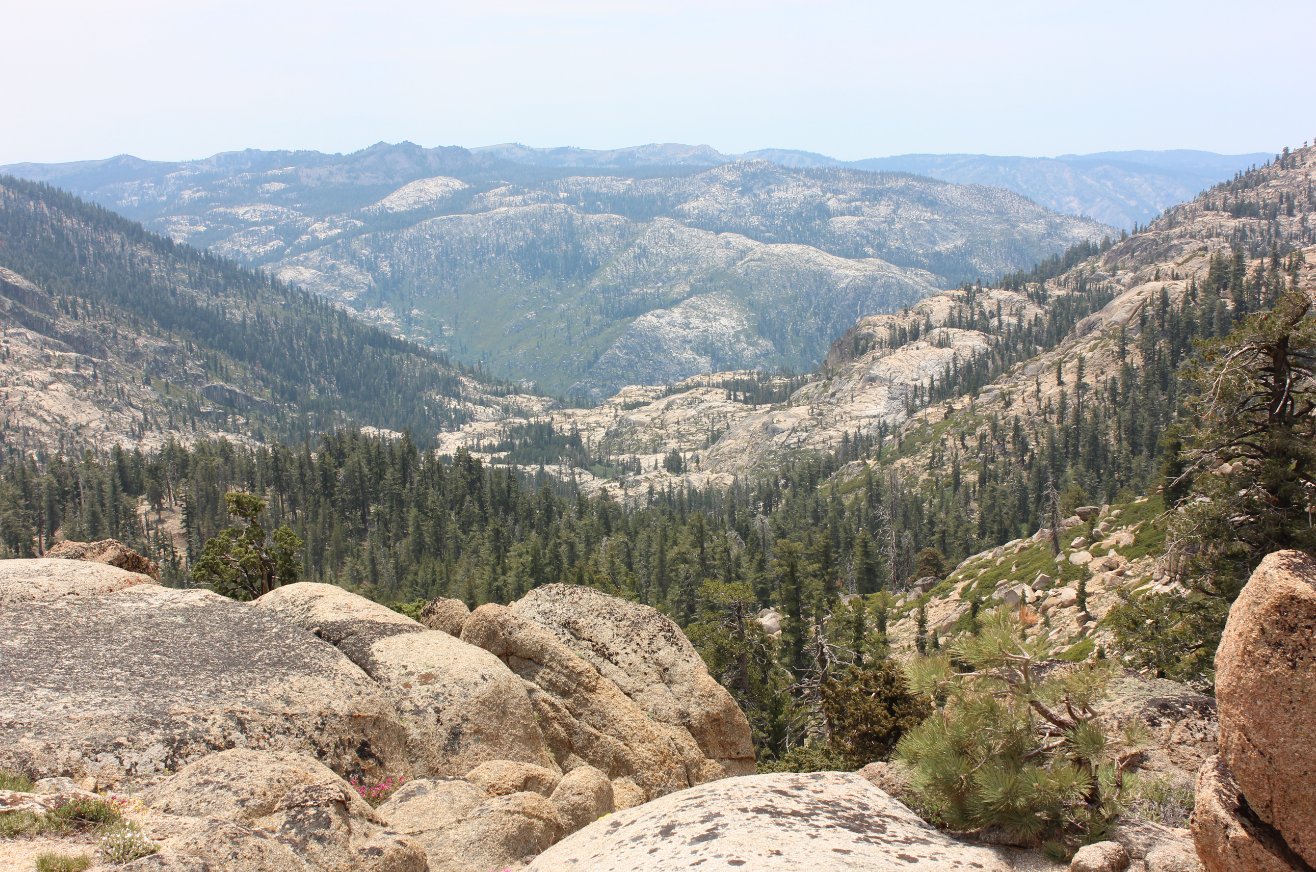
Almost to
the first lake, the trail emerges from the forest for a little while.
There are great views to the southeast of the central Sierras
on
days not filled with smoke. |
 |
|
Passing the first, unnamed
lake along the trail. |
 |
|
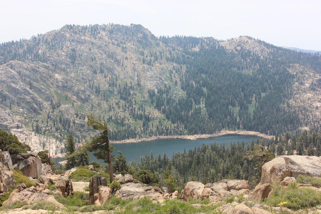
There is
about 300' of elevation gain to Granite Lake, two miles into the hike.
Most of it occurs in the last 3/4 mile before the lake. |
 |
|
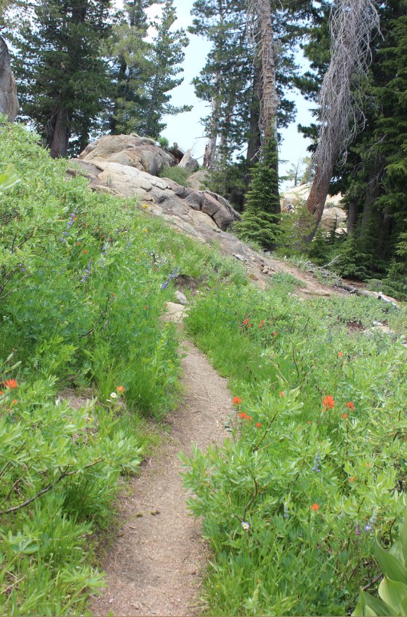
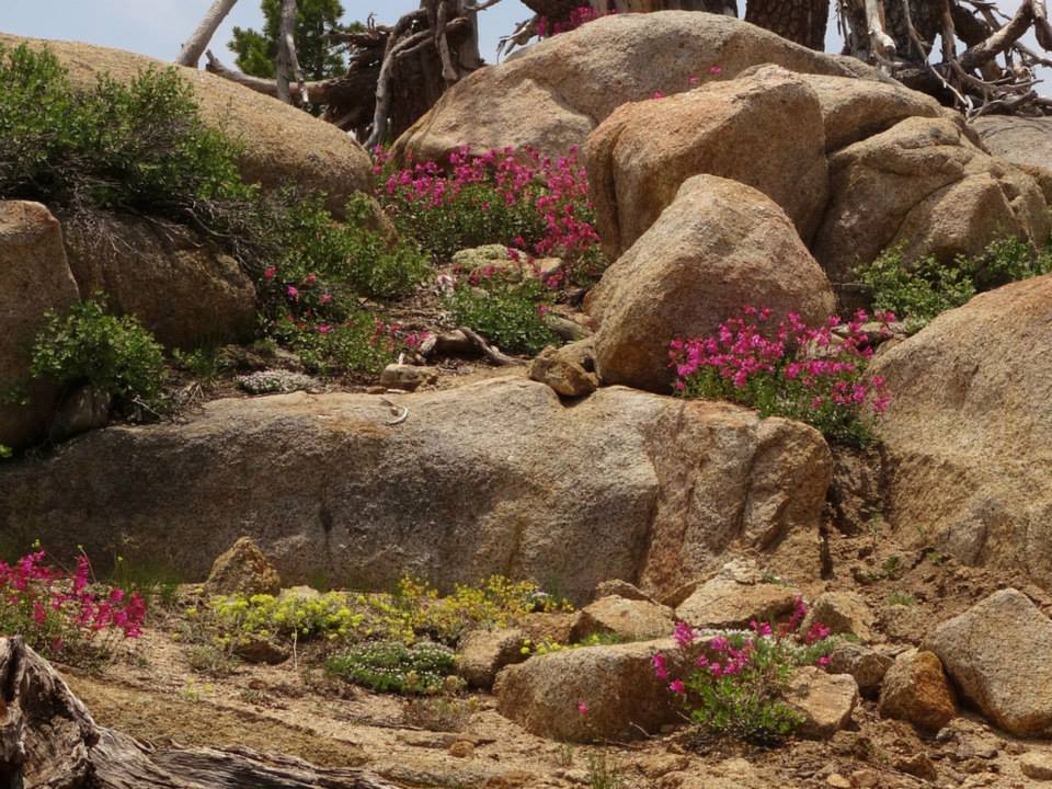
There were tons of wildflowers
along the way, both in the forested areas and even up near the peak. |
 |
|
Colors everywhere along the
trail. |
 |
|
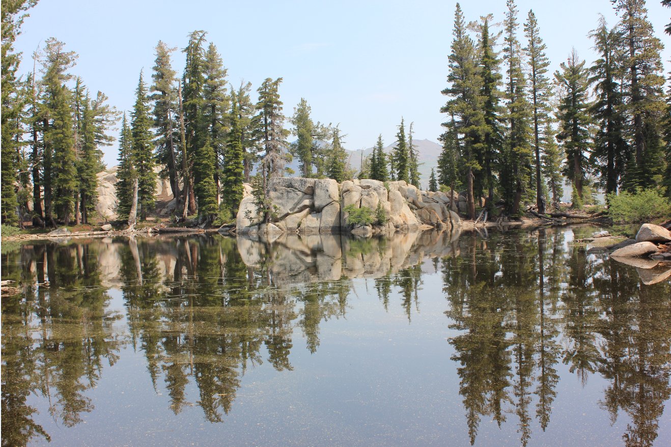
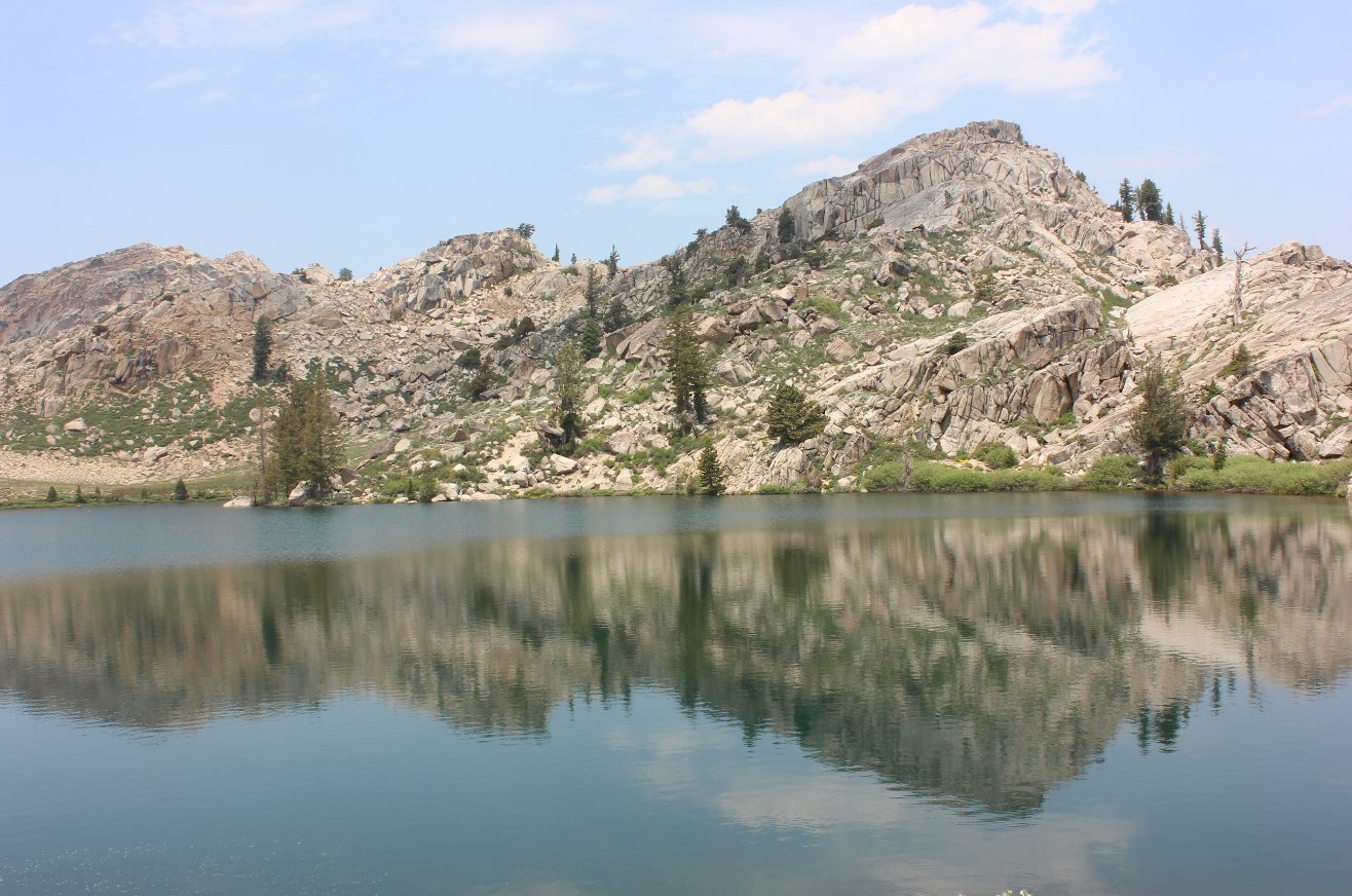
A first look at Granite Lake,
as the trail passes along the southern border very close to the water. |
 |
|
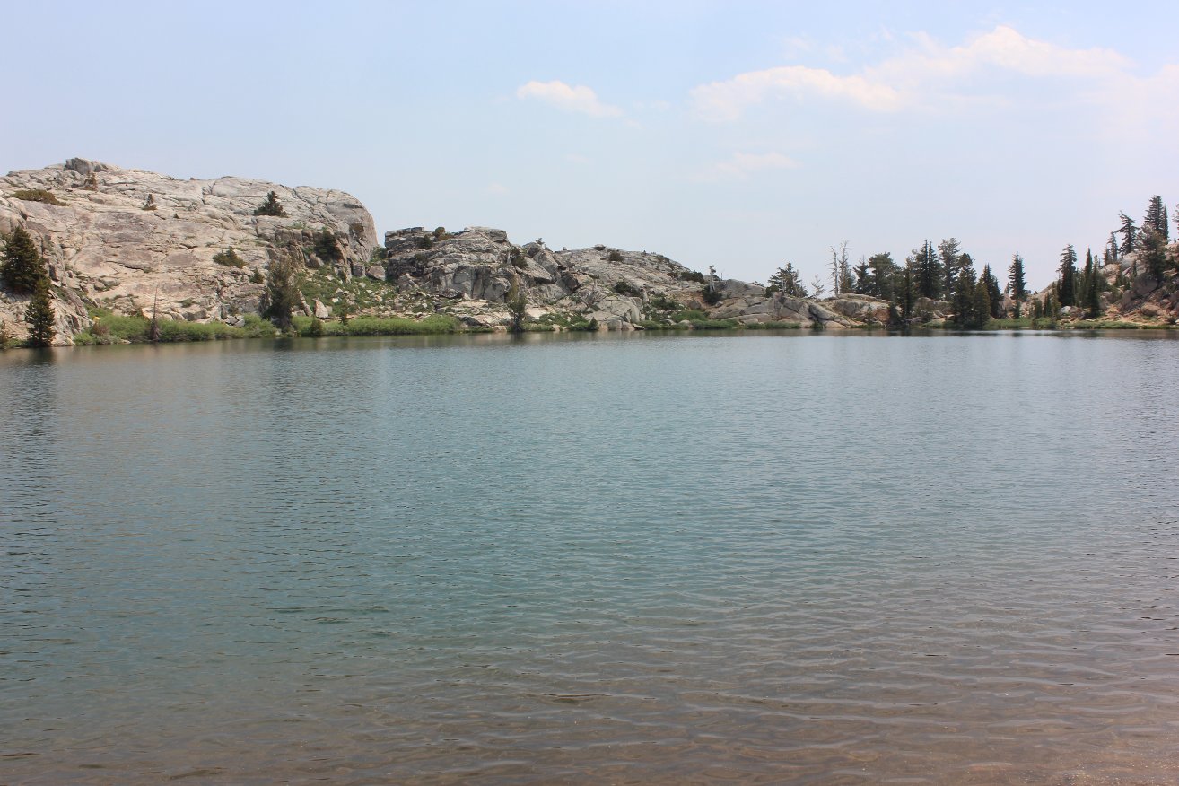
Another look back at Granite
Lake from near where the trail jogs left and climbs up and away from
the lake. |
 |
|
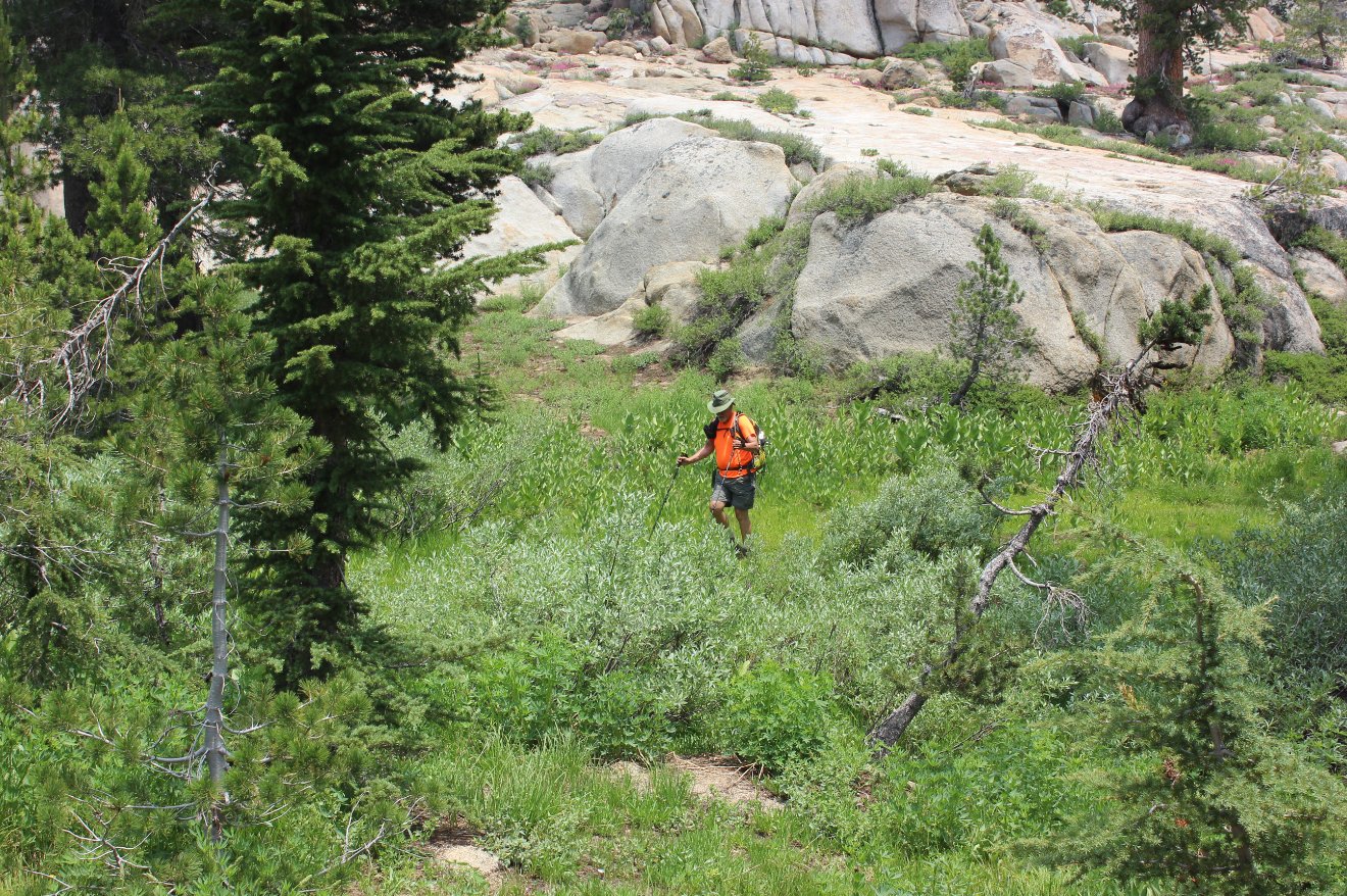
Passing through the abundant
greenery fed by the first natural spring along the trail past Granite
Lake. |
 |
|
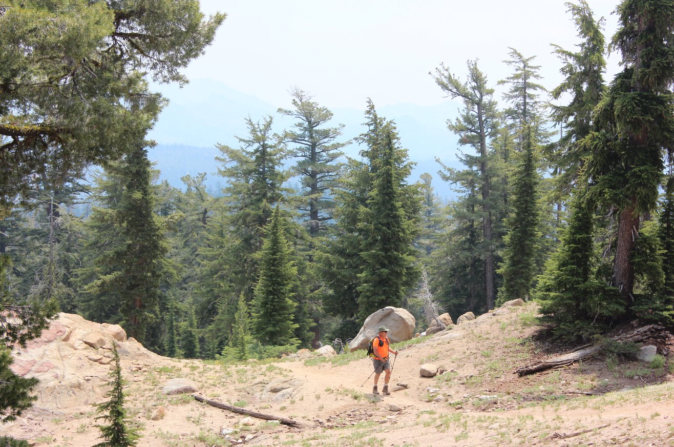
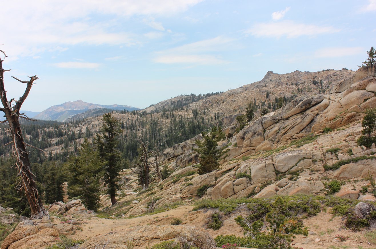
As the trail starts to climb
along the south ridge of Deadwood, the views to the south really open
up. |
 |
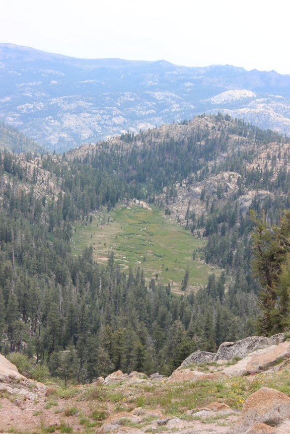
|
Looking down at Meadow Lake
further south from the trail. |
 |
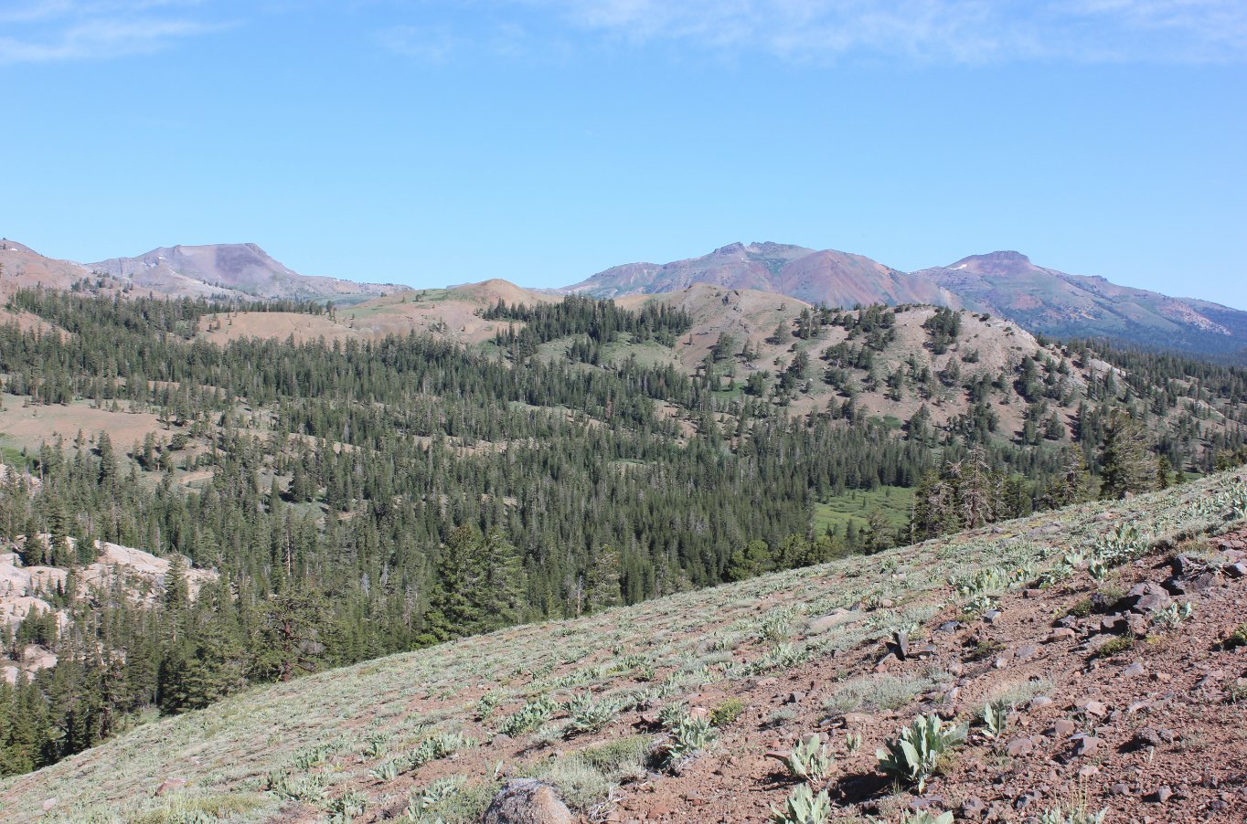
|
Looking west toward Mokelumne
Peak. |
 |
|
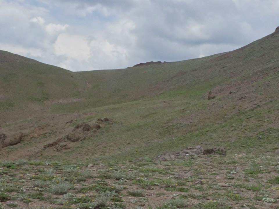
One of the steep sections of
trail as it gets closer to Deadwood Peak, just barely visible in the
background. |
 |
|
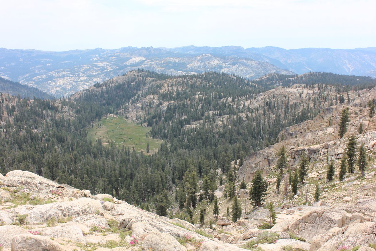
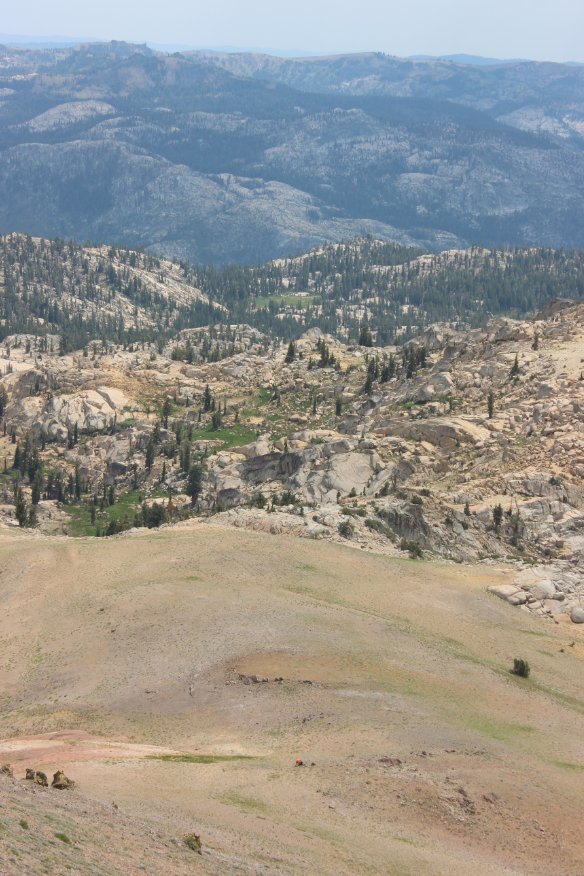
The
meadow below has a meandering stream through it which is fed by three
separate springs which come out of the mountain just above the trail. |
 |
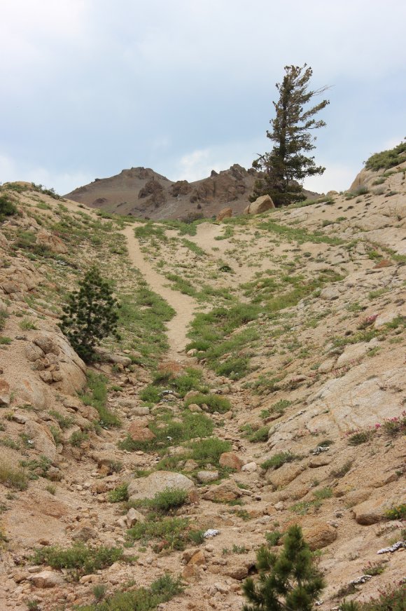
|
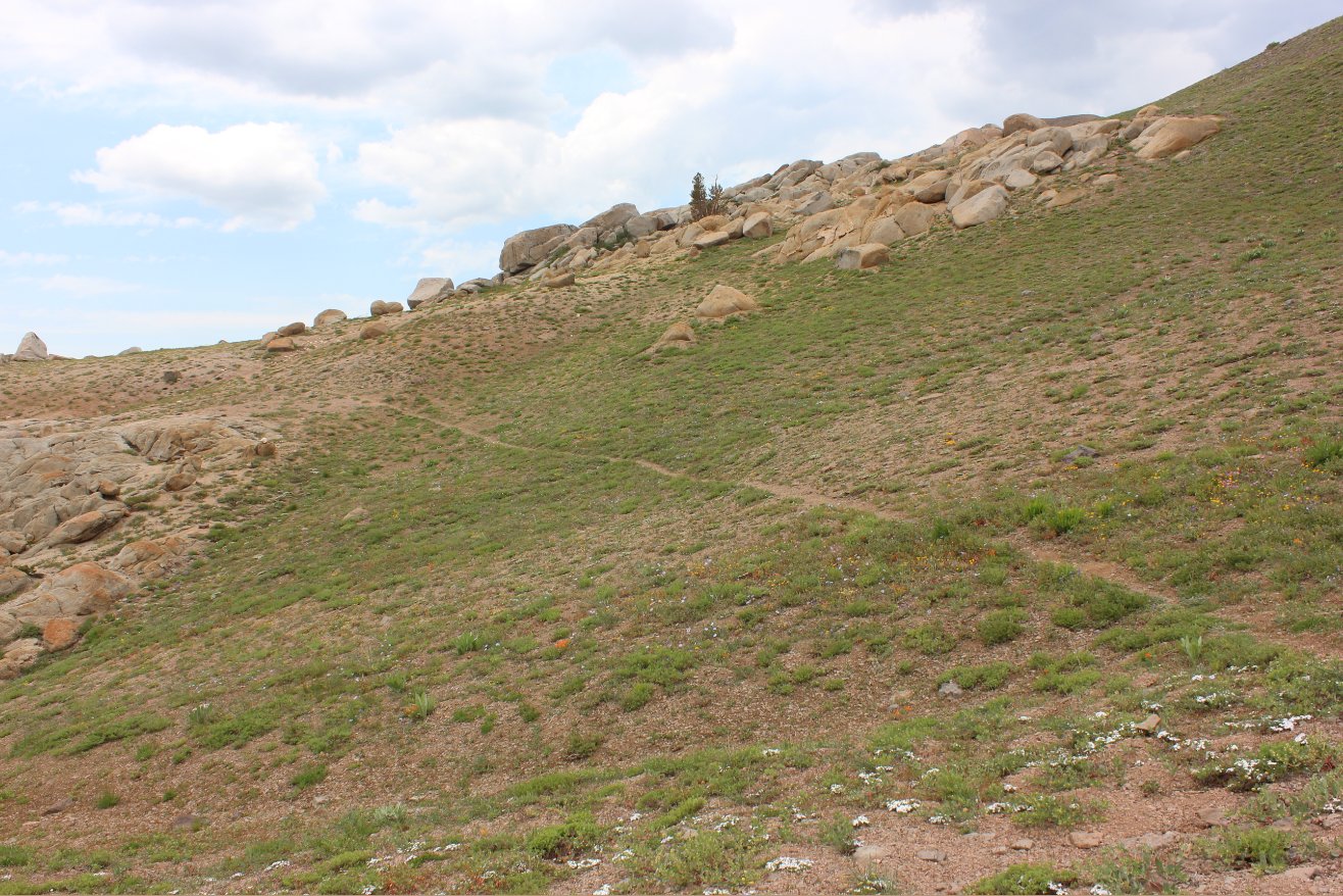
Trail up to the last rise
before an ascent directly up to Deadwood Peak. |
 |
|
Me near the top (center)
making my assault on the last 500' to the peak. |
 |
|
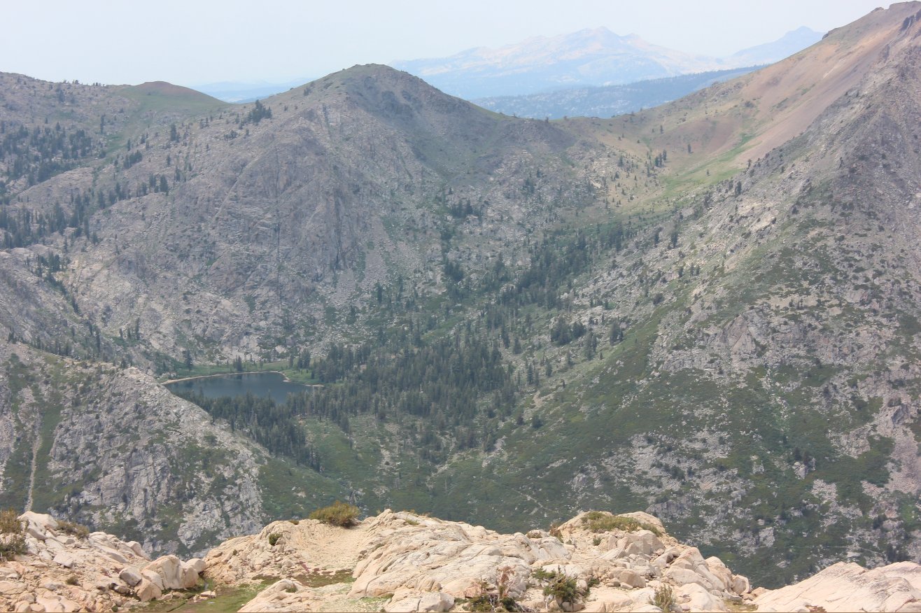
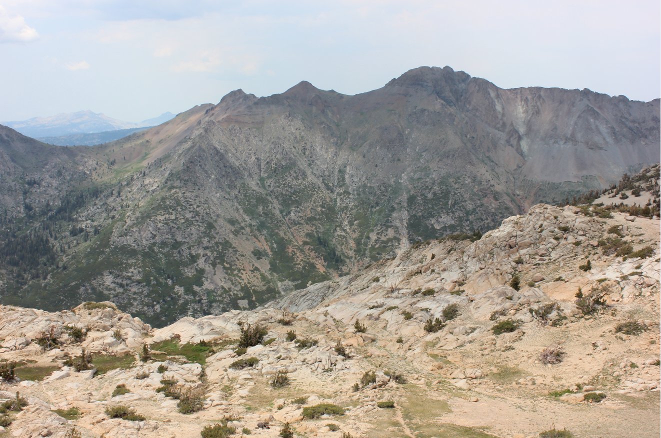
Looking
across at 4th of July Lake and Pass across Summit City Canyon.
The trail out of the canyon to the Lake and beyond can be seen to the
lower right in the pic. |
 |
|
A look across Summit City
Canyon at the extremely steep backside of Round Top Mountain. |
 |
|
Looking
back down toward the trail, with my hiking partner Mark keeping an eye
on my pack which I left for the climb to the peak. |
 |
|
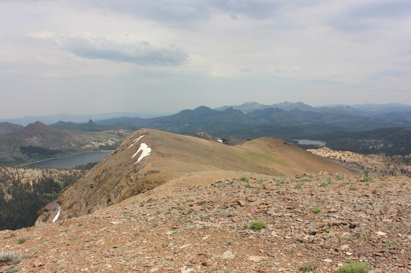
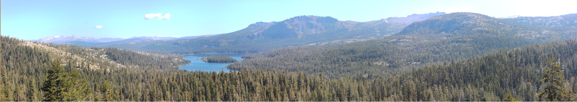
Looking back at Upper Blue
Lake from the top of Deadwood Peak. |
 |
|
One more look on the way back
at the spring meadow far below the trail. |
 |
|
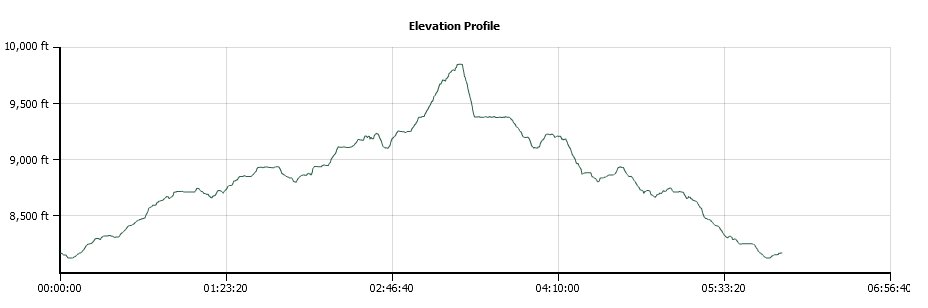
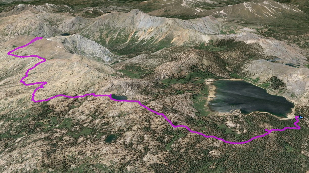
GPS Track of the full
hike. |
|