Back to index Caples Creek Drainage Hike

Trip Date:  06/26/2020

Distance
: 9.5 Miles

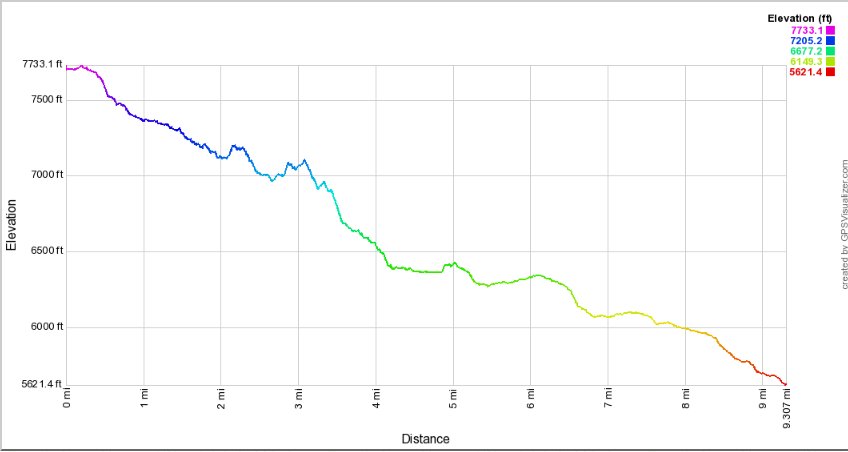
Vertical Gain: 200' (2100' loss)

Group Size: 5
Hike Rating:  Easy   Moderate    Hard   Strenuous
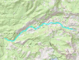
Caples Creek Drainage Route
Download GPXGPX for this trip

Caples Creek Drainage Elevation Profile
Start Coordinates:   N 38 42.402 W 120 05.251     End Coordinates:   N 38 41.696 W 120 11.931
Car Shuttle Req'd:   Yes
Parking Directions:   For the starting point, park at the Kirkwood Lake parking area.  This is found along Highway 88 just about a mile west of the Carson Spur near Kirkwood Ski Resort area.  
For the ending point, park at the Caples Creek trailhead, just east of the bridge over the Silver Fork River along Silverfork Road.  
Hazards of Note:   The first 6 miles of this adventure are all off-trail and will require significant route finding and bush whacking.  Do not attempt this trip if you are not prepared for difficult terrain and the posibility of having to spend an overnight in the area.


Crowd Factor:   None until you reach the trail connecting Government Meadow to the Caples Creek Trailhead 4 miles away.
General Notes:
From the parking area at Kirkwood Lake, head toward the information kiosks and  then find a small use trail heading north through the campgrounds in the area.  You will follow this trail down toward Caples Creek for this first half mile until you reach a sizeable waterfall along the creek.  Head downstream for a ways until you can find a safe way to cross the creek.   You will then stay on this north side of the creek for the rest of the trip.   Significant route finding will be necessary in this area for the next 5 miles, as there are steep granite routes all through this area.  Stay as close to the creek as possible without  getting caught  in any creek canyons.
About 4 miles into this route the difficult terrain will flatten out, and you need to navigate toward Government Meadow so that you can pick up the regular trail for the last four miles of the trip.

Checking out a rare pay phone at the Kirkwood Lake trailhead.  Head to the left of these signs to pick up the use trail toward the creek.
Starting out
Once you find this waterfall along Caples Creek, you will need to figure out a safe way to cross this.  We have found one safe crossing above the falls and then another in a slower moving section about a 1/2 mile downstream from this location.
Waterfall

One of our group, Steve checking out some of the terrain that lay in front of us on this trip.
What's ahead

Looking for a good way up and over one of the many granite rises which lay in front of us.
Determining the way

More routefinding along the way. Continuing on down

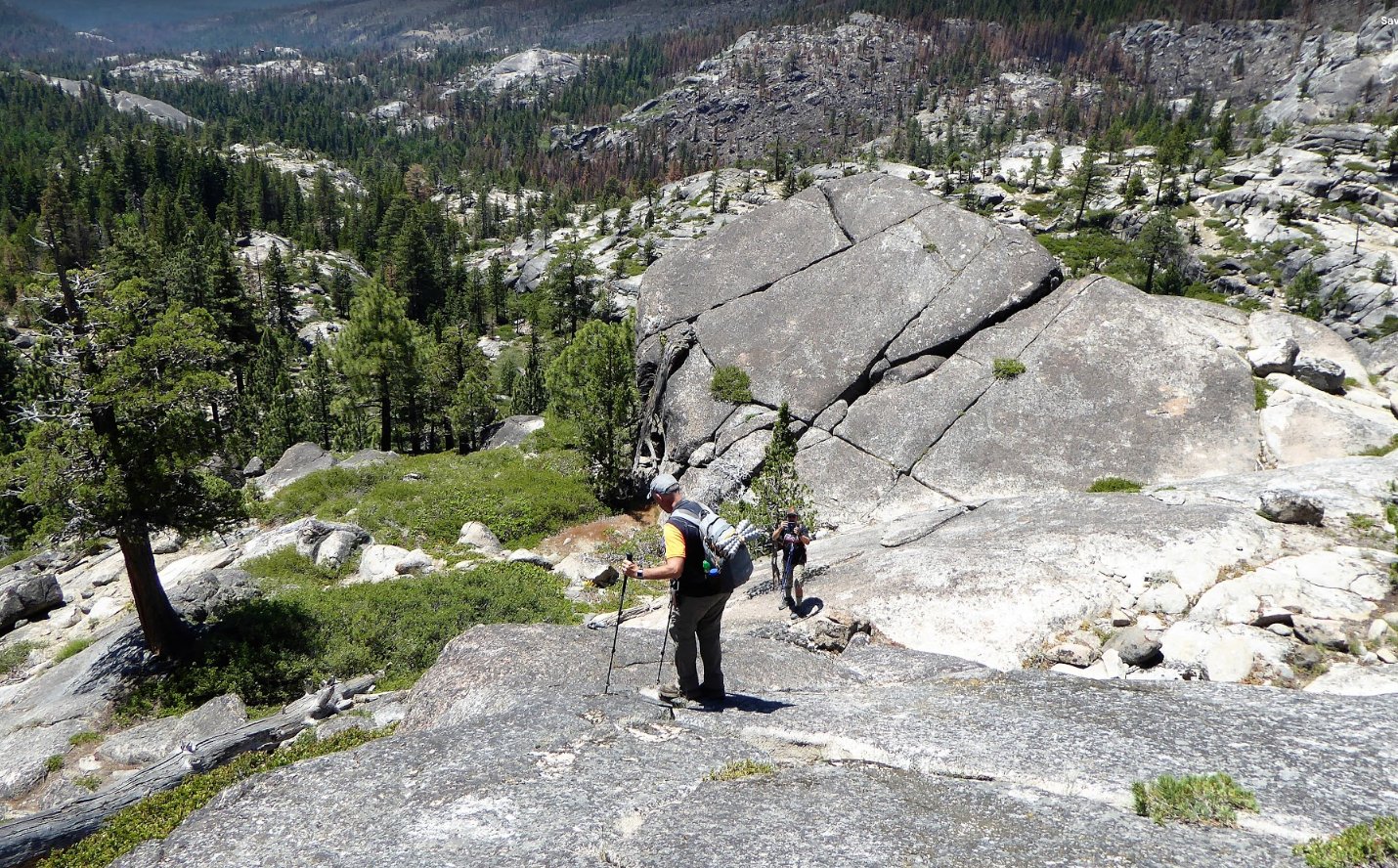
Making my way carefully down the steep granite on the back side of one of the granite rises in the area.
Careful footing
We found a great spot for lunch in the shade of a tree about 4 hours and 4 miles down the creek.
Lunch spot

A very picturesque unnamed lake we found along the way.
Unnamed Lake    

Another example of the type of terrain that we had to navigate on our way down the creek drainage area.
Terrain

A good look across the way toward Castle Point.  This is one of the best vantage points of the reason this place has that particular name.
Castle Point
One of the last sections of rough terrain we had to traverse before finally finding a reasonable flat area for the next mile to Government Meadow.
More terrain
The very welcome relief of a flat area after the rough terrain over the first 5 miles.
Flat Spot
The view of Government Meadow from the first actual trail we have been on all day.
Government Meadow
A glimpse of what much of the Caples Creek trail now looks like after a controlled burn in the area escaped and because a serious issue during the previous summer.
Fire scars
The unusual sight of a tree trunk and roots which have completely burned out and left this distinctive hole in the ground.
Burned out root

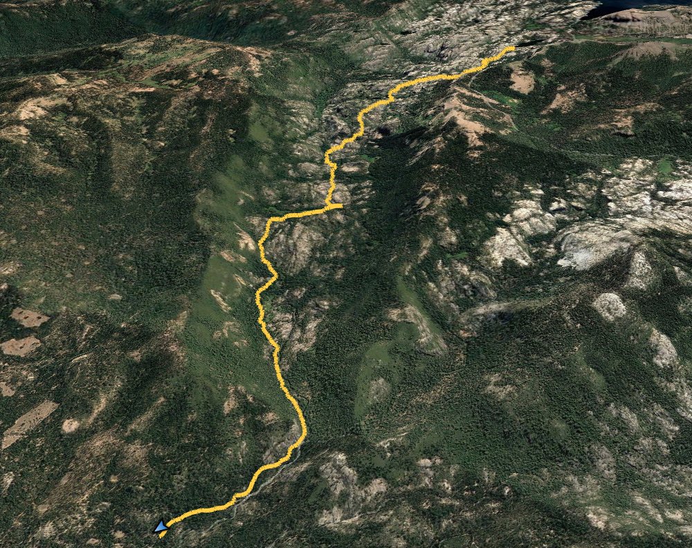
GPS Track of the full hike and then the off-trail section as well. GPS Track of Hike GPS Track of Hike