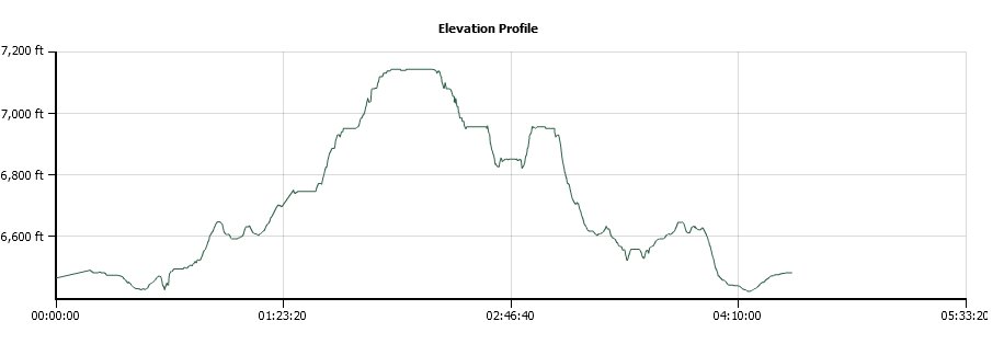
Distance: 6.7 Miles
Vertical Gain: 1000'
Group Size: 3
Hike Rating: Easy Moderate Hard Strenuous
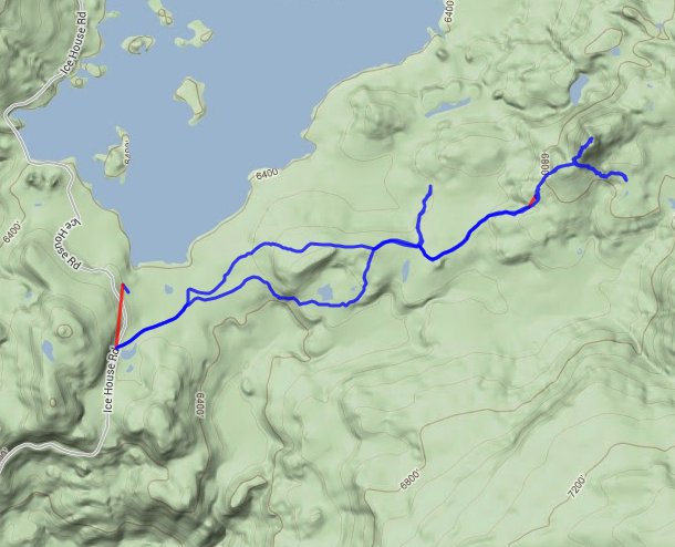
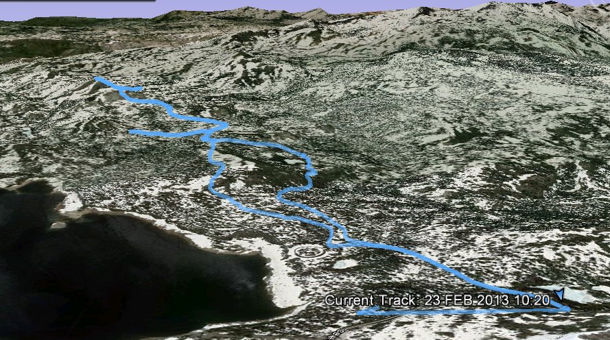
 GPX for
this trip
GPX for
this trip
| Start Coordinates: | N 38 58.565 W 120 19.503 | End Coordinates: | Same as Start Coordinates | ||
| Car Shuttle Req'd: | No | Parking Directions: | Take
the Ice House Road from Highway 50 and follow it for about 25 miles
north to the Loon Lake campground area. If the gate is closed
you
will have to park at that junction, otherwise you can cut a couple of
miles off the trip by parking in the campground area. |
||
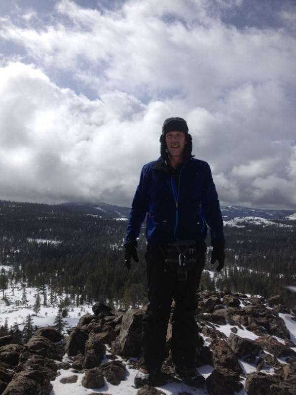
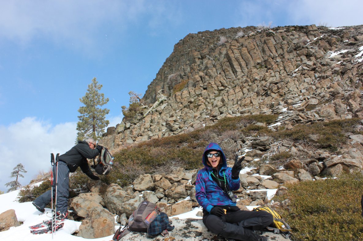
| Hazards of Note: | Class 3 rock scrambling to the top of Brown Mountain | Crowd Factor: | Moderate. This is a fairly popular snowshoe and cross country skiing route. | ||
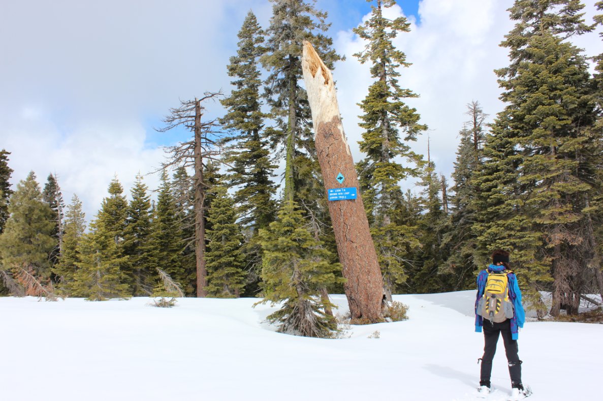
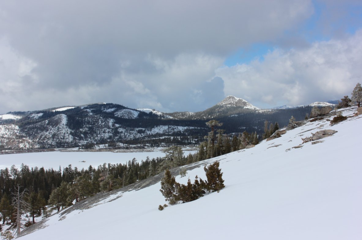
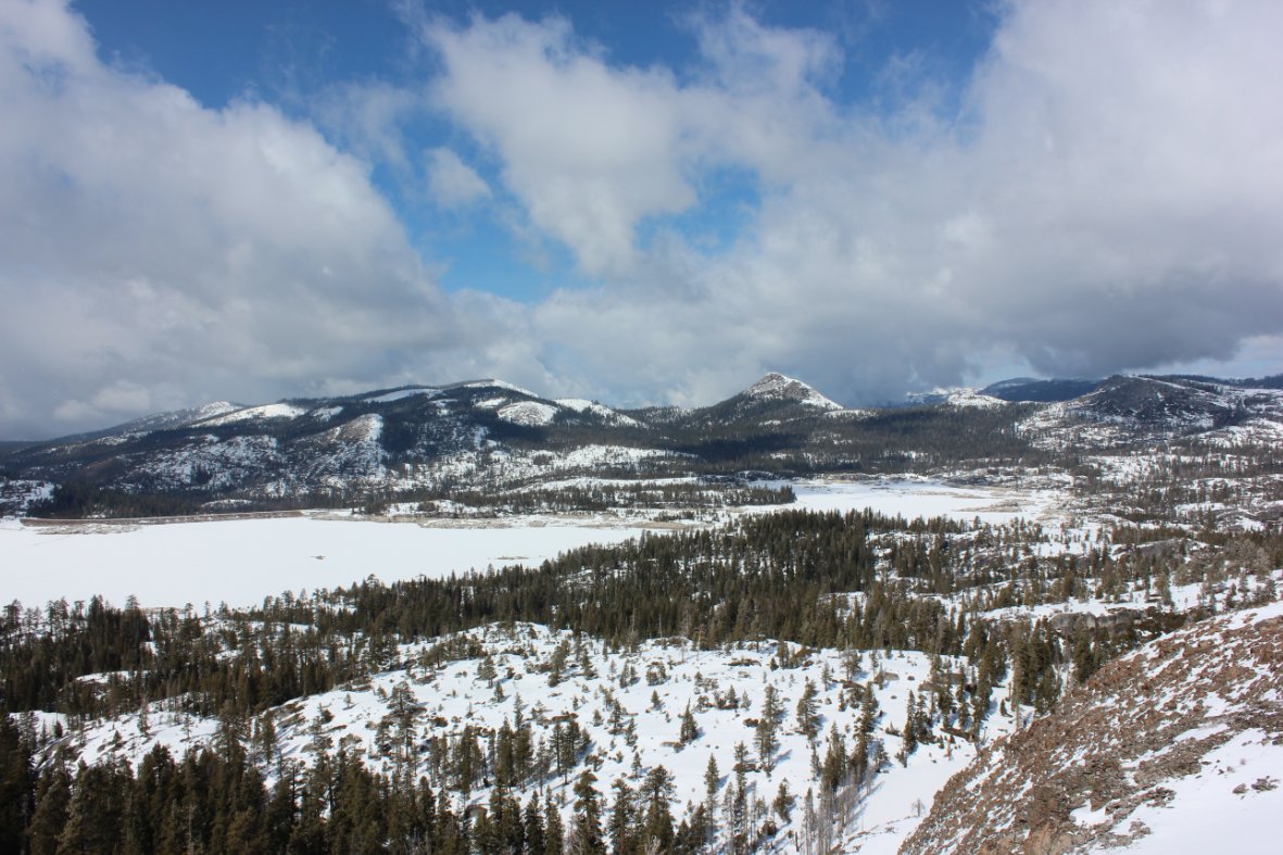
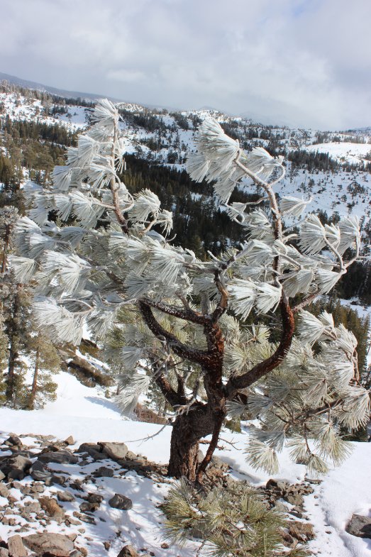
| General Notes: Follow the blue diamond markings in the trees along the trail to make your way east on this trail if there haven't been others there blazing the way after new snow. Once you get to the SW base of Brown Mountain, it is a scramble up granite boulders to attain the top of the mountain. The views of Loon Lake are tremendous from the peak. |
|||||

