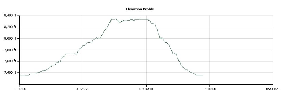
Distance: 4.3 Miles
Vertical Gain: 1000'
Group Size: 4
Hike Rating: Easy Moderate Hard Strenuous
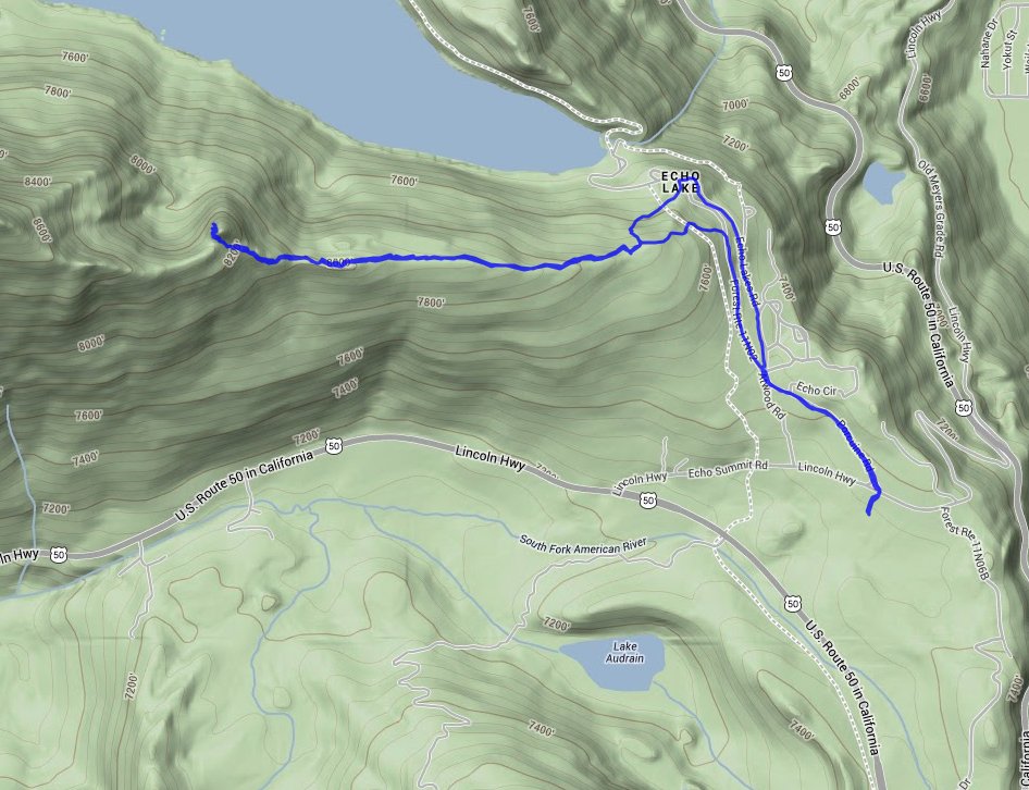
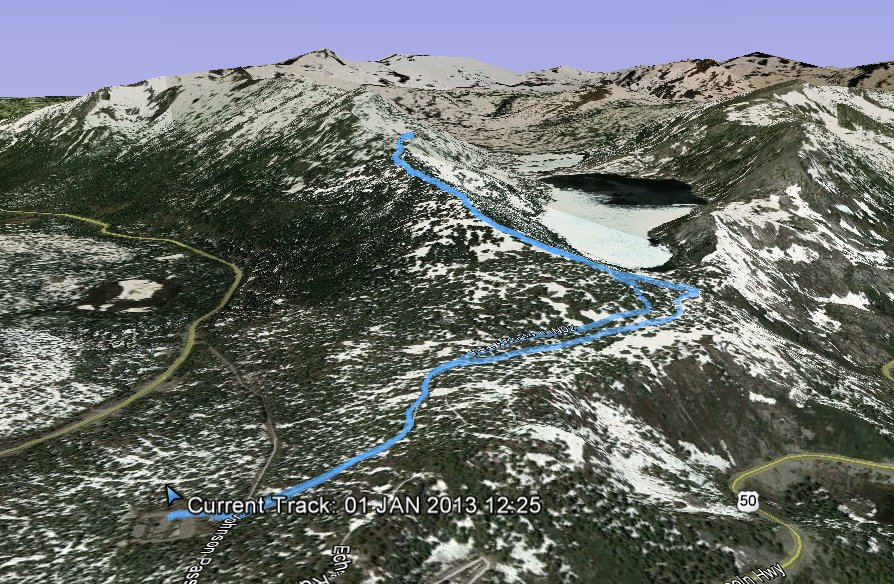
 GPX for
this trip
GPX for
this trip
| Start Coordinates: | N 38 49.403, W 120 02.047 | End Coordinates: | Same as Start Coordinates | ||
| Car Shuttle Req'd: | No | Parking Directions: | Take Highway 50 to the turnoff (Lincoln Highway) toward Echo Lakes. Turn right into the snow park parking area at the coordinates listed. Be sure to have a winter snow park parking permit for your vehicle to avoid a hefty fine during the winter. | ||
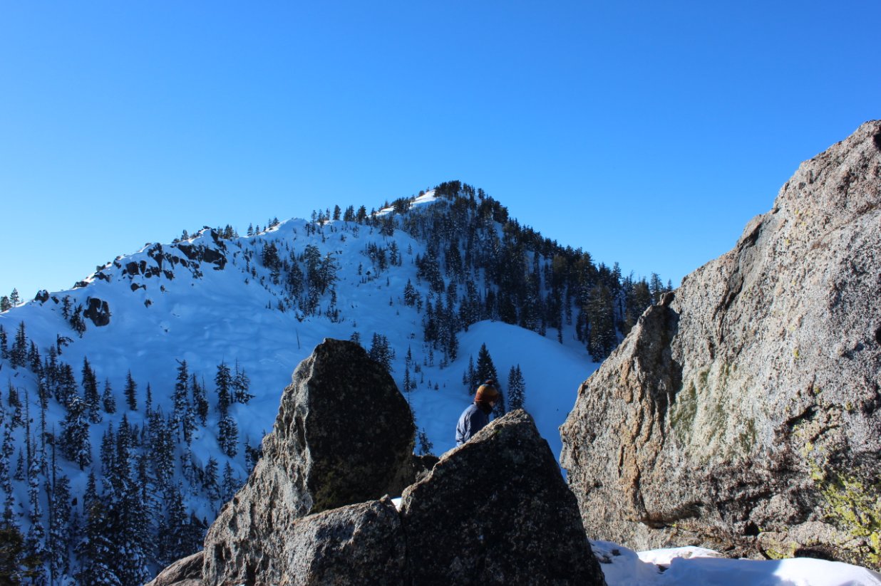
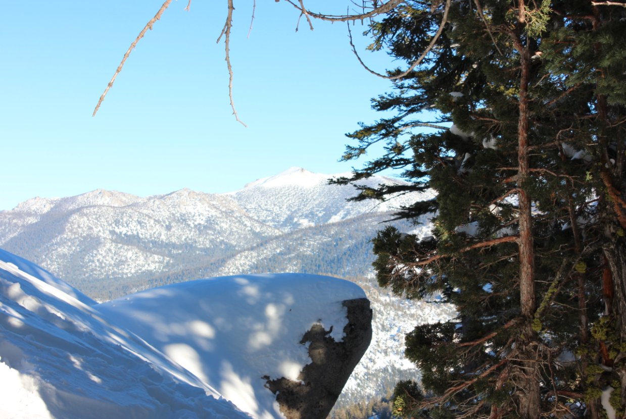
| Hazards of Note: | None. | Crowd Factor: | Moderate. This entire area, including Echo Lakes and Becker Peak are popular snowshoe destinations. | ||
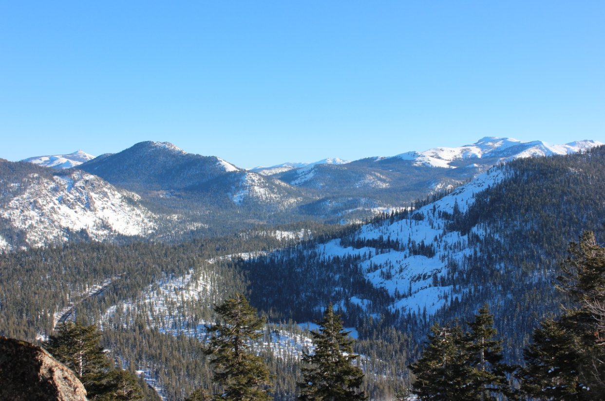
| General Notes: From the parking area head back up toward Echo Summit road, and hike up Porcupine Road until you reach the turnoff to head up to Becker Peak (Forest Road 11N02.) Follow previous tracks to the peak, or make your own after a recent snowfall. |
|||||