
|
Wheeler
Ridge Hike
|
|
Trip Date: 7/12/2019
Distance: 6.0 Miles
Vertical Gain:
1400'
Group Size:
1
Hike Rating: Easy
Moderate
Hard
Strenuous |
 See
video of hike
See
video of hike
 GPX for
this trip
GPX for
this trip
|
|
|
Start Coordinates: |
N 38 29.611, W 119 58.845 |
|
End Coordinates: |
Same as Start Coordinates |
| Car Shuttle
Req'd: |
No |
|
Parking
Directions: |
Take
Highway 4 to the parking area just about a mile east of the eastern end
of Lake Alpine. Turn north into the Woodchuck Basin parking
area, which has ample room for at least 10 parked cars.
|
| Hazards of
Note: |
Route-finding, wilderness
environment, snow, wildlife.
|
|
Crowd Factor: |
Moderate. The
Woodchuck Basin trailhead is one of the lesser known trails into the
Mokelumne Wilderness, but it is a relatively popular trail even for
shorter hikes. |
General Notes:
From
the parking area you will find the trail just past the information
kiosk to the north. The trail can be a little difficult to
pick up early on, especially when there is snow on the ground, but just
keep heading north and stay on the eastern side of the creek.
The trail winds through the forest for the first half mile,
and then gradually opens up and enters the Mokelumne Wilderness after
about a mile. From here the trail bends northwest, until you
reach the ridgeline and an unsigned junction with three trails.
The one heading straight and back down the other side of the
ridge will take you toward Wheeler Lake and further up into Underwood
Canyon. The trail to the west heads back down eventually
toward Lake Alpine, and the thin use trail to the east is the one you
will take to head along the ridgeline. Follow this general
direction for a couple of miles until you reach the basalt formation
just past the Wheeler Ridge summit register. Head back down
to the trailhead retracing your steps or follow the natural,
easy-sloping draw back about 1/2 mile to the west.
|
|
|
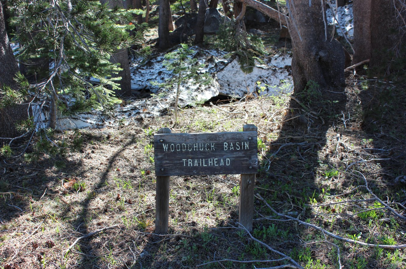
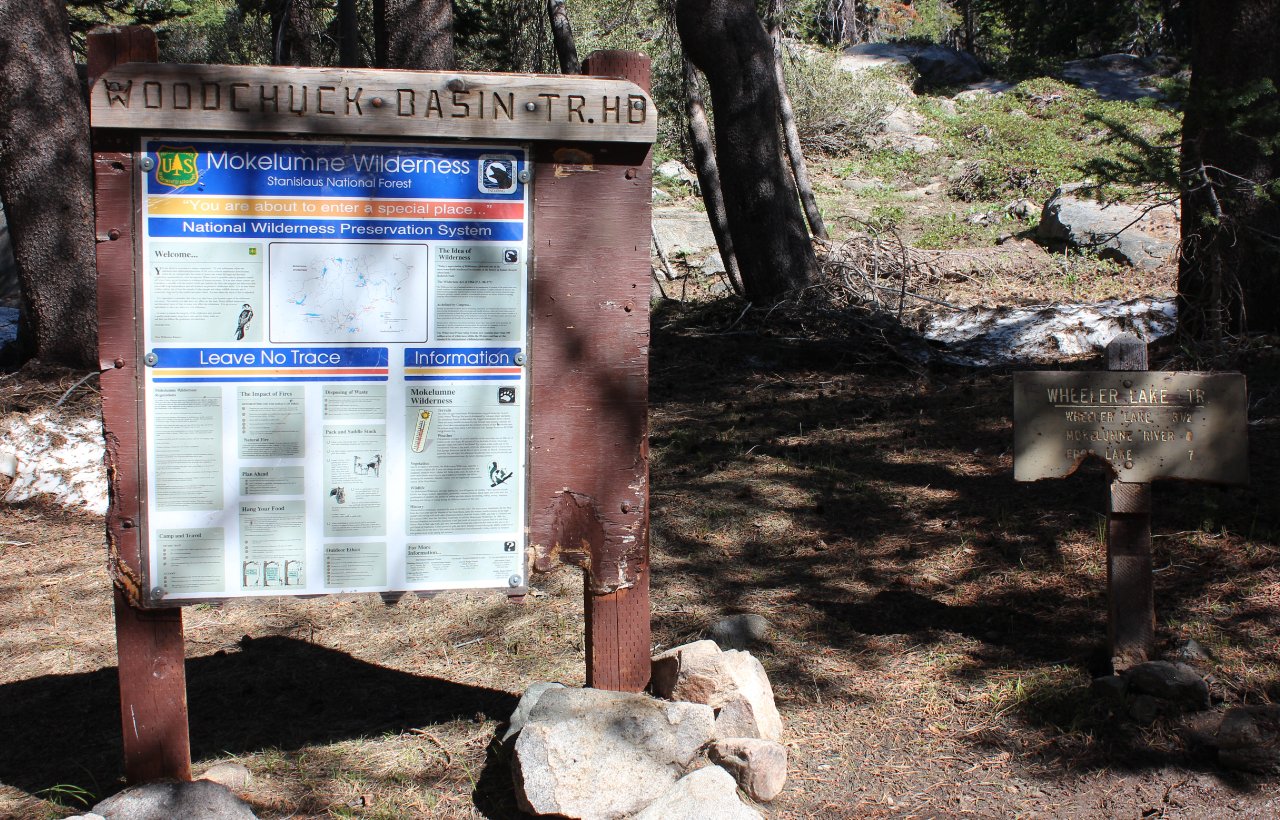
This is the small sign at the
entrance to the parking area for the Wheeler Lake trailhead and
Woodchuck Basin. |
 |
|
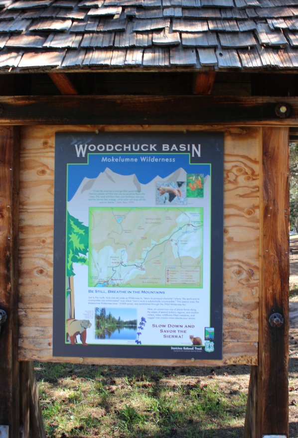
The actual trail starts just
past this information kiosk north of the parking area. |
 |
|
A quarter mile up the trail is
another information sign, including a mileage info marker indicating 3
1/2 miles to Wheeler Lake and 7 miles to Frog Lake deep in the
Mokelumne Wilderness. |
 |
|
When the trail opens up as you
near the Wilderness boundary, you get a good view of the ridgeline
which you will traverse across later on. |
 |
|
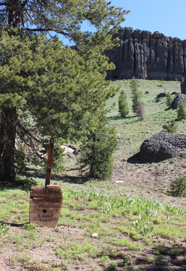
Once you pass this sign you
will be in the Mokelumne Wilderness for most of the rest of the hike.
|
 |
|
As you climb up the ridge, you
will start to get expansive views to the south of Lake Alpine and the
mountains of the Carson-Iceberg Wilderness further on. |
 |
|
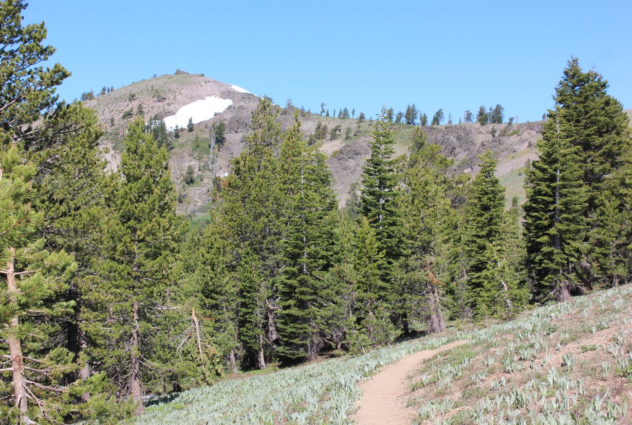
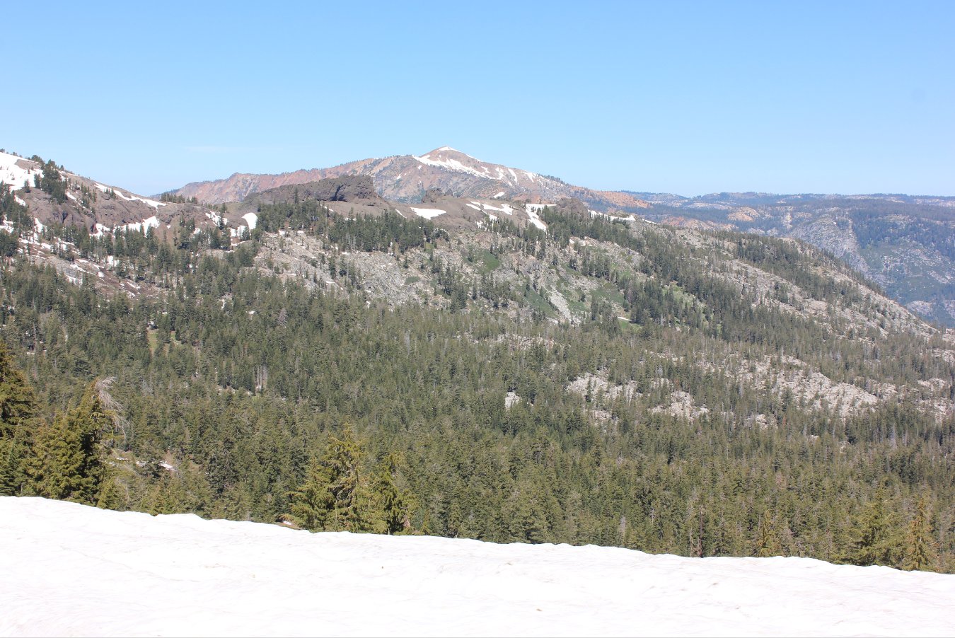
Nearing the top of the ridge
you will see an enticing peak to the west that undoubtedly offers
amazing views in all directions. |
 |
|
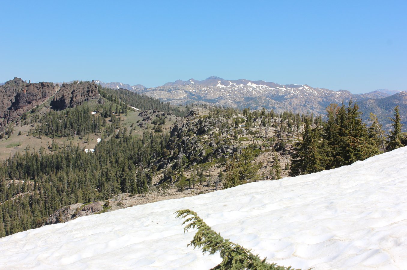
Reaching the top of the ridge,
a phenominal view north toward Round Top mountain far in the distance
awaits. |
 |
|
To the northwest is a clear
view of Mokelumne Peak, and the Mokelumne Tetons on the southeastern
side of the mountain. |
 |
|
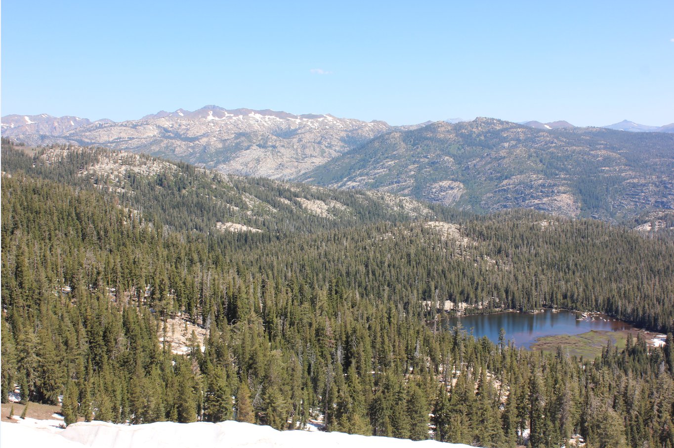
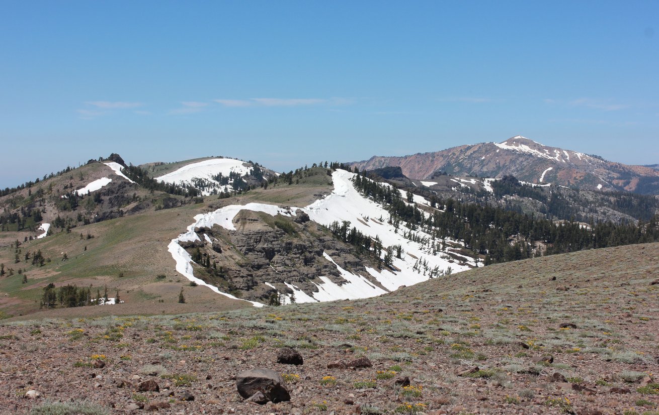
On this early season date the
north side ridge cornices blocked any attempt to reach Wheeler Lake
down in the Underwood Valley, but the setting is amazing and awaits
another day. |
 |
|
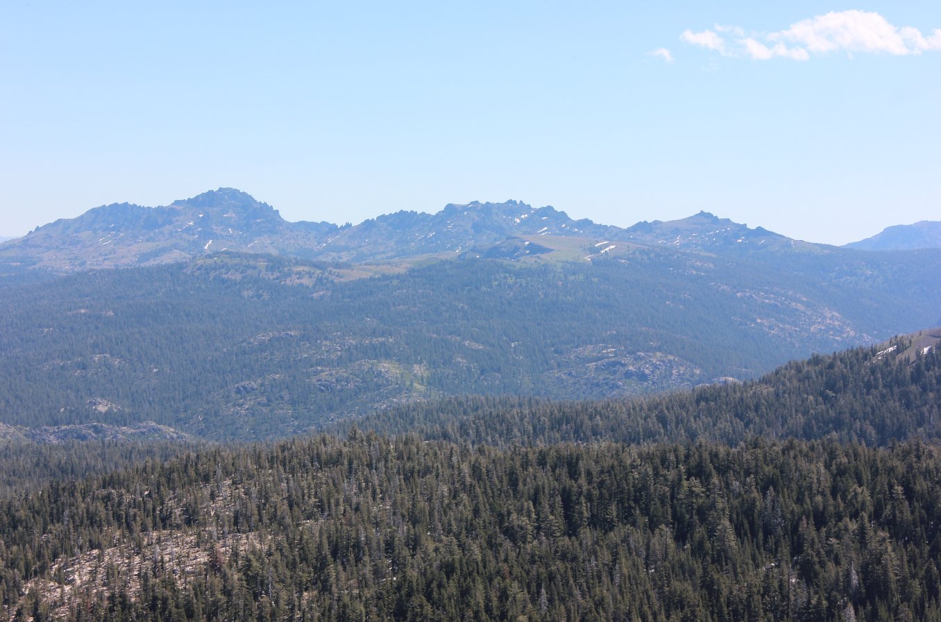
Along the ridgeline, to the
northeast are clear views of the western side of Raymond and Reynolds
Peaks, just west of the Pacific Crest Trail. |
 |
|
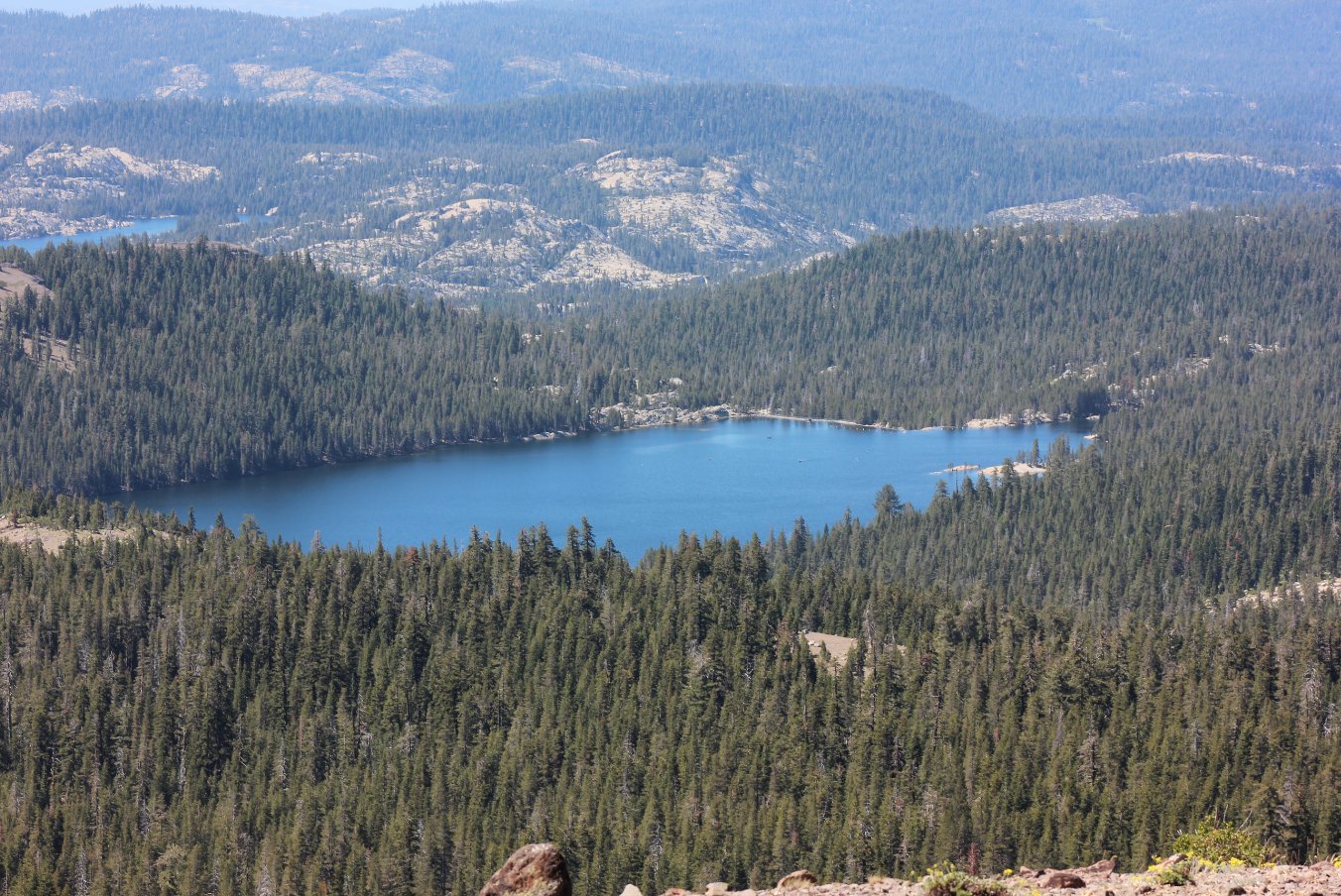
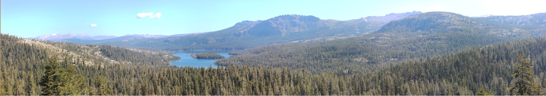
A good view of Lake Alpine and
Spicer Meadow Reservoir past it await from the ridgeline. |
 |
|
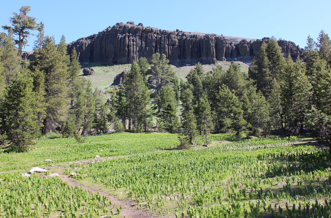
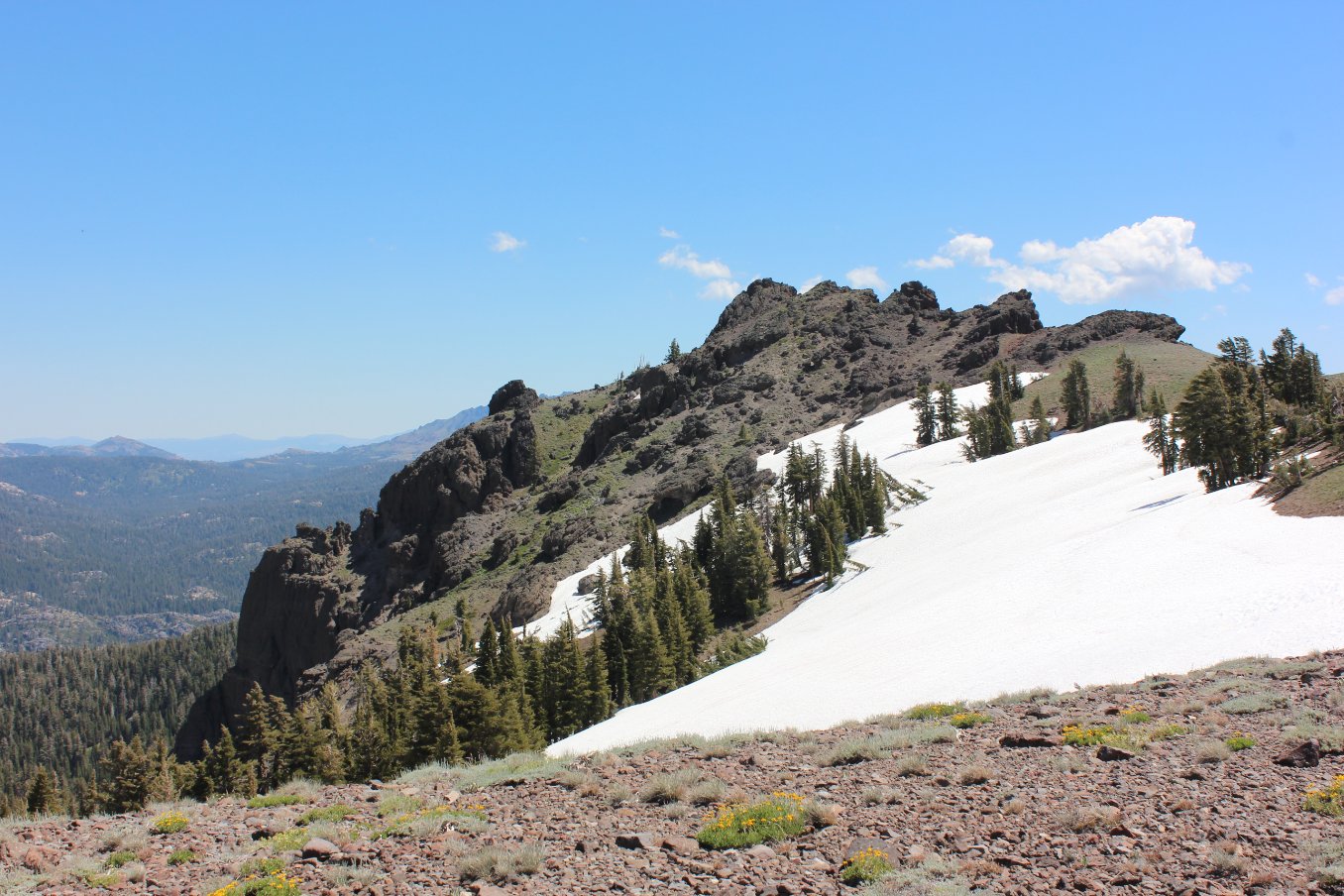
This distant basalt formation
is your turnaround destination for this particular trek. |
 |
|
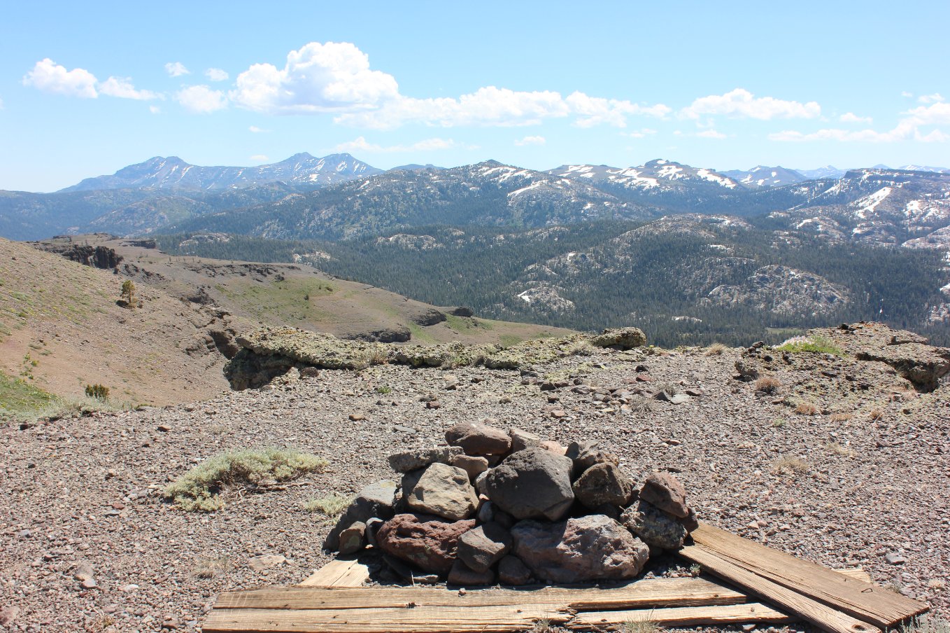
Near the destination is a
well-buried summit register with the Carson-Iceberg mountains (and
beyond) amazingly visible on a clear day. |
 |
|
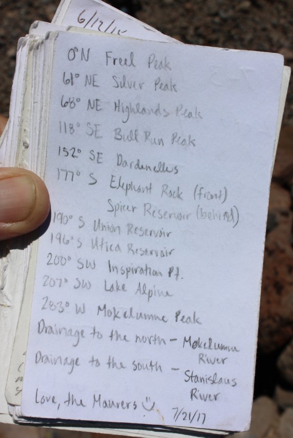
A helpful locator card was
found in the summit register. |
 |
|
A good view back along the
ridgeline just traversed from where the Wheeler Lake trail crested the
ridgeline. |
 |
|
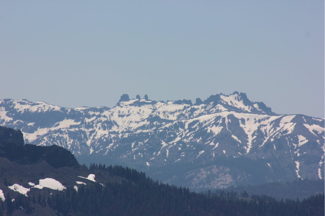
A closer look at the 3
Chimneys mountain south of Sonora Pass, with just a glimpse of the
Dardenelles in the foreground. |
 |
|
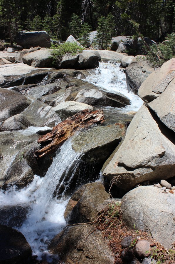
A waterfall off the trail
pretty close to the start of the trek. |
 |
|
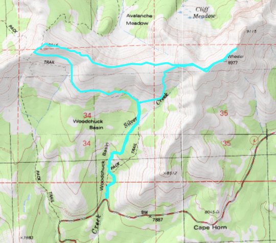
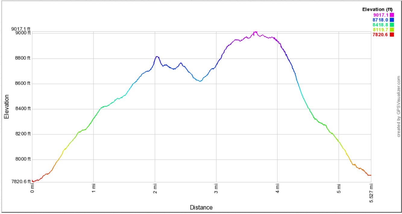
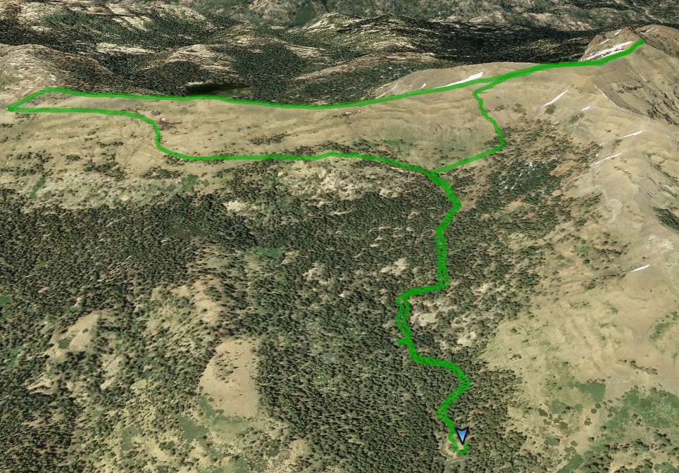
GPS Track of the full hike. |
 |