
|
Waterwheel
Falls Hike
|
|
Trip Date: 08/19/2016
Distance: 6.5 Miles
Vertical Gain:
1200'
Group Size:
2
Hike Rating:
Easy
Moderate
Hard
Strenuous |

 GPX for
this trip
GPX for
this trip
|
|

|
Start Coordinates: |
N 37 54.541, W 119 25.146 -
Location of Glen Aulin High Sierra Camp, 7 miles from the nearest
parking area. |
|
End Coordinates: |
Same as Start Coordinates
|
| Car Shuttle
Req'd: |
No |
|
Parking
Directions: |
Take Highway 120 (Tioga Pass
Road) into Yosemite National Park. Parking for the Glen Aulin
High Sierra Camp is available at the Wilderness Permit office near
Lembert Dome and there is other trailhead parking along the road. |
| Hazards of
Note: |
Significant elevation loss and
then gain over the 3.5 miles out and then 3.5 miles back to Glen Aulin. |
|
Crowd Factor: |
sModerate. Glen
Aulin is a popular destination within Yosemite, but Waterwheel Falls is
a long hike out of the way for those heading elsewhere from the High
Sierra Camp location. |
General Notes:
From
Glen Aulin High Sierra Camp, take the first bridge to the north back
across the river, and then turn right onto the Pacific Crest Trail.
There is then a junction just a couple hundred feet up the
trail on the left, pointing to Waterwheel Falls a little more than 3
miles to the north. Head up the small ridge past the sunset
rock on your left which is popular with the overnight campers and the
trail then heads down the granite along the east side of the Tuolumne
River. This is the beginning of the Grand Canyon of the
Tuolumne, which heads down for miles until it reaches the start of
Hetch Hetchy Reservoir at the far end. Across the river early
on is the original location for the Glen Aulin High Sierra Camp, which
was moved to the current location for a few reasons such as there
incessant mosquitos during the early summer.
After a mile you will reach California Falls, and then the trail begins
to drop down along the river in earnest. The rest of the way
down to Waterwheel Falls is more of the same, until you reach the
namesake location.
|
|
|
Looking back at the Glen Aulin
bridge over the Tuolumne River near the very beginning of the hike. |
 |
|
After a short first climb up
to 'Sunset Rock' south of the High Sierra Camp, the old location of the
Glen Aulin camp can be seen just across the river.
|
 |
|
The first part of the trail is
very flat with little elevation change, following along the east side
of the Tuolumne as it gently meanders along this section. |
 |
|
Looking back up the river from
the way you came offers no hint as to the raging river and drop in
elevation which awaits not too much further ahead. |
 |
|
After a mile the trail winds
through some exceptionally large granite boulders which have fallen
from high above, as well as this smooth granite 'ramp' on the east side
of the trail. |
 |
|
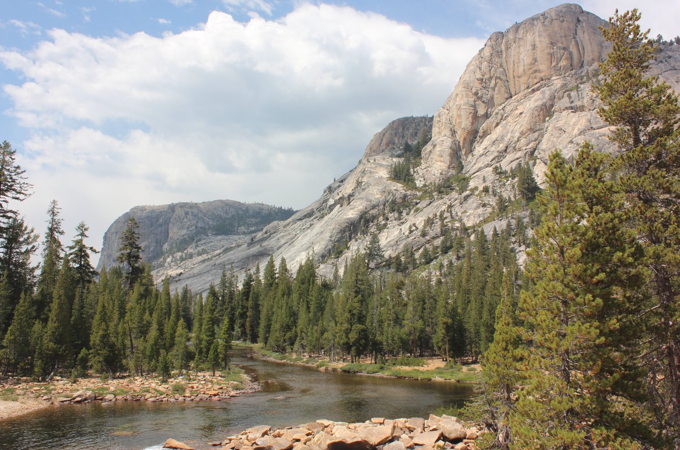
Some impressive granite
monoliths line the trail on either side as you pass through the
ever-deepening canyon heading down to the falls. |
 |
|
Halfway down the trail is
California Falls, which can be heard from the trail but only seen
partially through obscured views. A small, but obvious use
path off to the left will take you on a slight detour to a much better
view of the falls.
|
 |
|
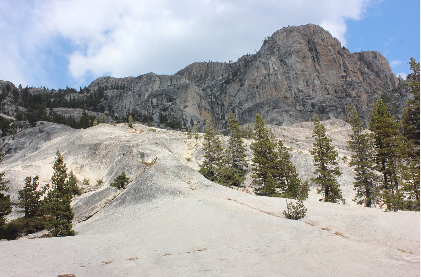
Some of the granite in open
areas along the trail have been smoothed by glacial movement to almost
impossible smoothness. |
 |
|
Just about to the falls the
canyon begins to drop off significantly, and many people have been
known to mistakenly continue on down to the bridge over Return Creek
1/2 mile distant. Here Mark is checking out the best place
for us to hang out at the falls. |
 |
|
Just at Waterwheel Falls, the
view further into the canyon is truly spectacular, and begs for further
exploration in the area on a future trip.
|
 |
|
A first glance at Waterwheel
falls as we approached it from the east side. Others in the
area actually crossed the river before the falls and scrambled along
the rocks on the other side of the river as well. |
 |
|
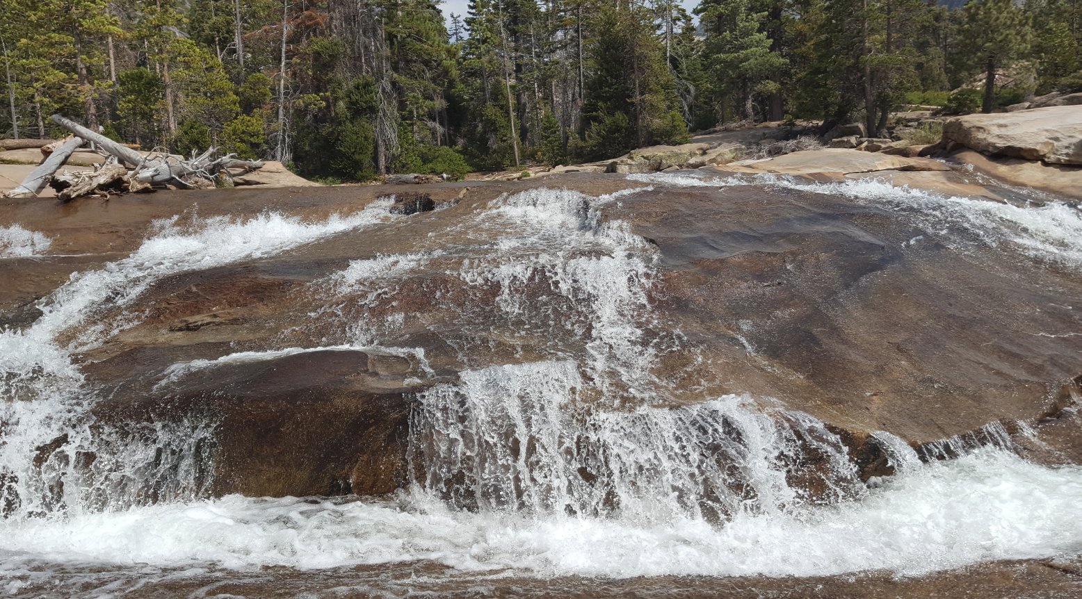
Although the water was a
little low in late August, the waterwheel effect was still visible as
the dropping water hit hard off flat ledges on the way down, bouncing
back up and being caught by the wind coming up the canyon to
effectively create the Waterwheel Effect the falls are named for. |
 |
|
After a long hike to Glen
Aulin and then down this canyon, Mark found a nice spot for us to soak
our feet before we turned around to head back up the 3 1/2 miles to
camp. |
 |
|
The upper section of the falls
area, where we found a good spot to soak our feet before the return
trip. |
 |
|
GPS Track of the full hike. |
 |