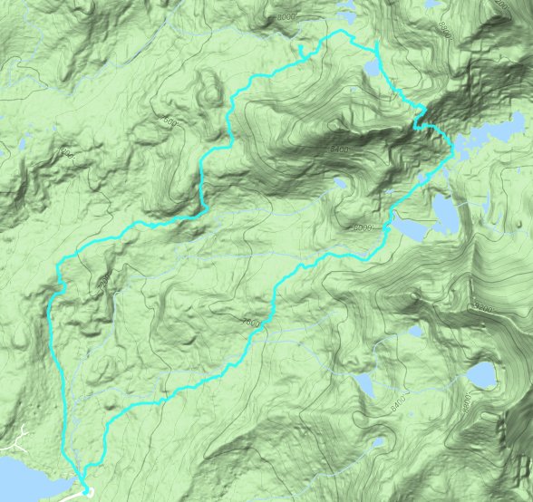
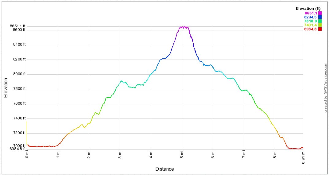
Distance: 9.5 Miles
Vertical Gain: 2000'
Group Size: 4
Hike Rating: Easy Moderate Hard Strenuous
 See
video of hike
See
video of hike
 GPX for
this trip
GPX for
this trip
| Start Coordinates: | N 38 50.063, W 120 02.641 or overflow parking at N 38 50.542, W 120 14.120 |
End Coordinates: | Same as Start Coordinates | ||
| Car Shuttle Req'd: | No | Parking Directions: | Take Highway 50 to Wrights Lake Road, and head approximately 8 miles north until you get to the entrance to the Wrights Lake recreation area (if this gate is closed you have to park just to the right before this spot and add a mile to the hike from this location each way.) Turn right at the junction and drive along the south end of the lake for a mile until you reach the Desolation Wilderness Trailhead parking area at the coordinates provided. | ||
| Hazards of Note: | The trail is rocky along the first part, and there might be some early season trail finding along the granite before the main rise in the trail toward the lakes. | Crowd Factor: | Tyler/Getrude Trail: Low to
Moderate. This is a lesser-travelled trail and does not
typically offer access into Desolation Wilderness proper so it is
less-frequented. Island/Twin Lakes Trail: Moderate to High. There are many people who access this trail into Desolation, and getting to the parking area early (before 8) is your best chance on a weekend of getting a spot here. |
||
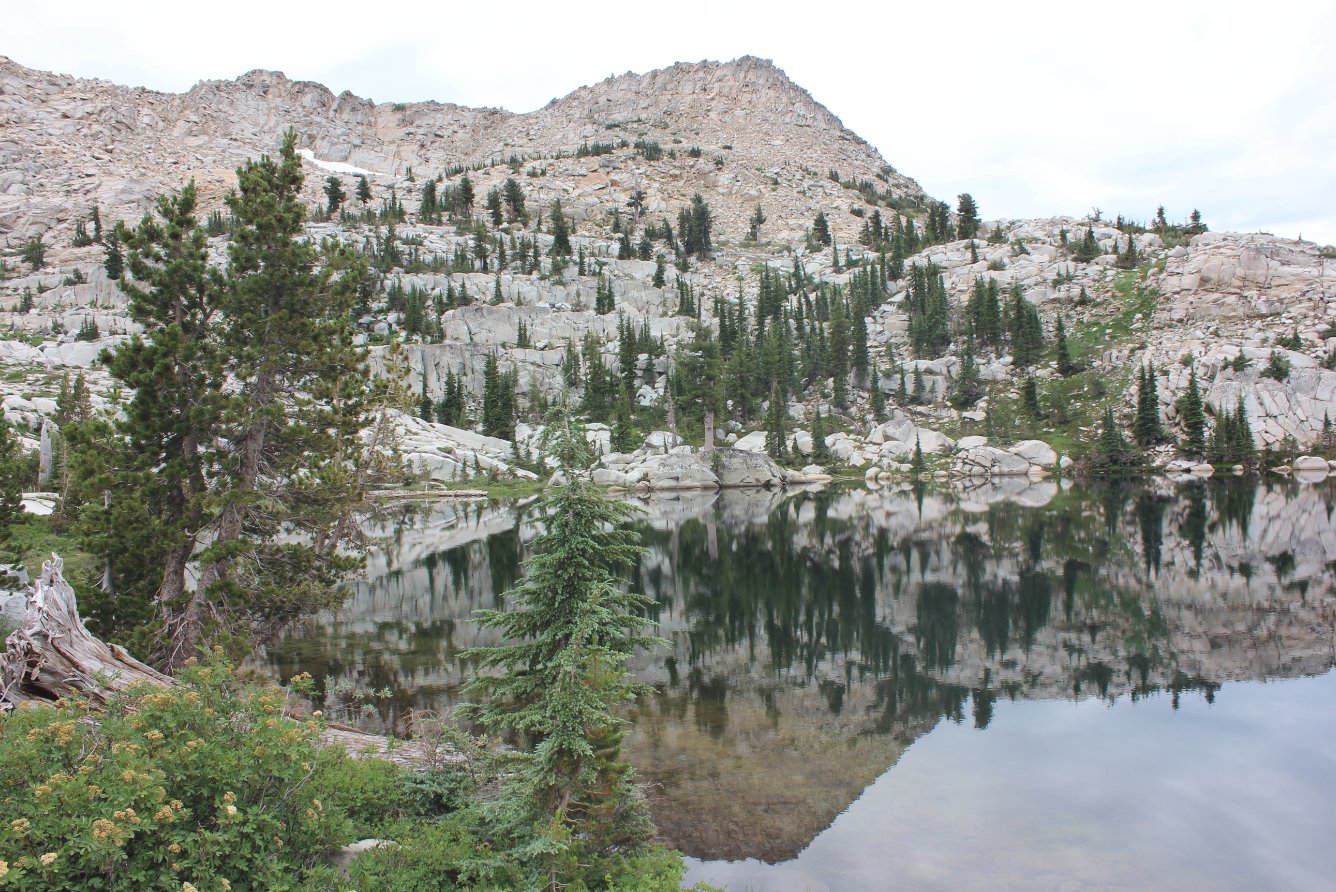
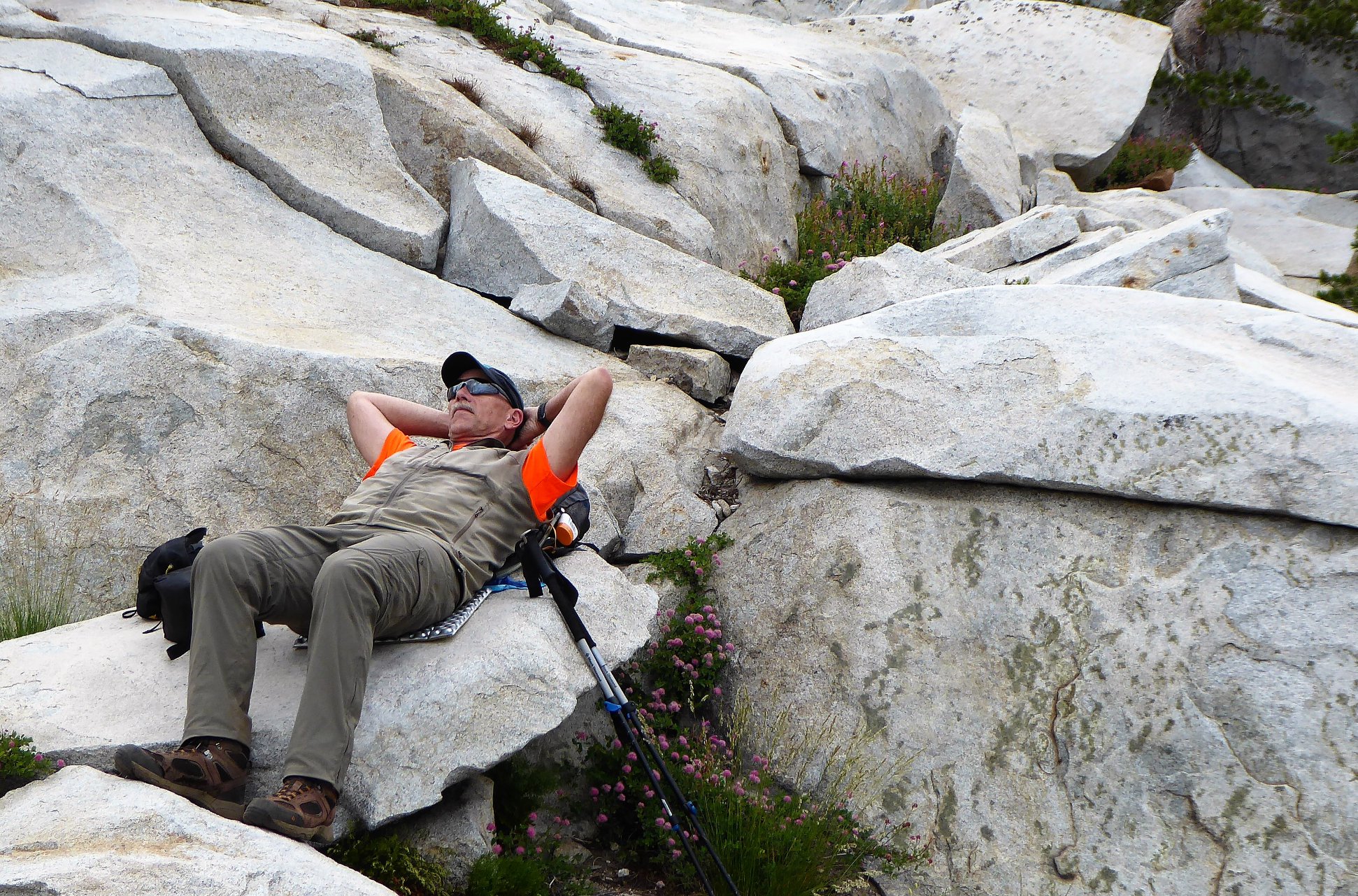
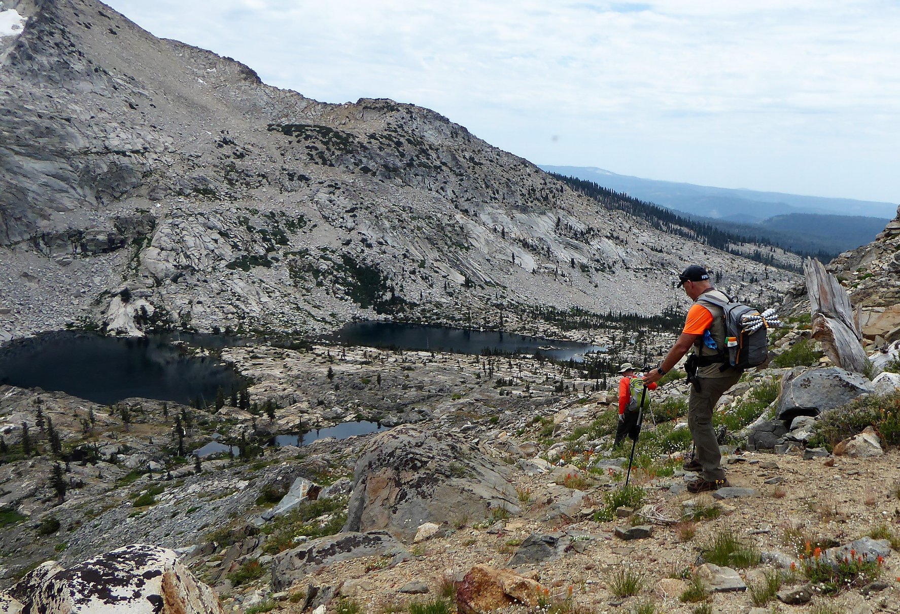
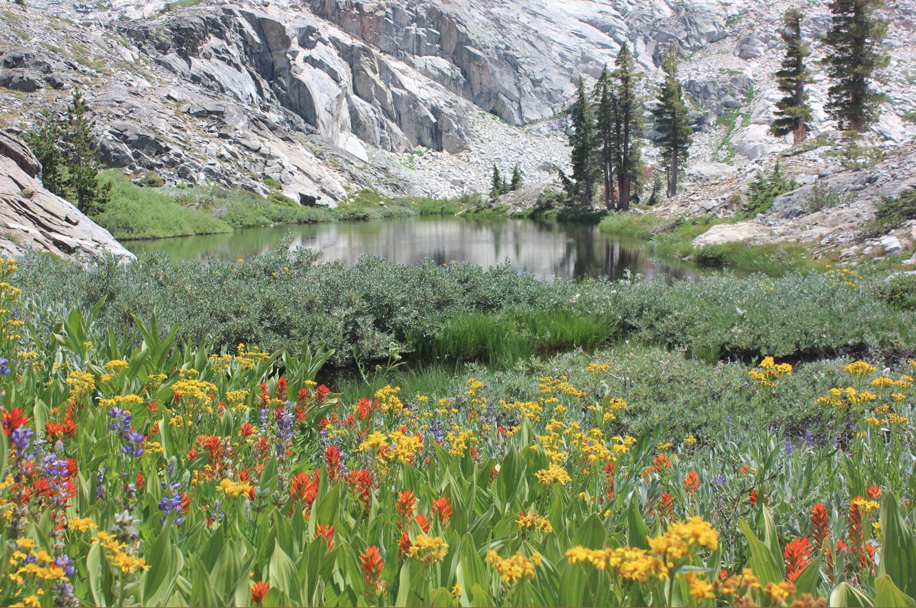
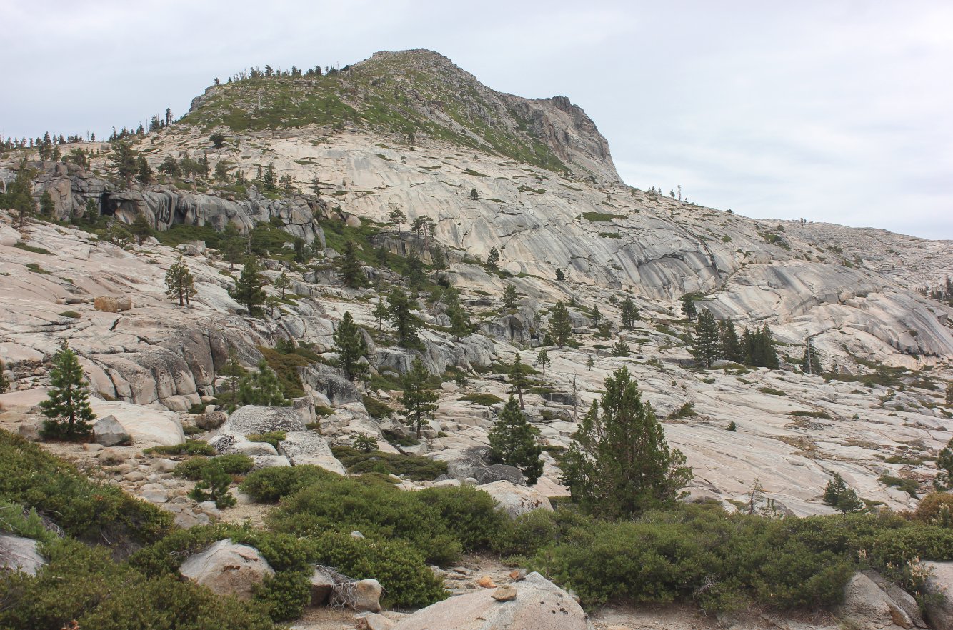
| General Notes: The first part of this hike crosses a small bridge right at the Desolation Wilderness permit kiosk near the parking area. Continue north on the Tyler Lake trail until you reach the intersection with the Rockbound trail, which converge for less than half a mile before they split off again. Head right at the next junction and reach Gertrude Lake about 3 miles from the start. Tyler Lake is a quick cross country up to the south, and sits in a granite bowl with mountains on 2/3 of the sides of the lake. From this point is where the hike changes from Moderate to Hard (or even Strenuous, depending upon your route selection.) Head up the granite to the south side of Tyler Lake, staying on the smooth granite as much as possible. When you reach the ridgeline you will have fantastic views down toward Island Lake and Twin Lakes far below, but you will need to choose your route carefully from here. Head to the west a bit and look for a brush-laden chute which will offer the more reasonable option for heading back down the other side. Aim for the west end of Island Lake, and you will be able to pick up the trail here and follow it back down past Boomerang Lake, cross over the outlet of Twin Lakes and then head down the rocky path until you end up back at the parking lot for the Twin Lakes/Tyler Lake trails. Since this is a hike into Desolation Wilderness, you will need a day permit (free at the trailhead) and the group size limit is 12. |
|||||
