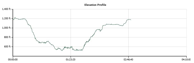
Distance: 4.1 Miles
Vertical Gain: 835'
Group Size: 2
Hike Rating: Easy Moderate Hard Strenuous
 GPX
for
this trip
GPX
for
this trip
| Start Coordinates: | N 38 53.546, W 121 03.222 | End Coordinates: | Same as Start Coordinates | ||
| Car Shuttle Req'd: | No | Parking Directions: | Take Highway 49 west from the American River Confluence Area near Auburn. When you get to Borland Avenue, turn left. This will become Brook Road. Turn right on Marvin Way, and then turn left on Robie Drive to the parking coordinates. | ||
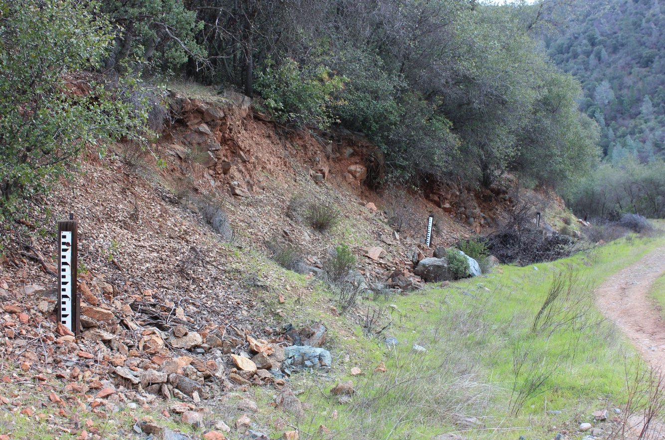
| Hazards of Note: | Rattlesnakes, ticks, poison oak, mountain lions. | Crowd Factor: | Moderate. This entire area is popular with hikers, runners, mountain bikers and dog walkers. | ||
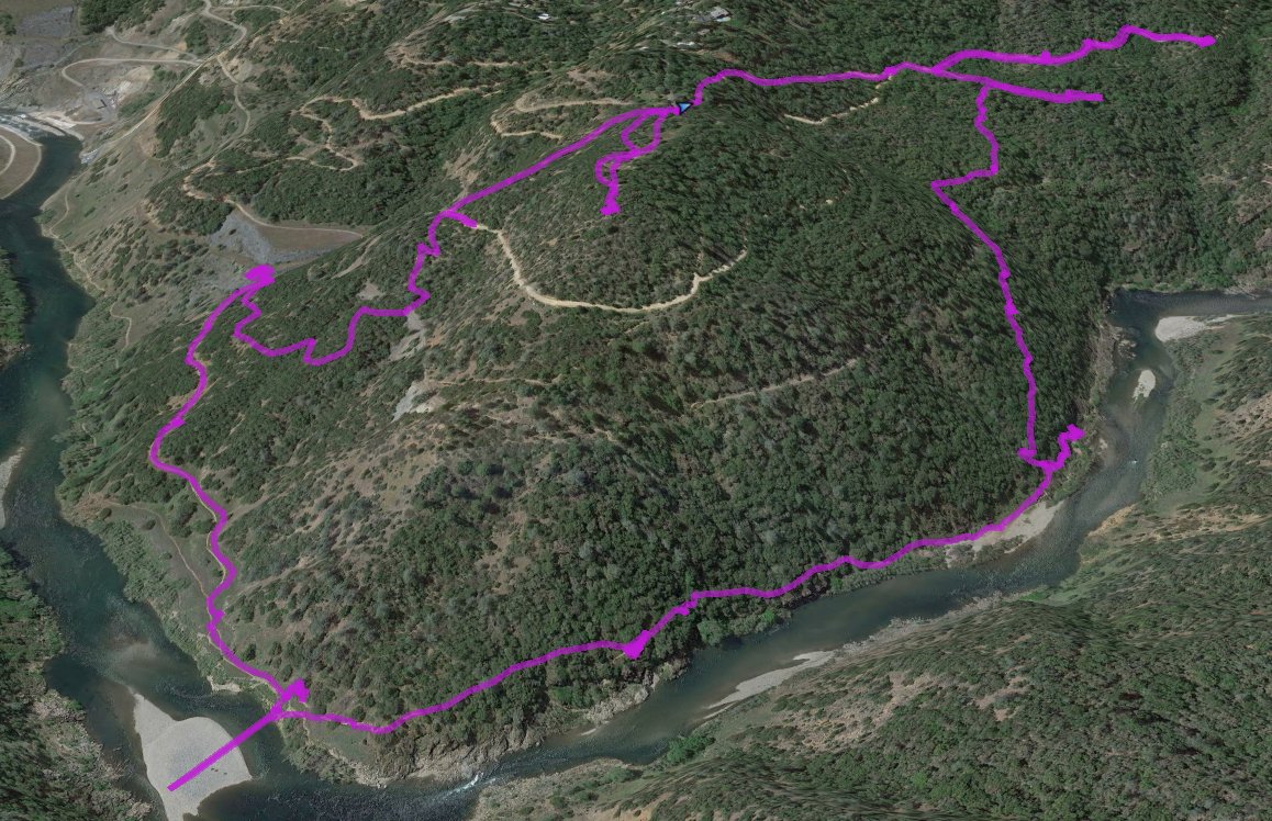
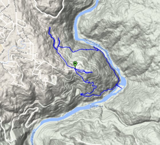
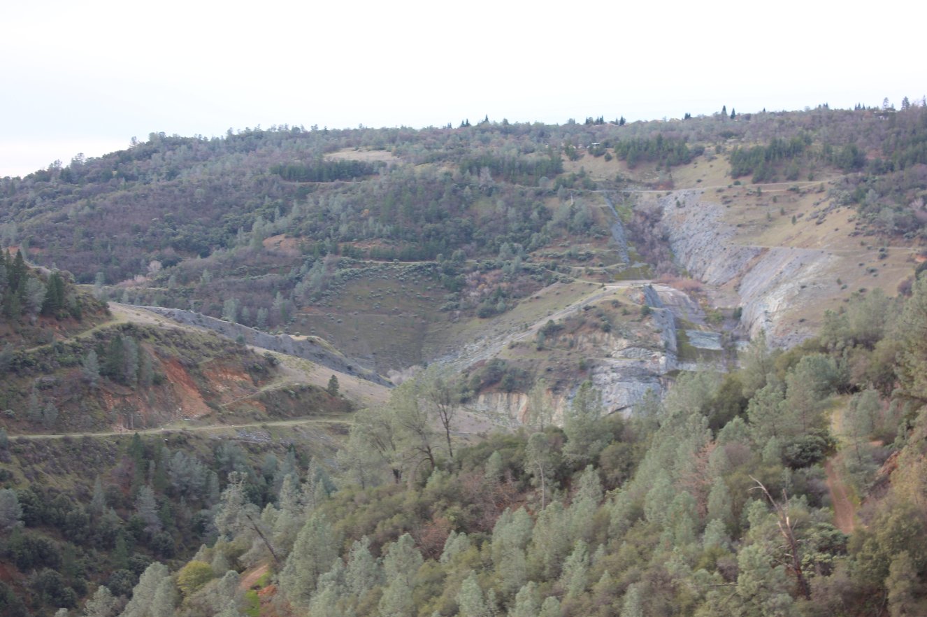
| General Notes: From the trailhead, check out the old Robie Point ruins less than a quarter mile walk to the east. This is an old homestead which was undoubted abandoned when the plans for the Auburn Dam were initially put into place. There is still a lot of landscaping and building foundation evidence all around to explore. Back at the trailhead, there are two paths to the south, and the one I took for the main loop was slightly southeast, as opposed to the other which is southwest. Head down this trail, and it quickly starts dropping off to the level of the river. There are many side paths which head down to various points of the river, and the one we took was not marked with a trail sign but was an obviously heavily travelled path. Once near the river, the path bends around along Robie Point itself, where the river then heads almost due north. Continue on this path for about 1/2 mile, before there is a steep uphill turn to the left. A use path also continues straight, but peters out near the river about a quarter mile further. Heading up this path, you will meet back up with another main trail, and then continue to the right until you meet either the Western States Trail (lower) or the Robie Firebreak trail (higher.) If you head right on either of these you will head toward the confluence area or highway 49, and then heading left will take you back to the trailhead parking area to complete the loop. |
|||||


