
|
Nevada
Point Hike
|
|
Trip Date: 05/05/2017
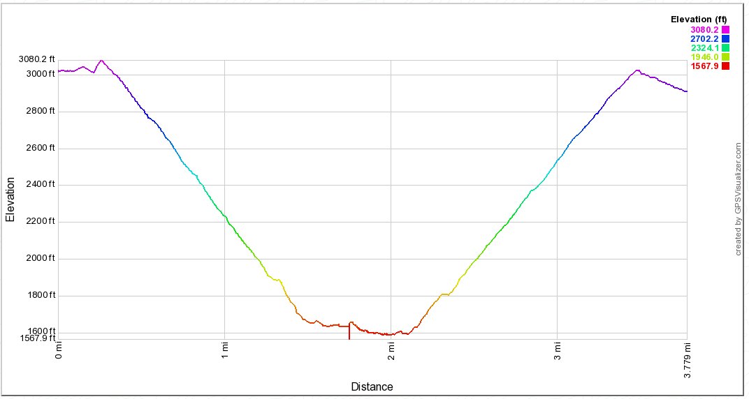
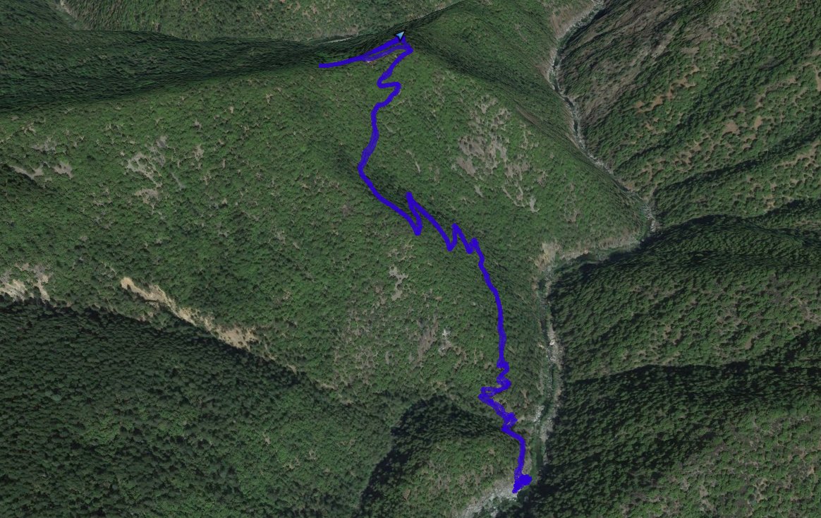
Distance: 3.7 Miles
Vertical Gain:
1500'
Group Size:
2
Hike Rating:
Easy
Moderate
Hard
Strenuous |

 See video of hike
 GPX
for
this trip GPX
for
this trip
|
|
|
Start Coordinates: |
N 38 58.703, W 120 41.382 |
|
End Coordinates: |
Same as start coordinates |
| Car Shuttle
Req'd: |
No |
|
Parking
Directions: |
Take Wentworth Springs Road to
Volcanoville Rd. Turn north on Volcanoville Rd and follow it
for about 1 3/4 miles to the turnoff on the right to Rubicon Rd.
Follow Rubicon Rd for about 2 1/4 miles to the parking area
on a dirt turnout on the north side of the road. |
| Hazards of
Note: |
Rattlesnakes, ticks, poison
oak. |
|
Crowd Factor: |
Negligible. This is
a remote location and the chances of running into others is very slight. |
General Notes:
From
the parking area, head back up the road 500' to the trailhead, or
follow a use trail southeast from the parking area which heads steeply
up the hill in that direction. It will connect with the
actual trail in about 1/10 of a mile. From this point the
trail begins a steep descent for the next mile and a half down to the
river and a bridge which has been washed out since 1997.
There is a significant amount of poison oak along the trail
which can be avoided, mostly. There are a couple of places
along the way with nice views of the American River and Rubicon Canyons
in this area, so make sure to stop and check out the views along the
way. |
|
|
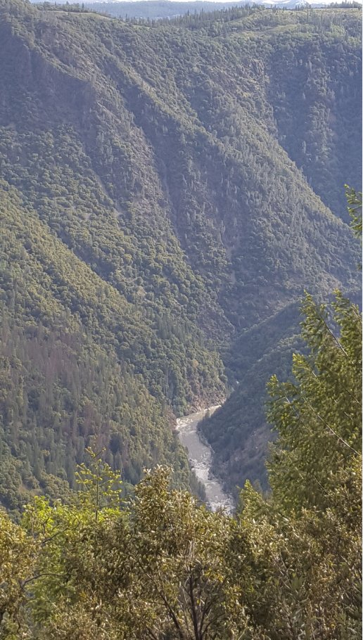
View down into the canyon from
near the start of the hike. |
 |
|
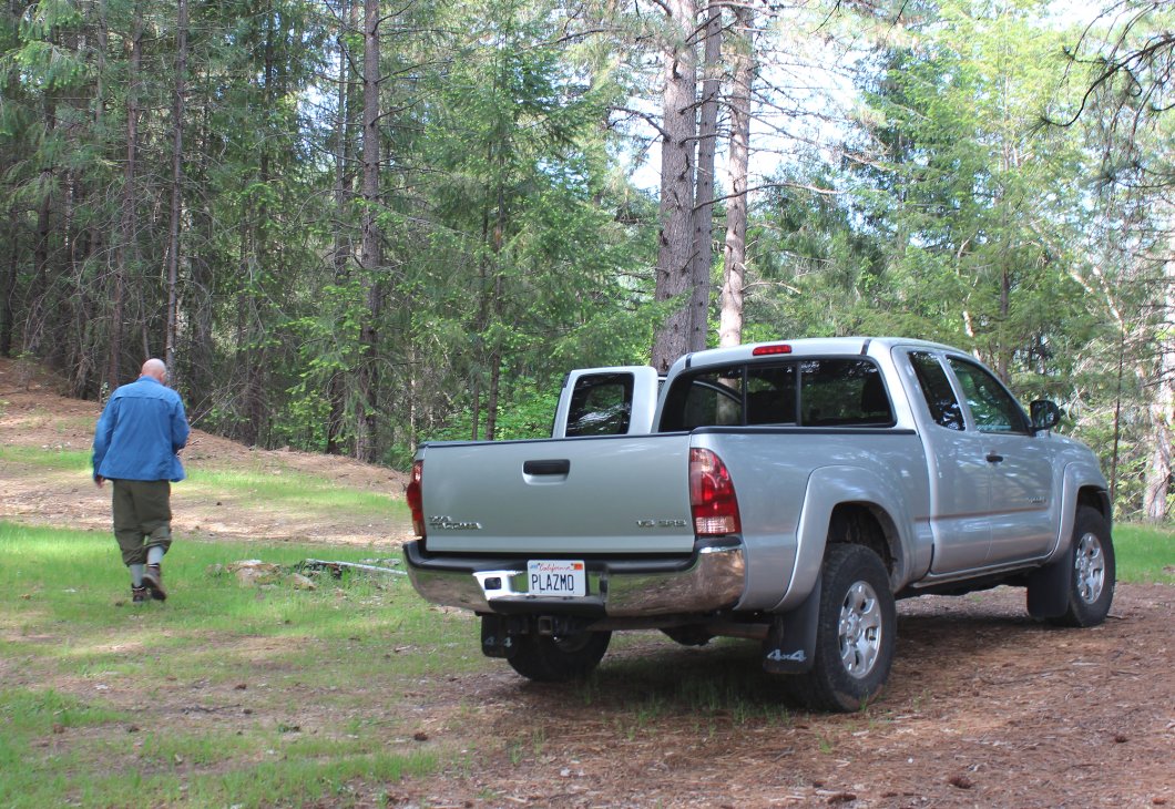
Looking for the actual
trailhead from the parking area.
|
 |
|
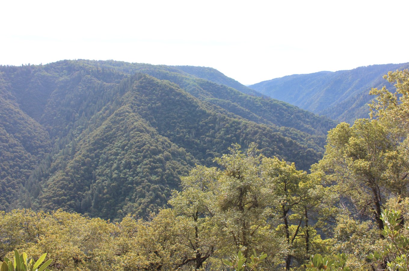
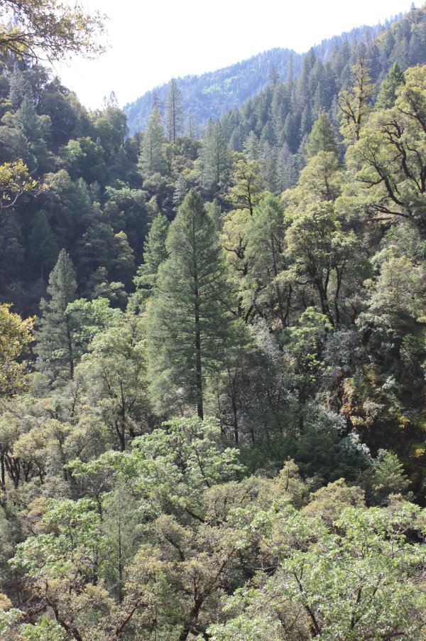
A couple of locations along
the trail offer some nice views into the very rugged and remote canyons
in this area. |
 |
|
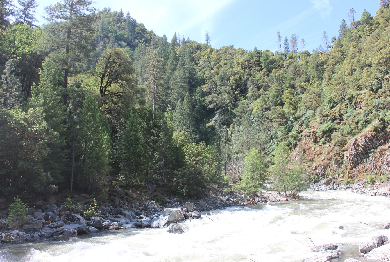
As the trail heads down into
the canyon, the terrain gets extremely rugged. Not many
people get to experience how remote this area of the Rubicon. |
 |
|
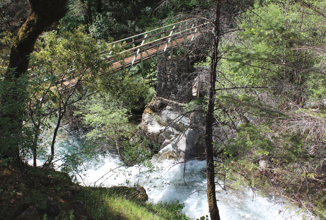
Before getting down to the
Rubicon and the destination for this hike, there is a well-built bridge
which crosses Pilot Creek.
|
 |
|
A look at the high levels of
water pouring down Pilot Creek on this wet spring. |
 |
|
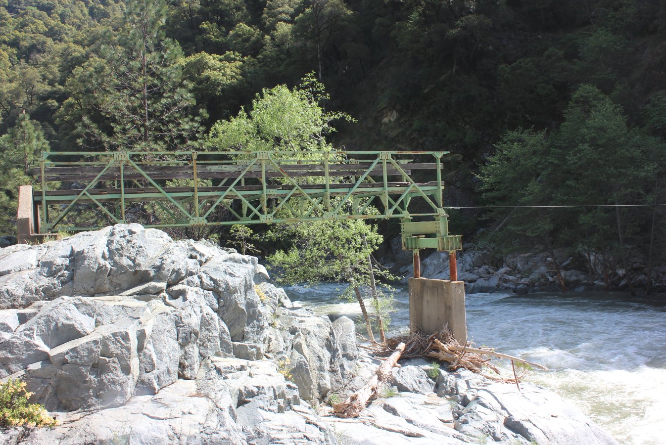
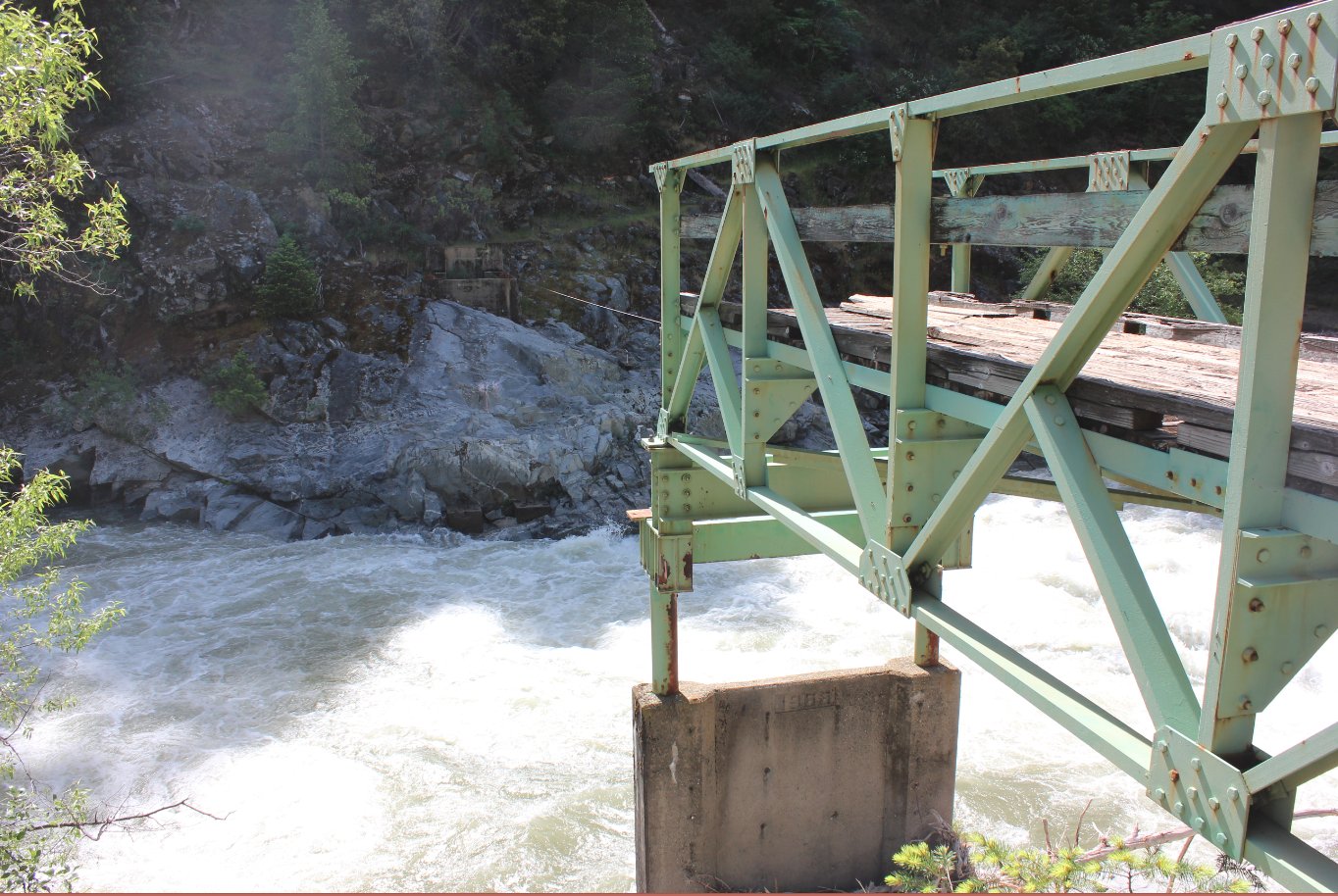
The washed out bridge over the
Rubicon River at the destination point. There is a small
cable attaching the bridge to the other side for moving supplies back
and forth. A longer trail can be seen on the other side
heading back up the canyon. |
 |
|
Another look at the bridge and
the inaccessible other side. This bridge has washed out
twice; once in the 1920s when the Hell Hole dam failed, and then again
in the late 1990s leaving what is still here today. |
 |
|
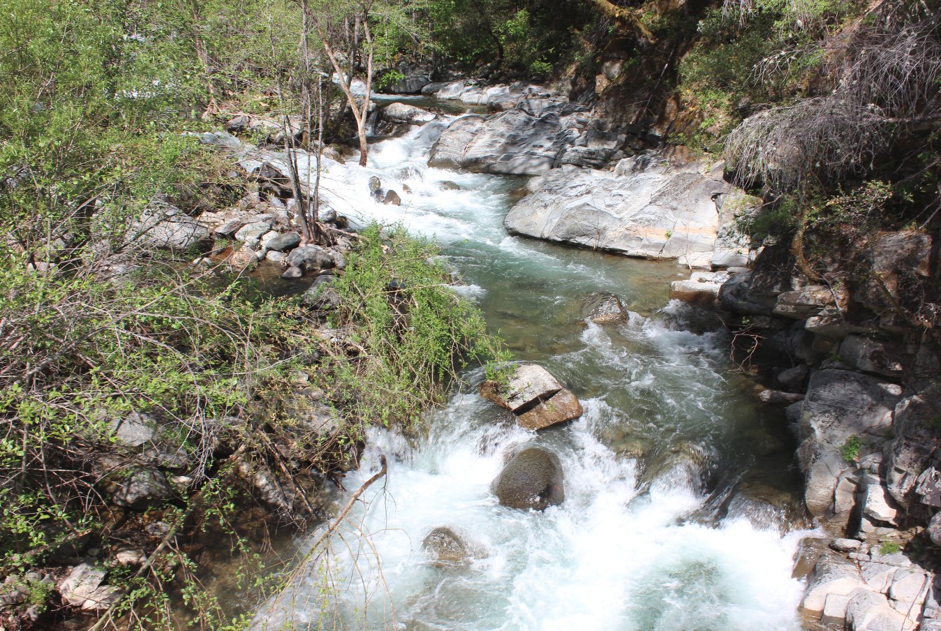
The view up the Rubicon River
from the remnants of the bridge. |
 |
|
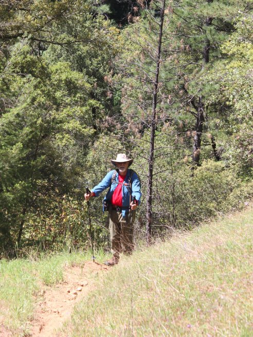
Mark on the way back up the
trail in one of the hotter, exposed locations close to the river.
|
 |
|
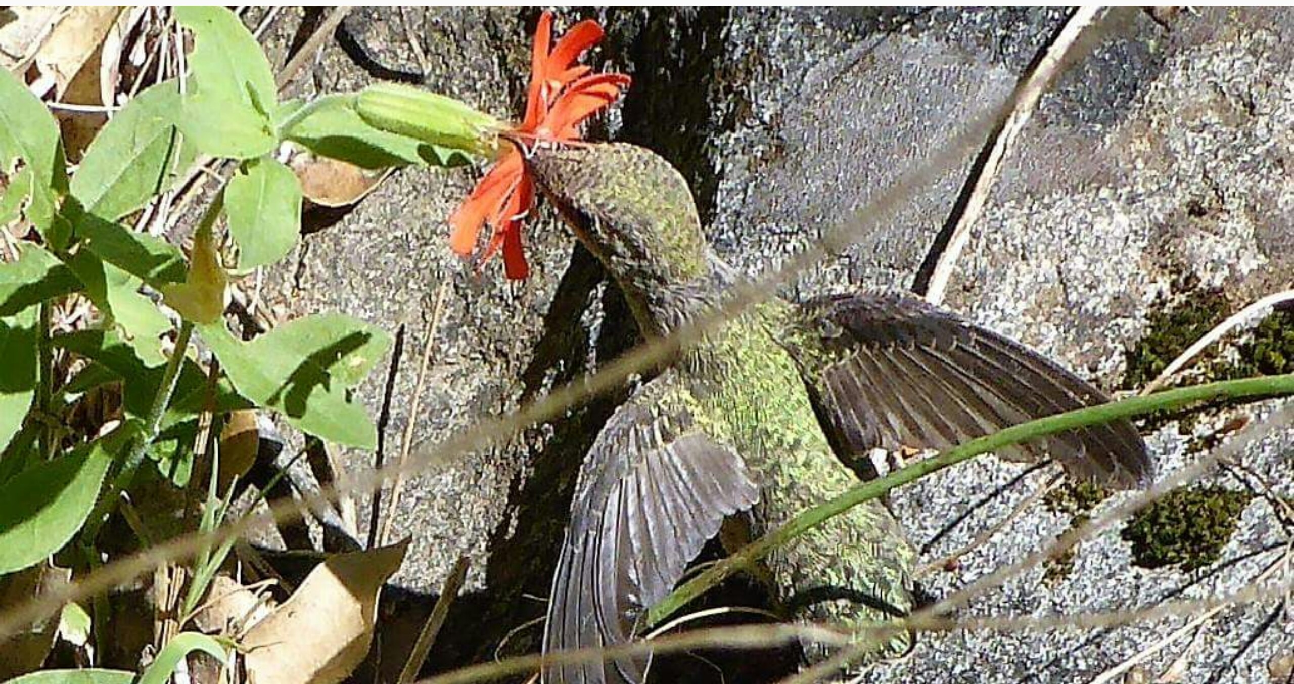
We were lucky enough to have
this Anna hummingbird working its way around us for about 5 minutes as
we just stood on the trail watching it. It appeared to be
completely unfazed by our presence. |
 |
|
GPS Track of the full hike. |
 |