Distance: 14.0 Miles
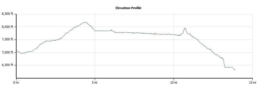
Vertical Gain: 1800'
Group Size: 6
Hike Rating: Easy Moderate Hard Strenuous

 GPX for
this trip

| Start Coordinates: | N 39 06.360 W 119 54.947 | End Coordinates: | N 39 14.099 W 119 55.816 | ||
| Car Shuttle Req'd: | Yes | Parking Directions: | Park one vehicle on the west
side of
Highway 28 (Tahoe Blvd) just across from the intersection with Tunnel
Creek Road. The Tunnel Creek
Cafe is directly across the street from this location, and offers car shuttles for those wanting to make this a one-way trek from Spooner Lake. The trailhead is south on Highway 28 at the Spooner Lake recreation area. There is currently a $10 fee to park for the day ($8 for Nevada residents.) |
||
| Hazards of Note: | Steep dropoffs Long sections with little shade Significant early elevation gain |
Crowd Factor: | Busy, especially on weekends. This is a very popular mountain biking trail. | ||
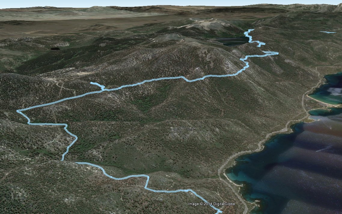
| General Notes: From the parking at Spooner Lake follow the trail to the north which is marked as the Marlette Flume trail. Within the first half mile you will come to a point where you can either head up the dirt road with the mountain bikers, or you can hike along a pathway just for hikers and equestrians. The first five miles are a gradual climb from about 7000 feet to a little over 8100 feet, which gets you to the south shore of Marlette Lake. Continue around the west side of the lake until you get to the area that was dammed up in the 1850s to create the lake in the first place, and then find the sign that starts the official Flume Trail. The next 4 and a half miles are along the old Marlette flume trail, and the views of Lake Tahoe and the mountains beyond are outstanding. Some of the best I have seen. Just before you reach the junction with Tunnel Creek Road, where the trail starts to drop significantly, you will reach a multiple trail junction. From here you can continue on the Flume trail, head up toward the Tahoe Rim Trail or off toward Twin Lakes. Keep going straight on your path to the right to finish the Flume section and start on the Tunnel Creek Rd section. This starts a steep downhill which continues like this for the next three miles. At the end of the road is the Tunnel Creek Cafe and Highway 28, which is where you will finish the trip. |
|||||


