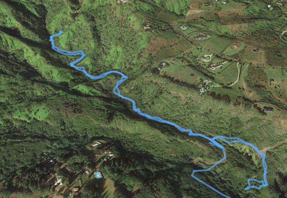
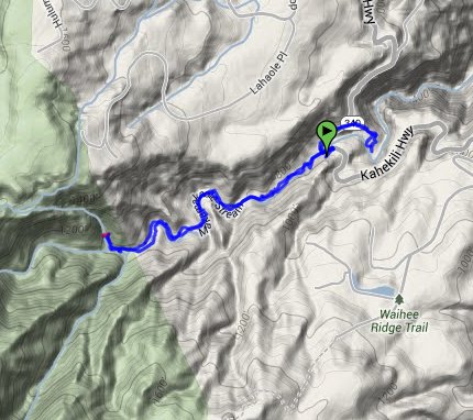
Distance: 2.6 Miles
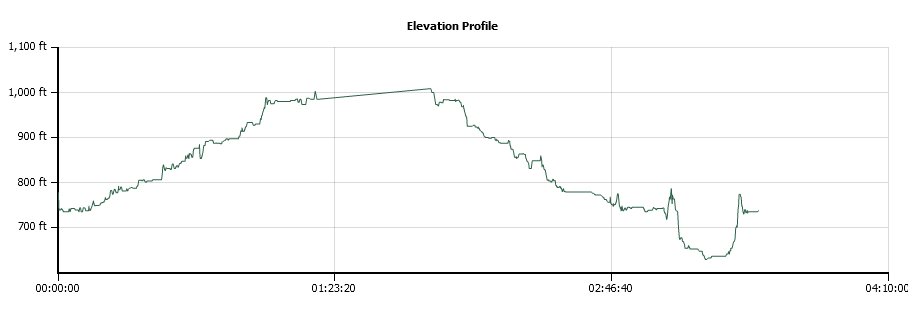
Vertical Gain: 450'
Group Size: 12
Hike Rating: Easy Moderate Hard Strenuous
 GPX for
this trip
GPX for
this trip
| Start Coordinates: | N 20 57.505 W 156 32.058 | End Coordinates: | Same as starting coordinates | ||
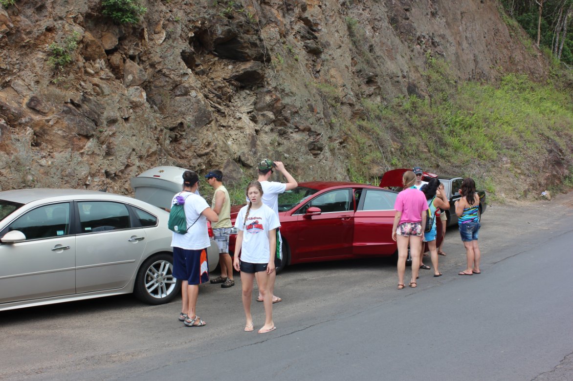
| Car Shuttle Req'd: | No | Parking Directions: | Take
Highway 340 7 1/2 miles north (Kahekili Highway) from Wailuku toward
Waihee. Park on the left side of the road as you are heading
north in a turnout area at the coordinates which will be ample enough
room for 3-4 vehicles. The trailhead is just on the west side of the road (away from the ocean) into a bamboo forest. You will have to walk through a small gate to start the hike. |
||
| Hazards of Note: | Be aware of the weather up the mountain, as this area is prone to flash flooding during intense rains. | Crowd Factor: | Minimal. This is not a well known hike, and the three locals we met the second time we were on it were very surprised we knew anything about it. | ||
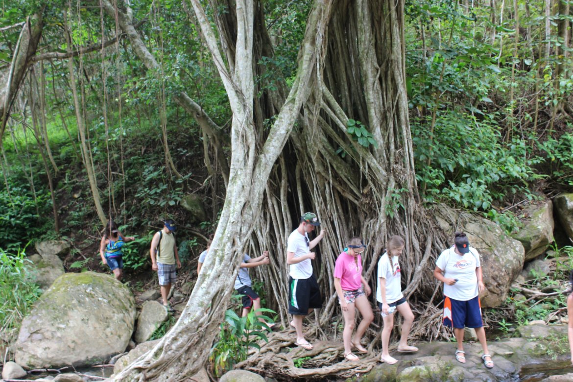
| General Notes: To reach the Maka'maka'ole falls from this trailhead you will cross the river 13 times. Hence the nickname of "13 Crossings" for this hike. There is a large banyan tree at the first crossing, where you start your count. Do not bother with any of the trails which lead away from the river. You will follow it the entire way. There is a very interesting bamboo forest you will hike through about halfway to the falls. Each of the crossings are very straightforward and everything else is pretty simple until the last crossing. At the 13th crossing you need to head to the right, and will possibly have to wade through some knee deep water if you are not able to navigate away along the rocks on the right hand side of the river at this point. Immediately after this you will come to the lower waterfall, which is tucked around the corner on the right side of the pool. If you are adventurous, you can climb the right side of the waterfall, step across it using a rope hanging on the other side and be at the pools for the twin falls which are above this one. There may be other falls further up, but this was the extent of our exploration. |
|||||