Back to index Little Lakes Valley (Morgan Pass) Hike
Trip Date:  06/25/2018

Distance
: 8.5 Miles

Vertical Gain: 900'

Group Size: 1
Hike Rating:  Easy   Moderate    Hard   Strenuous
Ruby Lake Hike
Download GPX GPX for this trip
Little Lakes Elevation Profile
Start Coordinates:   N 37 26.116, W 118 44.821     End Coordinates:   Same as Start Coordinates

Car Shuttle Req'd:   No Parking Directions:   Take Highway 395 to Tom's Place, just a little west of the town of Bishop.  Turn onto Rock Creek Road, and follow this all the way to the Mosquito Flat trailhead, where there is paved parking and overflow parking for when that area fills up.
Hazards of Note:   The last part of the trail to Gem Lake is not signed. Crowd Factor:   High.  From the beginning of the hike it will be crowded unless you can get there early enough to beat most of the crowds on the way in.
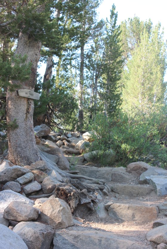
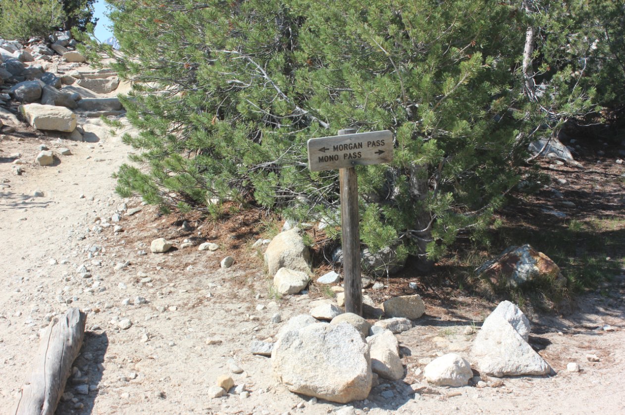
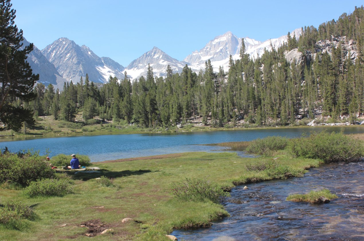
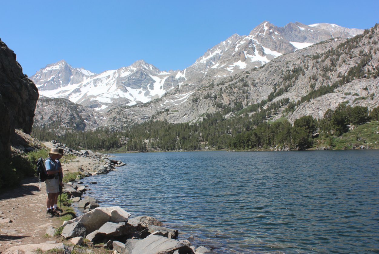
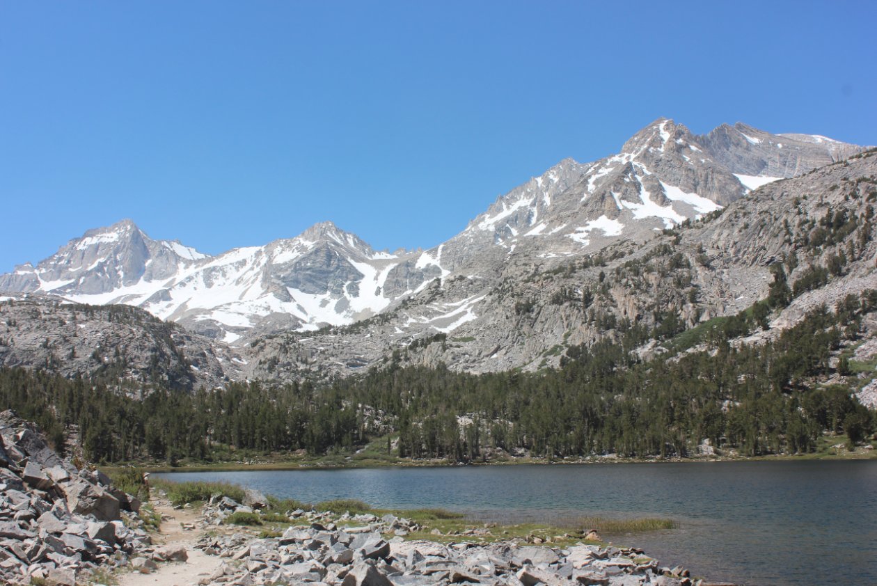
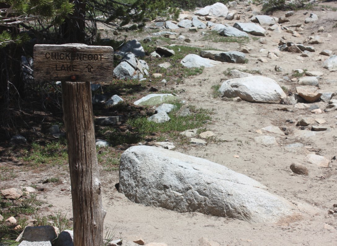
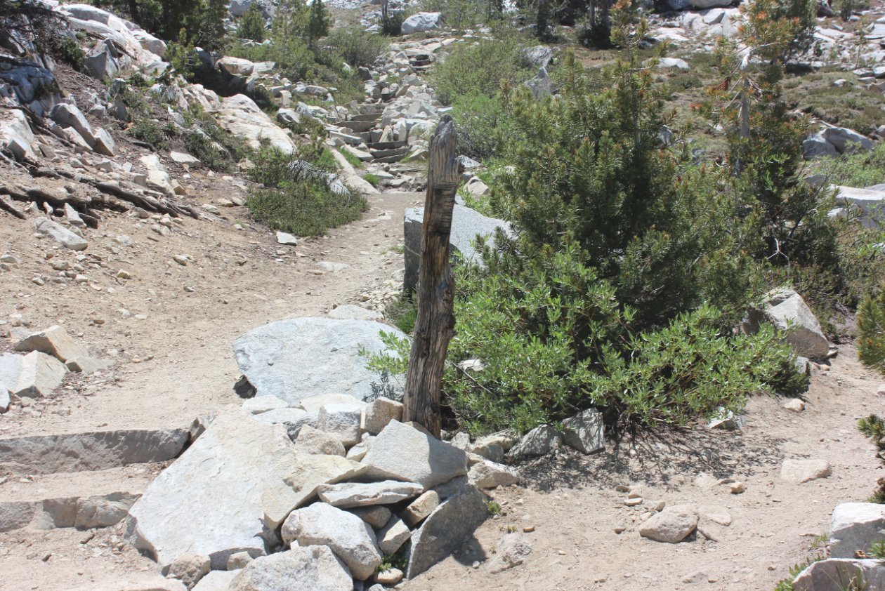
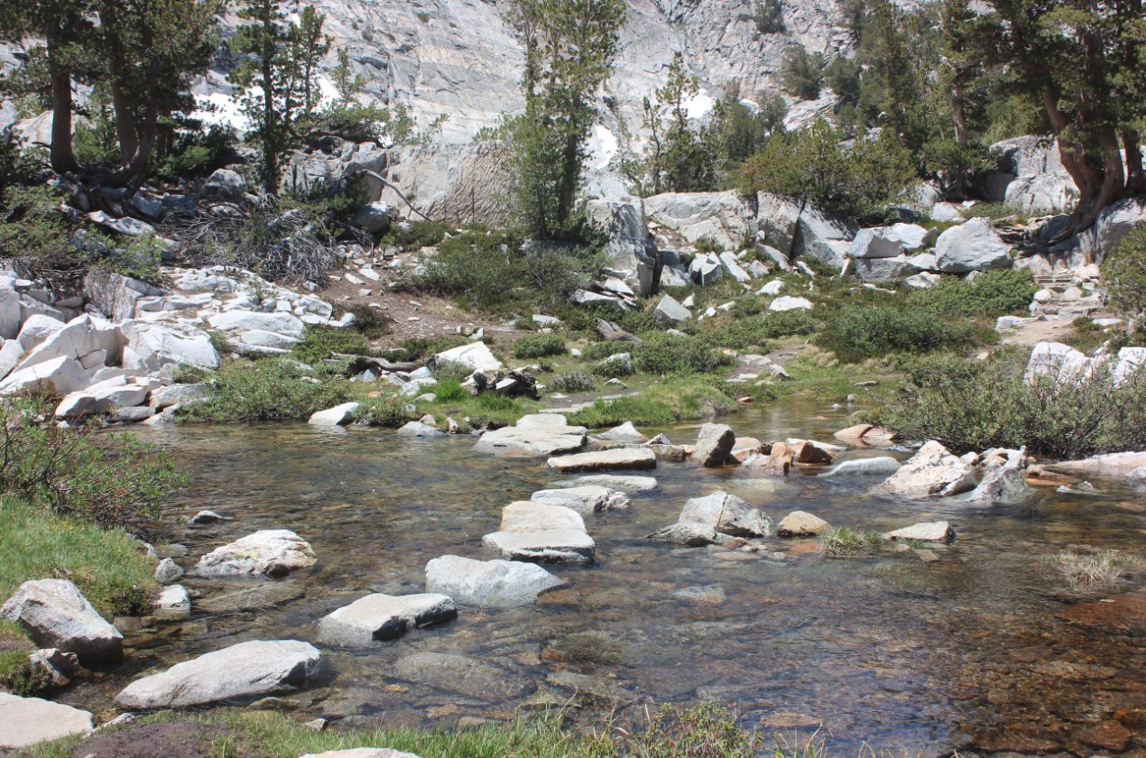
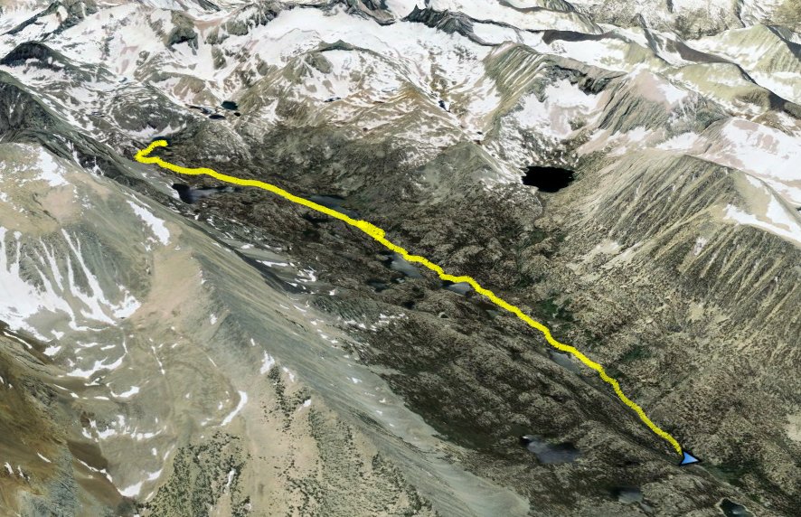
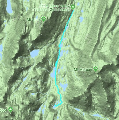
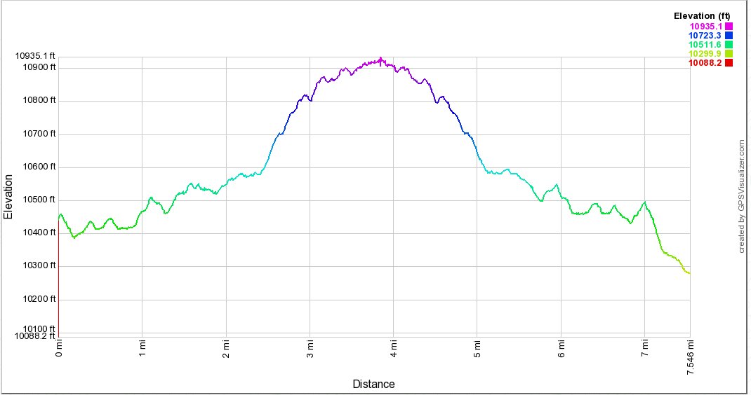
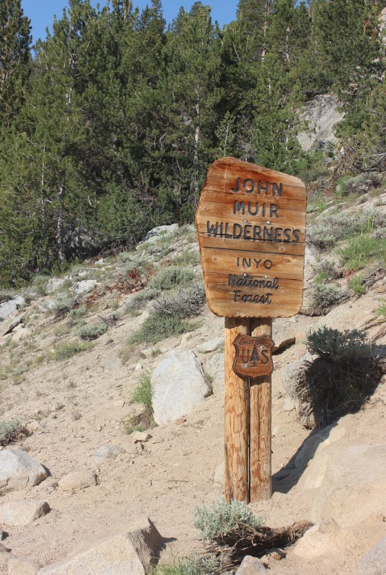
General Notes:
With the trailhead one of the highest in the Sierras starting at 10,500', you will want to make sure you are acclimated to the altitude before attempting any type of strenuous hike at this elevation.  From the Mosquito Flat trailhead begin heading south along the wide path which will take you into the John Muir Wilderness within the first quarter mile.  The trail rises up a couple hundred feet in the first mile, until you reach an intersection for Little Lakes Valley and Morgan Pass to the left or Ruby Lake and Mono Pass to the right.  Take this trail to the left, and you will pass by a number of lakes through the valley.  One you pass Heart Lake and climb a hundred feet on the trail, you will reach the outlet for Long Lake, and can either cross over on rocks or find an even easier path across a number of logs a little to your left.
After you pass Long Lake, the trail will climb again, and you will actually pass by Chickenfoot Lake on the left just a little bit out of view.  There is a signed trail junction here to visit the lake, or you can continue onward.  The trail crosses the outlet from the Gem Lakes plateau past this point, and then as the trail begins to once again start climbing, there is a trail junction (not signed in 2018) to the right which will lead 1/2 mile to the Gem Lakes.  Don't miss these cyan colored lakes, especially the largest one at the end of the trail sitting in granite bowl with mountain peaks all around.


Signs at the south end of the parking lot indicate the starting point for hikes for both Mono Pass and Morgan Pass treks. Mosquito Flat Trailhead
Less than a quarter mile from the trailhead you enter the John Muir Wilderness area just past this sign.
John Muir Wilderness 
Not only do you enter the Wilderness pass the sign, the trail also begins a gradual climb which will soon become much more pronounced. Starting up
Almost exactly one mile up the trail is a junction where you will take the Morgan Pass trail to the left.  From this point you pass lake after lake in rapid succession as you explore the depths of this amazing valley.  Decisions, decisions... 
Heart Lake is the third lake along the trail, but offers a setting that has to be stopped and admired. Heart Lake 
Water into Heart Lake cascades over a bunch of rocks before spilling into the lake proper.  On the way back, a good 15-20 people where playing around in the water here. Heart Lake inlet
Next up is Box Lake, with even more amazing vistas behind it.
Box Lake 
Lots of water everywhere in the valley between Long Lake and Box Lake. On the way to Long Lake 
There is a nicely framed view of the mountains at the end of the valley as you climb up the trail toward Long Lake. Climbing to Long Lake 
Checking out Long Lake with a father and son duo I met along the way.  
Checking out the lake
Long Lake is aptly named, as it was the longest of the lakes passed on by during this hike. South end of Long 
Past Long Lake the trail makes the most elevation gain for the entire hike, heading up toward Morgan Pass. Morgan Pass
Although the lake itself is not visible from the trail, the junction to Chickenfoot Lake is well marked and is only a short diversion on the way. Chickenfoot Lake
While not currently there, this is the fairly obvious junction off to the right to get to Gem Lakes and the end of the trek into the valley.  Gem Lake junction
There are many rock-aided water crossings on this hike, including this one on the way to Gem Lakes. Water crossing
View west of the largest of the Gem Lakes from a perfect rock overlook spot. Gem Lake
Another look at Gem Lake from a little further north. Looking north
GPS Track of the full hike. GPS Track of Hike