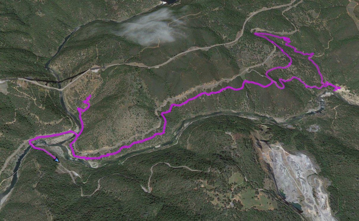
Distance: 8.6 Miles
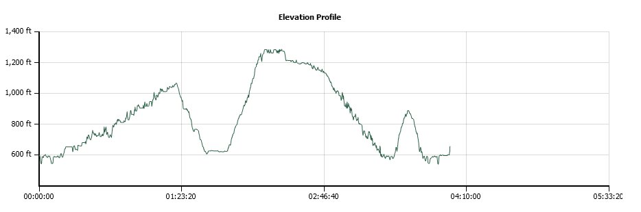
Vertical Gain: 2024'
Group Size: 1
Hike Rating: Easy Moderate Hard Strenuous
 GPX
for
this trip
GPX
for
this trip
| Start Coordinates: | N 38 54.901, W 121 02.379 | End Coordinates: | Same as Start Coordinates | ||
| Car Shuttle Req'd: | No | Parking Directions: | Take Highway 49 from Coloma toward Auburn. Right before the junction with highway 193, there is a wide area on the left side for free vehicle parking. Get there early, especially on a weekend or the space will be filled. | ||
| Hazards of Note: | Rattlesnakes, ticks, poison oak, mountain lions. | Crowd Factor: | Moderate. This entire area is popular with hikers, runners, mountain bikers and dog walkers. | ||
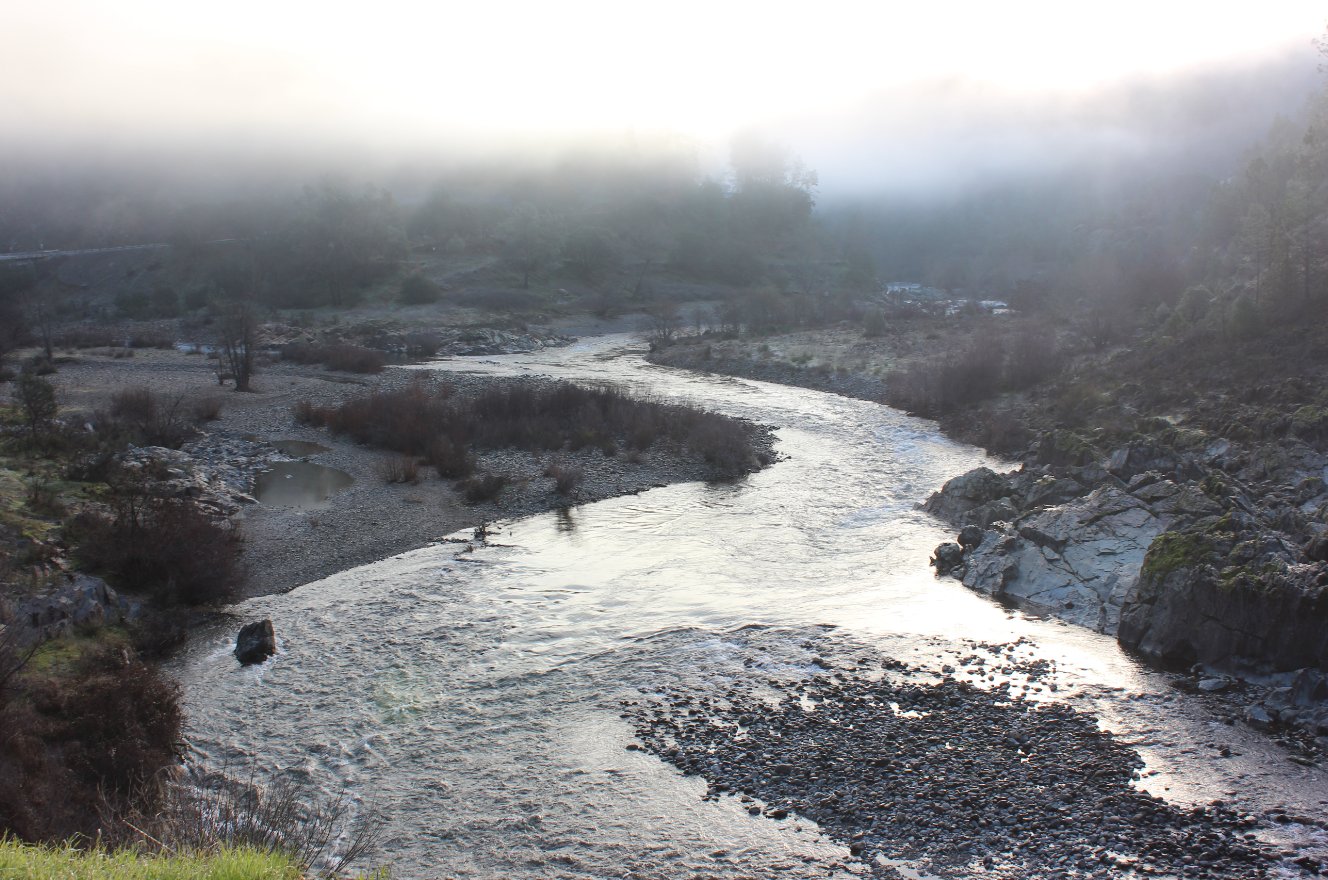
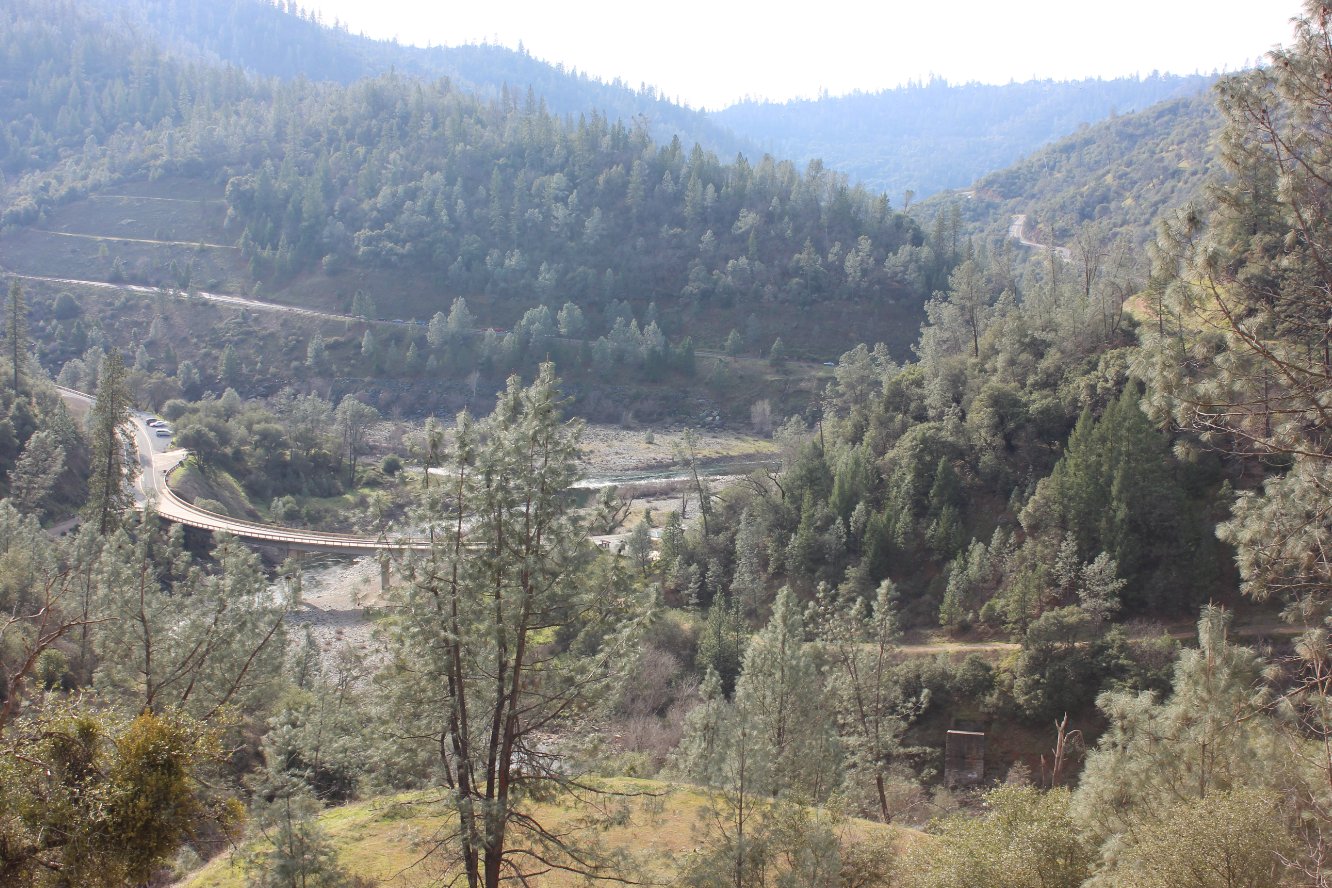
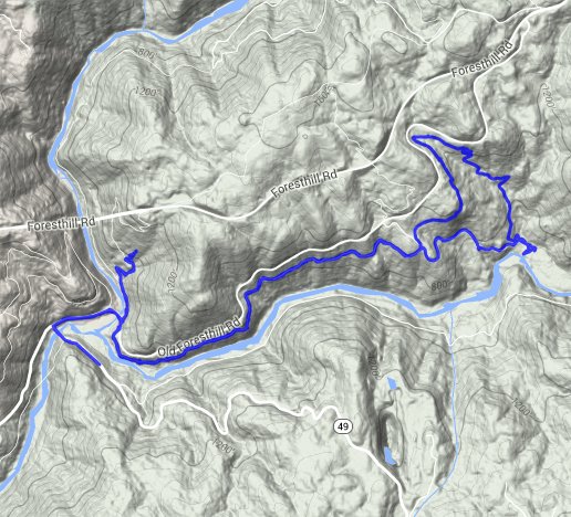
| General Notes: This hike starts off just on the SouthEast side of the confluence area at a signed parking area for the Confluence Trail. It is $10 to park here without a state parks pass, so parking is recommended at the coordinates provided above, adding another 1/2 mile to the trip. The first 2 miles of the trail are the actual confluence trail, which is fairly level and meanders along the north side of the river along an old roadway. At the far end of the confluence trail, there is a road which heads steeply down to the Off Highway Vehicle (OHV) park at Murderer's Bar. Bathroom facilities are available at this location. From here, you can head up one of the steep OHV trails to the north to gain back the altitude you lost (and more,) picking up the Stonewall Trail near the top. Join back with the Confluence Trail for the last couple of miles back to the confluence area. |
|||||