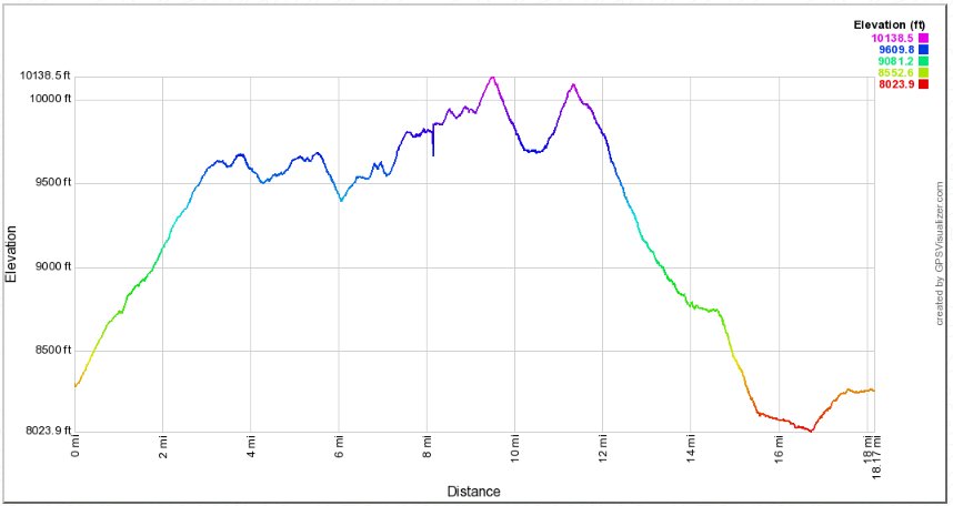
Distance: 18.2 Miles
Vertical Gain: 3090'
Group Size: 1
Hike Rating: Easy Moderate Hard Strenuous

 GPX
for
this trip

| Start Coordinates: | N 37 40.929, W 119 05.193 | End Coordinates: | Same as Start Coordinates |
||
| Car Shuttle Req'd: | No | Parking Directions: | From Highway 395 turn west on Mammoth Scenic Loop Road. Head on this road for approximately 6 miles until you reach Minaret Road. Turn right, and head 5 miles, past the Mammoth Mountain resort area until you reach a park service booth. Head past the booth (before 7am) and continue on this road which becomes Postpile Road for another 4 miles until you reach the parking area on the right for Agnew Meadows campground area. Drive in and park as far north as possible, passing by a couple of parking areas to get as close to the PCT trailhead as possible. NOTE: You need to arrive before 7am to park here or you will be REQUIRED to take a hiker shuttle bus from Mammoth Mountain to the trailhead area. There is a fee of $10 (as of Summer 2016) for use of the area past the booth. | ||
| Hazards of Note: | Long day hike, significant elevation gain, many trail junctions to be aware of. | Crowd Factor: | Moderate to High.
This is a crown
jewel hiking area, with many PCT through hikers to be found along the
first half of the hike and many JMT hikers along the second half of the
hike. The lakes are a popular destination and require
reaching
the destination early for the best available camping areas. |
||
| General
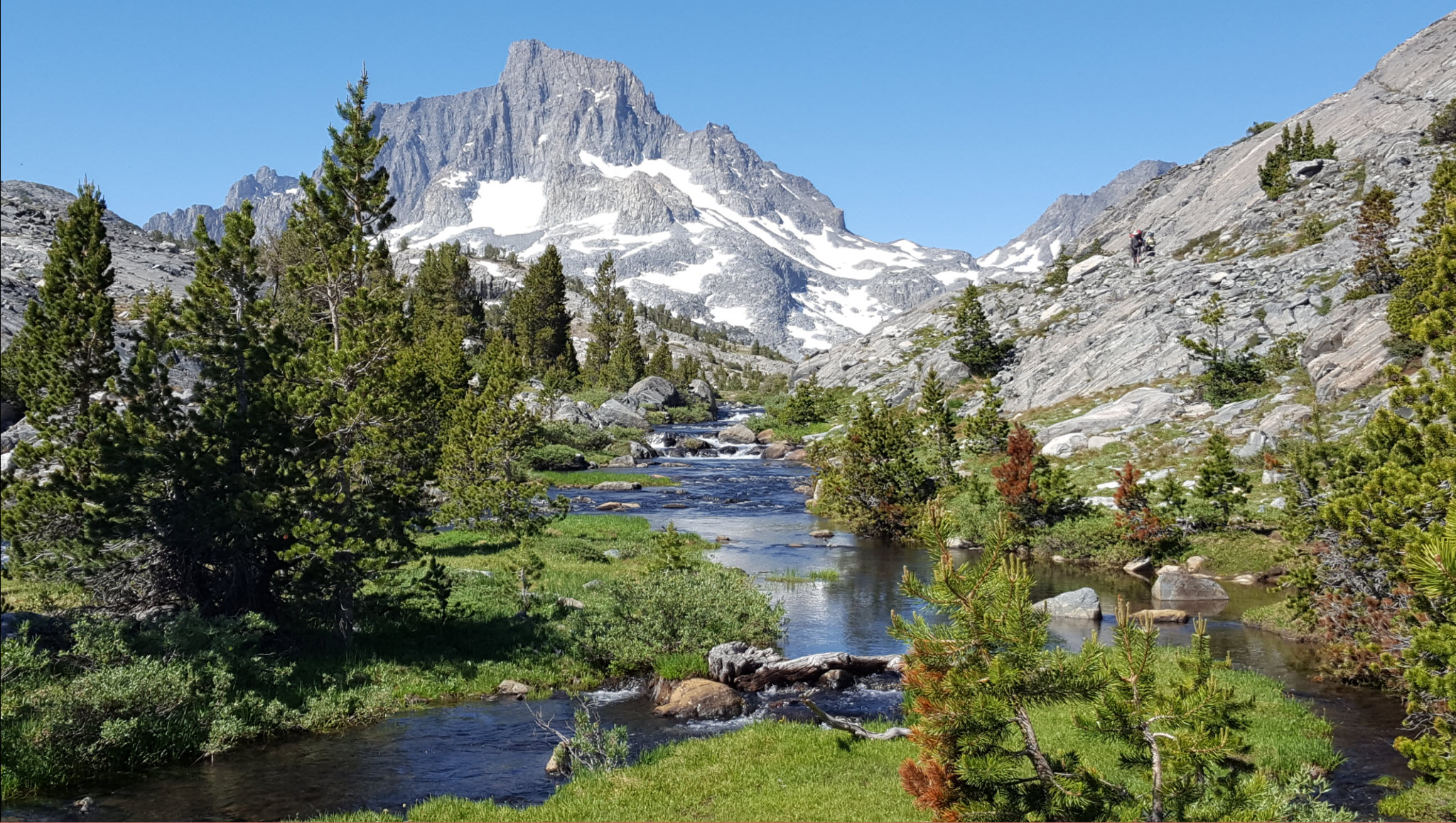
Notes: From the Agnew Meadows trailhead, find the signs for the Pacific Crest Trail (PCT), and head north on what is called the PCT "High Trail." This will lead you up about 500 feet of elevation gain in the first mile, but the next 4-5 miles along the eastern side of the mountain range offer incredibly spectacular views of the area, the mountians in the distance to your west and much of the area you will be traversing during the return portion of the loop hike. Near the 7 mile mark the trail will start to drop down into forested area, losing a little bit of elevation and connecting up with the River Trail which also was an option for this hike starting at Agnew Meadows. However, it doesn't offer the views from high above that the High Trail does. Just before you get to 1000 Island Lake, you will see the distinctive form of Banner Peak off to your west, and be sure to look for a small use trail on the left side of the trail which takes you about 50 feet down to the water outlet from 1000 Island Lake. This spot offers one of the most scenic picture spots ever. Reaching 1000 Island Lake, there is a trail junction with the John Muir Trail (JMT) where both trails combine heading north toward Yosemite or the JMT turns south. This spot was a good area for a brief rest to refuel and enjoy the area, or you if doing an overnight trip head to the west along the northern side of the lake to find camping sites on the other end of the lake area. Turning south on the JMT, in less than a mile you will reach the much smaller Emerald Lake. This is another popular camping location, with a number of good sites on the far (eastern) end. A bit further up the trail is Ruby Lake, another nice location, but only clearly visible if you leave the trail and head on down to the shoreline. After Ruby Lake you will head up another ridge climb, climbing another 400-500 feet in a mile until you reach the crest and the high point of the entire trip at just about 10,100 feet in elevation. Head down into the Garnet Lake area. Garnet Lake is another spectacular destination along this hike, similiar in size to 1000 Island Lake and also oriented with great views of Banner Peak off on the western side as well. The trail winds to the east and crosses over the outlet from Garnet Lake via a makeshift log crossing (complete with a handrail,) and then climbs back up out of the basin on the south side for another climb up to the top of a ridge. From here you will head down through a forested section for the next mile, slowly dropping down toward a trail junction just west of Shadow Lake that will take you either straight on to continue the JMT trail, to the right to head a couple miles up to Lake Ediza, or to the left to head toward Shadow Lake and the continuation of this particular loop. The trail heads along the northern edge of Shadow Lake, and views back highlight the Minarets behind the water. As you near the end of the lake, the outlet that was visible from the high trail earlier in the day comes into sight (and sound,) as water drops 400 feet from the lake outlet along the trail down to the river far below. The trail itself switchbacks down to the valley as well, soon losing sight of the falls and continuing on down until you reach a bridge which crosses the middle fork of the San Joaquin River which runs north and south through this large valley. Turn to the south along this trail and follow the river trail for the last couple of miles, climbing up about 300' near the end to return to Agnew Meadows and the terminus of the loop journey. |
|||||


